Lancing Beach

Beach in Sussex Adur

England

Lancing Beach

Grinstead Lane railway bridge The Bridge was built in the mid sixties for the new A2025 bypass road. The level crossing could be avoided.
Grinstead Lane railway bridge Credit: James Emmans

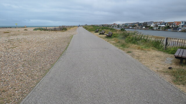
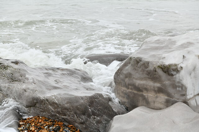
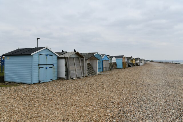
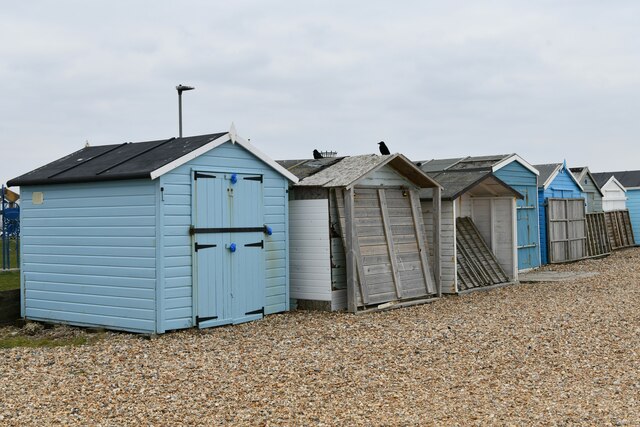
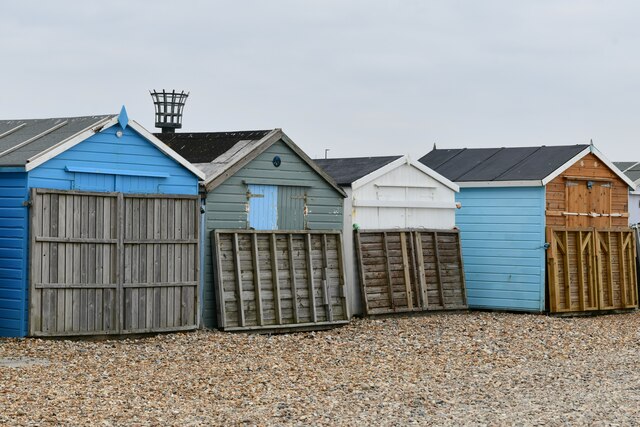
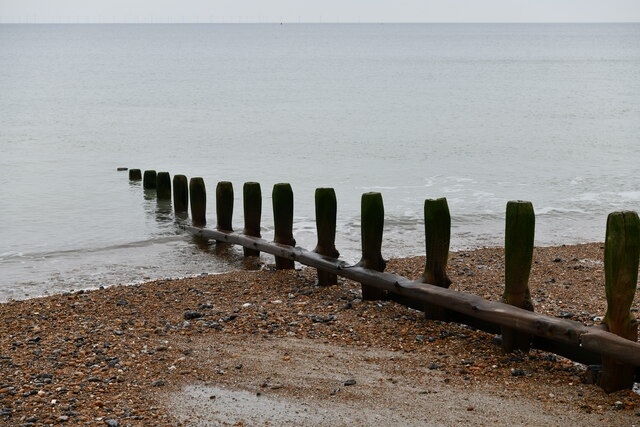
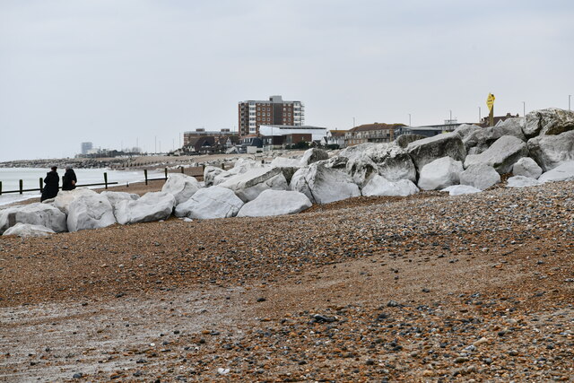
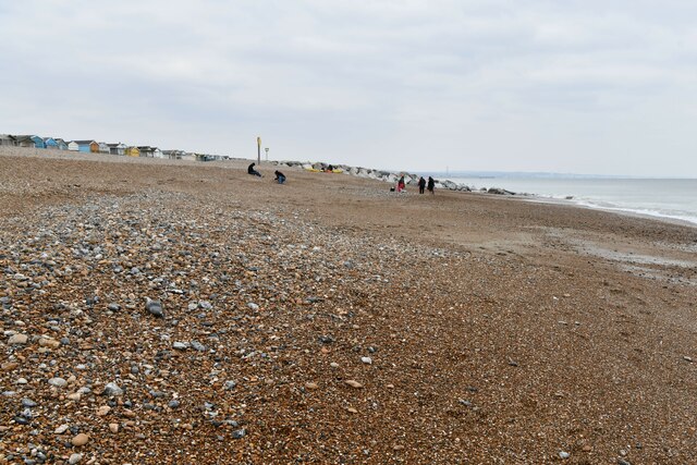
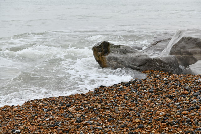
Lancing Beach, situated along the coast of Sussex, England, is a picturesque and popular destination for locals and tourists alike. Spanning approximately 2 miles, this pebble beach offers a peaceful and scenic retreat for visitors seeking relaxation and tranquility.

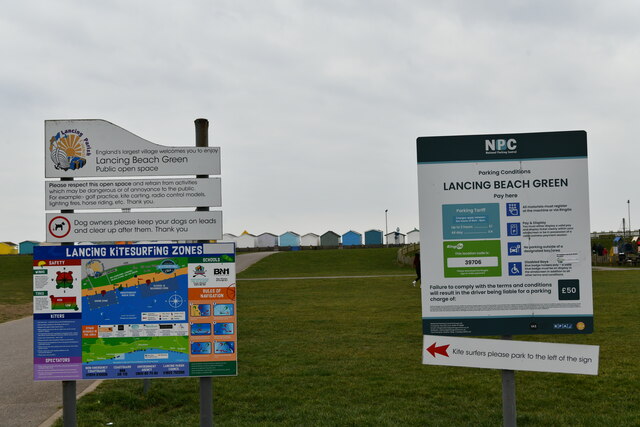
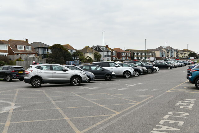
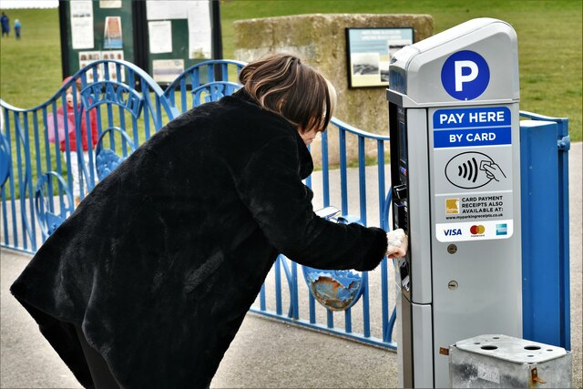
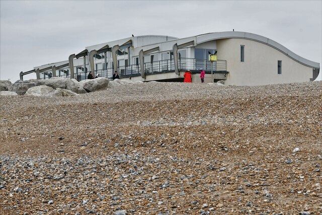
The beach is easily accessible, with ample parking available nearby, and is well-served by public transport links. Lancing Beach boasts excellent facilities, including clean public toilets, lifeguard services during peak seasons, and a range of nearby amenities such as cafes, restaurants, and shops.

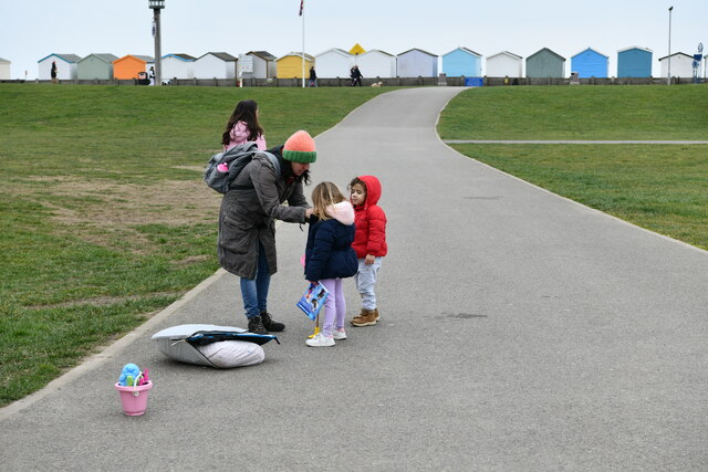
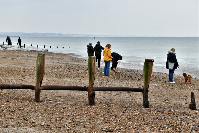
The beach itself offers stunning views of the English Channel and is backed by a long promenade, perfect for leisurely walks or cycling. The pebbles that make up the shoreline are smooth and comfortable to walk on, and many visitors enjoy sunbathing, picnicking, or simply taking in the refreshing sea breeze. The beach is also popular among water sports enthusiasts, with opportunities for windsurfing and kitesurfing due to the area's favorable wind conditions.

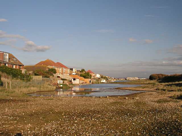
Nature lovers will appreciate the beach's proximity to the Lancing Nature Reserve, a protected area known for its diverse flora and fauna. The reserve provides an opportunity to observe various bird species and explore the surrounding salt marshes and reed beds.

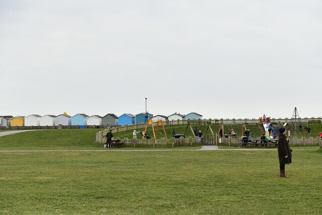
Lancing Beach is a family-friendly destination, with ample space for children to play and build sandcastles. It also hosts occasional events and festivals throughout the year, attracting both locals and visitors from afar.

Overall, Lancing Beach offers a serene and picturesque setting, combining natural beauty with modern amenities, making it an ideal spot for those seeking a coastal escape in Sussex.

If you have any feedback on the listing, please let us know in the comments section below.

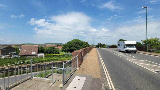
Lancing Beach Images

Images are sourced within 2km of 50.82068/-0.31447943 or Grid Reference TQ1803. Thanks to Geograph Open Source API. All images are credited.

Grinstead Lane railway bridge The Bridge was built in the mid sixties for the new A2025 bypass road. The level crossing could be avoided.
Grinstead Lane railway bridge
The Bridge was built in the mid sixties for the new A2025 bypass road. The level crossing could be avoided.
Path by Widewater Lagoon, lancing Widewater Lagoon is an area of brackish water landlocked by a man-made shingle bank. It lies between the beach and A259 coast road (Brighton Road) in Lancing; between the far east of Lancing Beach and the far west of Shoreham Beach.
This path runs between the beach and lagoon
Path by Widewater Lagoon, lancing
Widewater Lagoon is an area of brackish water landlocked by a man-made shingle bank. It lies between the beach and A259 coast road (Brighton Road) in Lancing; between the far east of Lancing Beach and the far west of Shoreham Beach. This path runs between the beach and lagoon
The Quadrant, Marlborough Road, Lancing
Lancing: Play area
Lancing: Play area
Lancing: Beach Green information boards
Lancing: Beach Green Car Park
Lancing: Beach Green Car Park, 'pay by card'
Lancing: Incoming tide on the large boulder breakwater
Lancing Beach: Huts
Lancing Beach: Huts
Lancing Beach Green: Path to the beach
Lancing Beach: Huts
Lancing Beach: Huts
Lancing Beach: Huts
Lancing Beach: Huts
Lancing Beach: Breakwater
Lancing Beach: Large boulder breakwater
Lancing Beach looking east
Lancing Beach: Perch Cafe and Gym
Lancing: Incoming tide on the large boulder breakwater
Lancing Beach
Lancing Beach
Show me another place!

Lancing Beach is located at Grid Ref: TQ1803 (Lat: 50.82068, Lng: -0.31447943)

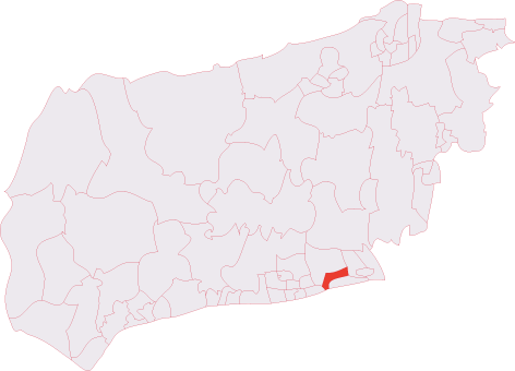
Administrative County: West Sussex

District: Adur

Police Authority: Sussex

What 3 Words

///tower.precautions.foil. Near Lancing, West Sussex

Nearby Locations

Lancing Beach

Related Wikis

East Worthing and Shoreham (UK Parliament constituency)

East Worthing and Shoreham is a constituency represented in the House of Commons of the UK Parliament since 1997 by Tim Loughton of the Conservative Party...

Lancing railway station

Lancing railway station is in Lancing in the county of West Sussex, England. It is 8 miles 19 chains (13.3 km) down the line from Brighton. The station...

Widewater Lagoon

Widewater Lagoon is a 8.8-hectare (22-acre) Local Nature Reserve in Lancing in West Sussex. It is owned by West Sussex County Council and managed by Lancing...

Lancing Carriage Works

Lancing Carriage Works was a railway carriage and wagon building and maintenance facility in the village of Lancing near Shoreham-by-Sea in the county...

Montpelier Villa F.C.

Montpelier Villa F.C. is an English football club located in Falmer, Brighton in East Sussex. The club are currently members of the Southern Combination...

Lancing F.C.

Lancing Football Club is a football club based in Lancing, West Sussex, England. They are members of the Isthmian League South East Division and play at...

Lancing, West Sussex

Lancing is a large coastal village and civil parish in the Adur district of West Sussex, England, on the western edge of the Adur Valley. It occupies part...

Lancing (electoral division)

Lancing is an electoral division of West Sussex in the United Kingdom, and returns one member to sit on West Sussex County Council. == Extent == The division...

Nearby Amenities

Located within 500m of 50.82068,-0.31447943
Source: PGS
Lat/Long: 50.8200716/-0.3200522
Source: PGS
Lat/Long: 50.820331/-0.3188122
Source: PGS
Lat/Long: 50.8204114/-0.3170219
Source: PGS
Lat/Long: 50.821141/-0.3118254
Source: PGS
Lat/Long: 50.8214143/-0.3104543
Tactile Paving: yes
Lat/Long: 50.8210742/-0.3162951
Bus Stop
The Haven
Bench: yes
Bin: no
Bus: yes
Lit: no
Naptan AtcoCode: 4400AD0065
Naptan Bearing: W
Naptan CommonName: The Haven
Naptan Indicator: o/s The Haven
Naptan Landmark: Kings Court
Naptan NaptanCode: wsxadgja
Naptan ShortCommonName: The Haven
Naptan Street: Brighton Road
Naptan Verified: no
Public Transport: platform
Shelter: yes
Source: naptan_import
Tactile Paving: no
Lat/Long: 50.8217994/-0.3181636
Bus Stop
The Haven
Bench: yes
Bin: no
Bus: yes
Naptan AtcoCode: 4400AD0067
Naptan Bearing: E
Naptan CommonName: The Haven
Naptan Indicator: adj Penhill Road
Naptan Landmark: Kings Road
Naptan NaptanCode: wsxadgjd
Naptan ShortCommonName: The Haven
Naptan Street: Brighton Road
Naptan Verified: no
Public Transport: platform
Shelter: yes
Source: naptan_import
Lat/Long: 50.8221499/-0.3162768
Bus Stop
Old Salts Farm Rd
Bench: yes
Bin: no
Bus: yes
Naptan AtcoCode: 4400AD0068
Naptan Bearing: W
Naptan CommonName: Old Salts Farm Rd
Naptan Indicator: opp
Naptan Landmark: Freshbrook Road
Naptan NaptanCode: wsxadgjg
Naptan ShortCommonName: Old Salts Farm Rd
Naptan Street: Brighton Road
Naptan Verified: no
Public Transport: platform
Shelter: yes
Source: naptan_import
Tactile Paving: no
Lat/Long: 50.8223118/-0.3131616
Bus Stop
Willowbrook Park
Bus: yes
Naptan AtcoCode: 4400AD0069
Naptan Bearing: NE
Naptan CommonName: Willowbrook Park
Naptan Indicator: opp Happy Days Caravan Park
Naptan Landmark: Happy Days Caravan Park
Naptan NaptanCode: wsxadgjm
Naptan ShortCommonName: Willowbrook Park
Naptan Street: Freshbrook Road
Naptan Verified: no
Public Transport: platform
Source: naptan_import
Lat/Long: 50.8232558/-0.312517
Willowbrook Park
Naptan AtcoCode: 4400AD0070
Naptan Bearing: SW
Naptan BusStopType: CUS
Naptan CommonName: Willowbrook Park
Naptan Indicator: adj Happy Days Caravan Park
Naptan Landmark: Happy Days Caravan Park
Naptan NaptanCode: wsxadgjp
Naptan ShortCommonName: Willowbrook Park
Naptan Street: Freshbrook Road
Naptan Verified: no
Source: naptan_import
Lat/Long: 50.8231916/-0.3124341
Bus Stop
South Bank Court
Naptan AtcoCode: 4400AD0176
Naptan Bearing: SW
Naptan CommonName: South Bank Court
Naptan Indicator: o/s South Bank Court
Naptan Landmark: Old Salts Farm Rd
Naptan NaptanCode: wsxadmjm
Naptan Street: Brighton Road
Naptan Verified: no
Public Transport: platform
Shelter: no
Source: naptan_import
Lat/Long: 50.8230916/-0.3086325
Bus Stop
Old Salts Farm Rd
Bench: yes
Bin: no
Bus: yes
Naptan AtcoCode: 4400AD0177
Naptan Bearing: E
Naptan CommonName: Old Salts Farm Rd
Naptan Indicator: adj Old Salts Farm Rd
Naptan Landmark: Old Salts Farm Road
Naptan NaptanCode: wsxadmjp
Naptan Street: Brighton Road A259
Naptan Verified: no
Public Transport: platform
Shelter: yes
Source: naptan_import
Lat/Long: 50.8225434/-0.3123865
Noexit: yes
Lat/Long: 50.8223171/-0.3186539
Noexit: yes
Lat/Long: 50.8238773/-0.3172862
Noexit: yes
Lat/Long: 50.8235803/-0.3129806
Brighton Road
Noexit: yes
Ref GB Usrn: 200838
Surface: asphalt
Lat/Long: 50.8230265/-0.3145541
Fixme: where does it end?
Lat/Long: 50.8239335/-0.310888
Source: PGS
Lat/Long: 50.8207086/-0.3146364
Noexit: yes
Lat/Long: 50.8212768/-0.3172563
Crossing
Button Operated: yes
Crossing Island: no
Crossing Signals: yes
Crossing Ref: puffin
Kerb: lowered
Tactile Paving: yes
Traffic Signals Vibration: yes
Lat/Long: 50.8217611/-0.3194664
Bench
Backrest: yes
Material: wood
Lat/Long: 50.8207801/-0.319521
Bench
Backrest: yes
Material: wood
Lat/Long: 50.8207133/-0.3197464
Bench
Backrest: yes
Material: wood
Lat/Long: 50.8206213/-0.3201437
Bench
Backrest: yes
Material: wood
Lat/Long: 50.8208615/-0.3192424
Bench
Backrest: yes
Material: wood
Lat/Long: 50.8209371/-0.3187132
Bench
Backrest: yes
Material: wood
Lat/Long: 50.8209741/-0.3184477
Artwork Type: sculpture
Tourism: artwork
Lat/Long: 50.8209654/-0.3188432
Noexit: yes
Lat/Long: 50.8223928/-0.3176813
Post Box
Brand: Royal Mail
Brand Wikidata: Q638098
Brand Wikipedia: en:Royal Mail
Collection Plate: CP1D
Collection Times: Mo-Fr 09:00; Sa 07:00
Operator: Royal Mail
Operator Wikidata: Q638098
Post Box Type: pillar
Ref: BN15 1376D
Royal Cypher: GVIR
Royal Cypher Wikidata: Q33102169
Lat/Long: 50.8227628/-0.3109355
Post Box
Brand: Royal Mail
Brand Wikidata: Q638098
Brand Wikipedia: en:Royal Mail
Collection Plate: CP7D
Collection Times: Mo-Fr 09:00; Sa 07:00
Operator: Royal Mail
Operator Wikidata: Q638098
Post Box Type: lamp
Ref: BN15 1423D
Royal Cypher: EIIR
Royal Cypher Wikidata: Q33102113
Lat/Long: 50.8229653/-0.3119059
Post Box
Brand: Royal Mail
Brand Wikidata: Q638098
Brand Wikipedia: en:Royal Mail
Collection Plate: CP1D
Collection Times: Mo-Fr 09:00; Sa 07:00
Operator: Royal Mail
Operator Wikidata: Q638098
Post Box Type: pillar
Ref: BN15 1375D
Royal Cypher: EIIR
Royal Cypher Wikidata: Q33102113
Lat/Long: 50.8221237/-0.316485
Post Box
Brand: Royal Mail
Brand Wikidata: Q638098
Brand Wikipedia: en:Royal Mail
Collection Plate: CP7D
Collection Times: Mo-Fr 09:00; Sa 07:00
Last Checked: 2020-09-29
Note: This postbox is of a brand new EIIR lamp design.
Operator: Royal Mail
Operator Wikidata: Q638098
Post Box Type: lamp
Ref: BN15 1422D
Royal Cypher: EIIR
Royal Cypher Wikidata: Q33102113
Source: survey
Lat/Long: 50.8226371/-0.3199038
Post Box
Brand: Royal Mail
Brand Wikidata: Q638098
Brand Wikipedia: en:Royal Mail
Operator: Royal Mail
Operator Wikidata: Q638098
Post Box Type: lamp
Ref: BN15 1379D
Royal Cypher: EIIR
Royal Cypher Wikidata: Q33102113
Lat/Long: 50.8243305/-0.3148511
Barrier: yes
Lat/Long: 50.8246161/-0.3111337
Noexit: yes
Lat/Long: 50.8237843/-0.317185
Aeroway: windsock
Lat/Long: 50.8208002/-0.3191031
Waste Basket
Lat/Long: 50.8210636/-0.3162747
Give Way
Direction: backward
Lat/Long: 50.8217582/-0.3189148
Crossing
Crossing: unmarked
Crossing Continuous: no
Crossing Island: no
Crossing Markings: no
Lat/Long: 50.8217449/-0.3189114
Give Way
Direction: backward
Lat/Long: 50.822171/-0.3155051
Crossing: no
Traffic Calming: island
Lat/Long: 50.8222028/-0.3155095
Crossing
Crossing: unmarked
Crossing Continuous: no
Crossing Island: no
Crossing Markings: no
Lat/Long: 50.8222398/-0.3155114
Crossing
Crossing: unmarked
Crossing Continuous: no
Crossing Island: yes
Crossing Markings: no
Tactile Paving: yes
Lat/Long: 50.8219146/-0.31782
Crossing
Crossing: unmarked
Crossing Continuous: no
Crossing Island: yes
Crossing Markings: no
Tactile Paving: yes
Lat/Long: 50.8221085/-0.3168856
Give Way
Direction: backward
Lat/Long: 50.822046/-0.3168668
Give Way
Direction: backward
Lat/Long: 50.8219394/-0.3170665
Noexit: yes
Lat/Long: 50.8236672/-0.3131262
The data included in this document is from www.openstreetmap.org. The data is made available under ODbL.

Have you been to Lancing Beach?

Leave your review of Lancing Beach below (or comments, questions and feedback).