Ireland Sands

Beach in Devon South Hams

England

Ireland Sands

South Milton stream Looking right from <a href="https://www.geograph.org.uk/photo/6879225">SX6741 : Sand dunes, Thurlestone</a>, with overlap, and showing more of the footbridge carrying South Milton footpath 9 and the coast path.
South Milton stream Credit: Derek Harper

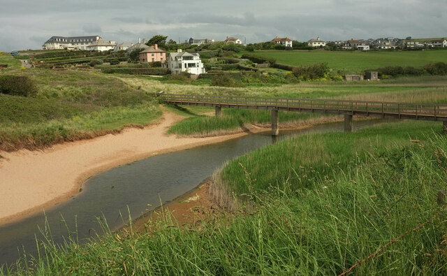
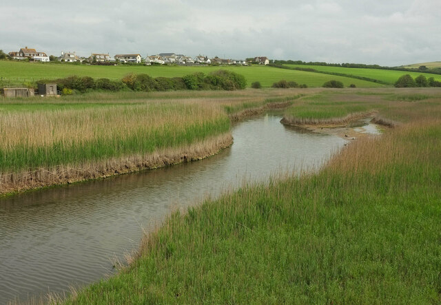
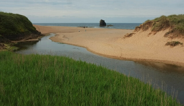
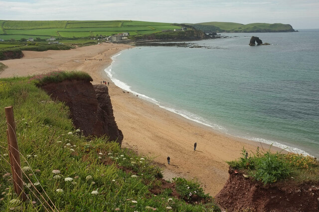
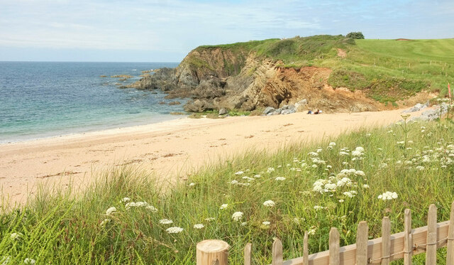
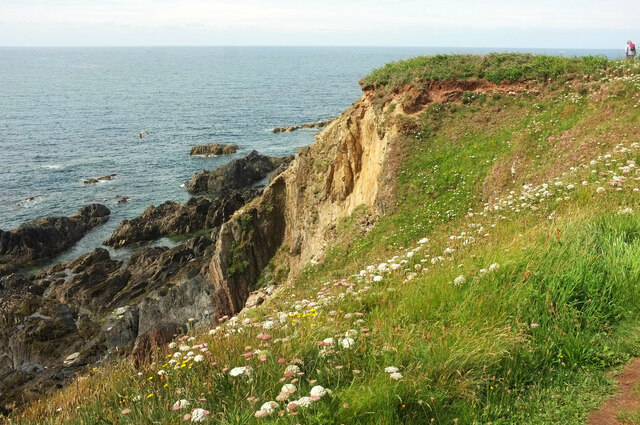
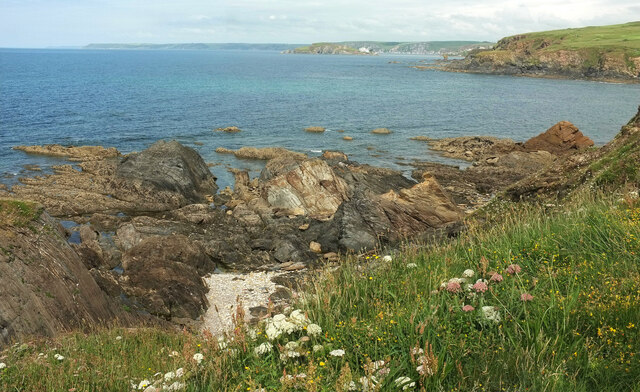
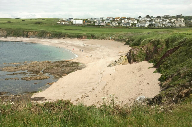
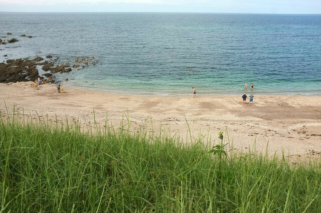
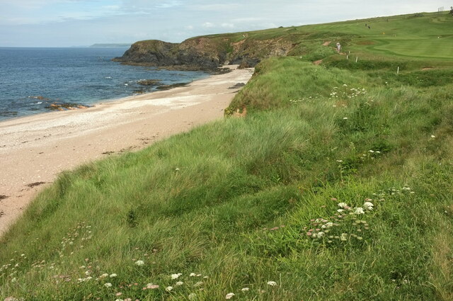
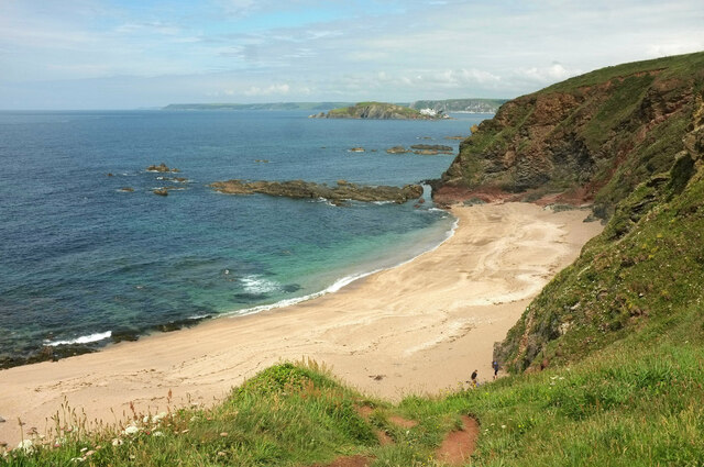
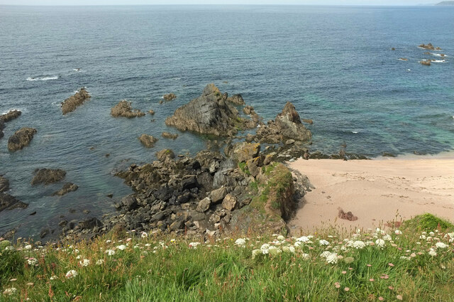
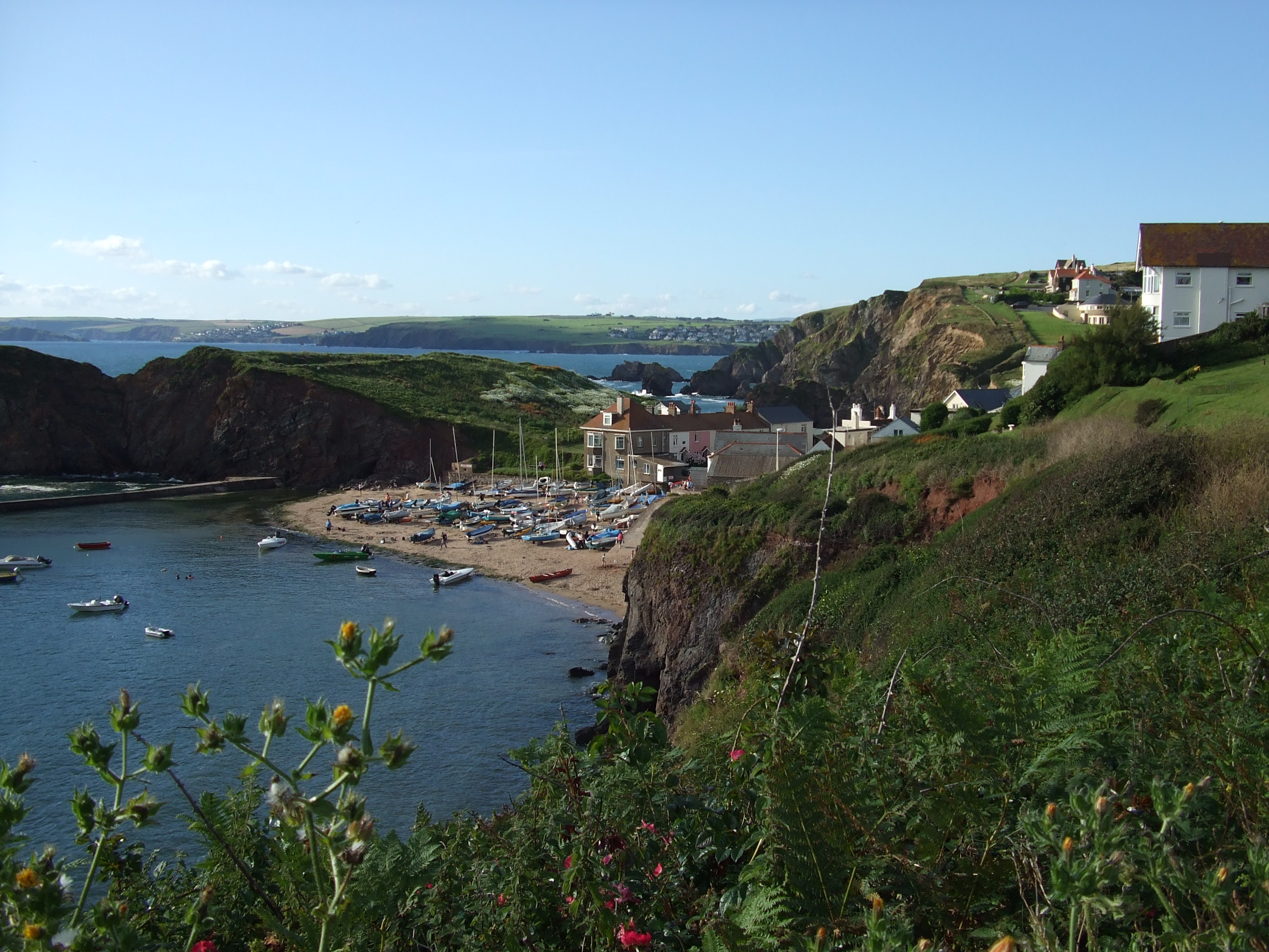
Ireland Sands is a picturesque beach located in Devon, England. Situated along the South West Coast Path, this sandy beach offers visitors stunning views of the coastline and the English Channel. With its unspoiled beauty and tranquil atmosphere, Ireland Sands is a popular destination for both locals and tourists seeking a peaceful escape.

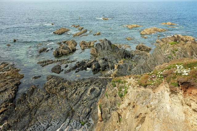
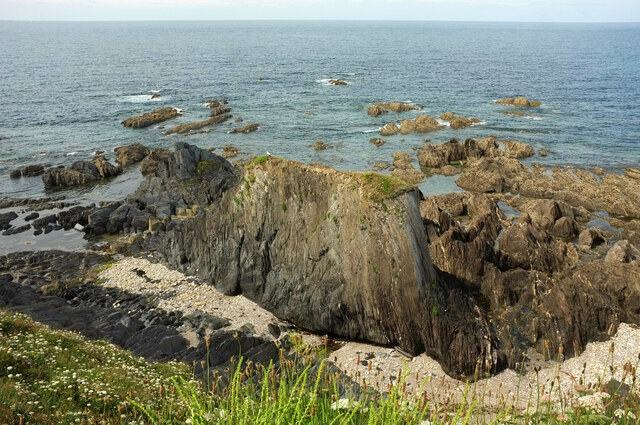
The beach stretches for approximately half a mile and is known for its soft golden sand and crystal-clear waters. At low tide, the beach expands, revealing rock pools teeming with marine life, making it a great spot for families and nature enthusiasts to explore. The gently sloping shore also provides a safe and enjoyable swimming experience for all ages.

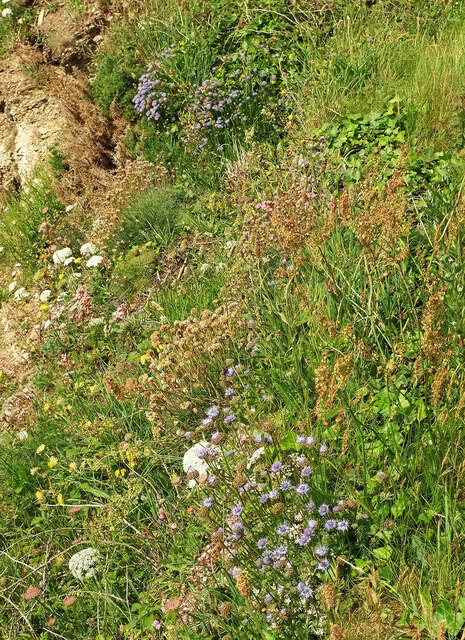
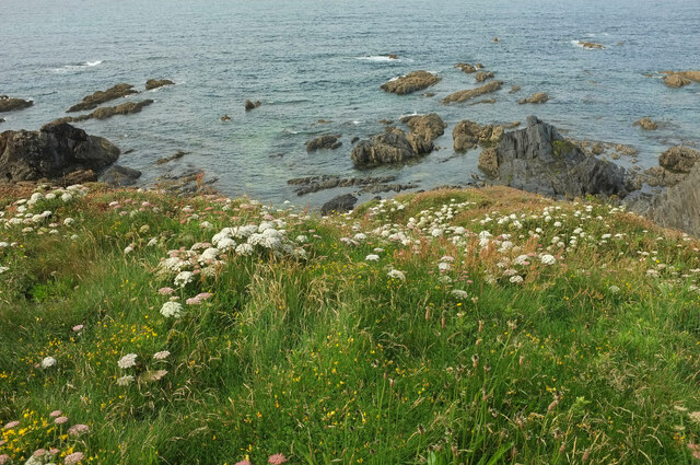
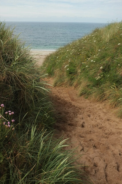
Surrounded by rolling hills and lush greenery, Ireland Sands offers ample opportunities for scenic walks and hikes, with several trails leading to breathtaking viewpoints. The area is also home to a diverse range of flora and fauna, making it a haven for birdwatchers and wildlife enthusiasts.

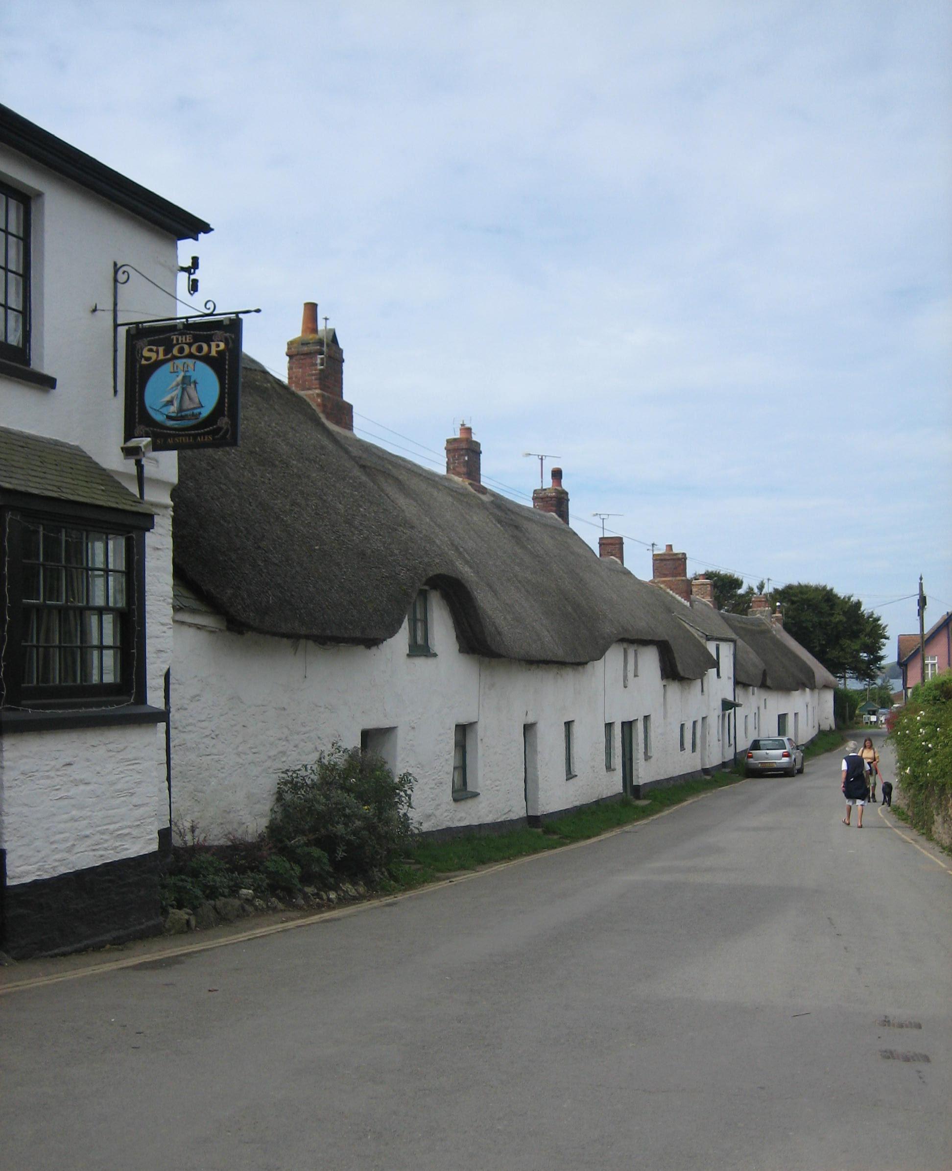
Facilities at Ireland Sands are limited, adding to its untouched charm. However, there is a small car park nearby, providing convenient access to the beach. Visitors are advised to bring their own food and drink, as there are no cafes or restaurants in the immediate vicinity.

Overall, Ireland Sands in Devon is a hidden gem that showcases the natural beauty of the region. Its idyllic setting, pristine sands, and stunning coastal scenery make it a truly special place to visit for those in search of tranquility and natural splendor.

If you have any feedback on the listing, please let us know in the comments section below.

Ireland Sands Images

Images are sourced within 2km of 50.264147/-3.8686648 or Grid Reference SX6642. Thanks to Geograph Open Source API. All images are credited.

South Milton stream Looking right from <a href="https://www.geograph.org.uk/photo/6879225">SX6741 : Sand dunes, Thurlestone</a>, with overlap, and showing more of the footbridge carrying South Milton footpath 9 and the coast path.
South Milton stream
Looking right from SX6741 : Sand dunes, Thurlestone, with overlap, and showing more of the footbridge carrying South Milton footpath 9 and the coast path.
South Milton stream Looking upstream from the eastern side of the footbridge seen in <a href="https://www.geograph.org.uk/photo/7152020">SX6741 : South Milton stream</a>.
South Milton stream
Looking upstream from the eastern side of the footbridge seen in SX6741 : South Milton stream.
South Milton stream Looking left from <a href="https://www.geograph.org.uk/photo/7152032">SX6741 : South Milton stream</a>, and showing the stream approaching the sea, as seen in <a href="https://www.geograph.org.uk/photo/6879225">SX6741 : Sand dunes, Thurlestone</a>. Thurlestone Rock is prominent in the centre.
South Milton stream
Looking left from SX6741 : South Milton stream, and showing the stream approaching the sea, as seen in SX6741 : Sand dunes, Thurlestone. Thurlestone Rock is prominent in the centre.
Thurlestone Sand From the clifftop coast path. On the right is Thurlestone Rock <a title="https://www.geograph.org.uk/gridref/SX6741?centi=SX674414" href="https://www.geograph.org.uk/gridref/SX6741?centi=SX674414">Link</a> , with Bolt Tail jutting out beyond.
Thurlestone Sand
From the clifftop coast path. On the right is Thurlestone Rock Link , with Bolt Tail jutting out beyond.
Cliffs at Warren Point Looking across Leas Foot Sand from the coast path.
Cliffs at Warren Point
Looking across Leas Foot Sand from the coast path.
Sheepsbit near Warren Point Jasione montana plus other plants on the cliffs east of the headland.
Sheepsbit near Warren Point
Jasione montana plus other plants on the cliffs east of the headland.
Cliffs near Warren Point Plus coastal rocks. Wild carrot is the dominant flower in the foreground.
Cliffs near Warren Point
Plus coastal rocks. Wild carrot is the dominant flower in the foreground.
Warren Point With The Delvers, offshore rocks seen from the coast path.
Warren Point
With The Delvers, offshore rocks seen from the coast path.
The Delvers Rocks north of Warren Point with a view along the coast to Burgh Island and beyond.
The Delvers
Rocks north of Warren Point with a view along the coast to Burgh Island and beyond.
The Delvers Rocks off Warren Point.
The Delvers
Rocks off Warren Point.
The Delvers Rocks off Warren Point.
The Delvers
Rocks off Warren Point.
Yarmouth Sand Also shown at <a title="https://www.geograph.org.uk/search.php?i=155564472" href="https://www.geograph.org.uk/search.php?i=155564472">Link</a>. Thurlestone is in the background.
Yarmouth Sand
Also shown at Link. Thurlestone is in the background.
Yarmouth Sand From the coast path.
Yarmouth Sand
From the coast path.
Path to Yarmouth Sand Thurlestone footpath 16, seen from where it is crossed by the coast path.
Path to Yarmouth Sand
Thurlestone footpath 16, seen from where it is crossed by the coast path.
Yarmouth Sand Loam Castle <a title="https://www.geograph.org.uk/search.php?i=155565115" href="https://www.geograph.org.uk/search.php?i=155565115">Link</a> is the headland at the north end of the beach. The distant headlands are Rame Head and Stoke Point.
Yarmouth Sand
Loam Castle Link is the headland at the north end of the beach. The distant headlands are Rame Head and Stoke Point.
Broad Sand A cove between Yarmouth Sand and Bantham Sand. Ahead is Burgh Island with its hotel.
Broad Sand
A cove between Yarmouth Sand and Bantham Sand. Ahead is Burgh Island with its hotel.
Rocks by Broad Sand Looking left from <a href="https://www.geograph.org.uk/photo/7153086">SX6642 : Broad Sand</a>.
Rocks by Broad Sand
Looking left from SX6642 : Broad Sand.
Goatsbeard near Butter Cove Tragopogon pratensis by the clifftop coastal path.
Goatsbeard near Butter Cove
Tragopogon pratensis by the clifftop coastal path.
Show me another place!

Ireland Sands is located at Grid Ref: SX6642 (Lat: 50.264147, Lng: -3.8686648)

Administrative County: Devon

District: South Hams

Police Authority: Devon and Cornwall

What 3 Words

///punctured.merely.alarm. Near Kingsbridge, Devon

Related Wikis

SS Louis Sheid

SS Louis Sheid was a 6,057 ton Belgian steamer that ran aground off Devon after escaping U-47 following the rescue of the captain and crew of the freighter...

Thurlestone

Thurlestone is a village located 5 miles (8.0 km) west of Kingsbridge in the South Hams district in south Devon, England. There is an electoral ward in...

Bantham

Bantham is a coastal village in south Devon, England. It is in the South Hams district and lies on the estuary of the River Avon a quarter of a mile from...

Hope Cove

Hope Cove is a small seaside village within the civil parish of South Huish in South Hams District, Devon, England. It is located 5 miles (8.0 km) west...

Nearby Amenities

Located within 500m of 50.264147,-3.8686648
Source: PGS
Lat/Long: 50.2650274/-3.862378
The Books
Place: locality
Lat/Long: 50.2605043/-3.8653248
Warren Point
Place: locality
Lat/Long: 50.2636965/-3.8678121
Bench
Backrest: yes
Lat/Long: 50.2657145/-3.8672469
Bench
Backrest: yes
Lat/Long: 50.2660783/-3.8670152
Bench
Backrest: no
Lat/Long: 50.264594/-3.8678852
The data included in this document is from www.openstreetmap.org. The data is made available under ODbL.

Have you been to Ireland Sands?

Leave your review of Ireland Sands below (or comments, questions and feedback).