Warren Point

Coastal Feature, Headland, Point in Devon South Hams

England

Warren Point

South Milton stream Looking right from <a href="https://www.geograph.org.uk/photo/6879225">SX6741 : Sand dunes, Thurlestone</a>, with overlap, and showing more of the footbridge carrying South Milton footpath 9 and the coast path.
South Milton stream Credit: Derek Harper

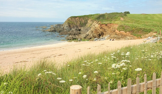
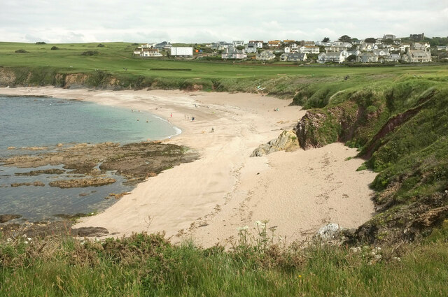
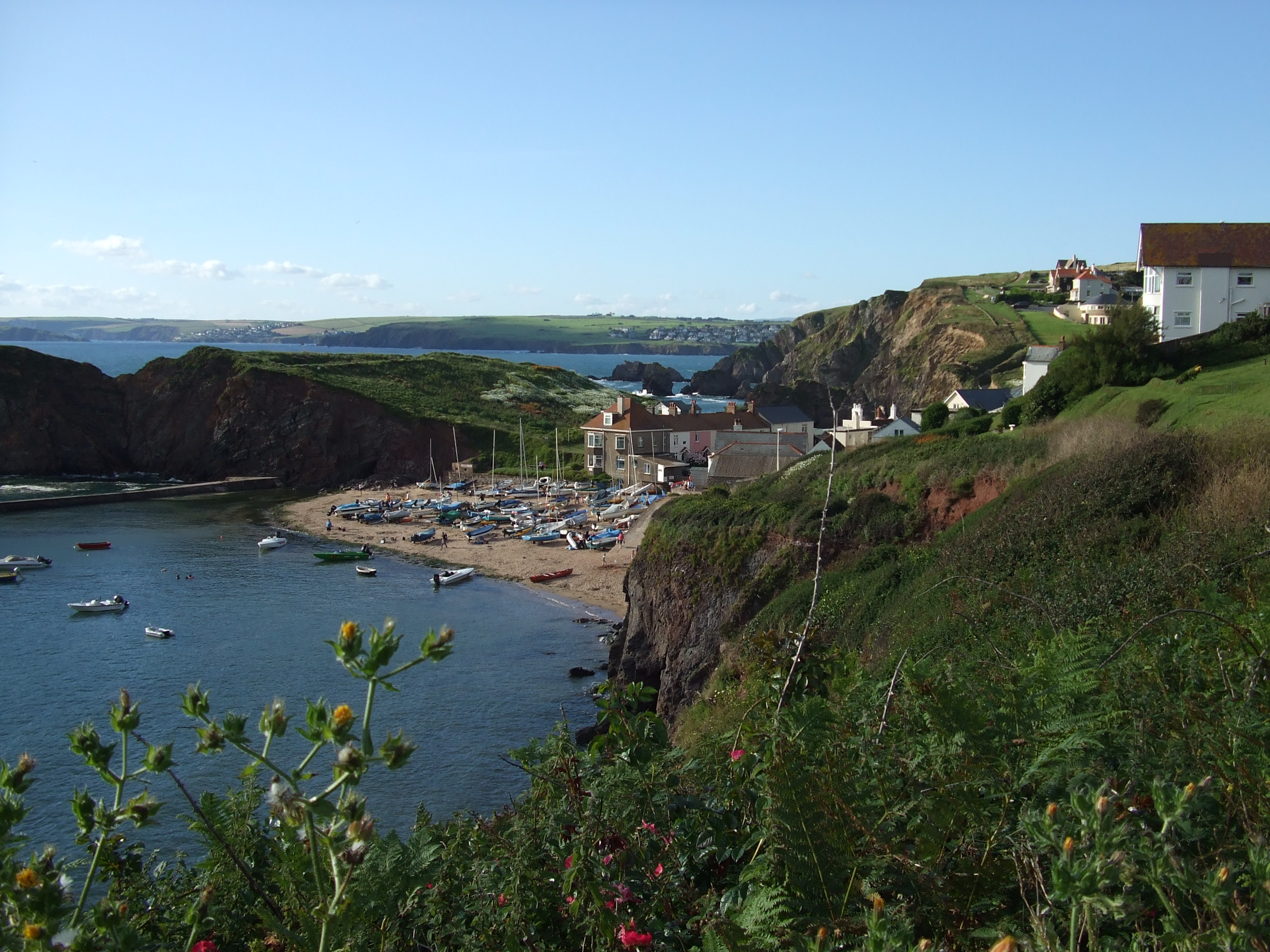
Warren Point, located in Devon, is a prominent coastal feature characterized by its picturesque headland and scenic point. Situated on the southern coast of England, it is bordered by the English Channel, providing breathtaking views of the ocean and surrounding landscapes.

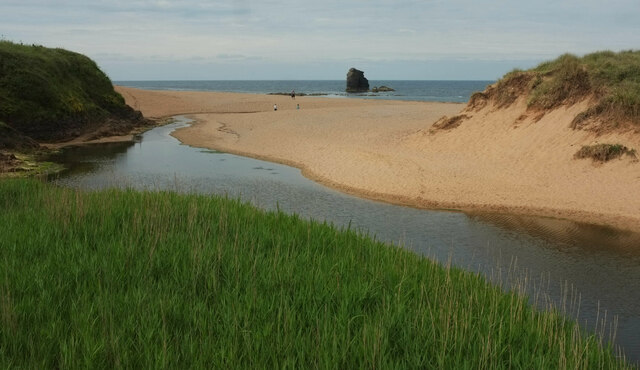
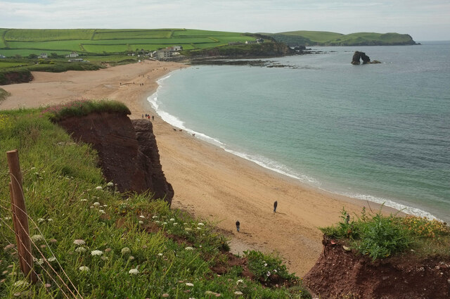
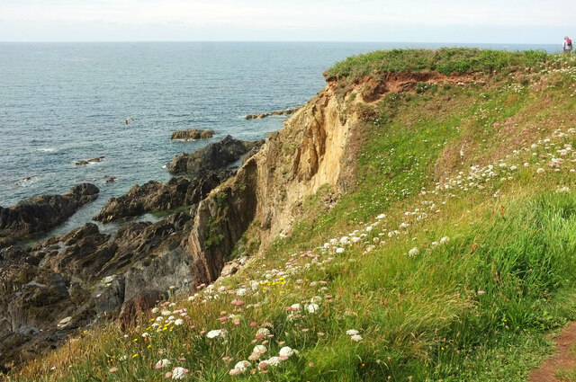
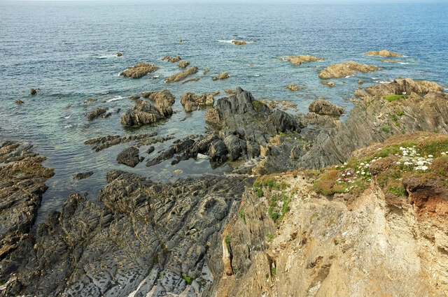
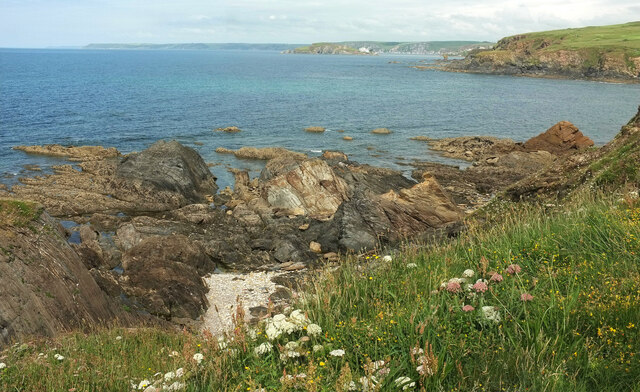
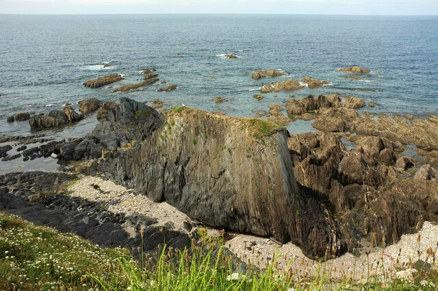
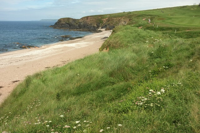
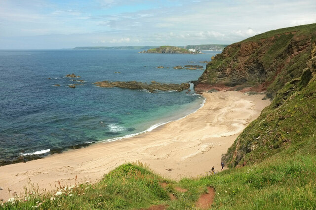
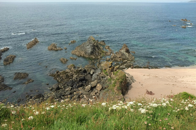
The headland of Warren Point boasts rugged cliffs that jut out into the sea, creating a visually striking silhouette against the horizon. These cliffs are composed of sedimentary rocks, primarily limestone and sandstone, which have been shaped by the relentless forces of wind and water over millions of years.

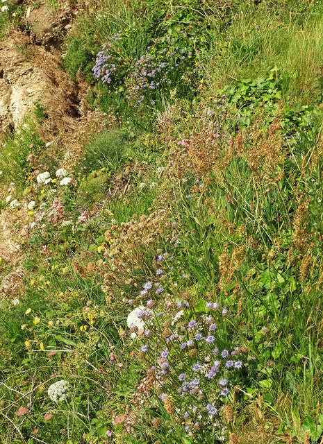
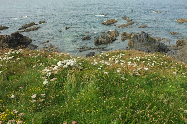
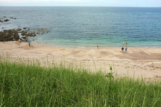
The point itself is a narrow projection of land that extends into the ocean, offering visitors an ideal vantage point to observe marine life and watch the ebb and flow of the tides. The area is renowned for its diverse ecosystem, with a variety of plant and animal species calling it home. Seabirds such as gulls and cormorants can often be seen perched on the cliffs, while seals and dolphins occasionally make appearances in the surrounding waters.

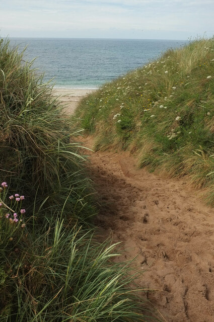
Warren Point is a popular destination for outdoor enthusiasts, attracting hikers, birdwatchers, and nature lovers alike. There are several walking trails that lead visitors along the coastline, providing opportunities to explore the headland and its unique geological formations. The area also offers stunning sunsets, making it a favorite spot for photographers to capture the beauty of the coast.

Overall, Warren Point stands as a testament to the captivating beauty of Devon's coastal landscape, offering a tranquil retreat for those seeking a connection with nature and a glimpse of the awe-inspiring power of the sea.

If you have any feedback on the listing, please let us know in the comments section below.

Warren Point Images

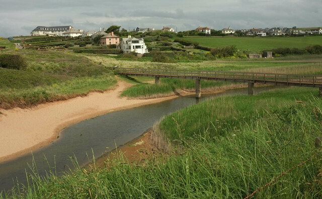
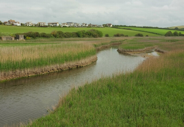
Images are sourced within 2km of 50.263078/-3.8685809 or Grid Reference SX6642. Thanks to Geograph Open Source API. All images are credited.

South Milton stream Looking right from <a href="https://www.geograph.org.uk/photo/6879225">SX6741 : Sand dunes, Thurlestone</a>, with overlap, and showing more of the footbridge carrying South Milton footpath 9 and the coast path.
South Milton stream
Looking right from SX6741 : Sand dunes, Thurlestone, with overlap, and showing more of the footbridge carrying South Milton footpath 9 and the coast path.
South Milton stream Looking upstream from the eastern side of the footbridge seen in <a href="https://www.geograph.org.uk/photo/7152020">SX6741 : South Milton stream</a>.
South Milton stream
Looking upstream from the eastern side of the footbridge seen in SX6741 : South Milton stream.
South Milton stream Looking left from <a href="https://www.geograph.org.uk/photo/7152032">SX6741 : South Milton stream</a>, and showing the stream approaching the sea, as seen in <a href="https://www.geograph.org.uk/photo/6879225">SX6741 : Sand dunes, Thurlestone</a>. Thurlestone Rock is prominent in the centre.
South Milton stream
Looking left from SX6741 : South Milton stream, and showing the stream approaching the sea, as seen in SX6741 : Sand dunes, Thurlestone. Thurlestone Rock is prominent in the centre.
Thurlestone Sand From the clifftop coast path. On the right is Thurlestone Rock <a title="https://www.geograph.org.uk/gridref/SX6741?centi=SX674414" href="https://www.geograph.org.uk/gridref/SX6741?centi=SX674414">Link</a> , with Bolt Tail jutting out beyond.
Thurlestone Sand
From the clifftop coast path. On the right is Thurlestone Rock Link , with Bolt Tail jutting out beyond.
Cliffs at Warren Point Looking across Leas Foot Sand from the coast path.
Cliffs at Warren Point
Looking across Leas Foot Sand from the coast path.
Sheepsbit near Warren Point Jasione montana plus other plants on the cliffs east of the headland.
Sheepsbit near Warren Point
Jasione montana plus other plants on the cliffs east of the headland.
Cliffs near Warren Point Plus coastal rocks. Wild carrot is the dominant flower in the foreground.
Cliffs near Warren Point
Plus coastal rocks. Wild carrot is the dominant flower in the foreground.
Warren Point With The Delvers, offshore rocks seen from the coast path.
Warren Point
With The Delvers, offshore rocks seen from the coast path.
The Delvers Rocks north of Warren Point with a view along the coast to Burgh Island and beyond.
The Delvers
Rocks north of Warren Point with a view along the coast to Burgh Island and beyond.
The Delvers Rocks off Warren Point.
The Delvers
Rocks off Warren Point.
The Delvers Rocks off Warren Point.
The Delvers
Rocks off Warren Point.
Yarmouth Sand Also shown at <a title="https://www.geograph.org.uk/search.php?i=155564472" href="https://www.geograph.org.uk/search.php?i=155564472">Link</a>. Thurlestone is in the background.
Yarmouth Sand
Also shown at Link. Thurlestone is in the background.
Yarmouth Sand From the coast path.
Yarmouth Sand
From the coast path.
Path to Yarmouth Sand Thurlestone footpath 16, seen from where it is crossed by the coast path.
Path to Yarmouth Sand
Thurlestone footpath 16, seen from where it is crossed by the coast path.
Yarmouth Sand Loam Castle <a title="https://www.geograph.org.uk/search.php?i=155565115" href="https://www.geograph.org.uk/search.php?i=155565115">Link</a> is the headland at the north end of the beach. The distant headlands are Rame Head and Stoke Point.
Yarmouth Sand
Loam Castle Link is the headland at the north end of the beach. The distant headlands are Rame Head and Stoke Point.
Broad Sand A cove between Yarmouth Sand and Bantham Sand. Ahead is Burgh Island with its hotel.
Broad Sand
A cove between Yarmouth Sand and Bantham Sand. Ahead is Burgh Island with its hotel.
Rocks by Broad Sand Looking left from <a href="https://www.geograph.org.uk/photo/7153086">SX6642 : Broad Sand</a>.
Rocks by Broad Sand
Looking left from SX6642 : Broad Sand.
Goatsbeard near Butter Cove Tragopogon pratensis by the clifftop coastal path.
Goatsbeard near Butter Cove
Tragopogon pratensis by the clifftop coastal path.
Show me another place!

Warren Point is located at Grid Ref: SX6642 (Lat: 50.263078, Lng: -3.8685809)

Administrative County: Devon

District: South Hams

Police Authority: Devon and Cornwall

What 3 Words

///shocks.insurers.fuses. Near Kingsbridge, Devon

Related Wikis

SS Louis Sheid

SS Louis Sheid was a 6,057 ton Belgian steamer that ran aground off Devon after escaping U-47 following the rescue of the captain and crew of the freighter...

Thurlestone

Thurlestone is a village located 5 miles (8.0 km) west of Kingsbridge in the South Hams district in south Devon, England. There is an electoral ward in...

Hope Cove

Hope Cove is a small seaside village within the civil parish of South Huish in South Hams District, Devon, England. It is located 5 miles (8.0 km) west...

Hope Cove Life Boat

Hope Cove Life Boat (based in Hope Cove, Devon) was formed in 1878 and is a voluntary search and rescue service that operates an inshore rescue boat in...

Nearby Amenities

Located within 500m of 50.263078,-3.8685809
Source: PGS
Lat/Long: 50.2650274/-3.862378
The Books
Place: locality
Lat/Long: 50.2605043/-3.8653248
Warren Point
Place: locality
Lat/Long: 50.2636965/-3.8678121
Bench
Backrest: yes
Lat/Long: 50.2657145/-3.8672469
Bench
Backrest: yes
Lat/Long: 50.2660783/-3.8670152
Bench
Backrest: no
Lat/Long: 50.264594/-3.8678852
The data included in this document is from www.openstreetmap.org. The data is made available under ODbL.

Have you been to Warren Point?

Leave your review of Warren Point below (or comments, questions and feedback).