Broad Sand

Beach in Devon South Hams

England

Broad Sand

South Milton stream Looking right from <a href="https://www.geograph.org.uk/photo/6879225">SX6741 : Sand dunes, Thurlestone</a>, with overlap, and showing more of the footbridge carrying South Milton footpath 9 and the coast path.
South Milton stream Credit: Derek Harper

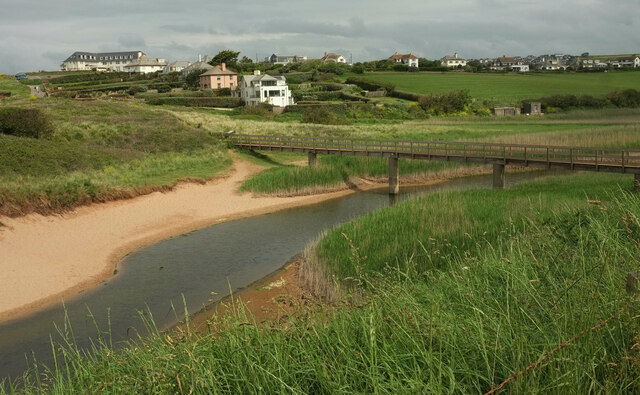
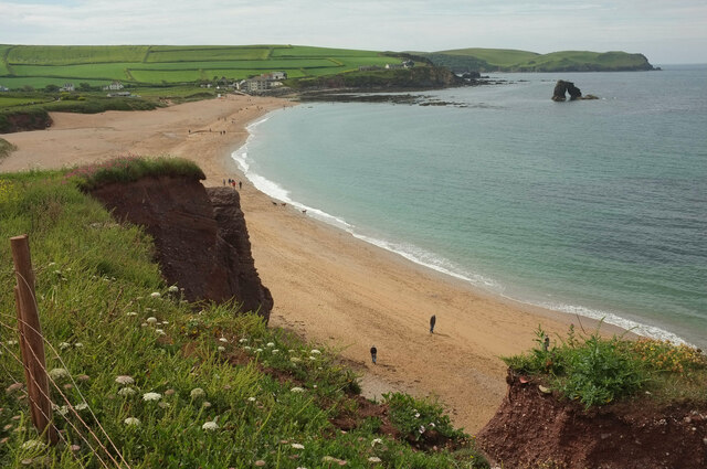
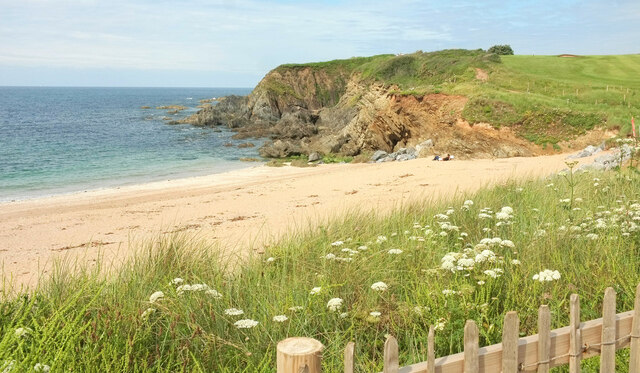
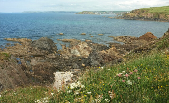
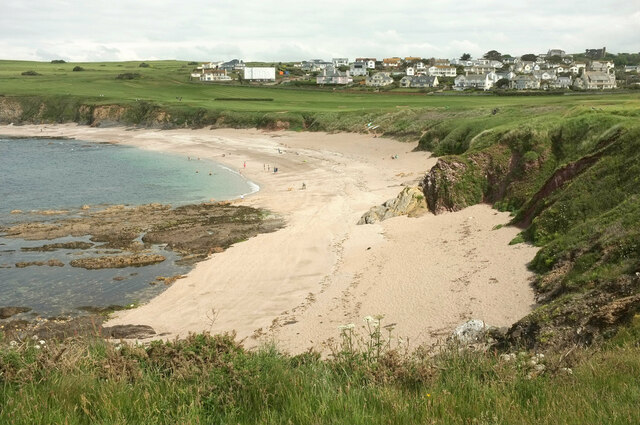
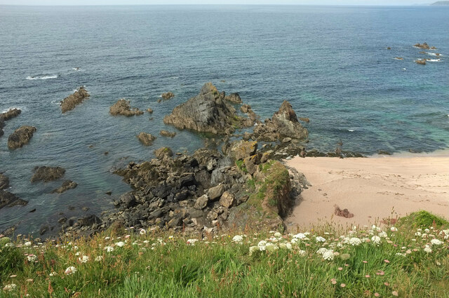
Broad Sand is a picturesque beach located on the southern coast of Devon, England. Situated between the popular seaside towns of Torquay and Paignton, it offers visitors a tranquil and idyllic setting to enjoy the beauty of the English Riviera.

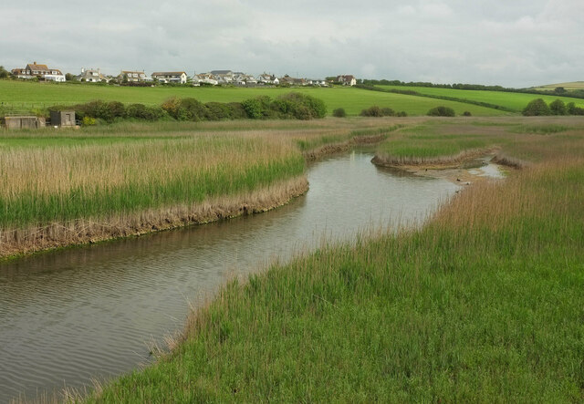
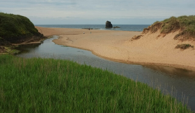
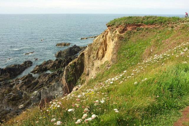
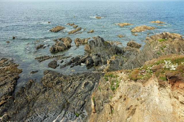
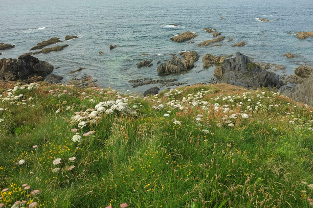
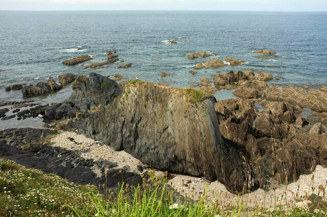
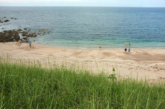
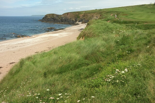
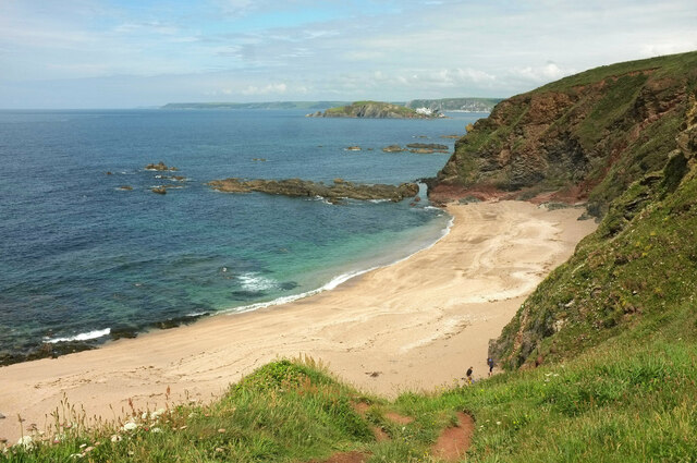
The beach itself is composed of fine golden sand, stretching for approximately half a mile along the coastline. It is bordered by cliffs on either side, providing a natural shelter from wind and creating a sense of seclusion. The crystal-clear waters of the English Channel lap gently against the shore, making it an ideal spot for swimming and paddling.

Broad Sand is known for its clean and well-maintained environment, with regular beach cleaning ensuring a pristine and litter-free space. Facilities such as toilets and refreshment kiosks are available nearby, ensuring visitors have all they need for a comfortable day at the beach.

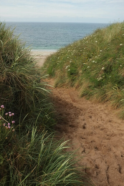
The surrounding area offers a range of activities for all ages. One can explore the nearby coastal path, which provides stunning views of the rugged cliffs and the sparkling sea. There are also opportunities for water sports enthusiasts, with kayaking and paddleboarding being popular choices.

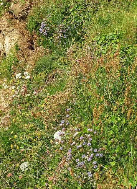
Nature lovers will appreciate the diverse flora and fauna found in the area, with various seabirds and marine life inhabiting the waters. The beach is also a great spot for rock pooling, where one can discover a variety of marine creatures.

Overall, Broad Sand in Devon offers a beautiful and peaceful beach experience, perfect for those seeking relaxation, natural beauty, and a touch of adventure.

If you have any feedback on the listing, please let us know in the comments section below.
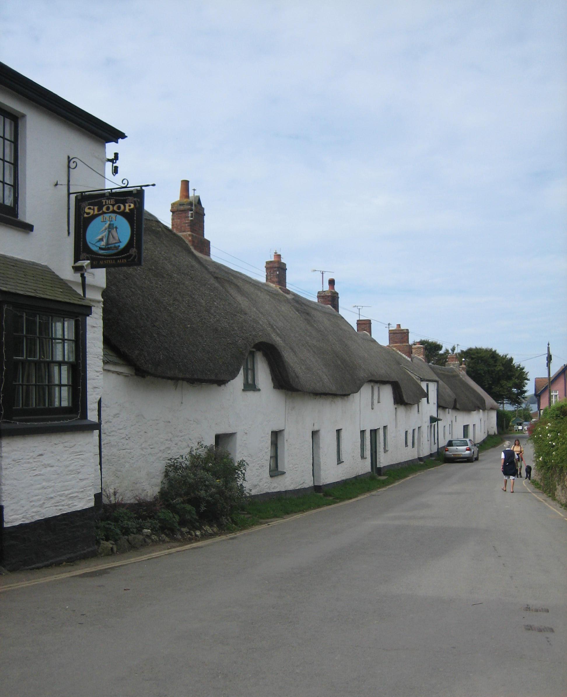
Broad Sand Images

Images are sourced within 2km of 50.270434/-3.8753663 or Grid Reference SX6642. Thanks to Geograph Open Source API. All images are credited.

South Milton stream Looking right from <a href="https://www.geograph.org.uk/photo/6879225">SX6741 : Sand dunes, Thurlestone</a>, with overlap, and showing more of the footbridge carrying South Milton footpath 9 and the coast path.
South Milton stream
Looking right from SX6741 : Sand dunes, Thurlestone, with overlap, and showing more of the footbridge carrying South Milton footpath 9 and the coast path.
South Milton stream Looking upstream from the eastern side of the footbridge seen in <a href="https://www.geograph.org.uk/photo/7152020">SX6741 : South Milton stream</a>.
South Milton stream
Looking upstream from the eastern side of the footbridge seen in SX6741 : South Milton stream.
South Milton stream Looking left from <a href="https://www.geograph.org.uk/photo/7152032">SX6741 : South Milton stream</a>, and showing the stream approaching the sea, as seen in <a href="https://www.geograph.org.uk/photo/6879225">SX6741 : Sand dunes, Thurlestone</a>. Thurlestone Rock is prominent in the centre.
South Milton stream
Looking left from SX6741 : South Milton stream, and showing the stream approaching the sea, as seen in SX6741 : Sand dunes, Thurlestone. Thurlestone Rock is prominent in the centre.
Thurlestone Sand From the clifftop coast path. On the right is Thurlestone Rock <a title="https://www.geograph.org.uk/gridref/SX6741?centi=SX674414" href="https://www.geograph.org.uk/gridref/SX6741?centi=SX674414">Link</a> , with Bolt Tail jutting out beyond.
Thurlestone Sand
From the clifftop coast path. On the right is Thurlestone Rock Link , with Bolt Tail jutting out beyond.
Cliffs at Warren Point Looking across Leas Foot Sand from the coast path.
Cliffs at Warren Point
Looking across Leas Foot Sand from the coast path.
Sheepsbit near Warren Point Jasione montana plus other plants on the cliffs east of the headland.
Sheepsbit near Warren Point
Jasione montana plus other plants on the cliffs east of the headland.
Cliffs near Warren Point Plus coastal rocks. Wild carrot is the dominant flower in the foreground.
Cliffs near Warren Point
Plus coastal rocks. Wild carrot is the dominant flower in the foreground.
Warren Point With The Delvers, offshore rocks seen from the coast path.
Warren Point
With The Delvers, offshore rocks seen from the coast path.
The Delvers Rocks north of Warren Point with a view along the coast to Burgh Island and beyond.
The Delvers
Rocks north of Warren Point with a view along the coast to Burgh Island and beyond.
The Delvers Rocks off Warren Point.
The Delvers
Rocks off Warren Point.
The Delvers Rocks off Warren Point.
The Delvers
Rocks off Warren Point.
Yarmouth Sand Also shown at <a title="https://www.geograph.org.uk/search.php?i=155564472" href="https://www.geograph.org.uk/search.php?i=155564472">Link</a>. Thurlestone is in the background.
Yarmouth Sand
Also shown at Link. Thurlestone is in the background.
Yarmouth Sand From the coast path.
Yarmouth Sand
From the coast path.
Path to Yarmouth Sand Thurlestone footpath 16, seen from where it is crossed by the coast path.
Path to Yarmouth Sand
Thurlestone footpath 16, seen from where it is crossed by the coast path.
Yarmouth Sand Loam Castle <a title="https://www.geograph.org.uk/search.php?i=155565115" href="https://www.geograph.org.uk/search.php?i=155565115">Link</a> is the headland at the north end of the beach. The distant headlands are Rame Head and Stoke Point.
Yarmouth Sand
Loam Castle Link is the headland at the north end of the beach. The distant headlands are Rame Head and Stoke Point.
Broad Sand A cove between Yarmouth Sand and Bantham Sand. Ahead is Burgh Island with its hotel.
Broad Sand
A cove between Yarmouth Sand and Bantham Sand. Ahead is Burgh Island with its hotel.
Rocks by Broad Sand Looking left from <a href="https://www.geograph.org.uk/photo/7153086">SX6642 : Broad Sand</a>.
Rocks by Broad Sand
Looking left from SX6642 : Broad Sand.
Goatsbeard near Butter Cove Tragopogon pratensis by the clifftop coastal path.
Goatsbeard near Butter Cove
Tragopogon pratensis by the clifftop coastal path.
Show me another place!

Broad Sand is located at Grid Ref: SX6642 (Lat: 50.270434, Lng: -3.8753663)

Administrative County: Devon

District: South Hams

Police Authority: Devon and Cornwall

What 3 Words

///shippers.twigs.crisper. Near Kingsbridge, Devon

Related Wikis

Bantham

Bantham is a coastal village in south Devon, England. It is in the South Hams district and lies on the estuary of the River Avon a quarter of a mile from...

Thurlestone

Thurlestone is a village located 5 miles (8.0 km) west of Kingsbridge in the South Hams district in south Devon, England. There is an electoral ward in...

SS Louis Sheid

SS Louis Sheid was a 6,057 ton Belgian steamer that ran aground off Devon after escaping U-47 following the rescue of the captain and crew of the freighter...

River Avon, Devon

The River Avon, also known as the River Aune, is a river in the county of Devon in the southwest of England. It rises in the southern half of Dartmoor...

Nearby Amenities

Located within 500m of 50.270434,-3.8753663
Source: PGS
Lat/Long: 50.2725295/-3.8804813
Source: PGS
Lat/Long: 50.2724154/-3.8805411
Source: PGS
Lat/Long: 50.271796/-3.8799416
Source: PGS
Lat/Long: 50.271756/-3.8801409
Source: PGS
Lat/Long: 50.2715468/-3.8791708
Source: PGS
Lat/Long: 50.2715349/-3.8790092
Source: PGS
Lat/Long: 50.2712963/-3.8781888
Source: PGS
Lat/Long: 50.2711225/-3.877811
Source: PGS
Lat/Long: 50.2710427/-3.8777575
Source: PGS
Lat/Long: 50.271304/-3.8786215
Source: PGS
Lat/Long: 50.2709506/-3.8783624
Source: PGS
Lat/Long: 50.270916/-3.8783061
Source: PGS
Lat/Long: 50.2700049/-3.8765954
Source: PGS
Lat/Long: 50.2700787/-3.8762092
Source: PGS
Lat/Long: 50.2699961/-3.8757119
Source: PGS
Lat/Long: 50.269877/-3.8759876
Source: PGS
Lat/Long: 50.2695085/-3.8755088
Source: PGS
Lat/Long: 50.2694342/-3.8756619
Source: PGS
Lat/Long: 50.2688148/-3.8758963
Source: PGS
Lat/Long: 50.2688599/-3.8745712
Source: PGS
Lat/Long: 50.268903/-3.8744255
Source: PGS
Lat/Long: 50.2682716/-3.8740566
Bench
Backrest: yes
Lat/Long: 50.2704788/-3.8742408
Bench
Backrest: yes
Lat/Long: 50.2713169/-3.8758827
Bench
Backrest: yes
Lat/Long: 50.2687814/-3.871908
Bench
Backrest: yes
Lat/Long: 50.2694977/-3.8735253
Bench
Backrest: yes
Lat/Long: 50.2723479/-3.8776328
Bench
Backrest: yes
Lat/Long: 50.2689991/-3.8726611
The data included in this document is from www.openstreetmap.org. The data is made available under ODbL.

Have you been to Broad Sand?

Leave your review of Broad Sand below (or comments, questions and feedback).