Bathpool

Settlement in Somerset Somerset West and Taunton

England

Bathpool

Canal bridge, Creech St Michael This bridge carries a footpath over the Bridgwater and Taunton Canal, 150m east of the main road bridge in Creech St Michael.
Canal bridge, Creech St Michael Credit: Crispin Purdye

Bathpool is a small village situated in the county of Somerset, England. Located approximately 7 miles northwest of Taunton, the village is nestled in a picturesque rural landscape, characterized by rolling hills and lush green fields. Bathpool is part of the Sedgemoor district and falls within the civil parish of North Petherton.

The village is primarily residential, with a population of around 500 residents. The housing in Bathpool is a mix of traditional cottages and modern properties, offering a variety of accommodation options. The village is known for its tight-knit community and friendly atmosphere, making it an attractive place to live for families and individuals seeking a peaceful countryside lifestyle.

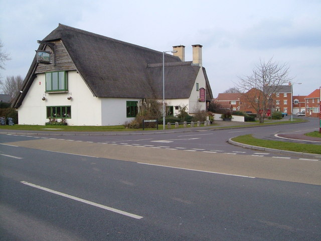
Although small in size, Bathpool offers a range of amenities to its residents. These include a local convenience store, a post office, and a pub, providing essential services and a place for locals to gather and socialize. Additionally, the nearby town of Taunton offers a wider range of shopping, leisure, and entertainment facilities.

Nature enthusiasts and outdoor lovers are drawn to Bathpool for its scenic surroundings. The village is surrounded by beautiful countryside, offering opportunities for walking, cycling, and exploring the nearby Quantock Hills, an Area of Outstanding Natural Beauty. The River Tone also runs close to the village, providing a tranquil spot for fishing and picnicking.

In summary, Bathpool is a charming village in Somerset that offers a peaceful and idyllic rural lifestyle, with a close-knit community and stunning natural surroundings.

If you have any feedback on the listing, please let us know in the comments section below.

Bathpool Images

Images are sourced within 2km of 51.028735/-3.06334 or Grid Reference ST2526. Thanks to Geograph Open Source API. All images are credited.

Canal bridge, Creech St Michael This bridge carries a footpath over the Bridgwater and Taunton Canal, 150m east of the main road bridge in Creech St Michael.
Canal bridge, Creech St Michael
This bridge carries a footpath over the Bridgwater and Taunton Canal, 150m east of the main road bridge in Creech St Michael.
Railway bridge & track, Creech St Michael View from the access road bridge towards the main road bridge over the Paddington - Penzance mainline.  The line separates two miles east, one to Bridgwater and Bristol the other via Langport and Westbury.  The trackbed looks as if it was originally set out for 2 more lines to  allow parallel running in and out of Taunton.
Railway bridge & track, Creech St Michael
View from the access road bridge towards the main road bridge over the Paddington - Penzance mainline. The line separates two miles east, one to Bridgwater and Bristol the other via Langport and Westbury. The trackbed looks as if it was originally set out for 2 more lines to allow parallel running in and out of Taunton.
The Creech Castle Hotel. Taunton A local landmark at the busy junction of the A38 and the A358.
The Creech Castle Hotel. Taunton
A local landmark at the busy junction of the A38 and the A358.
Hankridge Farm Sainsbury's. Taunton's only out of town shopping centre is close to the M5 junction. Other stores on site include B&Q, Comet, Curry's and Halfords but the stores are quite small in comparison with those outside larger towns.
Hankridge Farm Sainsbury's.
Taunton's only out of town shopping centre is close to the M5 junction. Other stores on site include B&Q, Comet, Curry's and Halfords but the stores are quite small in comparison with those outside larger towns.
The Merry Monk. Monkton Heathfield. The conveniently located bus stop is handy for those monks who get a little too merry.
The Merry Monk. Monkton Heathfield.
The conveniently located bus stop is handy for those monks who get a little too merry.
Monkton Elm. Taunton's largest Garden Centre is privately owned. Unlike the national chains the emphasis is still on living plants! On the day the picture was taken Santa Claus himself was visiting.
Monkton Elm.
Taunton's largest Garden Centre is privately owned. Unlike the national chains the emphasis is still on living plants! On the day the picture was taken Santa Claus himself was visiting.
Cheddon Fitzpaine The village of Cheddon Fitzpaine, just beyond the suburbs of Taunton, from  footpath T 5/11 to the south-west.
Cheddon Fitzpaine
The village of Cheddon Fitzpaine, just beyond the suburbs of Taunton, from footpath T 5/11 to the south-west.
The "Master Thatcher", Taunton It may be thatched but this is a modern pub, next to a Tesco Express and set amidst the extensive housing estates of south-east Taunton. Seen from the south across Lisieux (twin town) Way. 2:30 pm
The "Master Thatcher", Taunton
It may be thatched but this is a modern pub, next to a Tesco Express and set amidst the extensive housing estates of south-east Taunton. Seen from the south across Lisieux (twin town) Way. 2:30 pm
Tractor graveyard beside the A3259 Tractors seem to congregate in this field when their working life is over. The main road leads north eastwards out of Taunton.
Tractor graveyard beside the A3259
Tractors seem to congregate in this field when their working life is over. The main road leads north eastwards out of Taunton.
Sidbrook, near Monkton Heathfield An area of scattered houses on the north eastern fringe of Taunton
Sidbrook, near Monkton Heathfield
An area of scattered houses on the north eastern fringe of Taunton
Gates to Sidbrook Coach House These specially commissioned gates include a coach and horses and each gatepost is topped by a horse's head.
Gates to Sidbrook Coach House
These specially commissioned gates include a coach and horses and each gatepost is topped by a horse's head.
St. Teresa of Lisieux This Roman Catholic Church was built at the same time as the Priorswood (housing) Estate. The smaller building to the right side is accommodation for the clergy. 
Although the usual spelling is St. Theresa, the "h" seems to be missing in this case.
St. Teresa of Lisieux
This Roman Catholic Church was built at the same time as the Priorswood (housing) Estate. The smaller building to the right side is accommodation for the clergy. Although the usual spelling is St. Theresa, the "h" seems to be missing in this case.
Blackbrook Business Park, Junction 25 of the M5 The Holiday Inn and the Harvester are to the right of the fountain.
Blackbrook Business Park, Junction 25 of the M5
The Holiday Inn and the Harvester are to the right of the fountain.
The Bridgwater  and Taunton Canal passes underneath the M5 This section of the canal towpath is part of the National Cycle Route number 3.
The Bridgwater and Taunton Canal passes underneath the M5
This section of the canal towpath is part of the National Cycle Route number 3.
M5 motorway near Creech St. Michael Looking southwest towards Junction 25,about one mile away.
M5 motorway near Creech St. Michael
Looking southwest towards Junction 25,about one mile away.
Ruishton Ruishton was formerly a village but now is virtually joined to Taunton. The large out of town shops are less than a kilometre away along a footpath under the M5.
Ruishton
Ruishton was formerly a village but now is virtually joined to Taunton. The large out of town shops are less than a kilometre away along a footpath under the M5.
Tanpits Cider Farm, Taunton This farm operates as a camp site in the summer months and we stayed in this cider orchard, surrounded by many rabbits and visited by free-range ducks, chickens, cats and (4!) peacocks. We could also hear geese and dogs and, along with the nearby main road and railway, this made it probably the noisiest camp site I've ever stayed on but things seemed to quieten down at night and it was very basic and cheap - both criteria I favour.
Tanpits Cider Farm, Taunton
This farm operates as a camp site in the summer months and we stayed in this cider orchard, surrounded by many rabbits and visited by free-range ducks, chickens, cats and (4!) peacocks. We could also hear geese and dogs and, along with the nearby main road and railway, this made it probably the noisiest camp site I've ever stayed on but things seemed to quieten down at night and it was very basic and cheap - both criteria I favour.
Noisy neighbours At <a href="https://www.geograph.org.uk/photo/196606">ST2526 : Tanpits Cider Farm, Taunton</a>. The peacock (one of four) seemed to delight in chasing the white cockerel around the orchard at this cider farm camp site close by the A38 northeast of Taunton.
Noisy neighbours
At ST2526 : Tanpits Cider Farm, Taunton. The peacock (one of four) seemed to delight in chasing the white cockerel around the orchard at this cider farm camp site close by the A38 northeast of Taunton.
Show me another place!

Bathpool is located at Grid Ref: ST2526 (Lat: 51.028735, Lng: -3.06334)

Administrative County: Somerset

District: Somerset West and Taunton

Police Authority: Avon and Somerset

What 3 Words

///slack.hydrant.hello. Near Creech St Michael, Somerset

Related Wikis

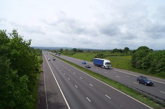
2011 M5 motorway crash

On 4 November 2011, a multiple-vehicle collision occurred on the M5 motorway near Taunton, Somerset, in South West England. The crash involved dozens of...

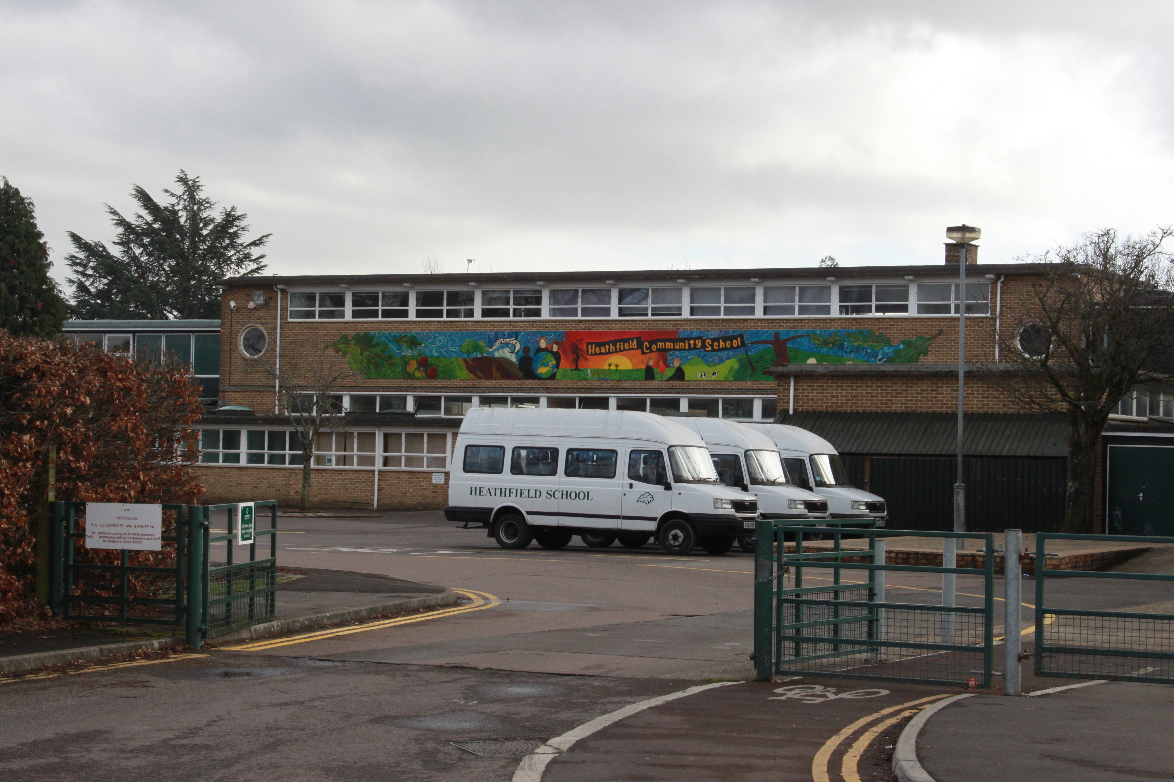
Heathfield Community School

Monkton Wood Academy is an Academy (England and Wales) located at West Monkton in the outskirts of Taunton, England. It had 1,192 pupils aged 11 to 18...

Cambria Farm

Cambria Farm is the site of a Bronze, Iron Age, Roman rural settlement, between Ruishton and Taunton, Somerset, England. A survey of the site was carried...

Ruishton

Ruishton is a village and civil parish in Somerset, England, situated on the River Tone and A358 road 2 miles (3.2 km) east of Taunton. The village has...

Roman Catholic Church of St Teresa of Lisieux, Taunton

The Roman Catholic Church of St Teresa of Lisieux in Taunton, Somerset, England, dates from 1958–1959. It is the only known church design of Eric Francis...

Creech St Michael

Creech St Michael is a village and civil parish in Somerset, three miles east of Taunton. The parish straddles the M5 motorway and includes several scattered...

Church of St Mary, Cheddon Fitzpaine

The Anglican Church of St Mary in Cheddon Fitzpaine, Somerset, England was built in the late 13th century. It is a Grade II* listed building. == History... ==

Taunton Town F.C.

Taunton Town Football Club are an English football club based in Taunton, Somerset. They compete in the National League South and play their home matches...

Nearby Amenities

Located within 500m of 51.028735,-3.06334
Traffic Signals
Traffic Signals: signal
Traffic Signals Direction: forward
Lat/Long: 51.0305221/-3.0628206
Barrier: bollard
Bicycle: yes
Foot: yes
Lat/Long: 51.0278336/-3.0663096
Barrier: bollard
Bicycle: yes
Bollard: removable
Foot: yes
Material: plastic
Lat/Long: 51.0304943/-3.0693118
Broomhay Crossing
Crossing Barrier: yes
Railway: level_crossing
Lat/Long: 51.0257538/-3.0639587
Brand: National Grid
Brand Wikidata: Q1465461
Colour: gray
Line Attachment: suspension
Material: steel
Operator: National Grid Electricity Distribution Plc
Operator Old: Western Power Distribution
Operator Wikidata: Q7988183
Owner: National Grid Electricity Distribution (South West) Plc
Owner Wikidata: Q114397866
Power: tower
Structure: lattice
Lat/Long: 51.0332236/-3.0633456
Broomhay Crossing
Crossing Barrier: yes
Railway: level_crossing
Lat/Long: 51.0257946/-3.0639439
Barrier: bollard
Bicycle: yes
Foot: yes
Lat/Long: 51.02935/-3.06421
Give Way
Direction: forward
Lat/Long: 51.0300823/-3.0655437
Passing Place
Lat/Long: 51.0263983/-3.0583733
Give Way
Direction: backward
Lat/Long: 51.0271762/-3.067912
Crossing
Button Operated: yes
Crossing: traffic_signals
Crossing Island: no
Crossing Ref: pelican
Tactile Paving: yes
Traffic Signals Sound: no
Traffic Signals Vibration: yes
Lat/Long: 51.0274921/-3.0670214
Power: pole
Lat/Long: 51.0300384/-3.0693927
Power: pole
Ref: BA52
Lat/Long: 51.0301583/-3.0691967
Power: pole
Ref: BA51
Lat/Long: 51.0303904/-3.0687482
Power: pole
Lat/Long: 51.0309443/-3.0675969
Power: pole
Lat/Long: 51.0313456/-3.0667898
Power: pole
Lat/Long: 51.031794/-3.0655672
Brand: National Grid
Brand Wikidata: Q1465461
Location Transition: yes
Material: wood
Operator: National Grid Electricity Distribution Plc
Operator Old: Western Power Distribution
Operator Wikidata: Q7988183
Owner: National Grid Electricity Distribution (South West) Plc
Owner Wikidata: Q114397866
Power: pole
Lat/Long: 51.0322874/-3.0641994
Crossing
Bicycle: dismount
Crossing: unmarked
Kerb: lowered
Tactile Paving: yes
Lat/Long: 51.029909/-3.0629472
Give Way
Direction: backward
Lat/Long: 51.0328178/-3.0662768
Barrier: bollard
Bicycle: yes
Foot: yes
Material: metal
Lat/Long: 51.0294857/-3.0659697
Barrier: bollard
Bicycle: yes
Foot: yes
Material: metal
Lat/Long: 51.0295639/-3.0658936
Access: yes
Entrance: yes
Wheelchair: yes
Lat/Long: 51.0276438/-3.0659007
Give Way
Lat/Long: 51.026824/-3.0640769
Crossing
Bicycle: dismount
Crossing: unmarked
Kerb: lowered
Tactile Paving: yes
Lat/Long: 51.03009/-3.0631711
Crossing
Bicycle: dismount
Crossing: unmarked
Kerb: lowered
Tactile Paving: yes
Lat/Long: 51.0301018/-3.0633057
Crossing Island: yes
Traffic Calming: island
Lat/Long: 51.0305598/-3.0630714
Crossing
Bicycle: dismount
Crossing: traffic_signals
Crossing Ref: pelican
Lat/Long: 51.0310464/-3.0618218
Post Box
Brand: Royal Mail
Brand Wikidata: Q638098
Collection Times: Mo-Fr 16:15; Sa 10:30
Mapillary: 3879977288781798
Operator: Royal Mail
Operator Wikidata: Q638098
Post Box Type: pillar
Ref: TA2 185
Survey Date: 2020-03-11
Lat/Long: 51.0274494/-3.0673662
Post Box
Operator: Royal Mail
Operator Wikidata: Q638098
Ref: TA2 677
Lat/Long: 51.0322656/-3.0627923
Noexit: yes
Lat/Long: 51.0310733/-3.0606961
Barrier: bollard
Bicycle: yes
Foot: yes
Material: plastic
Lat/Long: 51.0315629/-3.0579562
Crossing
Bicycle: dismount
Crossing: uncontrolled
Kerb: lowered
Tactile Paving: yes
Lat/Long: 51.0311541/-3.0577375
Barrier: bollard
Bicycle: yes
Foot: yes
Height: 1
Material: plastic
Lat/Long: 51.0310679/-3.0577952
Crossing
Bicycle: dismount
Crossing: uncontrolled
Kerb: lowered
Tactile Paving: yes
Lat/Long: 51.030769/-3.0575074
Crossing
Bicycle: dismount
Crossing: uncontrolled
Kerb: lowered
Tactile Paving: yes
Lat/Long: 51.0308345/-3.0576485
Barrier: bollard
Bicycle: yes
Foot: yes
Material: plastic
Lat/Long: 51.0312712/-3.0575219
Noexit: yes
Lat/Long: 51.0312987/-3.0611582
Crossing
Crossing: uncontrolled
Kerb: lowered
Tactile Paving: no
Lat/Long: 51.0319286/-3.0637687
Give Way
Direction: backward
Lat/Long: 51.0319021/-3.063865
Give Way
Lat/Long: 51.0307652/-3.062255
Power: pole
Ref: LAJ5
Lat/Long: 51.0260126/-3.0640219
Power: pole
Lat/Long: 51.0256887/-3.0645798
Power: pole
Lat/Long: 51.0250948/-3.0655561
Brand: National Grid
Brand Wikidata: Q1465461
Colour: gray
Line Attachment: suspension
Material: steel
Operator: National Grid Electricity Distribution Plc
Operator Old: Western Power Distribution
Operator Wikidata: Q7988183
Owner: National Grid Electricity Distribution (South West) Plc
Owner Wikidata: Q114397866
Power: tower
Structure: lattice
Lat/Long: 51.0317713/-3.0671796
Crossing
Bicycle: dismount
Crossing: unmarked
Horse: no
Kerb: lowered
Tactile Paving: no
Lat/Long: 51.0324277/-3.0653887
Colour: black
Man Made: street_cabinet
Street Cabinet: traffic_control
Lat/Long: 51.0327796/-3.0656688
Crossing
Bicycle: yes
Button Operated: yes
Crossing: traffic_signals
Crossing Ref: toucan
Foot: yes
Kerb: lowered
Tactile Paving: yes
Traffic Signals Sound: yes
Lat/Long: 51.032831/-3.0657054
Crossing
Bicycle: yes
Button Operated: yes
Crossing: traffic_signals
Crossing Ref: toucan
Foot: yes
Kerb: lowered
Tactile Paving: yes
Traffic Signals Sound: yes
Lat/Long: 51.0329133/-3.0655968
Colour: green
Direction: W
Man Made: street_cabinet
Street Cabinet: street_lighting
Lat/Long: 51.0315343/-3.0636435
Bus Stop
Farrier's Green (N-bound)
Bench: yes
Bus: yes
Naptan AtcoCode: 3600SOA10386
Naptan Bearing: N
Naptan CommonName: Farriers Green
Naptan Indicator: N-bound
Naptan NaptanCode: sotajwdp
Naptan PlusbusZoneRef: TAUNTON
Naptan Street: Milton Hill
Naptan Verified: no
Network: The Buses of Somerset
Network Wikidata: Q17018973
Network Wikipedia: en:The Buses of Somerset
Operator: First South West
Operator Wikidata: Q5454172
Public Transport: platform
Ref: 21
Shelter: yes
Lat/Long: 51.0316356/-3.0638299
Colour: green
Direction: W
Man Made: street_cabinet
Operator: Openreach
Street Cabinet: telecom
Lat/Long: 51.0317545/-3.063673
Colour: green
Direction: E
Man Made: street_cabinet
Street Cabinet: power
Lat/Long: 51.0317891/-3.0637776
Bus Stop
Farriers Green (S-bound)
Bench: yes
Bus: yes
Naptan AtcoCode: 3600SOA10387
Naptan Bearing: S
Naptan CommonName: Farriers Green
Naptan Indicator: S-bound
Naptan NaptanCode: sotajwdt
Naptan PlusbusZoneRef: TAUNTON
Naptan Street: Milton Hill
Naptan Verified: no
Network: The Buses of Somerset
Network Wikidata: Q17018973
Network Wikipedia: en:The Buses of Somerset
Operator: First South West
Operator Wikidata: Q5454172
Public Transport: platform
Ref: 21
Shelter: yes
Lat/Long: 51.0321309/-3.064063
Crossing
Bicycle: yes
Crossing Island: yes
Horse: no
Kerb: lowered
Tactile Paving: yes
Lat/Long: 51.0328729/-3.0656509
Cycleway: asl
Direction: backward
Lat/Long: 51.0303299/-3.0630837
Barrier: bollard
Bicycle: yes
Foot: yes
Horse: no
Material: plastic
Motorcycle: no
Lat/Long: 51.03069/-3.0615003
Barrier: bollard
Bicycle: yes
Foot: yes
Horse: no
Material: plastic
Motorcycle: no
Lat/Long: 51.0307816/-3.0614612
Note: For future extension.
Lat/Long: 51.0307986/-3.0614546
Barrier: bollard
Material: plastic
Lat/Long: 51.030488/-3.0616615
Access: private
Addr Flats: 31;32;33;34;35;36;37;38;39;40;41;42
Entrance: main
Lat/Long: 51.0303402/-3.0626236
Barrier: bollard
Bicycle: yes
Foot: yes
Material: plastic
Lat/Long: 51.030419/-3.0625986
Access: private
Addr Flats: 52
Entrance: main
Lat/Long: 51.0304323/-3.062713
Barrier: bollard
Bicycle: yes
Foot: yes
Material: plastic
Lat/Long: 51.0304904/-3.0627123
Crossing
Bicycle: dismount
Crossing: unmarked
Kerb: lowered
Tactile Paving: yes
Lat/Long: 51.0307424/-3.0622226
Access: private
Door: overhead
Entrance: yes
Motorcar: yes
Lat/Long: 51.0313464/-3.0606577
Barrier: bollard
Bicycle: yes
Foot: yes
Material: plastic
Lat/Long: 51.031312/-3.0612838
Access: private
Door: overhead
Entrance: yes
Motorcar: yes
Lat/Long: 51.0313737/-3.0593901
Noexit: yes
Lat/Long: 51.0314505/-3.0594994
Access: private
Door: overhead
Entrance: yes
Motorcar: yes
Lat/Long: 51.0314366/-3.060533
Access: private
Door: overhead
Entrance: yes
Motorcar: yes
Lat/Long: 51.031553/-3.0603637
Give Way
Direction: forward
Lat/Long: 51.0317025/-3.0598216
Give Way
Direction: forward
Lat/Long: 51.0318223/-3.0603313
Give Way
Direction: forward
Lat/Long: 51.0320643/-3.0591451
Give Way
Direction: forward
Lat/Long: 51.0321333/-3.0590783
Access: private
Door: overhead
Entrance: yes
Motorcar: yes
Lat/Long: 51.0322712/-3.0596602
Access: private
Door: overhead
Entrance: yes
Motorcar: yes
Lat/Long: 51.032433/-3.0595208
Noexit: yes
Lat/Long: 51.0313875/-3.0590278
Access: private
Door: overhead
Entrance: yes
Motorcar: yes
Lat/Long: 51.0318845/-3.0586845
Access: private
Door: overhead
Entrance: yes
Motorcar: yes
Lat/Long: 51.0319271/-3.0588341
Access: private
Door: overhead
Entrance: yes
Motorcar: yes
Lat/Long: 51.0319865/-3.0585921
Access: private
Door: overhead
Entrance: yes
Motorcar: yes
Lat/Long: 51.031216/-3.0608461
Access: private
Door: overhead
Entrance: yes
Motorcar: yes
Lat/Long: 51.0314455/-3.0600535
Access: private
Door: overhead
Entrance: yes
Motorcar: yes
Lat/Long: 51.031501/-3.0592445
Access: private
Door: overhead
Entrance: yes
Motorcar: yes
Lat/Long: 51.0314905/-3.0602509
Access: private
Door: overhead
Entrance: yes
Motorcar: yes
Lat/Long: 51.0316837/-3.0593495
Access: private
Door: overhead
Entrance: yes
Motorcar: yes
Lat/Long: 51.0322009/-3.0596336
Waste Basket
Waste: trash
Lat/Long: 51.0295859/-3.0659727
Bench
Backrest: yes
Material: wood
Seats: 4
Lat/Long: 51.0295859/-3.0659841
Waste Basket
Waste: dog_excrement
Lat/Long: 51.0294982/-3.0659986
Camera Mount: pole
Camera Type: fixed
Height: 3
Man Made: surveillance
Operator: Bathpool Marina
Surveillance: outdoor
Surveillance Type: camera
Lat/Long: 51.0304202/-3.0693959
Barrier: bollard
Bicycle: yes
Foot: yes
Height: 1
Material: plastic
Lat/Long: 51.0311773/-3.0578799
Barrier: bollard
Bicycle: yes
Foot: yes
Material: plastic
Lat/Long: 51.0313207/-3.057666
Barrier: bollard
Bicycle: yes
Foot: yes
Material: plastic
Lat/Long: 51.0307657/-3.0570156
Barrier: bollard
Bicycle: yes
Foot: yes
Material: plastic
Lat/Long: 51.0307505/-3.0573777
Crossing
Bicycle: dismount
Crossing Island: yes
Kerb: lowered
Tactile Paving: yes
Lat/Long: 51.0308137/-3.0575784
Crossing
Bicycle: dismount
Crossing: uncontrolled
Kerb: lowered
Tactile Paving: yes
Lat/Long: 51.0312262/-3.0576336
Crossing
Bicycle: dismount
Crossing Island: yes
Kerb: lowered
Tactile Paving: yes
Lat/Long: 51.0311841/-3.05767
Barrier: bollard
Bicycle: yes
Foot: yes
Height: 1
Material: plastic
Lat/Long: 51.030813/-3.0577813
Barrier: bollard
Bicycle: yes
Foot: yes
Height: 1
Material: plastic
Lat/Long: 51.0309277/-3.0577196
Bus: yes
Operator: First South West
Public Transport: stop_position
Lat/Long: 51.0314012/-3.0579429
Give Way
Lat/Long: 51.0296902/-3.0624881
Noexit: yes
Lat/Long: 51.0290947/-3.0635379
Noexit: yes
Lat/Long: 51.0292224/-3.0639454
Access: no
Barrier: lift_gate
Bicycle: no
Foot: no
Lat/Long: 51.0295577/-3.062582
Crossing
Bicycle: dismount
Crossing Island: yes
Kerb: lowered
Tactile Paving: yes
Lat/Long: 51.0298689/-3.0629705
Crossing
Bicycle: dismount
Crossing: unmarked
Kerb: lowered
Tactile Paving: yes
Lat/Long: 51.029823/-3.0629782
Crossing
Bicycle: dismount
Crossing Island: yes
Kerb: lowered
Tactile Paving: yes
Lat/Long: 51.0297436/-3.0634067
Barrier: bollard
Bicycle: yes
Foot: yes
Material: plastic
Lat/Long: 51.0297207/-3.0636174
Crossing
Bicycle: dismount
Crossing: unmarked
Kerb: lowered
Tactile Paving: yes
Lat/Long: 51.0297677/-3.0634778
Crossing
Bicycle: dismount
Crossing: unmarked
Kerb: lowered
Tactile Paving: yes
Lat/Long: 51.0297168/-3.0633605
Crossing
Bicycle: dismount
Crossing Island: yes
Kerb: lowered
Tactile Paving: yes
Lat/Long: 51.0300921/-3.0632359
Barrier: bollard
Bicycle: yes
Foot: yes
Material: plastic
Lat/Long: 51.0301408/-3.0630732
Barrier: bollard
Bicycle: yes
Foot: yes
Material: plastic
Lat/Long: 51.0299317/-3.0628354
Barrier: bollard
Bicycle: yes
Foot: yes
Material: plastic
Lat/Long: 51.0310506/-3.0616911
Barrier: bollard
Bicycle: yes
Foot: yes
Material: plastic
Lat/Long: 51.0309497/-3.06186
Barrier: bollard
Bicycle: yes
Foot: yes
Material: plastic
Lat/Long: 51.0313879/-3.0611647
Bus: yes
Operator: First South West
Public Transport: stop_position
Ref: 21A
Lat/Long: 51.031301/-3.0613902
Bus Stop
The Forge (NE-bound)
Bus: yes
Naptan AtcoCode: 3600SOA10433
Naptan Bearing: NE
Naptan CommonName: The Forge
Naptan Indicator: NE-bound
Naptan NaptanCode: sotajwjw
Naptan PlusbusZoneRef: TAUNTON
Naptan Street: Bridgwater Road
Naptan Verified: no
Network: The Buses of Somerset
Network Wikidata: Q17018973
Network Wikipedia: en:The Buses of Somerset
Operator: First South West
Operator Wikidata: Q5454172
Public Transport: platform
Ref: 21A
Lat/Long: 51.0312462/-3.0615726
Bus Stop
The Forge (SW-bound)
Bus: yes
Naptan AtcoCode: 3600SOA10432
Naptan Bearing: SW
Naptan CommonName: The Forge
Naptan Indicator: SW-bound
Naptan NaptanCode: sotajwma
Naptan PlusbusZoneRef: TAUNTON
Naptan Street: Bridgwater Road
Naptan Verified: no
Network: The Buses of Somerset
Network Wikidata: Q17018973
Network Wikipedia: en:The Buses of Somerset
Operator: First South West
Operator Wikidata: Q5454172
Public Transport: platform
Ref: 2, 21A
Lat/Long: 51.0313643/-3.0612266
Waste Basket
Waste: trash
Lat/Long: 51.0321394/-3.0639946
Bench
Backrest: yes
Colour: brown
Material: wood
Seats: 4
Lat/Long: 51.0321554/-3.0640235
Farriers Green (S-bound)
Bench: yes
Bus: yes
Operator: First South West
Public Transport: stop_position
Ref: 21
Shelter: yes
Lat/Long: 51.0321208/-3.0640936
Bus Stop
Bishops Close
Bus: yes
Naptan AtcoCode: 360000189
Naptan Bearing: N
Naptan CommonName: Bishops Close
Naptan Indicator: opp
Naptan NaptanCode: sotdtmdw
Naptan Street: Hardys Road
Naptan Verified: no
Public Transport: platform
Lat/Long: 51.0313693/-3.058008
Crossing
Crossing Island: yes
Kerb: lowered
Tactile Paving: yes
Lat/Long: 51.0270445/-3.0686129
Access: delivery
Entrance: service
Wheelchair: no
Lat/Long: 51.0263664/-3.0683679
Access: delivery
Entrance: service
Lat/Long: 51.026351/-3.0683769
Give Way
Direction: forward
Lat/Long: 51.0269261/-3.0688084
Barrier: bollard
Bicycle: yes
Foot: yes
Material: metal
Lat/Long: 51.0263376/-3.0684828
Barrier: bollard
Bicycle: yes
Foot: yes
Material: metal
Lat/Long: 51.0263863/-3.0686705
Barrier: bollard
Bicycle: yes
Foot: yes
Material: metal
Lat/Long: 51.026442/-3.068644
Barrier: bollard
Bicycle: yes
Foot: yes
Material: metal
Lat/Long: 51.0264659/-3.0686563
Barrier: bollard
Bicycle: yes
Foot: yes
Material: metal
Lat/Long: 51.0264818/-3.0686644
Barrier: bollard
Bicycle: yes
Foot: yes
Material: metal
Lat/Long: 51.0264978/-3.0686716
Barrier: bollard
Bicycle: yes
Foot: yes
Material: metal
Lat/Long: 51.0265179/-3.0686791
Barrier: bollard
Bicycle: yes
Foot: yes
Material: metal
Lat/Long: 51.0265053/-3.0686134
Barrier: bollard
Bicycle: yes
Foot: yes
Material: metal
Lat/Long: 51.0265591/-3.068584
Barrier: bollard
Bicycle: yes
Foot: yes
Material: metal
Lat/Long: 51.0265916/-3.0685662
Barrier: bollard
Bicycle: yes
Foot: yes
Material: metal
Lat/Long: 51.0266132/-3.0685545
Barrier: bollard
Bicycle: yes
Foot: yes
Material: metal
Lat/Long: 51.0266456/-3.0685368
Barrier: bollard
Bicycle: yes
Foot: yes
Material: metal
Lat/Long: 51.026667/-3.0685251
Barrier: bollard
Bicycle: yes
Foot: yes
Material: metal
Lat/Long: 51.0266889/-3.0685145
Barrier: bollard
Bicycle: yes
Foot: yes
Material: metal
Lat/Long: 51.0266977/-3.0685478
Barrier: bollard
Bicycle: yes
Foot: yes
Material: metal
Lat/Long: 51.0267045/-3.0685733
Barrier: bollard
Bicycle: yes
Foot: yes
Material: metal
Lat/Long: 51.0267107/-3.0685969
Barrier: bollard
Bicycle: yes
Foot: yes
Material: metal
Lat/Long: 51.0267274/-3.0685863
Barrier: bollard
Bicycle: yes
Foot: yes
Material: metal
Lat/Long: 51.0267429/-3.0685764
Barrier: bollard
Bicycle: yes
Foot: yes
Material: metal
Lat/Long: 51.0267527/-3.0685842
Barrier: bollard
Bicycle: yes
Foot: yes
Material: metal
Lat/Long: 51.026763/-3.0685917
Barrier: bollard
Bicycle: yes
Foot: yes
Material: metal
Lat/Long: 51.0267694/-3.0685689
Barrier: bollard
Bicycle: yes
Foot: yes
Material: metal
Lat/Long: 51.0267756/-3.0685464
Barrier: bollard
Bicycle: yes
Foot: yes
Material: metal
Lat/Long: 51.0267812/-3.0685252
Barrier: bollard
Bicycle: yes
Foot: yes
Material: metal
Lat/Long: 51.0267932/-3.0685343
Barrier: bollard
Bicycle: yes
Foot: yes
Material: metal
Lat/Long: 51.0268056/-3.0685432
Barrier: bollard
Bicycle: yes
Foot: yes
Material: metal
Lat/Long: 51.0268183/-3.0685533
Barrier: bollard
Bicycle: yes
Foot: yes
Material: metal
Lat/Long: 51.0268311/-3.0685627
Barrier: bollard
Bicycle: yes
Foot: yes
Material: metal
Lat/Long: 51.0268436/-3.0685721
Barrier: bollard
Bicycle: yes
Foot: yes
Material: metal
Lat/Long: 51.0268379/-3.0685925
Barrier: bollard
Bicycle: yes
Foot: yes
Material: metal
Lat/Long: 51.0268313/-3.068615
Barrier: bollard
Bicycle: yes
Foot: yes
Material: metal
Lat/Long: 51.0268252/-3.0686376
Barrier: bollard
Bicycle: yes
Foot: yes
Material: metal
Lat/Long: 51.0268352/-3.0686424
Barrier: bollard
Bicycle: yes
Foot: yes
Material: metal
Lat/Long: 51.0268407/-3.0686215
Barrier: bollard
Bicycle: yes
Foot: yes
Material: metal
Lat/Long: 51.026847/-3.0685989
Barrier: bollard
Bicycle: yes
Foot: yes
Material: metal
Lat/Long: 51.0268532/-3.0685759
Barrier: bollard
Bicycle: yes
Foot: yes
Material: metal
Lat/Long: 51.02686/-3.0685536
Barrier: bollard
Bicycle: yes
Foot: yes
Material: metal
Lat/Long: 51.0268662/-3.0685311
Barrier: bollard
Bicycle: yes
Foot: yes
Material: metal
Lat/Long: 51.026876/-3.0685115
Barrier: bollard
Bicycle: yes
Foot: yes
Material: metal
Lat/Long: 51.026888/-3.0684952
Barrier: bollard
Bicycle: yes
Foot: yes
Material: metal
Lat/Long: 51.0269013/-3.0684828
Barrier: bollard
Bicycle: yes
Foot: yes
Material: metal
Lat/Long: 51.0269109/-3.0684775
Barrier: bollard
Bicycle: yes
Foot: yes
Material: metal
Lat/Long: 51.0269303/-3.0684608
Barrier: bollard
Bicycle: yes
Foot: yes
Material: metal
Lat/Long: 51.0269408/-3.0684471
Barrier: bollard
Bicycle: yes
Foot: yes
Material: metal
Lat/Long: 51.0269509/-3.0684273
Barrier: bollard
Bicycle: yes
Foot: yes
Material: metal
Lat/Long: 51.0269588/-3.0684064
Barrier: bollard
Bicycle: yes
Foot: yes
Material: metal
Lat/Long: 51.0269671/-3.0683774
Barrier: bollard
Bicycle: yes
Foot: yes
Material: metal
Lat/Long: 51.0269733/-3.0683506
Barrier: bollard
Bicycle: yes
Foot: yes
Material: metal
Lat/Long: 51.0269586/-3.0683584
Barrier: bollard
Bicycle: yes
Foot: yes
Material: metal
Lat/Long: 51.0269438/-3.0683678
Barrier: bollard
Bicycle: yes
Foot: yes
Material: metal
Lat/Long: 51.0269317/-3.0683737
Barrier: bollard
Bicycle: yes
Foot: yes
Material: metal
Lat/Long: 51.0269288/-3.0683611
Barrier: bollard
Bicycle: yes
Foot: yes
Material: metal
Lat/Long: 51.026923/-3.0683369
Barrier: bollard
Bicycle: yes
Foot: yes
Material: metal
Lat/Long: 51.0269171/-3.0683128
Barrier: bollard
Bicycle: yes
Foot: yes
Material: metal
Lat/Long: 51.0269119/-3.0682892
Barrier: bollard
Bicycle: yes
Foot: yes
Material: metal
Lat/Long: 51.0269062/-3.0682656
Barrier: bollard
Bicycle: yes
Foot: yes
Material: metal
Lat/Long: 51.0269004/-3.0682412
Barrier: bollard
Bicycle: yes
Foot: yes
Material: metal
Lat/Long: 51.0268944/-3.0682178
Barrier: bollard
Bicycle: yes
Foot: yes
Material: metal
Lat/Long: 51.0268886/-3.068194
Barrier: bollard
Bicycle: yes
Foot: yes
Material: metal
Lat/Long: 51.0268827/-3.0681698
Barrier: bollard
Bicycle: yes
Foot: yes
Material: metal
Lat/Long: 51.026877/-3.0681462
Barrier: bollard
Bicycle: yes
Foot: yes
Material: metal
Lat/Long: 51.0268716/-3.0681232
Barrier: bollard
Bicycle: yes
Foot: yes
Material: metal
Lat/Long: 51.0268662/-3.0681001
Barrier: bollard
Bicycle: yes
Foot: yes
Material: metal
Lat/Long: 51.0268606/-3.068076
Barrier: bollard
Bicycle: yes
Foot: yes
Material: metal
Lat/Long: 51.0268777/-3.0680559
Barrier: bollard
Bicycle: yes
Foot: yes
Material: metal
Lat/Long: 51.0268724/-3.0680315
Barrier: bollard
Bicycle: yes
Foot: yes
Material: metal
Lat/Long: 51.0268669/-3.0680084
Access: customers
Entrance: main
Wheelchair: yes
Lat/Long: 51.0268599/-3.0684268
Access: customers
Entrance: exit
Wheelchair: yes
Lat/Long: 51.0269031/-3.0684244
Crossing
Crossing: uncontrolled
Crossing Ref: zebra
Direction: both
Side: both
Lat/Long: 51.0269909/-3.0684091
Farrier's Green (N-bound)
Bench: yes
Bus: yes
Operator: First South West
Public Transport: stop_position
Ref: 21
Shelter: yes
Lat/Long: 51.0316358/-3.0637943
Camera Mount: pole
Camera Type: fixed
Height: 4
Man Made: surveillance
Operator: British Waterways
Surveillance: outdoor
Surveillance Type: camera
Surveillance Zone: building
Lat/Long: 51.0300245/-3.0661649
Camera Mount: pole
Camera Type: fixed
Height: 4
Man Made: surveillance
Operator: British Waterways
Surveillance: outdoor
Surveillance Type: camera
Surveillance Zone: building
Lat/Long: 51.0297816/-3.066178
Give Way
Direction: backward
Lat/Long: 51.0298777/-3.0664804
Traffic Calming: bump
Lat/Long: 51.030983/-3.0653673
Camera Mount: pole
Camera Type: dome
Height: 5
Man Made: surveillance
Surveillance: outdoor
Surveillance Type: camera
Surveillance Zone: town
Lat/Long: 51.0328208/-3.0653867
Crossing
Bicycle: dismount
Crossing: unmarked
Horse: no
Kerb: raised
Tactile Paving: no
Lat/Long: 51.0328853/-3.0649843
Crossing
Bicycle: dismount
Crossing Island: yes
Horse: no
Kerb: raised
Tactile Paving: no
Lat/Long: 51.0328697/-3.0650313
Crossing
Bicycle: dismount
Crossing: unmarked
Horse: no
Kerb: raised
Tactile Paving: no
Lat/Long: 51.0328427/-3.0650655
Bathpool
Place: hamlet
Lat/Long: 51.0288147/-3.067358
Camera Direction: 220
Camera Mount: pole
Camera Type: fixed
Man Made: surveillance
Surveillance: bus_gate
Surveillance Type: camera
Surveillance Zone: traffic
Lat/Long: 51.0307787/-3.0624056
Access: private
Door: overhead
Entrance: yes
Motorcar: yes
Lat/Long: 51.0322378/-3.0589291
Access: private
Door: overhead
Entrance: yes
Motorcar: yes
Lat/Long: 51.0314825/-3.0592367
Access: private
Door: overhead
Entrance: yes
Motorcar: yes
Lat/Long: 51.0315203/-3.0592527
Access: private
Door: overhead
Entrance: yes
Motorcar: yes
Lat/Long: 51.0317756/-3.0586909
Access: private
Door: overhead
Entrance: yes
Motorcar: yes
Lat/Long: 51.0317577/-3.0586828
Access: private
Door: hinged
Entrance: main
Foot: yes
Motorcar: no
Lat/Long: 51.0317401/-3.0586748
Access: private
Door: overhead
Entrance: yes
Motorcar: yes
Lat/Long: 51.0317225/-3.0586668
Access: private
Door: overhead
Entrance: yes
Motorcar: yes
Lat/Long: 51.0315849/-3.0586289
Access: private
Door: overhead
Entrance: yes
Motorcar: yes
Lat/Long: 51.0315741/-3.0586865
Access: private
Door: overhead
Entrance: yes
Motorcar: yes
Lat/Long: 51.0315796/-3.0586571
Access: private
Door: overhead
Entrance: yes
Motorcar: yes
Lat/Long: 51.0317312/-3.0583977
Access: private
Door: overhead
Entrance: yes
Motorcar: yes
Lat/Long: 51.0318592/-3.0584786
Access: private
Door: overhead
Entrance: yes
Motorcar: yes
Lat/Long: 51.0318257/-3.0588689
Access: private
Door: overhead
Entrance: yes
Motorcar: yes
Lat/Long: 51.0314091/-3.0607396
Access: private
Door: overhead
Entrance: yes
Motorcar: yes
Lat/Long: 51.0323969/-3.0594001
Access: private
Door: overhead
Entrance: yes
Motorcar: yes
Lat/Long: 51.0318316/-3.0591819
Access: private
Door: overhead
Entrance: yes
Motorcar: yes
Lat/Long: 51.0318973/-3.0593941
Access: private
Door: overhead
Entrance: yes
Motorcar: yes
Lat/Long: 51.0318112/-3.0594914
Access: private
Door: overhead
Entrance: yes
Motorcar: yes
Lat/Long: 51.0317297/-3.0595805
Access: private
Door: overhead
Entrance: yes
Motorcar: yes
Lat/Long: 51.0313756/-3.0594678
Access: private
Door: overhead
Entrance: yes
Motorcar: yes
Lat/Long: 51.0313724/-3.0594988
Access: private
Door: overhead
Entrance: yes
Motorcar: yes
Lat/Long: 51.0313626/-3.0595918
Access: private
Door: overhead
Entrance: yes
Motorcar: yes
Lat/Long: 51.0313658/-3.0595608
Access: private
Entrance: main
Foot: yes
Motorcar: no
Lat/Long: 51.0313691/-3.0595298
Access: private
Door: overhead
Entrance: yes
Motorcar: yes
Lat/Long: 51.0313488/-3.0596973
Access: private
Door: overhead
Entrance: yes
Motorcar: yes
Lat/Long: 51.0314414/-3.0598966
Access: private
Door: overhead
Entrance: yes
Motorcar: yes
Lat/Long: 51.0325342/-3.0595936
Access: private
Door: overhead
Entrance: yes
Motorcar: yes
Lat/Long: 51.0322352/-3.059863
Access: private
Door: overhead
Entrance: yes
Motorcar: yes
Lat/Long: 51.0322182/-3.0598784
Access: private
Door: overhead
Entrance: yes
Motorcar: yes
Lat/Long: 51.0322011/-3.0598937
Access: private
Door: overhead
Entrance: yes
Motorcar: yes
Lat/Long: 51.0320927/-3.0600267
Access: private
Door: overhead
Entrance: yes
Motorcar: yes
Lat/Long: 51.0319533/-3.0600419
Access: private
Door: overhead
Entrance: yes
Motorcar: yes
Lat/Long: 51.0318676/-3.0599305
Access: private
Door: overhead
Entrance: yes
Motorcar: yes
Lat/Long: 51.0305631/-3.062153
Access: private
Door: overhead
Entrance: yes
Motorcar: yes
Lat/Long: 51.0304532/-3.0625289
Access: private
Door: overhead
Entrance: yes
Motorcar: yes
Lat/Long: 51.030248/-3.0613486
Access: private
Door: overhead
Entrance: yes
Motorcar: yes
Lat/Long: 51.0302647/-3.0613372
Access: private
Door: overhead
Entrance: yes
Motorcar: yes
Lat/Long: 51.0303115/-3.0613109
Access: private
Door: hinged
Entrance: main
Foot: yes
Motorcar: no
Lat/Long: 51.0302959/-3.0613426
Access: private
Door: hinged
Entrance: main
Foot: yes
Motorcar: no
Lat/Long: 51.0304174/-3.062251
Access: private
Door: overhead
Entrance: yes
Motorcar: yes
Lat/Long: 51.0304441/-3.0623014
Access: private
Door: overhead
Entrance: yes
Motorcar: yes
Lat/Long: 51.0304381/-3.0622783
Access: private
Door: overhead
Entrance: yes
Motorcar: yes
Lat/Long: 51.0304216/-3.0622117
Access: private
Door: overhead
Entrance: yes
Motorcar: yes
Lat/Long: 51.030412/-3.0621747
Access: private
Door: overhead
Entrance: yes
Motorcar: yes
Lat/Long: 51.0303711/-3.0620362
Access: private
Door: overhead
Entrance: yes
Motorcar: yes
Lat/Long: 51.03067/-3.0610556
Access: private
Door: overhead
Entrance: yes
Motorcar: yes
Lat/Long: 51.0303348/-3.061295
Access: private
Door: overhead
Entrance: yes
Motorcar: yes
Lat/Long: 51.0302712/-3.0615474
Access: private
Door: overhead
Entrance: yes
Motorcar: yes
Lat/Long: 51.0305157/-3.0612503
Access: private
Door: overhead
Entrance: yes
Motorcar: yes
Lat/Long: 51.030527/-3.0613163
Access: private
Door: overhead
Entrance: yes
Motorcar: yes
Lat/Long: 51.0305214/-3.0612833
Access: private
Door: overhead
Entrance: yes
Motorcar: yes
Lat/Long: 51.0306418/-3.0612563
Access: private
Door: overhead
Entrance: yes
Motorcar: yes
Lat/Long: 51.0306775/-3.0614585
Access: private
Door: overhead
Entrance: yes
Motorcar: yes
Lat/Long: 51.0306931/-3.0615431
Access: private
Door: overhead
Entrance: yes
Motorcar: yes
Lat/Long: 51.0307383/-3.0617963
Access: private
Door: overhead
Entrance: yes
Motorcar: yes
Lat/Long: 51.030702/-3.0619158
Give Way
Direction: backward
Lat/Long: 51.0315147/-3.0581095
Give Way
Lat/Long: 51.0319276/-3.0604139
Access: customers
Colour: black
Door: hinged
Door Type: single
Entrance: main
Foot: customers
Material: metal; glass
Vehicle: no
Lat/Long: 51.0308933/-3.0601798
Access: customers
Colour: black
Door: hinged
Door Type: single
Entrance: main
Foot: customers
Material: metal; glass
Vehicle: no
Lat/Long: 51.0308427/-3.0598304
Access: private
Colour: red
Door: overhead
Entrance: yes
Foot: private
Material: metal; glass
Vehicle: private
Lat/Long: 51.0306146/-3.0600543
Access: customers
Colour: black
Door: hinged
Door Type: single
Entrance: main
Foot: customers
Material: metal; glass
Vehicle: no
Lat/Long: 51.0307893/-3.060133
Access: private
Colour: red
Door: overhead
Entrance: yes
Foot: private
Material: metal; glass
Vehicle: private
Lat/Long: 51.0307179/-3.0601009
Access: private
Colour: red
Door: overhead
Entrance: yes
Foot: private
Material: metal; glass
Vehicle: private
Lat/Long: 51.0307713/-3.0597982
Access: private
Colour: red
Door: overhead
Entrance: yes
Foot: private
Material: metal; glass
Vehicle: private
Lat/Long: 51.030822/-3.0601477
Access: private
Colour: red
Door: overhead
Entrance: yes
Foot: private
Material: metal; glass
Vehicle: private
Lat/Long: 51.0308753/-3.0598451
Access: customers
Colour: black
Door: hinged
Door Type: single
Entrance: main
Foot: customers
Material: metal; glass
Vehicle: no
Lat/Long: 51.0309468/-3.0598773
Access: private
Colour: red
Door: overhead
Entrance: yes
Foot: private
Material: metal; glass
Vehicle: private
Lat/Long: 51.0309797/-3.0598921
Access: customers
Colour: black
Door: hinged
Door Type: single
Entrance: main
Foot: customers
Material: metal; glass
Vehicle: no
Lat/Long: 51.03105/-3.0599238
Access: customers
Colour: black
Door: hinged
Door Type: single
Entrance: main
Foot: customers
Material: metal; glass
Vehicle: no
Lat/Long: 51.0309961/-3.0602261
Access: private
Colour: red
Door: overhead
Entrance: yes
Foot: private
Material: metal; glass
Vehicle: private
Lat/Long: 51.030925/-3.0601941
Access: private
Colour: red
Door: overhead
Entrance: yes
Foot: private
Material: metal; glass
Vehicle: private
Lat/Long: 51.0303564/-3.059938
Access: customers
Colour: black
Door: hinged
Door Type: single
Entrance: main
Foot: customers
Material: metal; glass
Vehicle: no
Lat/Long: 51.0302319/-3.059882
Give Way
Direction: forward
Lat/Long: 51.0310676/-3.0604317
Give Way
Direction: forward
Lat/Long: 51.0311478/-3.0597997
Give Way
Direction: forward
Lat/Long: 51.0313564/-3.0586459
Give Way
Direction: forward
Lat/Long: 51.0312313/-3.0592202
Crossing
Bicycle: yes
Kerb: flush
Tactile Paving: yes
Lat/Long: 51.0328321/-3.0662764
Traffic Calming: island
Lat/Long: 51.0307224/-3.0624337
Traffic Calming: island
Lat/Long: 51.0305078/-3.0628458
Traffic Calming: island
Lat/Long: 51.0303758/-3.0630419
Traffic Signals
Traffic Signals: signal
Traffic Signals Direction: forward
Lat/Long: 51.0305737/-3.0630959
Traffic Signals
Traffic Signals: signal
Traffic Signals Direction: backward
Lat/Long: 51.0303522/-3.0630635
Bench
Lat/Long: 51.0311895/-3.06292
The data included in this document is from www.openstreetmap.org. The data is made available under ODbL.

Have you been to Bathpool?

Leave your review of Bathpool below (or comments, questions and feedback).