Aith Voe

Bay in Shetland

Scotland

Aith Voe

Mail Burial Ground Adjacent to the sea as is usual on Scottish islands.
Mail Burial Ground Credit: Oliver Dixon

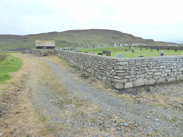
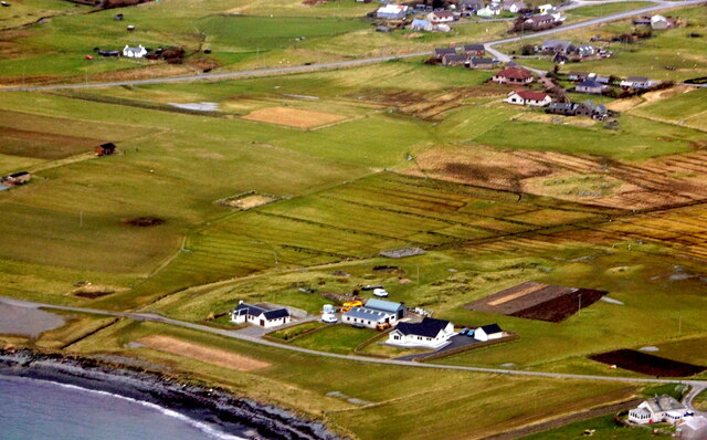
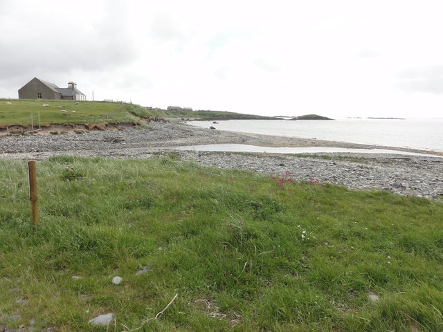
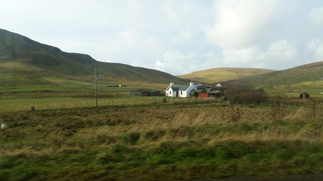
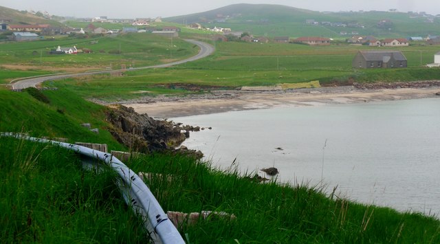
Aith Voe is a picturesque bay located on the west coast of the Shetland Mainland, Scotland. The bay stretches approximately 3 kilometers inland and is surrounded by rolling hills and rugged cliffs, creating a stunning natural landscape. It is situated near the village of Walls and is one of the largest voes (bays) in Shetland.

The bay of Aith Voe is renowned for its rich wildlife, making it a popular spot for nature enthusiasts. Visitors can often spot a variety of seabirds, including puffins, guillemots, and fulmars, nesting on the cliffs. Grey seals can also be seen basking on the rocks or swimming in the clear waters of the bay.

Aith Voe is also a hub for fishing activities, with its deep waters providing a perfect habitat for a variety of fish species. It has a small pier where local fishing boats can be seen unloading their catch, creating a vibrant atmosphere. The bay is also a popular spot for recreational fishing, attracting anglers from near and far.

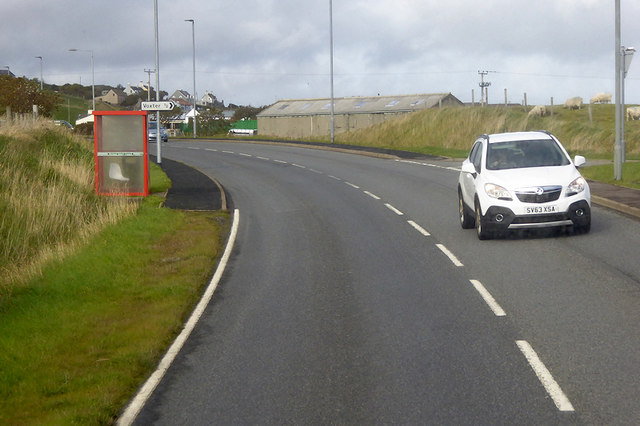
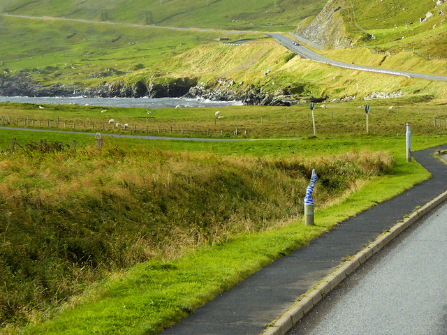
Surrounding the bay, visitors can find a range of walking trails that offer panoramic views of the coastline and the nearby islands. The area is dotted with ancient archaeological sites, such as brochs and standing stones, which provide glimpses into Shetland's rich history.

With its natural beauty and diverse wildlife, Aith Voe is a must-visit destination for those seeking tranquility, outdoor activities, and a connection with nature.

If you have any feedback on the listing, please let us know in the comments section below.

Aith Voe Images

Images are sourced within 2km of 60.037189/-1.2121306 or Grid Reference HU4328. Thanks to Geograph Open Source API. All images are credited.

Mail Burial Ground Adjacent to the sea as is usual on Scottish islands.
Mail Burial Ground
Adjacent to the sea as is usual on Scottish islands.
Helli Ness to Bard Head We are at the parking place above Crossie Geo halfway between Lerwick and Sumburgh Head on the mainland of Shetland and I am looking north east across Greenmow and Helli Ness to Bard Head, Bressay. The Isle of Noss can be seen beyond Bressay.
Helli Ness to Bard Head
We are at the parking place above Crossie Geo halfway between Lerwick and Sumburgh Head on the mainland of Shetland and I am looking north east across Greenmow and Helli Ness to Bard Head, Bressay. The Isle of Noss can be seen beyond Bressay.
Aith, Cunningsburgh, from the air
Greenmow and Helli Ness, Cunningsburgh, from the air
Helli Ness, Cunningsburgh, from the air
South Voxter, Cunningsburgh, from the air
Mail, Cunningsburgh, from the air
Shoreline with joining stream Small sandy pebble beach with joining stream to the sea
Shoreline with joining stream
Small sandy pebble beach with joining stream to the sea
Road bridge Road bridge buttress as it passes over the stream. It should have been the location of an Ordnance Survey OSBM Bolt, which seems to have been destroyed in the rebuilding of the road.
Road bridge
Road bridge buttress as it passes over the stream. It should have been the location of an Ordnance Survey OSBM Bolt, which seems to have been destroyed in the rebuilding of the road.
House under renovation, Cunningsburgh
Vadsgarth, Cunningsburgh
Small beach at the Sands of Mail The road is the A970 approaching Cunningsburgh.
Small beach at the Sands of Mail
The road is the A970 approaching Cunningsburgh.
A970 at Cunningsburgh Cunningsburgh, formerly also known as Coningsburgh (from the Old Norse: Konungsborgr meaning "King's castle"), is a hamlet on the coast of Mainland Shetland, nine miles south-west of Lerwick, about halfway between there and Sumburgh Head.
A970 at Cunningsburgh
Cunningsburgh, formerly also known as Coningsburgh (from the Old Norse: Konungsborgr meaning "King's castle"), is a hamlet on the coast of Mainland Shetland, nine miles south-west of Lerwick, about halfway between there and Sumburgh Head.
Bus Stop at Cunningsburgh Bus stop outside Cunningsburgh Primary School.
Bus Stop at Cunningsburgh
Bus stop outside Cunningsburgh Primary School.
Bus Stop on the A970 at Cunningsburgh Cunningsburgh, formerly also known as Coningsburgh (from the Old Norse: Konungsborgr meaning "King's castle"), is a hamlet on the coast of Mainland Shetland, nine miles south-west of Lerwick, about halfway between there and Sumburgh Head.
Bus Stop on the A970 at Cunningsburgh
Cunningsburgh, formerly also known as Coningsburgh (from the Old Norse: Konungsborgr meaning "King's castle"), is a hamlet on the coast of Mainland Shetland, nine miles south-west of Lerwick, about halfway between there and Sumburgh Head.
Bus Stop at Cunningsburgh Cunningsburgh, formerly also known as Coningsburgh (from the Old Norse: Konungsborgr meaning "King's castle"), is a hamlet on the coast of Mainland Shetland, nine miles south-west of Lerwick, about halfway between there and Sumburgh Head.
Bus Stop at Cunningsburgh
Cunningsburgh, formerly also known as Coningsburgh (from the Old Norse: Konungsborgr meaning "King's castle"), is a hamlet on the coast of Mainland Shetland, nine miles south-west of Lerwick, about halfway between there and Sumburgh Head.
Coastal Sheep Farm near Mail
Cunningsburgh, A970 Cunningsburgh, formerly also known as Coningsburgh (from the Old Norse: Konungsborgr meaning "King's castle"), is a hamlet on the coast of Mainland Shetland, nine miles south-west of Lerwick, about halfway between there and Sumburgh Head.
Cunningsburgh, A970
Cunningsburgh, formerly also known as Coningsburgh (from the Old Norse: Konungsborgr meaning "King's castle"), is a hamlet on the coast of Mainland Shetland, nine miles south-west of Lerwick, about halfway between there and Sumburgh Head.
Show me another place!

Aith Voe is located at Grid Ref: HU4328 (Lat: 60.037189, Lng: -1.2121306)

Unitary Authority: Shetland Islands

Police Authority: Highlands and Islands

What 3 Words

///insurance.shower.free. Near Sandwick, Shetland Islands

Related Wikis

Mail, Shetland

Mail is a hamlet on the island of Mainland, in the Shetland Islands, Scotland. == Geography == Mail is located on the south-eastern side of the island...

Bremirehoull

Bremirehoull is a settlement on the island of Mainland, in Shetland, Scotland. Bremirehoull is situated on the A970 in the Cunningsburgh area. == References... ==

Catpund

Catpund is a quarry site in Shetland, Scotland, where steatite vessels were cut from the rock from prehistory onwards. The quarrying marks are still visible...

Cunningsburgh

Cunningsburgh, formerly also known as Coningsburgh (Old Norse: Konungsborgr meaning "King's castle"), is a new hamlet and ancient parish in the south of...

Nearby Amenities

Located within 500m of 60.037189,-1.2121306
Seamark Light Character: Fl
Seamark Light Colour: red
Seamark Light Height: 3
Seamark Light Period: 3
Seamark Light Range: 2
Seamark Light Reference: A 3774
Seamark Light Sequence: 0.3+(2.7)
Seamark Type: light_minor
Source: US NGA Pub. 114. 2011-05-26.
Lat/Long: 60.0377333/-1.2157167
Leisure: slipway
Lat/Long: 60.0381403/-1.2157129
Leisure: slipway
Lat/Long: 60.0415043/-1.2096377
Disaldo
Place: hamlet
Lat/Long: 60.0393138/-1.205217
South Voxter
Place: hamlet
Lat/Long: 60.0354343/-1.2180004
Skibhoull
Place: hamlet
Lat/Long: 60.0387542/-1.2174444
Power: pole
Lat/Long: 60.03815/-1.2175126
Power: pole
Lat/Long: 60.0384442/-1.2182126
Power: pole
Lat/Long: 60.0388422/-1.2191296
Power: pole
Lat/Long: 60.0392079/-1.2200213
Power: pole
Lat/Long: 60.0410674/-1.2080429
The data included in this document is from www.openstreetmap.org. The data is made available under ODbL.

Have you been to Aith Voe?

Leave your review of Aith Voe below (or comments, questions and feedback).