Cunningsburgh

Settlement in Shetland

Scotland

Cunningsburgh

Mail Burial Ground Adjacent to the sea as is usual on Scottish islands.
Mail Burial Ground Credit: Oliver Dixon

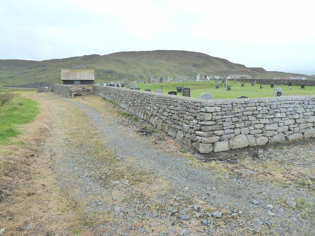
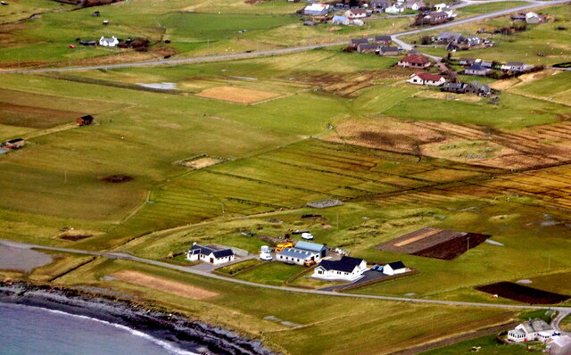
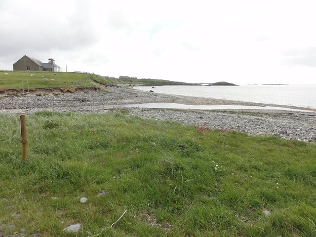
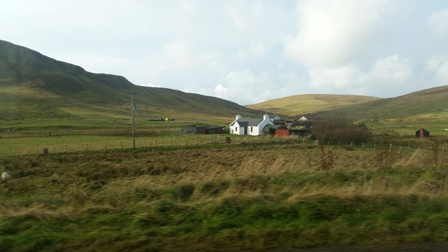
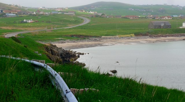
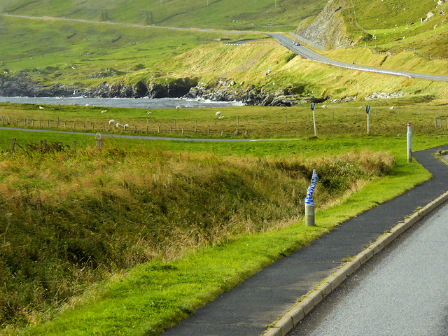
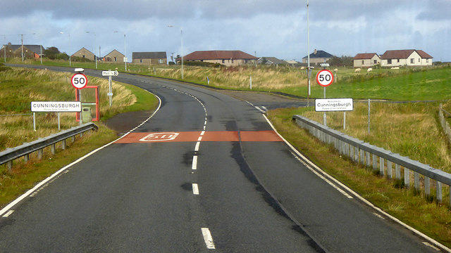
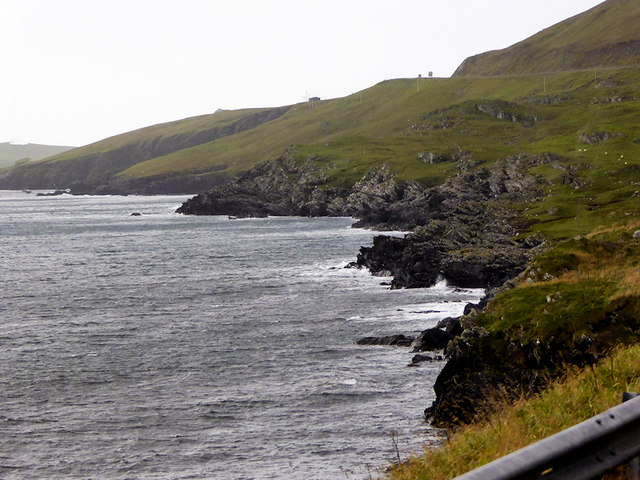
Cunningsburgh is a small village located on the South Mainland of the Shetland Islands in Scotland. It is situated approximately 12 miles south of Lerwick, the main administrative center of the islands. The village is surrounded by beautiful countryside and offers stunning views of the North Sea.

Cunningsburgh is a rural community with a population of around 400 people. The village is known for its picturesque landscapes, rolling hills, and fertile farmland. Agriculture plays a significant role in the local economy, with many residents engaged in farming and crofting.

The village has a strong sense of community, with various social and cultural activities taking place throughout the year. The Cunningsburgh Show, an annual agricultural show held in August, is a highlight for locals and visitors alike. The event showcases livestock, arts and crafts, and traditional Shetland music and dance.

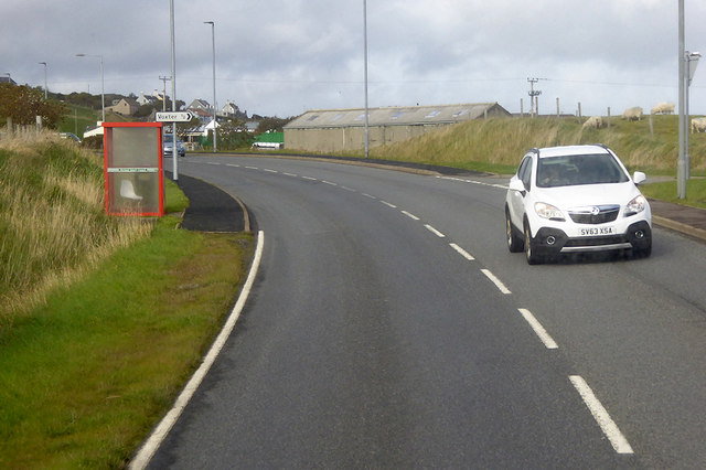
Facilities in Cunningsburgh include a primary school, a community hall, and a church. There are limited shopping options within the village, but the nearby town of Lerwick offers a wider range of amenities, including supermarkets, shops, restaurants, and leisure facilities.

Cunningsburgh is well-connected to the rest of the island by road, and public transportation is available, making it easy to explore other parts of Shetland. The village offers a peaceful and scenic setting for those seeking a tranquil escape in the rugged beauty of the Shetland Islands.

If you have any feedback on the listing, please let us know in the comments section below.

Cunningsburgh Images

Images are sourced within 2km of 60.038868/-1.2180858 or Grid Reference HU4328. Thanks to Geograph Open Source API. All images are credited.

Mail Burial Ground Adjacent to the sea as is usual on Scottish islands.
Mail Burial Ground
Adjacent to the sea as is usual on Scottish islands.
Helli Ness to Bard Head We are at the parking place above Crossie Geo halfway between Lerwick and Sumburgh Head on the mainland of Shetland and I am looking north east across Greenmow and Helli Ness to Bard Head, Bressay. The Isle of Noss can be seen beyond Bressay.
Helli Ness to Bard Head
We are at the parking place above Crossie Geo halfway between Lerwick and Sumburgh Head on the mainland of Shetland and I am looking north east across Greenmow and Helli Ness to Bard Head, Bressay. The Isle of Noss can be seen beyond Bressay.
Aith, Cunningsburgh, from the air
Greenmow and Helli Ness, Cunningsburgh, from the air
South Voxter, Cunningsburgh, from the air
Mail, Cunningsburgh, from the air
Shoreline with joining stream Small sandy pebble beach with joining stream to the sea
Shoreline with joining stream
Small sandy pebble beach with joining stream to the sea
Road bridge Road bridge buttress as it passes over the stream. It should have been the location of an Ordnance Survey OSBM Bolt, which seems to have been destroyed in the rebuilding of the road.
Road bridge
Road bridge buttress as it passes over the stream. It should have been the location of an Ordnance Survey OSBM Bolt, which seems to have been destroyed in the rebuilding of the road.
House under renovation, Cunningsburgh
Vadsgarth, Cunningsburgh
Small beach at the Sands of Mail The road is the A970 approaching Cunningsburgh.
Small beach at the Sands of Mail
The road is the A970 approaching Cunningsburgh.
A970 at Cunningsburgh Cunningsburgh, formerly also known as Coningsburgh (from the Old Norse: Konungsborgr meaning "King's castle"), is a hamlet on the coast of Mainland Shetland, nine miles south-west of Lerwick, about halfway between there and Sumburgh Head.
A970 at Cunningsburgh
Cunningsburgh, formerly also known as Coningsburgh (from the Old Norse: Konungsborgr meaning "King's castle"), is a hamlet on the coast of Mainland Shetland, nine miles south-west of Lerwick, about halfway between there and Sumburgh Head.
Bus Stop at Cunningsburgh Bus stop outside Cunningsburgh Primary School.
Bus Stop at Cunningsburgh
Bus stop outside Cunningsburgh Primary School.
Bus Stop on the A970 at Cunningsburgh Cunningsburgh, formerly also known as Coningsburgh (from the Old Norse: Konungsborgr meaning "King's castle"), is a hamlet on the coast of Mainland Shetland, nine miles south-west of Lerwick, about halfway between there and Sumburgh Head.
Bus Stop on the A970 at Cunningsburgh
Cunningsburgh, formerly also known as Coningsburgh (from the Old Norse: Konungsborgr meaning "King's castle"), is a hamlet on the coast of Mainland Shetland, nine miles south-west of Lerwick, about halfway between there and Sumburgh Head.
Bus Stop at Cunningsburgh Cunningsburgh, formerly also known as Coningsburgh (from the Old Norse: Konungsborgr meaning "King's castle"), is a hamlet on the coast of Mainland Shetland, nine miles south-west of Lerwick, about halfway between there and Sumburgh Head.
Bus Stop at Cunningsburgh
Cunningsburgh, formerly also known as Coningsburgh (from the Old Norse: Konungsborgr meaning "King's castle"), is a hamlet on the coast of Mainland Shetland, nine miles south-west of Lerwick, about halfway between there and Sumburgh Head.
Coastal Sheep Farm near Mail
Cunningsburgh, A970 Cunningsburgh, formerly also known as Coningsburgh (from the Old Norse: Konungsborgr meaning "King's castle"), is a hamlet on the coast of Mainland Shetland, nine miles south-west of Lerwick, about halfway between there and Sumburgh Head.
Cunningsburgh, A970
Cunningsburgh, formerly also known as Coningsburgh (from the Old Norse: Konungsborgr meaning "King's castle"), is a hamlet on the coast of Mainland Shetland, nine miles south-west of Lerwick, about halfway between there and Sumburgh Head.
Rocky Shoreline near Mail
Show me another place!

Cunningsburgh is located at Grid Ref: HU4328 (Lat: 60.038868, Lng: -1.2180858)

Unitary Authority: Shetland Islands

Police Authority: Highlands and Islands

What 3 Words

///lasts.peach.outgrown. Near Sandwick, Shetland Islands

Related Wikis

Mail, Shetland

Mail is a hamlet on the island of Mainland, in the Shetland Islands, Scotland. == Geography == Mail is located on the south-eastern side of the island...

Bremirehoull

Bremirehoull is a settlement on the island of Mainland, in Shetland, Scotland. Bremirehoull is situated on the A970 in the Cunningsburgh area. == References... ==

Cunningsburgh

Cunningsburgh, formerly also known as Coningsburgh (Old Norse: Konungsborgr meaning "King's castle"), is a new hamlet and ancient parish in the south of...

Catpund

Catpund is a quarry site in Shetland, Scotland, where steatite vessels were cut from the rock from prehistory onwards. The quarrying marks are still visible...

Nearby Amenities

Located within 500m of 60.038868,-1.2180858
Seamark Light Character: Fl
Seamark Light Colour: red
Seamark Light Height: 3
Seamark Light Period: 3
Seamark Light Range: 2
Seamark Light Reference: A 3774
Seamark Light Sequence: 0.3+(2.7)
Seamark Type: light_minor
Source: US NGA Pub. 114. 2011-05-26.
Lat/Long: 60.0377333/-1.2157167
Leisure: slipway
Lat/Long: 60.0381403/-1.2157129
South Voxter
Place: hamlet
Lat/Long: 60.0354343/-1.2180004
Power: pole
Lat/Long: 60.0353677/-1.221457
Power: pole
Lat/Long: 60.0355124/-1.2207409
Power: pole
Lat/Long: 60.0352967/-1.2220927
Power: pole
Lat/Long: 60.0351748/-1.2231951
Skibhoull
Place: hamlet
Lat/Long: 60.0387542/-1.2174444
Power: pole
Lat/Long: 60.03815/-1.2175126
Power: pole
Lat/Long: 60.0384442/-1.2182126
Power: pole
Lat/Long: 60.0388422/-1.2191296
Power: pole
Lat/Long: 60.0392079/-1.2200213
Power: pole
Lat/Long: 60.039284/-1.2202823
Power: pole
Lat/Long: 60.0393048/-1.2215297
Power: pole
Lat/Long: 60.0393175/-1.222747
Power: pole
Lat/Long: 60.0393486/-1.2242901
Power: pole
Lat/Long: 60.0392552/-1.2256599
Power: pole
Lat/Long: 60.039149/-1.2270274
Power: pole
Lat/Long: 60.0402115/-1.2201576
Power: pole
Lat/Long: 60.039885/-1.2201067
The data included in this document is from www.openstreetmap.org. The data is made available under ODbL.

Have you been to Cunningsburgh?

Leave your review of Cunningsburgh below (or comments, questions and feedback).