Bay of Fladdabister

Bay in Shetland

Scotland

Bay of Fladdabister

Ukinsetter, Fladdabister, from the air
Ukinsetter, Fladdabister, from the air Credit: Mike Pennington

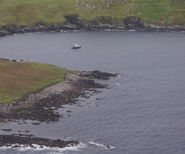
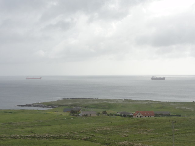
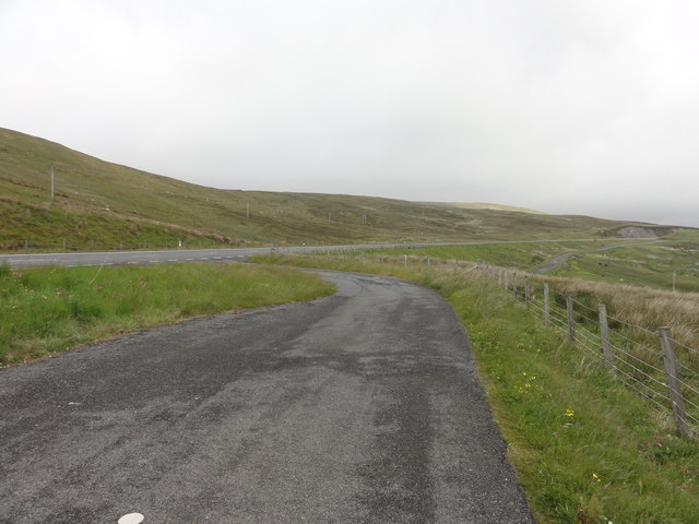
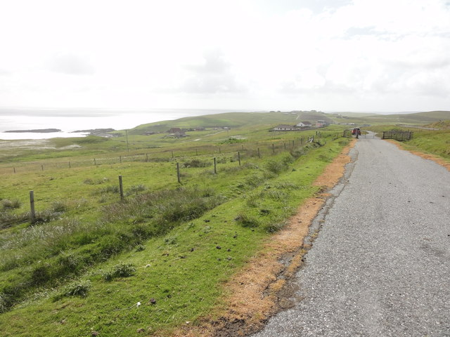
The Bay of Fladdabister is a picturesque coastal area located on the east coast of the Shetland Islands in Scotland. Situated approximately 6 miles south of the town of Lerwick, this bay is renowned for its stunning natural beauty and tranquil atmosphere.

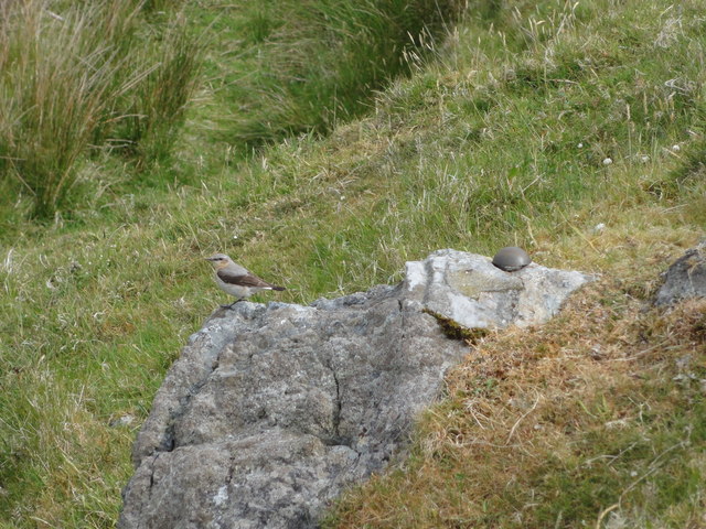
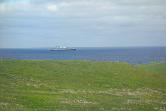
The bay is characterized by its pristine sandy beach, which stretches for around half a mile and is backed by rolling sand dunes. The crystal-clear turquoise waters of the North Sea gently lap against the shore, offering a delightful spot for swimming and water activities during the summer months. The bay is also a popular destination for birdwatchers, as it provides a habitat for a wide variety of coastal and seabirds, including oystercatchers, gulls, and terns.

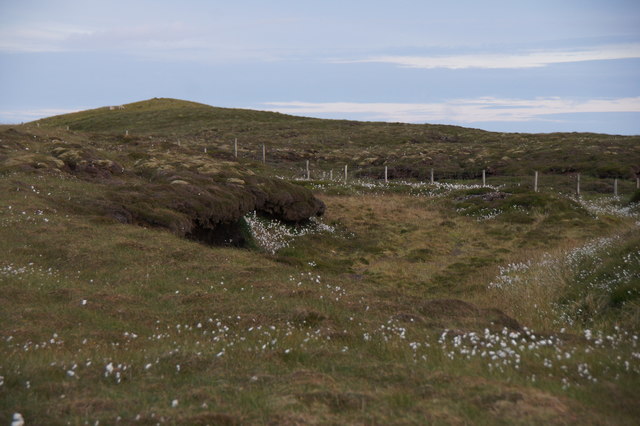
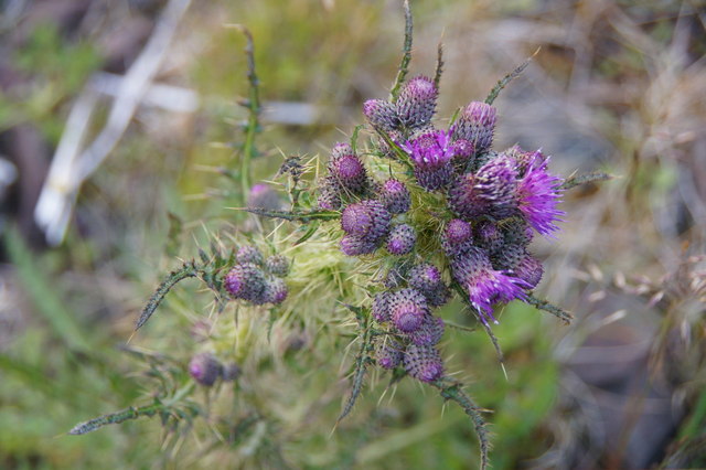
Surrounding the bay are verdant green fields and rugged cliffs, providing breathtaking views of the surrounding landscape. The area is rich in wildlife, with seals often spotted basking on the rocks and otters occasionally seen playing in the shallows.

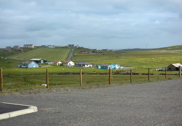
Fladdabister itself is a small hamlet located near the bay, consisting of a handful of houses and a picturesque old pier. The area has a strong sense of community, with many locals engaged in fishing and farming activities.

The Bay of Fladdabister is a hidden gem on the Shetland Islands, offering visitors a chance to immerse themselves in the natural beauty and tranquility of this remote and unspoiled coastal area.

If you have any feedback on the listing, please let us know in the comments section below.

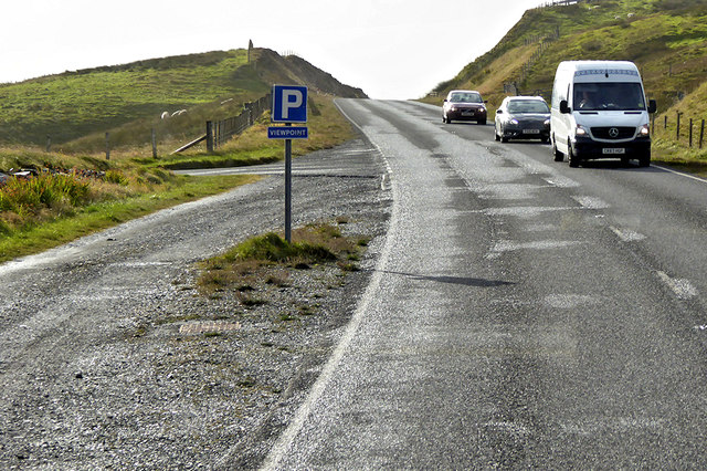
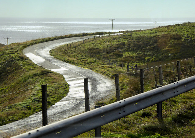
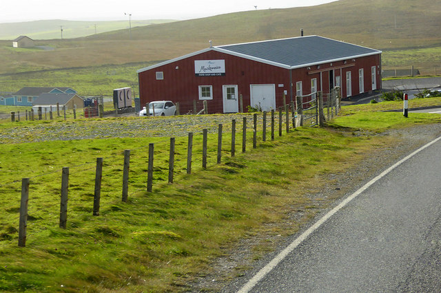
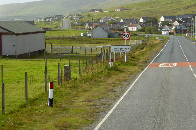
Bay of Fladdabister Images

Images are sourced within 2km of 60.07489/-1.2114475 or Grid Reference HU4332. Thanks to Geograph Open Source API. All images are credited.

Ukinsetter, Fladdabister, from the air
Bay of Fladdabister from the air
Quarff Leog between Quarff and Fladdabister
Marsh Thistle (Cirsium palustre), Quarff The densely packed flowerheads, and tallness, help distinguish this from other thistles.
Marsh Thistle (Cirsium palustre), Quarff
The densely packed flowerheads, and tallness, help distinguish this from other thistles.
Bay of Fladdabister Bay of Fladdabister with cargo ships passing the coastline
Bay of Fladdabister
Bay of Fladdabister with cargo ships passing the coastline
A970 Road A970 road with a lay-by formed out of the old single lane road.
A970 Road
A970 road with a lay-by formed out of the old single lane road.
Abandoned road near Fladdabister Old road no longer used near Fladdabister
Abandoned road near Fladdabister
Old road no longer used near Fladdabister
New OSBM Bolt Ordnance Survey benchmark bolt, described as: NEW OSBM BOLT ROCK 12.3M NE SIDE RD 5.1M SE C STR (67.718m above Lerwick datum, 2nd order, new 1978).
New OSBM Bolt
Ordnance Survey benchmark bolt, described as: NEW OSBM BOLT ROCK 12.3M NE SIDE RD 5.1M SE C STR (67.718m above Lerwick datum, 2nd order, new 1978).
View towards Aithsetter View from the car park of a new farm and coffee shop which has recently opened beside the main road.
View towards Aithsetter
View from the car park of a new farm and coffee shop which has recently opened beside the main road.
View out to sea A cruise ship heads south. If it's the one that the coach party we met at Jarlshof were rushing back to catch, then it's off to the Isle of Skye.
This view is from the back window of a new farm shop that has opened here.
View out to sea
A cruise ship heads south. If it's the one that the coach party we met at Jarlshof were rushing back to catch, then it's off to the Isle of Skye. This view is from the back window of a new farm shop that has opened here.
A970 between Quarff and Fladdabister The A970 runs for 71 miles across most of the length of the "Mainland" in the Shetland Islands. It is a good-quality single-carriageway road for most of its route. Travelling from south to north, the road begins at Grutness near Sumburgh Airport and winds around the many hills and inlets passing close to a number of small villages without going through any large ones before Lerwick. After looping around Lerwick, a short spur runs to Scalloway whilst the main route continues northwards towards Brae where it crosses the narrow isthmus of Mavis Grind. At Sandy Lochs the road splits and a four-mile spur goes through Urafirth to Hillswick. The main route continuing to the right towards its northern terminus at Isbister. This last part of the route tends to be narrower with passing places.

<span class="nowrap"><a title="https://www.sabre-roads.org.uk/wiki/index.php?title=A970" rel="nofollow ugc noopener" href="https://www.sabre-roads.org.uk/wiki/index.php?title=A970">Link</a><img style="margin-left:2px;" alt="External link" title="External link - shift click to open in new window" src="https://s1.geograph.org.uk/img/external.png" width="10" height="10"/></span>  SABRE
A970 between Quarff and Fladdabister
The A970 runs for 71 miles across most of the length of the "Mainland" in the Shetland Islands. It is a good-quality single-carriageway road for most of its route. Travelling from south to north, the road begins at Grutness near Sumburgh Airport and winds around the many hills and inlets passing close to a number of small villages without going through any large ones before Lerwick. After looping around Lerwick, a short spur runs to Scalloway whilst the main route continues northwards towards Brae where it crosses the narrow isthmus of Mavis Grind. At Sandy Lochs the road splits and a four-mile spur goes through Urafirth to Hillswick. The main route continuing to the right towards its northern terminus at Isbister. This last part of the route tends to be narrower with passing places. LinkExternal link SABRE
A970 near to Fladdabister The A970 runs for 71 miles across most of the length of the "Mainland" in the Shetland Islands. It is a good-quality single-carriageway road for most of its route. Travelling from south to north, the road begins at Grutness near Sumburgh Airport and winds around the many hills and inlets passing close to a number of small villages without going through any large ones before Lerwick. After looping around Lerwick, a short spur runs to Scalloway whilst the main route continues northwards towards Brae where it crosses the narrow isthmus of Mavis Grind. At Sandy Lochs the road splits and a four-mile spur goes through Urafirth to Hillswick. The main route continuing to the right towards its northern terminus at Isbister. This last part of the route tends to be narrower with passing places.

<span class="nowrap"><a title="https://www.sabre-roads.org.uk/wiki/index.php?title=A970" rel="nofollow ugc noopener" href="https://www.sabre-roads.org.uk/wiki/index.php?title=A970">Link</a><img style="margin-left:2px;" alt="External link" title="External link - shift click to open in new window" src="https://s1.geograph.org.uk/img/external.png" width="10" height="10"/></span>  SABRE
A970 near to Fladdabister
The A970 runs for 71 miles across most of the length of the "Mainland" in the Shetland Islands. It is a good-quality single-carriageway road for most of its route. Travelling from south to north, the road begins at Grutness near Sumburgh Airport and winds around the many hills and inlets passing close to a number of small villages without going through any large ones before Lerwick. After looping around Lerwick, a short spur runs to Scalloway whilst the main route continues northwards towards Brae where it crosses the narrow isthmus of Mavis Grind. At Sandy Lochs the road splits and a four-mile spur goes through Urafirth to Hillswick. The main route continuing to the right towards its northern terminus at Isbister. This last part of the route tends to be narrower with passing places. LinkExternal link SABRE
Parking Place and Viewpoint, A970 near to Ocraquoy The A970 runs for 71 miles across most of the length of the "Mainland" in the Shetland Islands. It is a good-quality single-carriageway road for most of its route. Travelling from south to north, the road begins at Grutness near Sumburgh Airport and winds around the many hills and inlets passing close to a number of small villages without going through any large ones before Lerwick. After looping around Lerwick, a short spur runs to Scalloway whilst the main route continues northwards towards Brae where it crosses the narrow isthmus of Mavis Grind. At Sandy Lochs the road splits and a four-mile spur goes through Urafirth to Hillswick. The main route continuing to the right towards its northern terminus at Isbister. This last part of the route tends to be narrower with passing places.

<span class="nowrap"><a title="https://www.sabre-roads.org.uk/wiki/index.php?title=A970" rel="nofollow ugc noopener" href="https://www.sabre-roads.org.uk/wiki/index.php?title=A970">Link</a><img style="margin-left:2px;" alt="External link" title="External link - shift click to open in new window" src="https://s1.geograph.org.uk/img/external.png" width="10" height="10"/></span>  SABRE
Parking Place and Viewpoint, A970 near to Ocraquoy
The A970 runs for 71 miles across most of the length of the "Mainland" in the Shetland Islands. It is a good-quality single-carriageway road for most of its route. Travelling from south to north, the road begins at Grutness near Sumburgh Airport and winds around the many hills and inlets passing close to a number of small villages without going through any large ones before Lerwick. After looping around Lerwick, a short spur runs to Scalloway whilst the main route continues northwards towards Brae where it crosses the narrow isthmus of Mavis Grind. At Sandy Lochs the road splits and a four-mile spur goes through Urafirth to Hillswick. The main route continuing to the right towards its northern terminus at Isbister. This last part of the route tends to be narrower with passing places. LinkExternal link SABRE
Old Route of the A970 near to Ocraquoy The A970 runs for 71 miles across most of the length of the "Mainland" in the Shetland Islands. It is a good-quality single-carriageway road for most of its route. Travelling from south to north, the road begins at Grutness near Sumburgh Airport and winds around the many hills and inlets passing close to a number of small villages without going through any large ones before Lerwick. After looping around Lerwick, a short spur runs to Scalloway whilst the main route continues northwards towards Brae where it crosses the narrow isthmus of Mavis Grind. At Sandy Lochs the road splits and a four-mile spur goes through Urafirth to Hillswick. The main route continuing to the right towards its northern terminus at Isbister. This last part of the route tends to be narrower with passing places.

<span class="nowrap"><a title="https://www.sabre-roads.org.uk/wiki/index.php?title=A970" rel="nofollow ugc noopener" href="https://www.sabre-roads.org.uk/wiki/index.php?title=A970">Link</a><img style="margin-left:2px;" alt="External link" title="External link - shift click to open in new window" src="https://s1.geograph.org.uk/img/external.png" width="10" height="10"/></span>  SABRE
Old Route of the A970 near to Ocraquoy
The A970 runs for 71 miles across most of the length of the "Mainland" in the Shetland Islands. It is a good-quality single-carriageway road for most of its route. Travelling from south to north, the road begins at Grutness near Sumburgh Airport and winds around the many hills and inlets passing close to a number of small villages without going through any large ones before Lerwick. After looping around Lerwick, a short spur runs to Scalloway whilst the main route continues northwards towards Brae where it crosses the narrow isthmus of Mavis Grind. At Sandy Lochs the road splits and a four-mile spur goes through Urafirth to Hillswick. The main route continuing to the right towards its northern terminus at Isbister. This last part of the route tends to be narrower with passing places. LinkExternal link SABRE
Mackenzies Farm Shop, Ocraquoy
A970 approaching Cunningsburgh Cunningsburgh, formerly also known as Coningsburgh (from the Old Norse: Konungsborgr meaning "King's castle"), is a hamlet on the coast of Mainland Shetland, nine miles south west of Lerwick, about half way between there and Sumburgh Head.
A970 approaching Cunningsburgh
Cunningsburgh, formerly also known as Coningsburgh (from the Old Norse: Konungsborgr meaning "King's castle"), is a hamlet on the coast of Mainland Shetland, nine miles south west of Lerwick, about half way between there and Sumburgh Head.
Old Milestone by the former A970, Cunningsburgh North Shetland concrete by the old A970, in parish of Dunrossness (Mainland District), Cunningsburgh North, on East side of old road, visible from the A970.

Inscription reads:-
: G / 16 : : A970 : : L / 10 :
(To Grutness and Lerwick)

Surveyed

Milestone Society National ID: SH_LWSB09
Old Milestone by the former A970, Cunningsburgh North
Shetland concrete by the old A970, in parish of Dunrossness (Mainland District), Cunningsburgh North, on East side of old road, visible from the A970. Inscription reads:- : G / 16 : : A970 : : L / 10 : (To Grutness and Lerwick) Surveyed Milestone Society National ID: SH_LWSB09
Show me another place!

Bay of Fladdabister is located at Grid Ref: HU4332 (Lat: 60.07489, Lng: -1.2114475)

Unitary Authority: Shetland Islands

Police Authority: Highlands and Islands

What 3 Words

///enchanted.remove.goats. Near Scalloway, Shetland Islands

Related Wikis

Aithsetter

Aithsetter (Old Norse: Eiðseti, meaning "the farm at the isthmus") is a village on the island of Mainland, in Shetland, Scotland. Aithsetter is in the...

Cunningsburgh

Cunningsburgh, formerly also known as Coningsburgh (Old Norse: Konungsborgr meaning "King's castle"), is a new hamlet and ancient parish in the south of...

South Mainland

The South Mainland of the Shetland Islands is the southern peninsula of Mainland island. It lies south of Hellister (60° 14′N). The greater southern part...

Bremirehoull

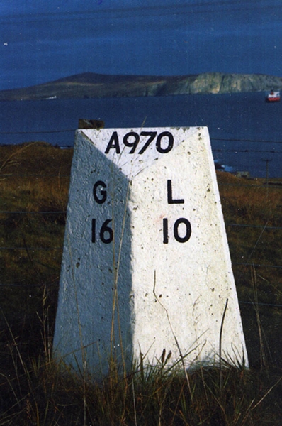
Bremirehoull is a settlement on the island of Mainland, in Shetland, Scotland. Bremirehoull is situated on the A970 in the Cunningsburgh area. == References... ==

Quarff

Quarff is a small village on Mainland in the Shetland Islands in Scotland. It is located on the main A970 road, 5 miles (8.0 km) south of Shetland's only...

Brindister, South Mainland

Brindister is a village on South Mainland in Shetland, Scotland. Brindister is within the parish of Lerwick, and adjacent to the A970 south of Gulberwick...

Mail, Shetland

Mail is a hamlet on the island of Mainland, in the Shetland Islands, Scotland. == Geography == Mail is located on the south-eastern side of the island...

East Burra

East Burra (Scots: East Burra; Old Norse: "Barrey") is one of the Scalloway Islands, a subgroup of the Shetland Islands in Scotland. It is connected by...

Nearby Amenities

Located within 500m of 60.07489,-1.2114475
Bay of Fladdabister
Natural: bay
Lat/Long: 60.0741335/-1.2138391
The data included in this document is from www.openstreetmap.org. The data is made available under ODbL.

Have you been to Bay of Fladdabister?

Leave your review of Bay of Fladdabister below (or comments, questions and feedback).