Wick of Sandsayre

Bay in Shetland

Scotland

Wick of Sandsayre

Wick of Sandsyre Bay at Leebitten.
Wick of Sandsyre Credit: Oliver Dixon

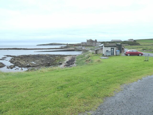
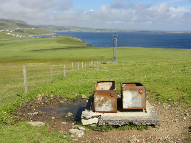
Wick of Sandsayre, located in the Shetland Islands, is a picturesque bay known for its natural beauty and tranquil atmosphere. Situated on the western coast of the island of Shetland, this bay offers breathtaking views of the surrounding rugged cliffs, pristine sandy beaches, and crystal-clear turquoise waters.

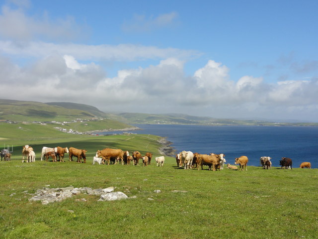
The bay is renowned for its diverse wildlife, making it a popular destination for nature enthusiasts and birdwatchers. Visitors can often spot various species of seabirds, including puffins, kittiwakes, and fulmars, nesting along the cliffs. The nearby grassy dunes and heathlands are home to a variety of wildflowers and plants, adding to the bay's natural charm.

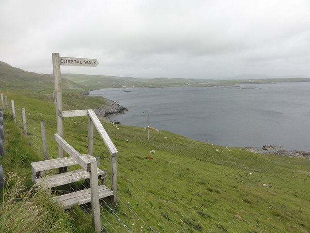
The sandy beach at Wick of Sandsayre is a hidden gem, providing a peaceful and secluded spot for relaxation and picnicking. The calm and clear waters are ideal for swimming and snorkeling during the summer months, while the surrounding cliffs offer opportunities for coastal walks and hiking.

Although Wick of Sandsayre is relatively remote, it is easily accessible by car or public transportation. The bay is located approximately 10 miles northwest of the town of Lerwick, the main settlement in Shetland, and is well-connected by a network of roads.

In summary, Wick of Sandsayre is a stunning bay in the Shetland Islands, offering a serene and unspoiled natural environment. With its breathtaking scenery, diverse wildlife, and peaceful sandy beach, it is a must-visit destination for those seeking tranquility and natural beauty.

If you have any feedback on the listing, please let us know in the comments section below.

Wick of Sandsayre Images

Images are sourced within 2km of 60.008762/-1.2199083 or Grid Reference HU4325. Thanks to Geograph Open Source API. All images are credited.

Wick of Sandsyre Bay at Leebitten.
Wick of Sandsyre
Bay at Leebitten.
Solan IV This is the Solan IV moored at the pier at the Wick of Sandsayre, Leebitten, on the eastern mainland of Shetland. This boat would have taken us out to Mousa if it had not been so windy on this day. Solan is Shetland dialect for northern gannet.
Solan IV
This is the Solan IV moored at the pier at the Wick of Sandsayre, Leebitten, on the eastern mainland of Shetland. This boat would have taken us out to Mousa if it had not been so windy on this day. Solan is Shetland dialect for northern gannet.
Sandsayre and Sand Lodge, Sandwick, from the air
Sand Lodge, Sandwick, from the air
Meadowbank, Sandwick, from the air
Sanick, Sandwick, from the air
Sand Wick, Sandwick, from the air
View to Mousa Just about showing Mousa's famous Broch, towards the right hand end of the island.
View to Mousa
Just about showing Mousa's famous Broch, towards the right hand end of the island.
North from the Viewpoint There is a lay by here for looking across to Mousa, and this scene northwards.
Not much dry land in HU4326, what this square's mostly about is views to somewhere else.
North from the Viewpoint
There is a lay by here for looking across to Mousa, and this scene northwards. Not much dry land in HU4326, what this square's mostly about is views to somewhere else.
Coastal Walk View out to sea and the Coastal Walk stile
Coastal Walk
View out to sea and the Coastal Walk stile
Sandwick coastline Rocky coastline at Sandwick
Sandwick coastline
Rocky coastline at Sandwick
Grazing cattle Grazing cattle with a view out to the sea
Grazing cattle
Grazing cattle with a view out to the sea
Triangulation Station Ordnance Survey triangulation station TP1791 - Burraland
Triangulation Station
Ordnance Survey triangulation station TP1791 - Burraland
Transmitter mast Cattle water troughs and a telecoms transmission mast
Transmitter mast
Cattle water troughs and a telecoms transmission mast
Dusk at Stove by Sandwick One house seemed to stay alive as all others sank into the darkness of the evening.  Lights were on in the rooms and the white facing reflected all the available light.
Dusk at Stove by Sandwick
One house seemed to stay alive as all others sank into the darkness of the evening. Lights were on in the rooms and the white facing reflected all the available light.
Sandwick kirk
Sandwick kirk
Track in fields at Sandwick
Fields at the Wart, Sandwick Looking towards the transmitter on the Ward of Burraland.
Fields at the Wart, Sandwick
Looking towards the transmitter on the Ward of Burraland.
Show me another place!

Wick of Sandsayre is located at Grid Ref: HU4325 (Lat: 60.008762, Lng: -1.2199083)

Unitary Authority: Shetland Islands

Police Authority: Highlands and Islands

What 3 Words

///detective.assets.sleeper. Near Sandwick, Shetland Islands

Related Wikis

Sandwick, Dunrossness

see also Sandwick, Whalsay and Sandwick, OrkneySandwick (Old Norse: Sandvik "Sandy Bay") is a village and an ancient parish in the Shetland Islands, Scotland...

Catpund

Catpund is a quarry site in Shetland, Scotland, where steatite vessels were cut from the rock from prehistory onwards. The quarrying marks are still visible...

Hoswick

Hoswick is a settlement in Sandwick in the south mainland of Shetland, Scotland, on the eastern part of the Dunrossness civil parish. It is separated from...

Broch of Mousa

Broch of Mousa (or Mousa Broch) is a preserved Iron Age broch or round tower. It is on the island of Mousa in Shetland, Scotland. It is the tallest broch...

Mail, Shetland

Mail is a hamlet on the island of Mainland, in the Shetland Islands, Scotland. == Geography == Mail is located on the south-eastern side of the island...

Mousa

Mousa (Old Norse: Mosey "moss island") is a small island in Shetland, Scotland, uninhabited since the nineteenth century. The island is known for the...

Peerie Bard

Perie Bard is one of the Shetland Islands. It is a small islet off the east coast of the island of Mousa.Although named 'Perie Bard' on OS Maps, the name...

Bremirehoull

Bremirehoull is a settlement on the island of Mainland, in Shetland, Scotland. Bremirehoull is situated on the A970 in the Cunningsburgh area. == References... ==

Nearby Amenities

Located within 500m of 60.008762,-1.2199083
Ferry Terminal
Lat/Long: 60.0071113/-1.2205292
Sandsayre Pier and Slipway
Leisure: slipway
Lat/Long: 60.0065876/-1.2206918
Toilets
Lat/Long: 60.0065876/-1.2217325
Leebitten
Place: hamlet
Lat/Long: 60.0064301/-1.2220233
Mousa Ferry Waiting Room Exhibition
Tourism: museum
Lat/Long: 60.0063721/-1.2209193
Passing Place
Lat/Long: 60.0078493/-1.2240141
Barrier: stile
Lat/Long: 60.0093905/-1.2241884
Barrier: stile
Lat/Long: 60.0115653/-1.2243785
Power: pole
Lat/Long: 60.0073887/-1.2281889
Power: pole
Lat/Long: 60.0069294/-1.2275275
Power: pole
Lat/Long: 60.0061846/-1.2219582
Power: pole
Lat/Long: 60.0063082/-1.2235313
Power: pole
Lat/Long: 60.0064225/-1.2249519
Power: pole
Lat/Long: 60.0065103/-1.2259891
Power: pole
Lat/Long: 60.006628/-1.2269293
Power: pole
Lat/Long: 60.00927/-1.2273866
Power: pole
Lat/Long: 60.009382/-1.2281097
The data included in this document is from www.openstreetmap.org. The data is made available under ODbL.

Have you been to Wick of Sandsayre?

Leave your review of Wick of Sandsayre below (or comments, questions and feedback).