South Stour Houll

Coastal Feature, Headland, Point in Shetland

Scotland

South Stour Houll

Ukinsetter, Fladdabister, from the air
Ukinsetter, Fladdabister, from the air Credit: Mike Pennington

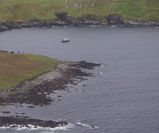
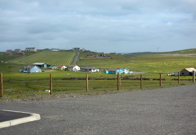
South Stour Houll is a prominent coastal feature located in the southwestern part of Shetland, a group of islands in Scotland. It is specifically situated on the west coast of the mainland, near the village of Sandness. South Stour Houll is classified as a headland or point due to its distinctive shape and geographical characteristics.

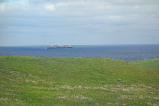
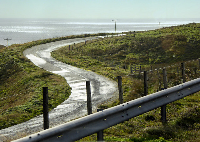
This coastal feature is characterized by its rugged cliffs that rise steeply from the sea, providing a spectacular view of the surrounding area. The cliffs are composed of layers of sedimentary rocks, including sandstone and shale, which have been shaped by natural erosion processes over thousands of years.

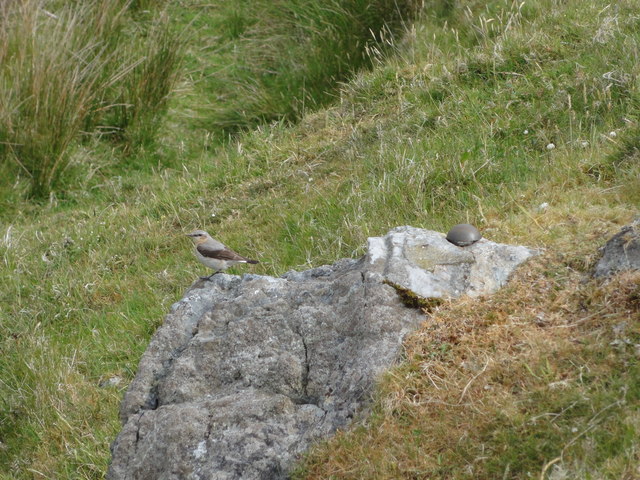
South Stour Houll is known for its dramatic coastline, with several sea stacks and rocky outcrops jutting out from the cliffs. These formations are a result of the constant battering of waves and the erosive power of the sea. The headland provides a natural habitat for various seabird species, including puffins, kittiwakes, and fulmars, which nest and breed in the area.

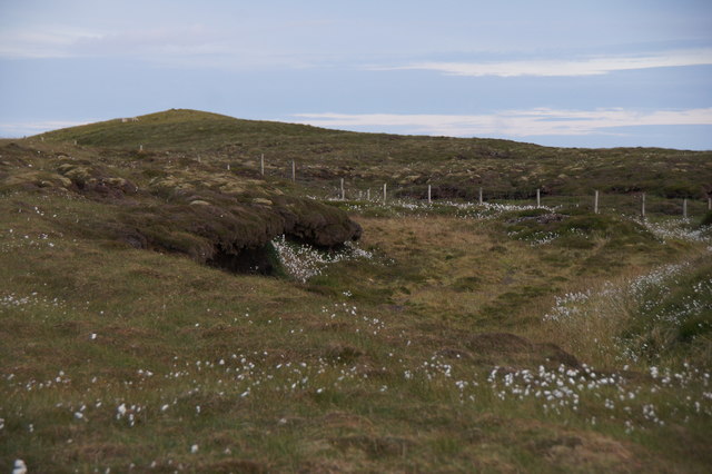
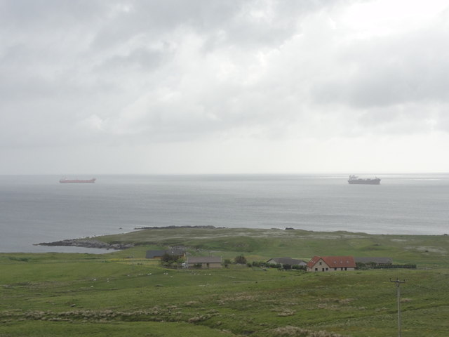
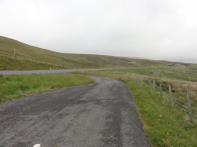
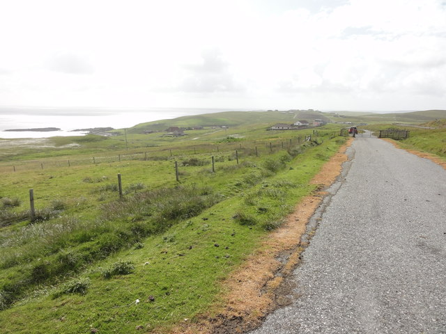
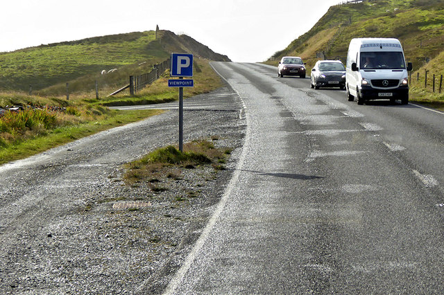
The headland is accessible by foot, and there are paths that lead visitors to viewpoints where they can enjoy panoramic vistas of the coastline and the Atlantic Ocean. The area is popular with hikers, nature enthusiasts, and photographers, who are attracted by its unspoiled beauty and abundant wildlife.

South Stour Houll is a significant landmark in Shetland, not only for its natural beauty but also for its cultural and historical importance. It is a testament to the forces of nature and the ever-changing landscape of this remote and awe-inspiring region.

If you have any feedback on the listing, please let us know in the comments section below.

South Stour Houll Images

Images are sourced within 2km of 60.076691/-1.2168495 or Grid Reference HU4332. Thanks to Geograph Open Source API. All images are credited.

Ukinsetter, Fladdabister, from the air
Bay of Fladdabister from the air
Quarff Leog between Quarff and Fladdabister
Marsh Thistle (Cirsium palustre), Quarff The densely packed flowerheads, and tallness, help distinguish this from other thistles.
Marsh Thistle (Cirsium palustre), Quarff
The densely packed flowerheads, and tallness, help distinguish this from other thistles.
Bay of Fladdabister Bay of Fladdabister with cargo ships passing the coastline
Bay of Fladdabister
Bay of Fladdabister with cargo ships passing the coastline
A970 Road A970 road with a lay-by formed out of the old single lane road.
A970 Road
A970 road with a lay-by formed out of the old single lane road.
Abandoned road near Fladdabister Old road no longer used near Fladdabister
Abandoned road near Fladdabister
Old road no longer used near Fladdabister
New OSBM Bolt Ordnance Survey benchmark bolt, described as: NEW OSBM BOLT ROCK 12.3M NE SIDE RD 5.1M SE C STR (67.718m above Lerwick datum, 2nd order, new 1978).
New OSBM Bolt
Ordnance Survey benchmark bolt, described as: NEW OSBM BOLT ROCK 12.3M NE SIDE RD 5.1M SE C STR (67.718m above Lerwick datum, 2nd order, new 1978).
View towards Aithsetter View from the car park of a new farm and coffee shop which has recently opened beside the main road.
View towards Aithsetter
View from the car park of a new farm and coffee shop which has recently opened beside the main road.
View out to sea A cruise ship heads south. If it's the one that the coach party we met at Jarlshof were rushing back to catch, then it's off to the Isle of Skye.
This view is from the back window of a new farm shop that has opened here.
View out to sea
A cruise ship heads south. If it's the one that the coach party we met at Jarlshof were rushing back to catch, then it's off to the Isle of Skye. This view is from the back window of a new farm shop that has opened here.
A970 between Quarff and Fladdabister The A970 runs for 71 miles across most of the length of the "Mainland" in the Shetland Islands. It is a good-quality single-carriageway road for most of its route. Travelling from south to north, the road begins at Grutness near Sumburgh Airport and winds around the many hills and inlets passing close to a number of small villages without going through any large ones before Lerwick. After looping around Lerwick, a short spur runs to Scalloway whilst the main route continues northwards towards Brae where it crosses the narrow isthmus of Mavis Grind. At Sandy Lochs the road splits and a four-mile spur goes through Urafirth to Hillswick. The main route continuing to the right towards its northern terminus at Isbister. This last part of the route tends to be narrower with passing places.

<span class="nowrap"><a title="https://www.sabre-roads.org.uk/wiki/index.php?title=A970" rel="nofollow ugc noopener" href="https://www.sabre-roads.org.uk/wiki/index.php?title=A970">Link</a><img style="margin-left:2px;" alt="External link" title="External link - shift click to open in new window" src="https://s1.geograph.org.uk/img/external.png" width="10" height="10"/></span>  SABRE
A970 between Quarff and Fladdabister
The A970 runs for 71 miles across most of the length of the "Mainland" in the Shetland Islands. It is a good-quality single-carriageway road for most of its route. Travelling from south to north, the road begins at Grutness near Sumburgh Airport and winds around the many hills and inlets passing close to a number of small villages without going through any large ones before Lerwick. After looping around Lerwick, a short spur runs to Scalloway whilst the main route continues northwards towards Brae where it crosses the narrow isthmus of Mavis Grind. At Sandy Lochs the road splits and a four-mile spur goes through Urafirth to Hillswick. The main route continuing to the right towards its northern terminus at Isbister. This last part of the route tends to be narrower with passing places. LinkExternal link SABRE
A970 near to Fladdabister The A970 runs for 71 miles across most of the length of the "Mainland" in the Shetland Islands. It is a good-quality single-carriageway road for most of its route. Travelling from south to north, the road begins at Grutness near Sumburgh Airport and winds around the many hills and inlets passing close to a number of small villages without going through any large ones before Lerwick. After looping around Lerwick, a short spur runs to Scalloway whilst the main route continues northwards towards Brae where it crosses the narrow isthmus of Mavis Grind. At Sandy Lochs the road splits and a four-mile spur goes through Urafirth to Hillswick. The main route continuing to the right towards its northern terminus at Isbister. This last part of the route tends to be narrower with passing places.

<span class="nowrap"><a title="https://www.sabre-roads.org.uk/wiki/index.php?title=A970" rel="nofollow ugc noopener" href="https://www.sabre-roads.org.uk/wiki/index.php?title=A970">Link</a><img style="margin-left:2px;" alt="External link" title="External link - shift click to open in new window" src="https://s1.geograph.org.uk/img/external.png" width="10" height="10"/></span>  SABRE
A970 near to Fladdabister
The A970 runs for 71 miles across most of the length of the "Mainland" in the Shetland Islands. It is a good-quality single-carriageway road for most of its route. Travelling from south to north, the road begins at Grutness near Sumburgh Airport and winds around the many hills and inlets passing close to a number of small villages without going through any large ones before Lerwick. After looping around Lerwick, a short spur runs to Scalloway whilst the main route continues northwards towards Brae where it crosses the narrow isthmus of Mavis Grind. At Sandy Lochs the road splits and a four-mile spur goes through Urafirth to Hillswick. The main route continuing to the right towards its northern terminus at Isbister. This last part of the route tends to be narrower with passing places. LinkExternal link SABRE
Parking Place and Viewpoint, A970 near to Ocraquoy The A970 runs for 71 miles across most of the length of the "Mainland" in the Shetland Islands. It is a good-quality single-carriageway road for most of its route. Travelling from south to north, the road begins at Grutness near Sumburgh Airport and winds around the many hills and inlets passing close to a number of small villages without going through any large ones before Lerwick. After looping around Lerwick, a short spur runs to Scalloway whilst the main route continues northwards towards Brae where it crosses the narrow isthmus of Mavis Grind. At Sandy Lochs the road splits and a four-mile spur goes through Urafirth to Hillswick. The main route continuing to the right towards its northern terminus at Isbister. This last part of the route tends to be narrower with passing places.

<span class="nowrap"><a title="https://www.sabre-roads.org.uk/wiki/index.php?title=A970" rel="nofollow ugc noopener" href="https://www.sabre-roads.org.uk/wiki/index.php?title=A970">Link</a><img style="margin-left:2px;" alt="External link" title="External link - shift click to open in new window" src="https://s1.geograph.org.uk/img/external.png" width="10" height="10"/></span>  SABRE
Parking Place and Viewpoint, A970 near to Ocraquoy
The A970 runs for 71 miles across most of the length of the "Mainland" in the Shetland Islands. It is a good-quality single-carriageway road for most of its route. Travelling from south to north, the road begins at Grutness near Sumburgh Airport and winds around the many hills and inlets passing close to a number of small villages without going through any large ones before Lerwick. After looping around Lerwick, a short spur runs to Scalloway whilst the main route continues northwards towards Brae where it crosses the narrow isthmus of Mavis Grind. At Sandy Lochs the road splits and a four-mile spur goes through Urafirth to Hillswick. The main route continuing to the right towards its northern terminus at Isbister. This last part of the route tends to be narrower with passing places. LinkExternal link SABRE
Old Route of the A970 near to Ocraquoy The A970 runs for 71 miles across most of the length of the "Mainland" in the Shetland Islands. It is a good-quality single-carriageway road for most of its route. Travelling from south to north, the road begins at Grutness near Sumburgh Airport and winds around the many hills and inlets passing close to a number of small villages without going through any large ones before Lerwick. After looping around Lerwick, a short spur runs to Scalloway whilst the main route continues northwards towards Brae where it crosses the narrow isthmus of Mavis Grind. At Sandy Lochs the road splits and a four-mile spur goes through Urafirth to Hillswick. The main route continuing to the right towards its northern terminus at Isbister. This last part of the route tends to be narrower with passing places.

<span class="nowrap"><a title="https://www.sabre-roads.org.uk/wiki/index.php?title=A970" rel="nofollow ugc noopener" href="https://www.sabre-roads.org.uk/wiki/index.php?title=A970">Link</a><img style="margin-left:2px;" alt="External link" title="External link - shift click to open in new window" src="https://s1.geograph.org.uk/img/external.png" width="10" height="10"/></span>  SABRE
Old Route of the A970 near to Ocraquoy
The A970 runs for 71 miles across most of the length of the "Mainland" in the Shetland Islands. It is a good-quality single-carriageway road for most of its route. Travelling from south to north, the road begins at Grutness near Sumburgh Airport and winds around the many hills and inlets passing close to a number of small villages without going through any large ones before Lerwick. After looping around Lerwick, a short spur runs to Scalloway whilst the main route continues northwards towards Brae where it crosses the narrow isthmus of Mavis Grind. At Sandy Lochs the road splits and a four-mile spur goes through Urafirth to Hillswick. The main route continuing to the right towards its northern terminus at Isbister. This last part of the route tends to be narrower with passing places. LinkExternal link SABRE
Mackenzies Farm Shop, Ocraquoy
Old Milestone by the former A970, Cunningsburgh North Shetland concrete by the old A970, in parish of Dunrossness (Mainland District), Cunningsburgh North, on East side of old road, visible from the A970.

Inscription reads:-
: G / 16 : : A970 : : L / 10 :
(To Grutness and Lerwick)

Surveyed

Milestone Society National ID: SH_LWSB09
Old Milestone by the former A970, Cunningsburgh North
Shetland concrete by the old A970, in parish of Dunrossness (Mainland District), Cunningsburgh North, on East side of old road, visible from the A970. Inscription reads:- : G / 16 : : A970 : : L / 10 : (To Grutness and Lerwick) Surveyed Milestone Society National ID: SH_LWSB09
Mackenzies Farm Shop and Cafe 'Our café features all the best fresh local ingredients, from beef, lamb, pork, and seafood to our own freshly made jams, chutneys, preserves and sauces.' <span class="nowrap"><a title="http://www.nortowerlodges.co.uk/mackenzies-farm-shop/the-cafe/" rel="nofollow ugc noopener" href="http://www.nortowerlodges.co.uk/mackenzies-farm-shop/the-cafe/">Link</a><img style="margin-left:2px;" alt="External link" title="External link - shift click to open in new window" src="https://s1.geograph.org.uk/img/external.png" width="10" height="10"/></span> 
Conveniently situated on the A970.
Mackenzies Farm Shop and Cafe
'Our café features all the best fresh local ingredients, from beef, lamb, pork, and seafood to our own freshly made jams, chutneys, preserves and sauces.' LinkExternal link Conveniently situated on the A970.
Show me another place!

South Stour Houll is located at Grid Ref: HU4332 (Lat: 60.076691, Lng: -1.2168495)

Unitary Authority: Shetland Islands

Police Authority: Highlands and Islands

What 3 Words

///briefer.hormones.mailboxes. Near Scalloway, Shetland Islands

Related Wikis

Aithsetter

Aithsetter (Old Norse: Eiðseti, meaning "the farm at the isthmus") is a village on the island of Mainland, in Shetland, Scotland. Aithsetter is in the...

Cunningsburgh

Cunningsburgh, formerly also known as Coningsburgh (Old Norse: Konungsborgr meaning "King's castle"), is a new hamlet and ancient parish in the south of...

South Mainland

The South Mainland of the Shetland Islands is the southern peninsula of Mainland island. It lies south of Hellister (60° 14′N). The greater southern part...

Quarff

Quarff is a small village on Mainland in the Shetland Islands in Scotland. It is located on the main A970 road, 5 miles (8.0 km) south of Shetland's only...

Bremirehoull

Bremirehoull is a settlement on the island of Mainland, in Shetland, Scotland. Bremirehoull is situated on the A970 in the Cunningsburgh area. == References... ==

Brindister, South Mainland

Brindister is a village on South Mainland in Shetland, Scotland. Brindister is within the parish of Lerwick, and adjacent to the A970 south of Gulberwick...

Mail, Shetland

Mail is a hamlet on the island of Mainland, in the Shetland Islands, Scotland. == Geography == Mail is located on the south-eastern side of the island...

East Burra

East Burra (Scots: East Burra; Old Norse: "Barrey") is one of the Scalloway Islands, a subgroup of the Shetland Islands in Scotland. It is connected by...

Nearby Amenities

Located within 500m of 60.076691,-1.2168495
Fladdabister
Place: hamlet
Lat/Long: 60.0763588/-1.2203389
Bay of Fladdabister
Natural: bay
Lat/Long: 60.0741335/-1.2138391
Power: pole
Lat/Long: 60.0748009/-1.2245534
Power: pole
Lat/Long: 60.0748343/-1.2227124
Power: pole
Lat/Long: 60.0748689/-1.221465
Power: pole
Lat/Long: 60.0741578/-1.2224606
Power: pole
Lat/Long: 60.0735344/-1.2222227
Power: pole
Lat/Long: 60.0758518/-1.2253989
Power: pole
Lat/Long: 60.0764464/-1.225027
Power: pole
Lat/Long: 60.0769822/-1.2246897
The data included in this document is from www.openstreetmap.org. The data is made available under ODbL.

Have you been to South Stour Houll?

Leave your review of South Stour Houll below (or comments, questions and feedback).