Banna Minn

Bay in Shetland

Scotland

Banna Minn

Fugla Stack, Burra, from the air
Fugla Stack, Burra, from the air Credit: Mike Pennington

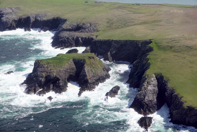
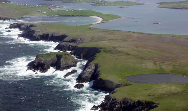
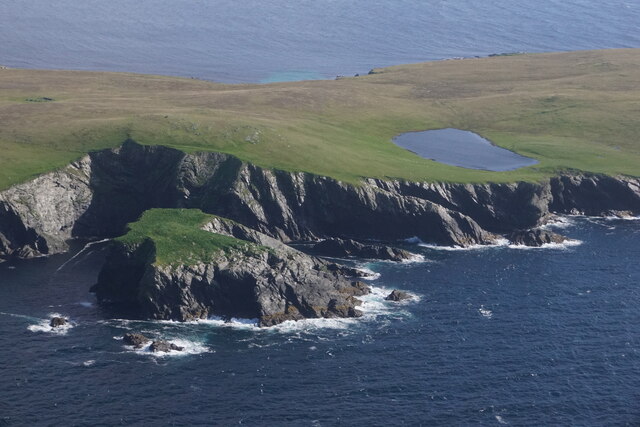
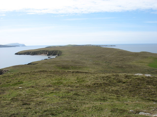
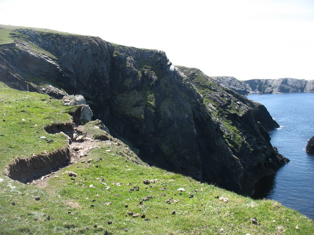
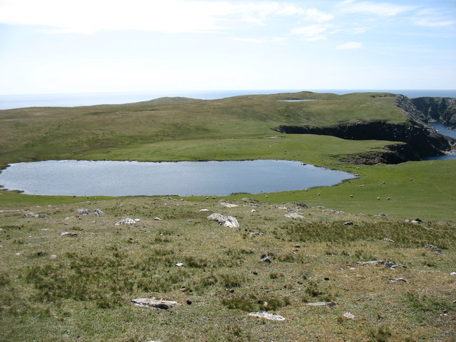
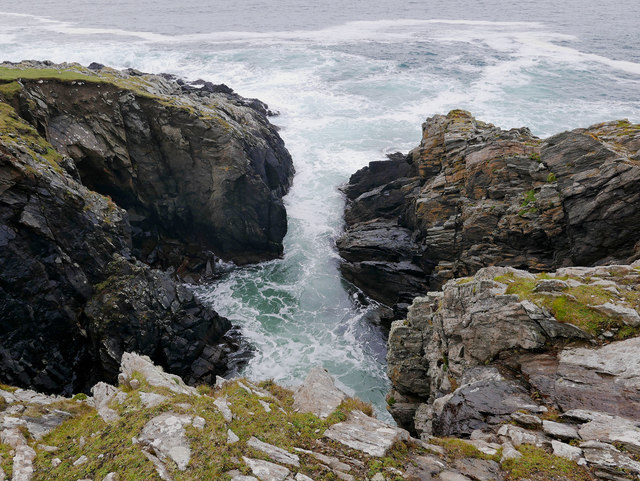
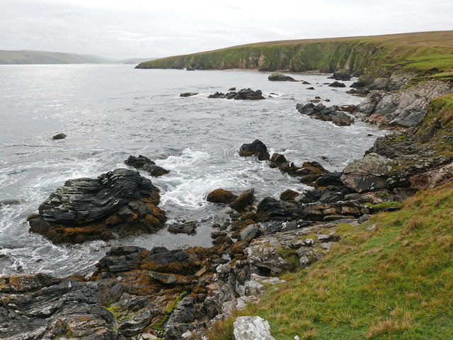
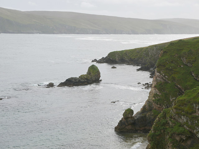
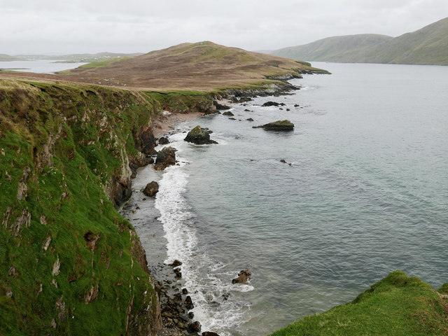
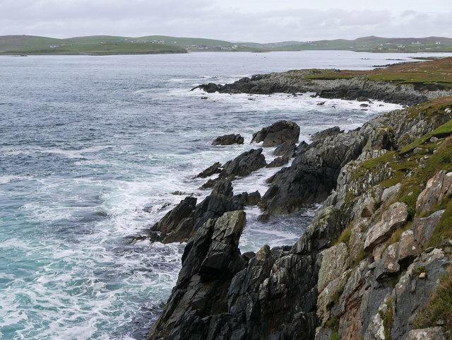
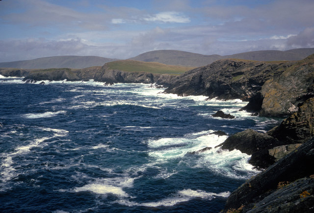
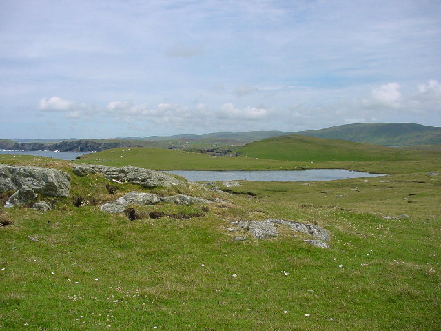
Banna Minn, also known as Shetland Bay, is a picturesque coastal area located in the Shetland Islands, Scotland. Situated on the western side of the mainland, Banna Minn offers stunning views of the North Atlantic Ocean and is surrounded by rugged cliffs and rocky shores.

The bay is known for its pristine sandy beach, which stretches for approximately 1.5 kilometers. The sand is soft and golden, making it a popular spot for beachgoers and nature enthusiasts. During low tide, the beach reveals extensive rock pools, offering opportunities for exploration and discovery of marine life.

Banna Minn is also recognized for its wildlife. The area is home to various seabirds, including puffins, fulmars, and guillemots. Birdwatchers flock to the bay to observe these species in their natural habitat. Additionally, seals can often be spotted lounging on the nearby rocks or swimming in the bay's crystal-clear waters.

The bay is easily accessible by road, with a parking area available for visitors. There are no facilities or amenities on-site, so visitors are advised to bring their own food, water, and other necessities. Banna Minn provides a tranquil and secluded environment, perfect for picnics, walks along the shore, or simply enjoying the breathtaking scenery.

Overall, Banna Minn in Shetland Bay is a hidden gem in Scotland, offering a serene coastal experience with its stunning beach, diverse wildlife, and untouched natural beauty.

If you have any feedback on the listing, please let us know in the comments section below.

Banna Minn Images

Images are sourced within 2km of 60.060012/-1.3468694 or Grid Reference HU3630. Thanks to Geograph Open Source API. All images are credited.
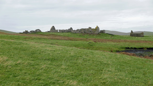
Fugla Stack, Burra, from the air
Sound of Fuglastack, Burra, from the air
Fugla Stack, Kettla Ness, West Burra, from the air Virda Vatn in the background.
Fugla Stack, Kettla Ness, West Burra, from the air
Virda Vatn in the background.
The southern part of Houss Ness Seen from just south of the summit of Ward of Symbister.
The southern part of Houss Ness
Seen from just south of the summit of Ward of Symbister.
Cliffs on the west side of Kettla Ness It looks as though there will soon be another landslide on this dramatic coast.
Cliffs on the west side of Kettla Ness
It looks as though there will soon be another landslide on this dramatic coast.
Kettla Ness The southern half of the island is unspoilt and very beautiful.
Kettla Ness
The southern half of the island is unspoilt and very beautiful.
At Gossigarth on Kettla Ness Looking towards Banna Minn and Duncansclett.
At Gossigarth on Kettla Ness
Looking towards Banna Minn and Duncansclett.
Geo by Scaalie Point The boisterous sea made quite a noise in the geo.
Geo by Scaalie Point
The boisterous sea made quite a noise in the geo.
The Haas on Houss Ness A curving bay on the east coast of Houss Ness.
The Haas on Houss Ness
A curving bay on the east coast of Houss Ness.
Stack of Oila, Houss Ness
View over the Haas, Houss Ness Beyond the bay (the Haas) rises the Ward of Symbister, the highest point on Houss Ness.
View over the Haas, Houss Ness
Beyond the bay (the Haas) rises the Ward of Symbister, the highest point on Houss Ness.
Approaching Clivland Bay, Houss Ness A small bay backed by numerous ruined buildings.
Approaching Clivland Bay, Houss Ness
A small bay backed by numerous ruined buildings.
Stream emerging at Clivland Bay Plenty of bubbles in peaty brown water.
Stream emerging at Clivland Bay
Plenty of bubbles in peaty brown water.
Symbister, East Burra An extensive set of ruined buildings.
Symbister, East Burra
An extensive set of ruined buildings.
Burnt Mound at Symbister One of three burnt mounds indicated on the 1:25,000 OS mapping.  This was a smaller mound.  Often features like this are marked on maps yet are hard to find. A Eureka moment followed after the  GPS location was checked. I understand the purpose of burnt mounds is a contentious issue.
Burnt Mound at Symbister
One of three burnt mounds indicated on the 1:25,000 OS mapping. This was a smaller mound. Often features like this are marked on maps yet are hard to find. A Eureka moment followed after the GPS location was checked. I understand the purpose of burnt mounds is a contentious issue.
West coast of Kettla Ness from The Heugg The aftermath of a Shetland gale.  The grass covered The Ward is the highest point on Kettla Ness. Beyond are the hills that make up the spine of Mainland Shetland.
West coast of Kettla Ness from The Heugg
The aftermath of a Shetland gale. The grass covered The Ward is the highest point on Kettla Ness. Beyond are the hills that make up the spine of Mainland Shetland.
Looking NW from hilltop near Kettla Ness
Symbister This croft site was abandoned in the early 1950s largely because there was no road to it. [P. Guy, Walking the Coastline of Shetland, South Mainland, Shetland Times, Lerwick, 2000.]
Symbister
This croft site was abandoned in the early 1950s largely because there was no road to it. [P. Guy, Walking the Coastline of Shetland, South Mainland, Shetland Times, Lerwick, 2000.]
Show me another place!

Banna Minn is located at Grid Ref: HU3630 (Lat: 60.060012, Lng: -1.3468694)

Unitary Authority: Shetland Islands

Police Authority: Highlands and Islands

What 3 Words

///ripen.firmer.being. Near Sandwick, Shetland Islands

Related Wikis

West Burra

West Burra is one of the Scalloway Islands, a subgroup of the Shetland Islands in Scotland. It is connected by bridge to East Burra. With an area of 743...

Burra, Shetland

Burra (Old Norse: Barrey ) is the collective name for two of the Shetland Islands, West (pop. 753) and East Burra (pop. 66), which are connected by bridge...

Scalloway Islands

The Scalloway Islands are in Shetland opposite Scalloway on south west of the Mainland. They form a mini-archipelago and include: Burra (two islands linked...

South Havra

South Havra (Scots: Sooth Haevra; Old Norse: Hafrey), formerly Hevera, is an uninhabited island in the Scalloway Islands, Shetland, Scotland. == Geography... ==

East Burra

East Burra (Scots: East Burra; Old Norse: "Barrey") is one of the Scalloway Islands, a subgroup of the Shetland Islands in Scotland. It is connected by...

South Mainland

The South Mainland of the Shetland Islands is the southern peninsula of Mainland island. It lies south of Hellister (60° 14′N). The greater southern part...

Little Havra

Little Havra is a small island off the west of South Mainland in Shetland. It is 35 metres (115 ft) at its highest point, upon which there is a cairn....

Oxna

Oxna is one of the Scalloway Islands, lying north west of Burra in Shetland, Scotland. Oxna has an area of 68 hectares (170 acres). The island has been...

Nearby Amenities

Located within 500m of 60.060012,-1.3468694
Duncansclett
Place: hamlet
Lat/Long: 60.0615323/-1.3415088
Power: pole
Lat/Long: 60.0632195/-1.3406941
Power: pole
Lat/Long: 60.0626881/-1.3411152
Power: pole
Lat/Long: 60.0620898/-1.3415954
Power: pole
Lat/Long: 60.0632831/-1.3433837
Power: pole
Lat/Long: 60.0630183/-1.3423854
Bus Stop
Papil
Bus: yes
Fixme: Location unknown
Public Transport: platform
Lat/Long: 60.0617377/-1.3407263
The data included in this document is from www.openstreetmap.org. The data is made available under ODbL.

Have you been to Banna Minn?

Leave your review of Banna Minn below (or comments, questions and feedback).