Bight of Valayre

Bay in Shetland

Scotland

Bight of Valayre

Brae in the snow
Brae in the snow Credit: Mike Pennington

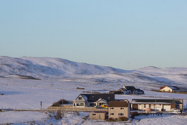
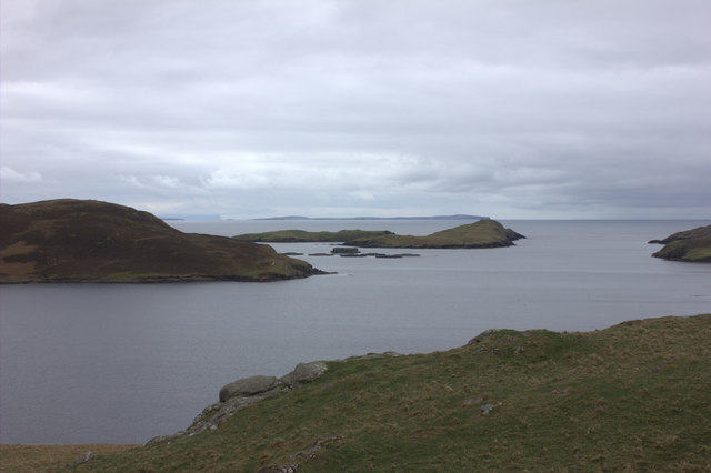
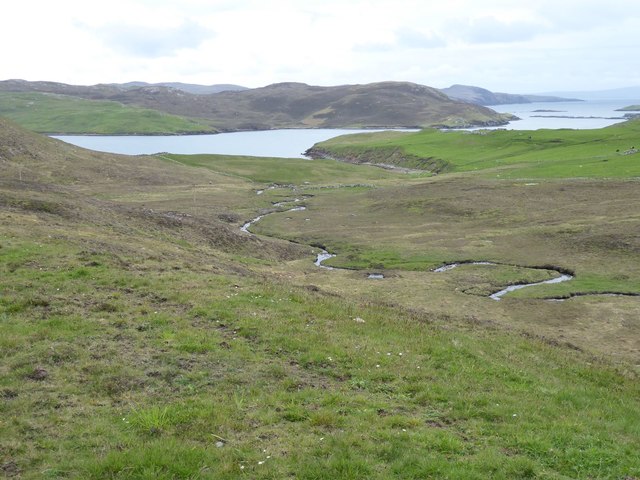
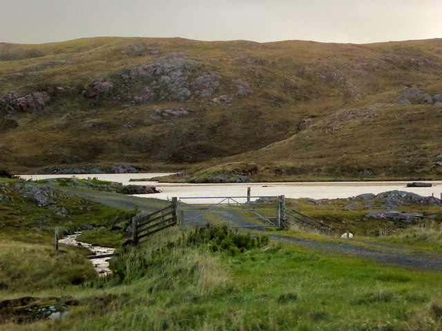
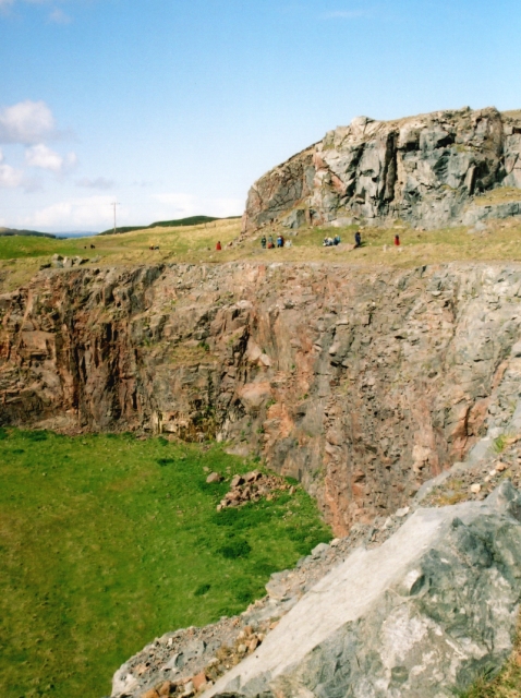
The Bight of Valayre is a picturesque bay located in the Shetland Islands of Scotland. Nestled along the western coast of the main island, it is known for its stunning natural beauty and tranquil atmosphere. The bay stretches over a mile in length and is characterized by its crescent-shaped sandy beach, which is backed by rugged cliffs and rolling hills.

The bay offers breathtaking views of the surrounding landscape, with its emerald green waters contrasting against the vibrant greenery of the coastal vegetation. The beach is a popular spot for locals and tourists alike, who come to enjoy leisurely walks, picnics, or simply to soak up the serene surroundings. The bay's calm waters also make it a great location for swimming, kayaking, and other water-based activities.

Aside from its natural beauty, the Bight of Valayre is also home to a diverse array of wildlife. Seals can often be spotted lounging on the rocks near the bay, while various species of seabirds can be seen soaring above. The bay's rocky outcrops and rock pools also provide a haven for marine life, making it a popular spot for snorkeling and exploring.

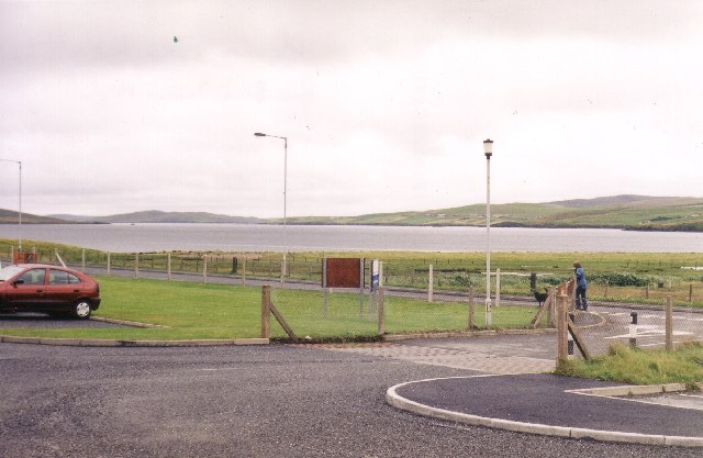
Access to the Bight of Valayre is relatively easy, with a car park located nearby and a short walk down to the beach. There are no facilities on-site, so visitors are advised to come prepared with their own food, drinks, and other necessities. Overall, the Bight of Valayre offers a tranquil and idyllic escape for those seeking to immerse themselves in the natural beauty of the Shetland Islands.

If you have any feedback on the listing, please let us know in the comments section below.

Bight of Valayre Images

Images are sourced within 2km of 60.408325/-1.3731773 or Grid Reference HU3469. Thanks to Geograph Open Source API. All images are credited.

Brae in the snow
Brae in the snow
West side of Brae in the snow
Brae Community Woodland
Delting Marina, Brae
Mangaster Voe
Mangaster Voe
The old road Single track remains of the A970 road
The old road
Single track remains of the A970 road
Mangaster Voe
Mangaster Voe
Pastures and ruins  South east of Mangaster.
Mangaster Voe in the foreground.
Pastures and ruins
South east of Mangaster. Mangaster Voe in the foreground.
Homestead on promontory  Overlooking Mangaster Voe.
Too Brekk is hill beyond on the left.
Homestead on promontory
Overlooking Mangaster Voe. Too Brekk is hill beyond on the left.
Burn of Mangaster Heads towards Mangaster Voe through rough grazing. 
Better pasture on the right..
Burn of Mangaster
Heads towards Mangaster Voe through rough grazing. Better pasture on the right..
Loch of Haggrister
Loch of Haggrister
A970 near Mangaster The A970 runs for 71 miles across most of the length of the "Mainland" in the Shetland Islands. It is a good-quality single-carriageway road for most of its route. Travelling from south to north, the road begins at Grutness near Sumburgh Airport and winds around the many hills and inlets passing close to a number of small villages without going through any large ones before Lerwick. After looping around Lerwick, a short spur runs to Scalloway whilst the main route continues northwards towards Brae where it crosses the narrow isthmus of Mavis Grind. At Sandy Lochs the road splits and a four-mile spur goes through Urafirth to Hillswick. The main route continuing to the right towards its northern terminus at Isbister. This last part of the route tends to be narrower with passing places.

<span class="nowrap"><a title="https://www.sabre-roads.org.uk/wiki/index.php?title=A970" rel="nofollow ugc noopener" href="https://www.sabre-roads.org.uk/wiki/index.php?title=A970">Link</a><img style="margin-left:2px;" alt="External link" title="External link - shift click to open in new window" src="https://s1.geograph.org.uk/img/external.png" width="10" height="10"/></span>  SABRE
A970 near Mangaster
The A970 runs for 71 miles across most of the length of the "Mainland" in the Shetland Islands. It is a good-quality single-carriageway road for most of its route. Travelling from south to north, the road begins at Grutness near Sumburgh Airport and winds around the many hills and inlets passing close to a number of small villages without going through any large ones before Lerwick. After looping around Lerwick, a short spur runs to Scalloway whilst the main route continues northwards towards Brae where it crosses the narrow isthmus of Mavis Grind. At Sandy Lochs the road splits and a four-mile spur goes through Urafirth to Hillswick. The main route continuing to the right towards its northern terminus at Isbister. This last part of the route tends to be narrower with passing places. LinkExternal link SABRE
Mavis Grind This is the narrowest land in the British Isles. The inlet on the right is an arm of the Atlantic Ocean; and on the left is Sullom Voe, which is an inlet of the North Sea.
Mavis Grind
This is the narrowest land in the British Isles. The inlet on the right is an arm of the Atlantic Ocean; and on the left is Sullom Voe, which is an inlet of the North Sea.
View from Brae Junior High school across Busta Voe View from Brae Junior High school car park across Busta Voe to the Ward of Runafirth and Muckle Roe on the right with the tip of Hevden Ness on the left above the red car.
View from Brae Junior High school across Busta Voe
View from Brae Junior High school car park across Busta Voe to the Ward of Runafirth and Muckle Roe on the right with the tip of Hevden Ness on the left above the red car.
Mavis Grind The steep cliff face frowns down at the Mavis Grind road.
Mavis Grind
The steep cliff face frowns down at the Mavis Grind road.
Mavis Grind, Shetland Looking to the west side of Mavis Grind at the Atlantic.
Mavis Grind, Shetland
Looking to the west side of Mavis Grind at the Atlantic.
Mavis Grind, Shetland Looking east at Mavis Grind, the sea is Sullom Voe, part of the North Sea to the east of Shetland.
Mavis Grind, Shetland
Looking east at Mavis Grind, the sea is Sullom Voe, part of the North Sea to the east of Shetland.
Virdins Quarry A large roadmetal quarry, with many veins of red granite cutting the surrounding grey diorite.
Virdins Quarry
A large roadmetal quarry, with many veins of red granite cutting the surrounding grey diorite.
Show me another place!

Bight of Valayre is located at Grid Ref: HU3469 (Lat: 60.408325, Lng: -1.3731773)

Unitary Authority: Shetland Islands

Police Authority: Highlands and Islands

What 3 Words

///quick.refreshed.crew. Near Brae, Shetland Islands

Related Wikis

Mavis Grind

Mavis Grind (Old Norse: Mæfeiðs grind or Mæveiðs grind, meaning "gate of the narrow isthmus") is a narrow isthmus joining the Northmavine peninsula to...

Brae

"Brae" is also the Lowland Scots language word for the slope or brow of a hill.Brae (Old Norse: Breiðeið, meaning "the wide isthmus") is a village on the...

Busta Voe

Busta Voe, (HU665350), in the north central Mainland, Shetland, is a sea inlet lying between the village of Brae and the island of Muckle Roe. At the head...

Sullom

Sullom is a village on the Shetland peninsula of Northmavine, between Haggrister and Bardister. It lies on the northwest side of Sullom Voe, to which it...

Delting

Delting is a civil parish and community council area on Mainland, Shetland, Scotland. It includes the Sullom Voe oil terminal and its main settlements...
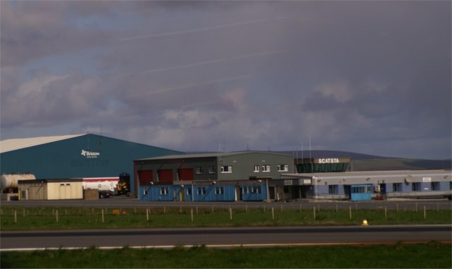
Scatsta Airport

Scatsta Airport (IATA: SCS, ICAO: EGPM), was a commercial airport on the island of Mainland, Shetland in Scotland located 17 nautical miles (31 km; 20...

Gunnister

Gunnister is a small 'abandoned' village at the North-West Mainland in Shetland, Scotland. It is most commonly known for the Gunnister Man - the remains...

Muckle Roe

Muckle Roe is an island in Shetland, Scotland, in St. Magnus Bay, to the west of Mainland. It has a population of around 130 people, who mainly croft and...

Nearby Amenities

Located within 500m of 60.408325,-1.3731773
Power: pole
Lat/Long: 60.4072395/-1.3814718
Power: pole
Lat/Long: 60.4076567/-1.381056
Power: pole
Lat/Long: 60.4083044/-1.3805705
Power: pole
Lat/Long: 60.4089746/-1.3801092
Power: pole
Lat/Long: 60.4095746/-1.3796774
Power: pole
Lat/Long: 60.4102421/-1.3792133
Power: pole
Lat/Long: 60.4108461/-1.3787815
Power: pole
Lat/Long: 60.4113679/-1.3784006
Power: pole
Lat/Long: 60.4119639/-1.3780117
Power: pole
Lat/Long: 60.404571/-1.3755614
Power: pole
Lat/Long: 60.4047131/-1.3764626
Power: pole
Lat/Long: 60.4049084/-1.377752
Power: pole
Lat/Long: 60.4050622/-1.3786627
Power: pole
Lat/Long: 60.4052327/-1.3797484
The data included in this document is from www.openstreetmap.org. The data is made available under ODbL.

Have you been to Bight of Valayre?

Leave your review of Bight of Valayre below (or comments, questions and feedback).