Sand Voe
Bay in Shetland
Scotland
Sand Voe

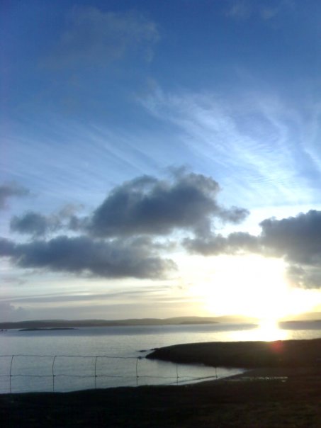
Sand Voe is a picturesque bay located on the island of Shetland, which is situated off the northeast coast of Scotland. Nestled between the villages of Voe and Brae, this bay is renowned for its stunning white sandy beach and crystal-clear turquoise waters.
With a length of approximately 1 kilometer, Sand Voe offers visitors a tranquil and idyllic setting. The bay is surrounded by rugged cliffs, providing a dramatic backdrop to the serene beach. The sand is soft and fine, inviting visitors to take a leisurely stroll or simply relax and soak up the peaceful atmosphere.
Sand Voe is a popular destination for outdoor enthusiasts and nature lovers. The bay is home to a diverse range of wildlife, including seals, otters, and seabirds. Birdwatchers will be thrilled by the opportunity to spot species such as puffins, guillemots, and kittiwakes.
The bay is also a haven for water sports enthusiasts, with opportunities for kayaking, paddleboarding, and swimming in the calm and clear waters. Fishing is another popular activity, with locals and visitors alike casting their lines in search of mackerel, cod, and haddock.
Access to Sand Voe is relatively easy, with a car park located nearby and a short walk down to the beach. The bay is also well-served by public transportation, making it accessible to those without their own transportation.
Overall, Sand Voe is a hidden gem of Shetland, offering visitors a breathtaking natural beauty and a peaceful respite from the hustle and bustle of everyday life.
If you have any feedback on the listing, please let us know in the comments section below.
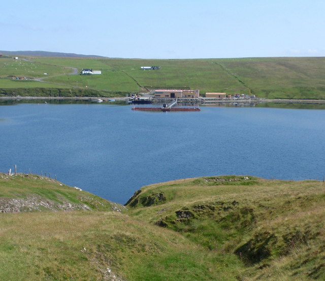
Sand Voe Images
Images are sourced within 2km of 60.199674/-1.3767985 or Grid Reference HU3446. Thanks to Geograph Open Source API. All images are credited.


Sand Voe is located at Grid Ref: HU3446 (Lat: 60.199674, Lng: -1.3767985)
Unitary Authority: Shetland Islands
Police Authority: Highlands and Islands
What 3 Words
///budgeted.unscrew.rebirth. Near Scalloway, Shetland Islands
Nearby Locations
Related Wikis

Sandsting
Sandsting is a parish in the West Mainland of Shetland, Scotland, forming a southern arm of the Walls Peninsula. After the parish of Aithsting was annexed...

Flotta, Shetland
Flotta (grid reference HU375462) is an island off the south west of Mainland, Shetland. The name may come from the Old Norse, flatey meaning flat island...

Hoy, Shetland
Hoy (Háey, Old Norse for 'high island') is a small island in Weisdale Voe, an arm of the sea in the Shetland islands, Scotland. Nearby are the smaller...

Skeld
Skeld (Old Norse: Skjolðr, Shield or shelter) refers to two villages on the south side of the West Mainland of Shetland, Scotland. The main village is...
Nearby Amenities
Located within 500m of 60.199674,-1.3767985Have you been to Sand Voe?
Leave your review of Sand Voe below (or comments, questions and feedback).