Chapman's Pool

Bay in Dorset

England

Chapman's Pool

Radar Research Memorial and NCI Lookout Station, St Alban's Head Radar Research Memorial at St Alban's Head, Isle of Purbeck, Dorset.

A plaque reads:
THIS MEMORIAL COMMEMORATES
THE RADAR RESEARCH
CARRIED OUT AT
WORTH MATRAVERS
FROM 1940 - 1942
WHICH WAS CRUCIAL TO
THE WINNING OF THE WAR
AND THE BIRTH OF MODERN
TELECOMMUNICATIONS

In the background the National Coastwatch Lookout Station. Built in the 1970's for HM Coastguard.
Radar Research Memorial and NCI Lookout Station, St Alban's Head Credit: J I Cheetham

Chapman's Pool is a picturesque bay located on the Jurassic Coastline in Dorset, England. Nestled between the small villages of Worth Matravers and Kingston, this secluded and unspoiled area offers a stunning natural landscape that attracts both locals and tourists alike.

The bay itself is a small cove with pebble and shingle beaches, surrounded by towering cliffs, creating a sense of tranquility and seclusion. The clear turquoise waters of the English Channel lap gently against the shore, making it an ideal spot for swimming and snorkeling during the summer months.

The area is a haven for wildlife enthusiasts, as Chapman's Pool is part of a protected nature reserve. Visitors have the opportunity to spot a variety of seabirds, including guillemots, razorbills, and even the occasional peregrine falcon. The surrounding cliffs are also home to a wide range of flora and fauna, with wildflowers blooming in abundance during the spring and summer.

Access to Chapman's Pool is limited, as there are no roads leading directly to the bay. Visitors must park in the nearby villages and take a scenic walk along footpaths that wind through rolling fields and pastures. This adds to the charm and exclusivity of the area, ensuring that it remains relatively untouched by mass tourism.

Chapman's Pool is a hidden gem along the Dorset coastline, offering breathtaking natural beauty and a peaceful escape from the hustle and bustle of everyday life. Whether you're looking for a quiet beach day or an opportunity to explore the diverse wildlife, this bay is a must-visit destination for nature lovers and outdoor enthusiasts.

If you have any feedback on the listing, please let us know in the comments section below.

Chapman's Pool Images

Images are sourced within 2km of 50.591278/-2.0682372 or Grid Reference SY9576. Thanks to Geograph Open Source API. All images are credited.

Radar Research Memorial and NCI Lookout Station, St Alban's Head Radar Research Memorial at St Alban's Head, Isle of Purbeck, Dorset.

A plaque reads:
THIS MEMORIAL COMMEMORATES
THE RADAR RESEARCH
CARRIED OUT AT
WORTH MATRAVERS
FROM 1940 - 1942
WHICH WAS CRUCIAL TO
THE WINNING OF THE WAR
AND THE BIRTH OF MODERN
TELECOMMUNICATIONS

In the background the National Coastwatch Lookout Station. Built in the 1970's for HM Coastguard.
Radar Research Memorial and NCI Lookout Station, St Alban's Head
Radar Research Memorial at St Alban's Head, Isle of Purbeck, Dorset. A plaque reads: THIS MEMORIAL COMMEMORATES THE RADAR RESEARCH CARRIED OUT AT WORTH MATRAVERS FROM 1940 - 1942 WHICH WAS CRUCIAL TO THE WINNING OF THE WAR AND THE BIRTH OF MODERN TELECOMMUNICATIONS In the background the National Coastwatch Lookout Station. Built in the 1970's for HM Coastguard.
Disused silo at Weston Farm Former dairy farm owned by the National Trust.
Disused silo at Weston Farm
Former dairy farm owned by the National Trust.
Coastal view across Winspit Bottom The lower houses of Worth Matravers are visible on the left.
Coastal view across Winspit Bottom
The lower houses of Worth Matravers are visible on the left.
Clifftop view west of St Alban’s Head Looking towards the cliffs above Chapman’s Pool.
Clifftop view west of St Alban’s Head
Looking towards the cliffs above Chapman’s Pool.
Radar memorial on St Alban’s Head Commemorating pioneering work on radar undertaken at Worth Matravers during World War II.
Radar memorial on St Alban’s Head
Commemorating pioneering work on radar undertaken at Worth Matravers during World War II.
Coastwatch station on St Alban’s Head One of many stations formerly operated by the coastguard but now run by National Coastwatch Institution volunteers. Seen from the coastal path.
Coastwatch station on St Alban’s Head
One of many stations formerly operated by the coastguard but now run by National Coastwatch Institution volunteers. Seen from the coastal path.
St Aldhelm’s Chapel St Aldhelm's Chapel is a Norman chapel on St Aldhelm's Head near Worth Matravers, Dorset. It is a Grade I listed building.
The square stone chapel stands within a low circular earthwork, which may be the remains of a pre-Conquest Christian enclosure. The building has several architectural features which are unusual for a chapel; the square shape, the orientation of the corners of the building towards the cardinal points, and the division and restriction of the interior space by a large central column. The lack of evidence for an altar or a piscina suggests that the building may not have been built as a chapel. It may have originally been built as a watchtower for Corfe Castle, covering the sea approaches to the south.
The interior of the chapel is approximately 25 feet square. In the centre is a square pier supporting four square rib vaults, with the heavy ribs leading to transverse arches, all stop-chamfered. In the north-west side is a Norman round-arched doorway. A small window is contemporary with the doorway.
During the late 19th and early 20th centuries regular weekly services were held, attended by coastguards and their families who lived in nearby cottages.
St Aldhelm’s Chapel
St Aldhelm's Chapel is a Norman chapel on St Aldhelm's Head near Worth Matravers, Dorset. It is a Grade I listed building. The square stone chapel stands within a low circular earthwork, which may be the remains of a pre-Conquest Christian enclosure. The building has several architectural features which are unusual for a chapel; the square shape, the orientation of the corners of the building towards the cardinal points, and the division and restriction of the interior space by a large central column. The lack of evidence for an altar or a piscina suggests that the building may not have been built as a chapel. It may have originally been built as a watchtower for Corfe Castle, covering the sea approaches to the south. The interior of the chapel is approximately 25 feet square. In the centre is a square pier supporting four square rib vaults, with the heavy ribs leading to transverse arches, all stop-chamfered. In the north-west side is a Norman round-arched doorway. A small window is contemporary with the doorway. During the late 19th and early 20th centuries regular weekly services were held, attended by coastguards and their families who lived in nearby cottages.
Abandoned cliff top quarry at St Alban’s Head
St Aldhelm's Quarry Active Purbeck stone quarry on the plateau of St Alban's Head.
St Aldhelm's Quarry
Active Purbeck stone quarry on the plateau of St Alban's Head.
Converging tracks on St Alban's Head The track on the left leads down to <a href="https://www.geograph.org.uk/photo/7759239">SY9676 : St Aldhelm's Quarry</a>.
Converging tracks on St Alban's Head
The track on the left leads down to SY9676 : St Aldhelm's Quarry.
Bridleway to St Alban's Head
Worth Matravers, seen across fields from the southwest
Weston Farm, from Bonvils Road The farm is owned by the National Trust and includes a motorhome site (just visible to the left here) and a summer-only campsite. The farm buildings, including the silo, are mostly disused.
Weston Farm, from Bonvils Road
The farm is owned by the National Trust and includes a motorhome site (just visible to the left here) and a summer-only campsite. The farm buildings, including the silo, are mostly disused.
Disused buildings at Weston Farm Former dairy farm.
Disused buildings at Weston Farm
Former dairy farm.
Corner of Weston Farm Sign on end of former dairy farm building.
Corner of Weston Farm
Sign on end of former dairy farm building.
Chapman’s Pool
Chapman’s Pool
Royal Marines Memorial, overlooking Chapman’s Pool A small memorial garden on the cliff top coast path overlooking Chapman’s Pool.
Royal Marines Memorial, overlooking Chapman’s Pool
A small memorial garden on the cliff top coast path overlooking Chapman’s Pool.
Steps descending towards Chapman’s Pool
Show me another place!

Chapman's Pool is located at Grid Ref: SY9576 (Lat: 50.591278, Lng: -2.0682372)

Unitary Authority: Dorset

Police Authority: Dorset

What 3 Words

///comments.ballooned.suiting. Near Corfe Castle, Dorset

Related Wikis

Chapman's Pool

Chapman's Pool is a small cove to the west of Worth Matravers on the Isle of Purbeck, in Dorset, England. == Geology == The rocks that form the cove are...

Egmont Bight

Egmont Bight is a shallow embayment at the southern end of the Encombe valley in Dorset, England. It is part of the Jurassic Coast. == Geology == The bay...

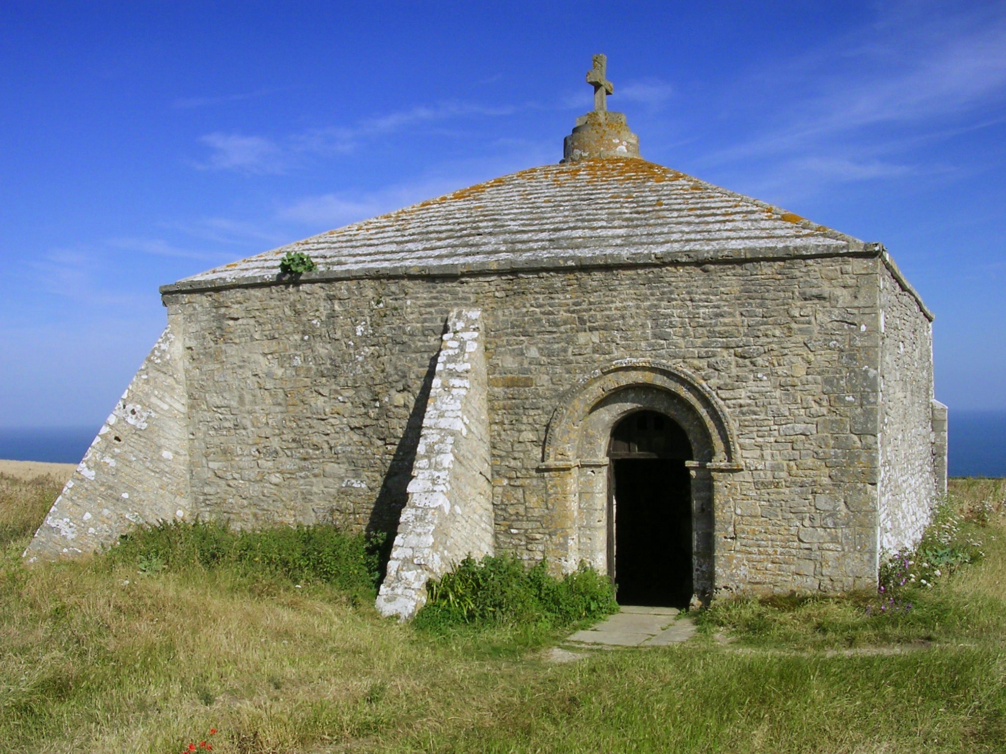
St. Aldhelm's Chapel, St. Aldhelm's Head

St Aldhelm's Chapel is a Norman chapel on St Aldhelm's Head in the parish of Worth Matravers, Swanage, Dorset. It stands close to the cliffs, 108 metres...

St Alban's Head

St Alban's Head (corruption of St Aldhelms Head) is a headland located 5 kilometres (3.1 mi) southwest of Swanage, on the coast of Dorset, England. It...

Nearby Amenities

Located within 500m of 50.591278,-2.0682372
Source: PGS
Lat/Long: 50.5929975/-2.074537
Source: PGS
Lat/Long: 50.5926921/-2.0740524
Source: PGS
Lat/Long: 50.5924557/-2.0736183
Source: PGS
Lat/Long: 50.5923021/-2.0729972
Source: PGS
Lat/Long: 50.5924022/-2.0727805
Source: PGS
Lat/Long: 50.5924938/-2.0725218
Source: PGS
Lat/Long: 50.5926238/-2.0721557
Source: PGS
Lat/Long: 50.5927576/-2.0712063
Source: PGS
Lat/Long: 50.592957/-2.0708944
Source: PGS
Lat/Long: 50.5930243/-2.0699304
Source: PGS
Lat/Long: 50.5929321/-2.0693503
Source: PGS
Lat/Long: 50.5925397/-2.0682541
Source: PGS
Lat/Long: 50.5925778/-2.0677402
Source: PGS
Lat/Long: 50.592697/-2.0673205
Source: PGS
Lat/Long: 50.5931072/-2.066448
Source: PGS
Lat/Long: 50.5932216/-2.0663734
Source: PGS
Lat/Long: 50.5939136/-2.0643635
Source: PGS
Lat/Long: 50.5937581/-2.0638563
Source: PGS
Lat/Long: 50.5935112/-2.0633972
Created By: almien_coastlines
Source: PGS
Lat/Long: 50.5931339/-2.0629722
Source: PGS
Lat/Long: 50.5925874/-2.0626421
Source: PGS
Lat/Long: 50.5914311/-2.0628572
Source: PGS
Lat/Long: 50.5913031/-2.0636218
Source: PGS
Lat/Long: 50.5912644/-2.0636979
Source: PGS
Lat/Long: 50.5911144/-2.0638134
Source: PGS
Lat/Long: 50.5906913/-2.0640563
Source: PGS
Lat/Long: 50.5903866/-2.0641687
Created By: almien_coastlines
Source: PGS
Lat/Long: 50.589766/-2.064249
Created By: almien_coastlines
Source: PGS
Lat/Long: 50.589509/-2.064254
Created By: almien_coastlines
Source: PGS
Lat/Long: 50.587715/-2.06429
Chapman's Pool
Natural: bay
Source Name: knowledge
Wikidata: Q258829
Lat/Long: 50.5925698/-2.0644441
Egmont Point
Natural: cape
Source: NLS - OS 1-inch 7th Series 1955-61
Lat/Long: 50.5924689/-2.0734312
Barrier: stile
Material: wood
Source: survey
Step Count: 2
Stile: stepover
Lat/Long: 50.5946307/-2.0670612
Access: private
Leisure: slipway
Surface: concrete
Lat/Long: 50.5913242/-2.06355
Ford: yes
Lat/Long: 50.5946093/-2.0640272
The data included in this document is from www.openstreetmap.org. The data is made available under ODbL.

Have you been to Chapman's Pool?

Leave your review of Chapman's Pool below (or comments, questions and feedback).