West Bay

Bay in Dorset

England

West Bay

High Street, Fortuneswell
High Street, Fortuneswell Credit: Vieve Forward

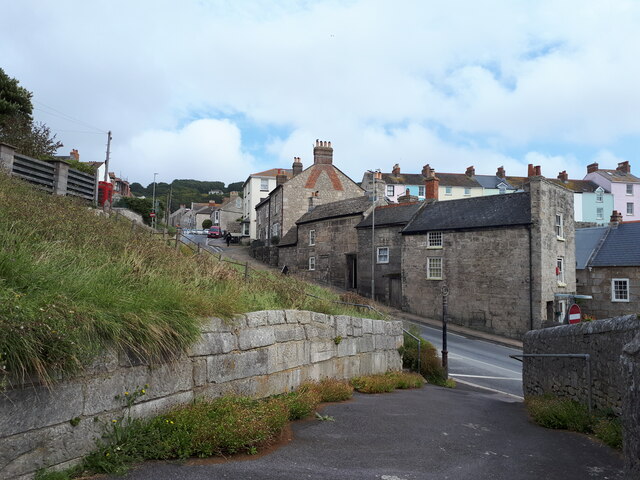
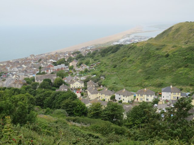
West Bay is a small coastal town located in Dorset, England. Situated at the mouth of the River Brit, it is also known as West Bay Bay. The town is renowned for its picturesque harbor and stunning cliffs, making it a popular tourist destination.

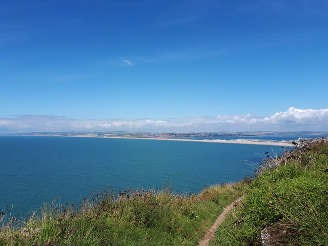
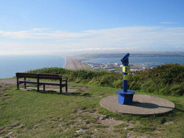
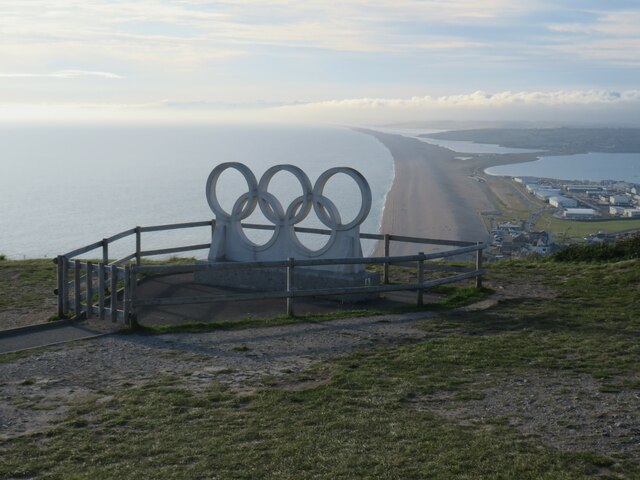
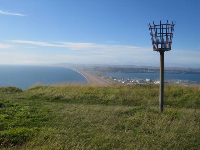
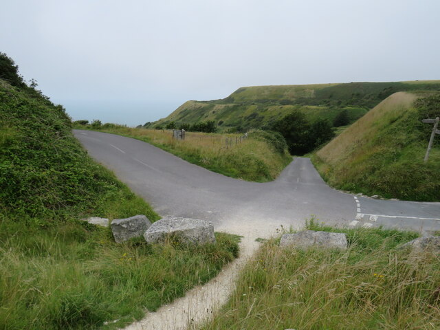
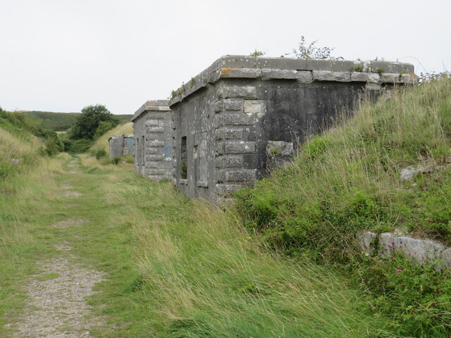
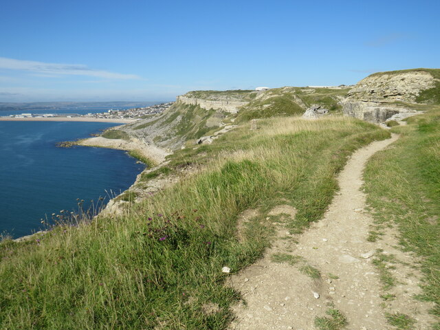
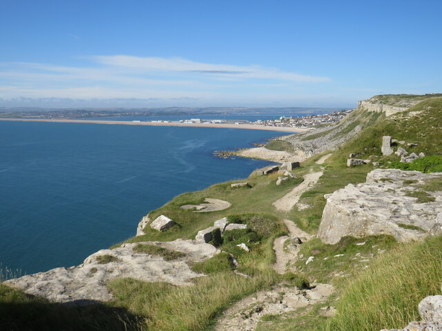
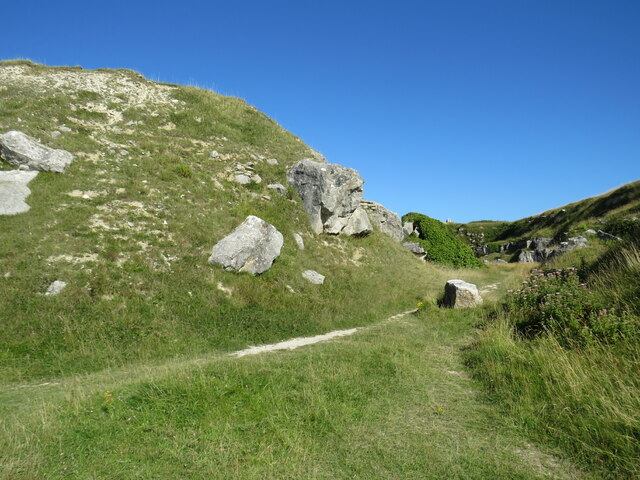
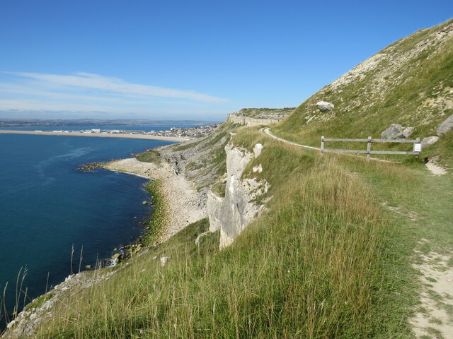
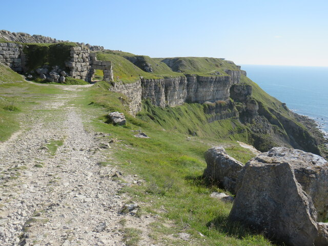
The harbor at West Bay is a hub of activity, with fishing boats and pleasure crafts moored alongside the quay. Visitors can enjoy a leisurely stroll along the promenade, taking in the panoramic views of the English Channel and the rugged coastline. The cliffs, made famous by the television series "Broadchurch," are a prominent feature of the town's landscape, attracting hikers and nature enthusiasts.

The town itself offers a range of amenities for visitors. There are numerous restaurants, cafes, and pubs where visitors can savor fresh seafood or enjoy a traditional English meal. West Bay boasts several shops and boutiques, offering a variety of local crafts and souvenirs.

For those seeking outdoor activities, West Bay provides ample opportunities. The beaches are ideal for sunbathing, swimming, and building sandcastles. Fishing trips and boat tours are also available for those wanting to explore the stunning Jurassic Coastline.

West Bay is well-connected to other parts of Dorset, with regular bus services and nearby railway stations. It is also an excellent base for exploring the surrounding areas, including the historic town of Bridport and the scenic countryside of the West Dorset AONB (Area of Outstanding Natural Beauty).

Overall, West Bay, Dorset, offers a delightful blend of natural beauty, coastal charm, and recreational activities, making it a must-visit destination for both locals and tourists alike.

If you have any feedback on the listing, please let us know in the comments section below.
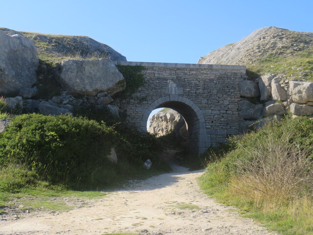
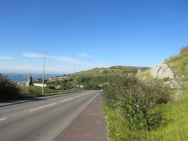
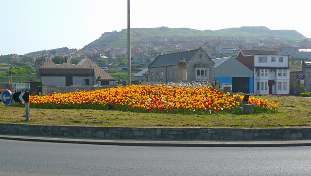
West Bay Images

Images are sourced within 2km of 50.561176/-2.4610001 or Grid Reference SY6773. Thanks to Geograph Open Source API. All images are credited.

High Street, Fortuneswell
Chesil Beach from Blacknor Fort
Viewpoint at Portland Heights, overlooking Weymouth A viewpoint at Portland Heights, with views over Weymouth and Chesil Beach.
Viewpoint at Portland Heights, overlooking Weymouth
A viewpoint at Portland Heights, with views over Weymouth and Chesil Beach.
Olympic Rings overlooking Chesil Beach London was the host city for the 2012 Olympic and Paralympic Games.  However, not all of the events took place in London.  Sailing events were held in Weymouth.  The Olympic rings sculpture stood outside Weymouth railway station for the duration of the Olympic games.  It was then moved to the viewpoint at Portland Heights, to serve as a permanent reminder of Weymouth and Portland's contribution to the 2012 Olympic Games.  The viewpoint overlooks Chesil Beach.

More information about the sculpture can be found on The Encyclopaedia of Portland History website: <span class="nowrap"><a title="https://www.portlandhistory.co.uk/olympic-rings.html" rel="nofollow ugc noopener" href="https://www.portlandhistory.co.uk/olympic-rings.html">Link</a><img style="margin-left:2px;" alt="External link" title="External link - shift click to open in new window" src="https://s1.geograph.org.uk/img/external.png" width="10" height="10"/></span>
Olympic Rings overlooking Chesil Beach
London was the host city for the 2012 Olympic and Paralympic Games. However, not all of the events took place in London. Sailing events were held in Weymouth. The Olympic rings sculpture stood outside Weymouth railway station for the duration of the Olympic games. It was then moved to the viewpoint at Portland Heights, to serve as a permanent reminder of Weymouth and Portland's contribution to the 2012 Olympic Games. The viewpoint overlooks Chesil Beach. More information about the sculpture can be found on The Encyclopaedia of Portland History website: LinkExternal link
Beacon at Portland Heights A beacon at Portland Heights, with a view over Chesil Beach
Beacon at Portland Heights
A beacon at Portland Heights, with a view over Chesil Beach
View over Fortuneswell, Isle of Portland A view over Fortuneswell on the Isle of Portland.  Chesil Beach can be seen in the distance, although this image was taken on a day when visibility was fairly poor.
View over Fortuneswell, Isle of Portland
A view over Fortuneswell on the Isle of Portland. Chesil Beach can be seen in the distance, although this image was taken on a day when visibility was fairly poor.
Ravine on the Isle of Portland A small ravine on the Isle of Portland.
Ravine on the Isle of Portland
A small ravine on the Isle of Portland.
Bridge near Fortuneswell, Isle of Portland A bridge carrying Verne Hill Road over a small ravine on the Isle of Portland.
Bridge near Fortuneswell, Isle of Portland
A bridge carrying Verne Hill Road over a small ravine on the Isle of Portland.
Road junction on the Isle of Portland A junction of minor roads on the Isle of Portland.
Road junction on the Isle of Portland
A junction of minor roads on the Isle of Portland.
East Weare Battery, Isle of Portland East Weare Battery was developed in the mid-19th Century to defend Portland Harbour against invasion.  More information about the history of the Battery can be found on The Encyclopaedia of Portland History website: <span class="nowrap"><a title="https://www.portlandhistory.co.uk/east-weare-batteries.html" rel="nofollow ugc noopener" href="https://www.portlandhistory.co.uk/east-weare-batteries.html">Link</a><img style="margin-left:2px;" alt="External link" title="External link - shift click to open in new window" src="https://s1.geograph.org.uk/img/external.png" width="10" height="10"/></span>
East Weare Battery, Isle of Portland
East Weare Battery was developed in the mid-19th Century to defend Portland Harbour against invasion. More information about the history of the Battery can be found on The Encyclopaedia of Portland History website: LinkExternal link
South West Coast Path, Isle of Portland The South West Coast Path on the western coastline of the Isle of Portland, looking northwards.
South West Coast Path, Isle of Portland
The South West Coast Path on the western coastline of the Isle of Portland, looking northwards.
South West Coast Path, Isle of Portland A view of the South West Coast Path, picking its way along on the rocky western coastline of the Isle of Portland.
South West Coast Path, Isle of Portland
A view of the South West Coast Path, picking its way along on the rocky western coastline of the Isle of Portland.
Path on the Isle of Portland A path through the limestone landscape on the Isle of Portlnad
Path on the Isle of Portland
A path through the limestone landscape on the Isle of Portlnad
South West Coast Path, Isle of Portland The South West Coast Path on the western coastline of the Isle of Portland.  The wooden fence ahead is a sign that the next section of the path had been closed for safety reasons.
South West Coast Path, Isle of Portland
The South West Coast Path on the western coastline of the Isle of Portland. The wooden fence ahead is a sign that the next section of the path had been closed for safety reasons.
South West Coast Path, Isle of Portland The South West Coast Path on the western coastline of the Isle of Portland.
South West Coast Path, Isle of Portland
The South West Coast Path on the western coastline of the Isle of Portland.
The Circle of Stones, Tout Quarry Sculpture Park, Isle of Portland Tout Quarry Nature Reserve and Sculpture Park is an abandoned stone quarry which has now been turned into a stone sculpture park. Now one of Portland’s most popular attractions, there are over 60 hidden sculptures in the Quarry, such as Antony Gormley’s ‘Still Falling’ sculpture and enjoy the stunning views over Chesil Beach and Portland Harbour. The park is also a haven for nature especially for those with a love of wild flowers and butterflies.
Tout Quarry Sculpture Park began in 1983 with artists residencies, where well known and emerging artists created both temporary and permanent work in response to the labyrinths and gullies of quarry workings within the 40 acre site – giving back to the Quarry where in the past so much had been taken away for buildings in London and around the world. 
Today, the stone faces and fallen crags have now become a living sculpture garden. The maze of paths through the quarry makes finding each of the etchings in the sculpture park like a game of hide-and-seek, as visitors scramble over boulders and squeeze through mini-valleys to find the little works of art spread across the grounds.
The Circle of Stones, Tout Quarry Sculpture Park, Isle of Portland
Tout Quarry Nature Reserve and Sculpture Park is an abandoned stone quarry which has now been turned into a stone sculpture park. Now one of Portland’s most popular attractions, there are over 60 hidden sculptures in the Quarry, such as Antony Gormley’s ‘Still Falling’ sculpture and enjoy the stunning views over Chesil Beach and Portland Harbour. The park is also a haven for nature especially for those with a love of wild flowers and butterflies. Tout Quarry Sculpture Park began in 1983 with artists residencies, where well known and emerging artists created both temporary and permanent work in response to the labyrinths and gullies of quarry workings within the 40 acre site – giving back to the Quarry where in the past so much had been taken away for buildings in London and around the world. Today, the stone faces and fallen crags have now become a living sculpture garden. The maze of paths through the quarry makes finding each of the etchings in the sculpture park like a game of hide-and-seek, as visitors scramble over boulders and squeeze through mini-valleys to find the little works of art spread across the grounds.
Arch in Tout Quarry Sculpture Park, Isle of Portland An arch in the Tout Quarry Sculpture Park, on the Isle of Portland.
Arch in Tout Quarry Sculpture Park, Isle of Portland
An arch in the Tout Quarry Sculpture Park, on the Isle of Portland.
New Road, Isle of Portland New Road forms part of the route of the A354, as it climbs to high ground on the Isle of Portland.
New Road, Isle of Portland
New Road forms part of the route of the A354, as it climbs to high ground on the Isle of Portland.
Show me another place!

West Bay is located at Grid Ref: SY6773 (Lat: 50.561176, Lng: -2.4610001)

Unitary Authority: Dorset

Police Authority: Dorset

What 3 Words

///firewall.hosts.dive. Near Portland, Dorset

Nearby Locations

West Bay

Related Wikis

Weymouth and Portland

Weymouth and Portland was a local government district and borough in Dorset, England from 1974 to 2019. It consisted of the resort of Weymouth and the...

South Dorset (UK Parliament constituency)

South Dorset is a constituency represented in the House of Commons of the UK Parliament since 2010 by Richard Drax, a Conservative. The constituency was...

Portland railway station (England)

Portland was a railway station on the Portland Branch Railway in the south of the English county of Dorset. The station opened with the Easton and Church...

Victoria Square, Portland

Victoria Square is a public square on the Isle of Portland, Dorset, England. Developed in the 19th century, it is situated at the entrance to Portland...

Have you been to West Bay?

Leave your review of West Bay below (or comments, questions and feedback).