Bay of Crook

Bay in Orkney

Scotland

Bay of Crook

Standing Stone in Shapinsay
Standing Stone in Shapinsay Credit: fabio sassi

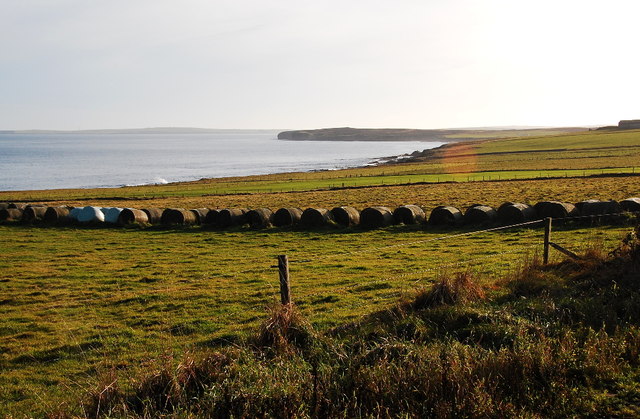
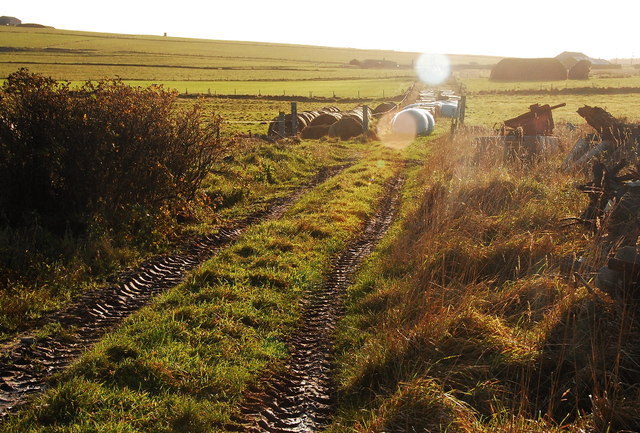
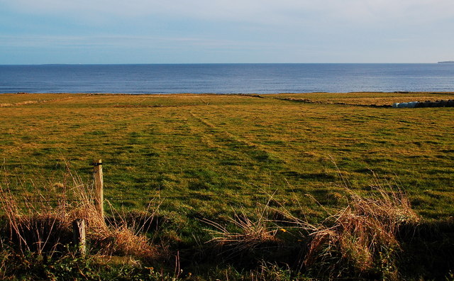
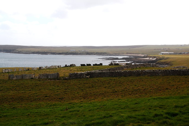
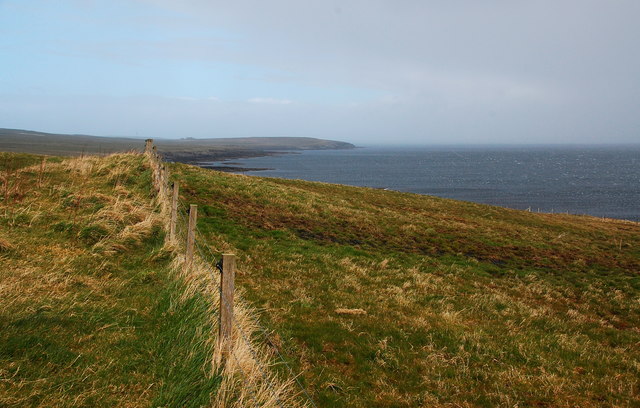
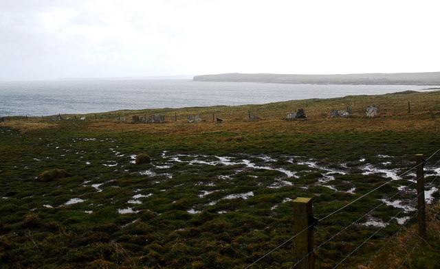
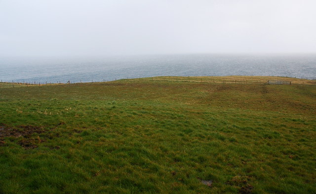
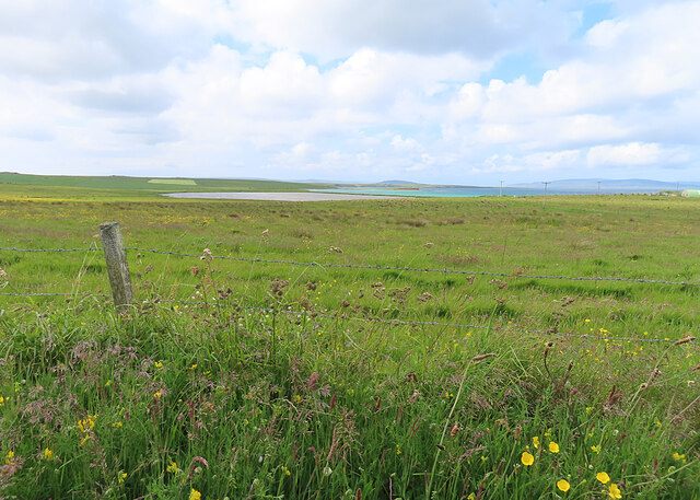
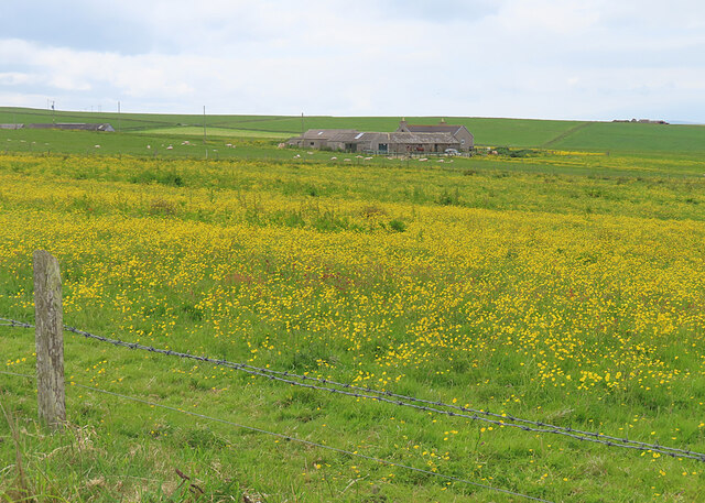
The Bay of Crook is a picturesque coastal area located on the island of Orkney, Scotland. Situated on the eastern coast of the Mainland, the largest island in the Orkney archipelago, the bay offers stunning views of the North Sea and the surrounding rugged landscape.

The Bay of Crook is characterized by its pristine sandy beach, which stretches for approximately one mile along the coast. The beach is known for its golden sand and crystal-clear waters, making it a popular destination for locals and tourists alike, especially during the summer months. The calm and tranquil atmosphere of the bay makes it an ideal spot for relaxation and leisurely walks.

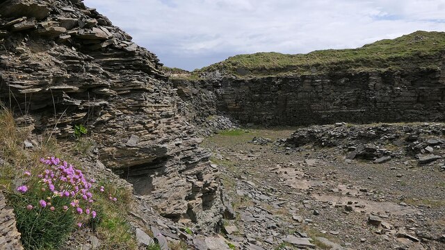
Surrounded by grassy dunes and dramatic cliffs, the bay provides a haven for various bird species, including oystercatchers, gulls, and terns. Birdwatchers flock to the area to observe the diverse avian population that inhabits the bay.

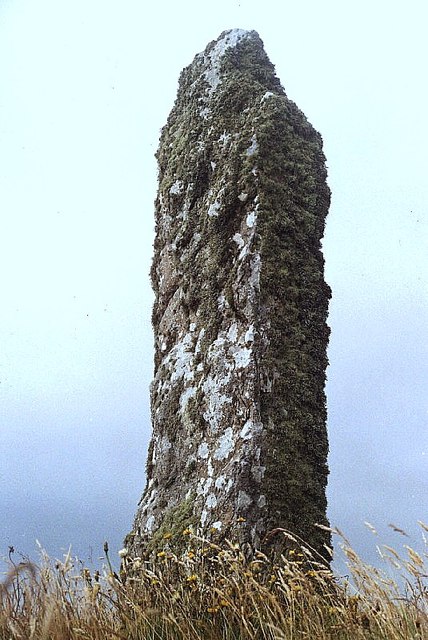
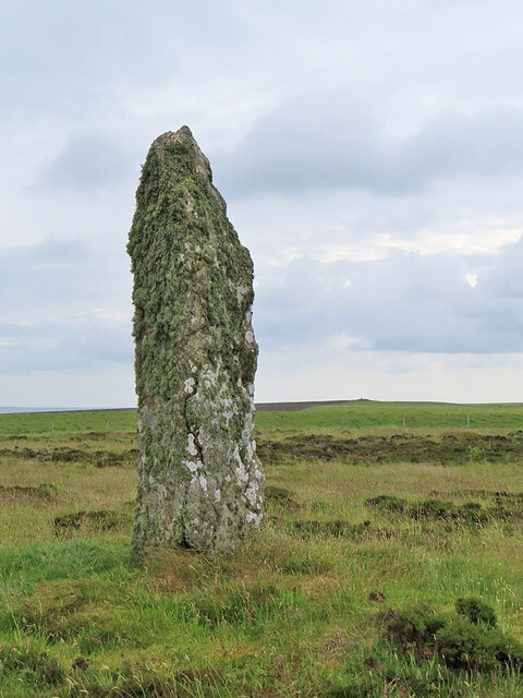
In addition to its natural beauty, the Bay of Crook also holds historical significance. The nearby standing stone known as the "Crook of Orkney" is believed to be a prehistoric monument, dating back thousands of years. This ancient site adds an element of mystery and intrigue to the area.

Overall, the Bay of Crook is a captivating destination that combines natural beauty, wildlife, and historical interest. Whether it be for relaxation, birdwatching, or exploring ancient monuments, visitors to the bay are sure to be enchanted by its charm.

If you have any feedback on the listing, please let us know in the comments section below.
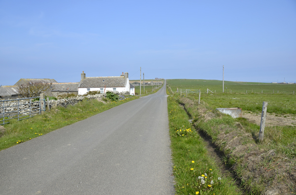
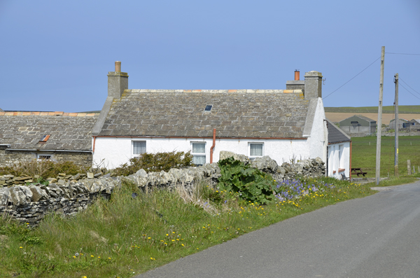
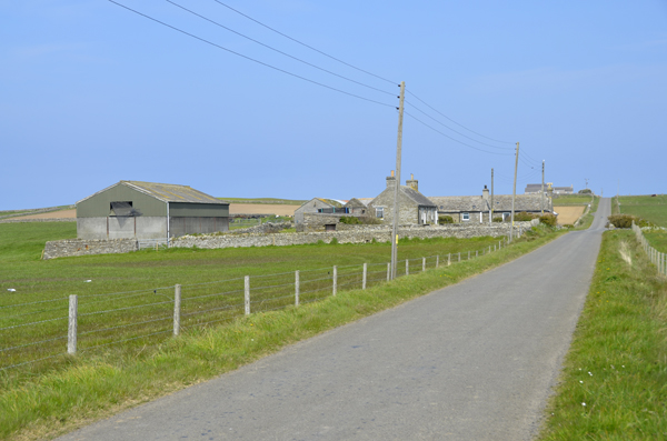
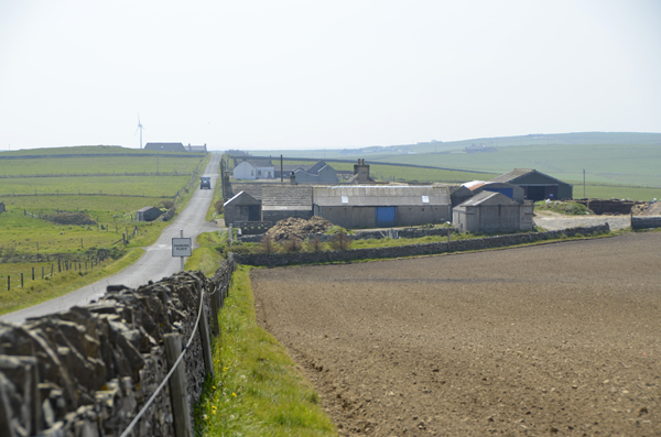
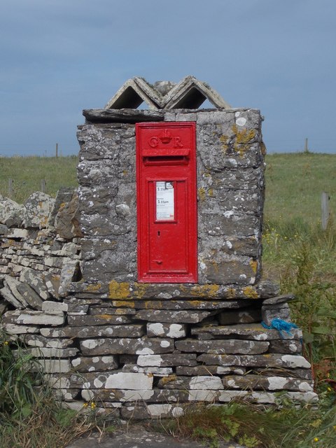
Bay of Crook Images

Images are sourced within 2km of 59.0465/-2.821007 or Grid Reference HY5218. Thanks to Geograph Open Source API. All images are credited.

Standing Stone in Shapinsay
Baled Hay at North Hill Mainland Orkney in the distance.
Baled Hay at North Hill
Mainland Orkney in the distance.
Track at North Hill Looking northwest.
Track at North Hill
Looking northwest.
Fields at North Hill I think that is Mull Head on Mainland (Orkney) to the right. The white speck towards the left horizon is the lighthouse on Auskerry.
Fields at North Hill
I think that is Mull Head on Mainland (Orkney) to the right. The white speck towards the left horizon is the lighthouse on Auskerry.
Inkerman House Shapinsay looking Northward
Close up of Inkerman
Lucknow Farm Shapinsay
Lucknow Farm Shapinsay Looking southwards
Shapinsay: postbox № KW17 69 A George V-reign postbox set into a stone pillar with a rather decorative top.
Shapinsay: postbox № KW17 69
A George V-reign postbox set into a stone pillar with a rather decorative top.
Flagstone field boundaries, Kirkton Field boundaries quarried from local sandstone, split into "flags" and used as a stone fence.
Flagstone field boundaries, Kirkton
Field boundaries quarried from local sandstone, split into "flags" and used as a stone fence.
Fence and coastal scenery, Kirkton Looking NNE with the wind and rain on my back.
Fence and coastal scenery, Kirkton
Looking NNE with the wind and rain on my back.
Waterlogged farmland Looking south towards the Bay of Linton.
Waterlogged farmland
Looking south towards the Bay of Linton.
Looking toward the sea from Kirkton Sheltering from the wind and rain with my back against the wall of a farm building. Looking straight downhill and out to sea.
Looking toward the sea from Kirkton
Sheltering from the wind and rain with my back against the wall of a farm building. Looking straight downhill and out to sea.
Former quarry, Shapinsay, Orkney Described in a local guide book as being an out of the wind suntrap.
Former quarry, Shapinsay, Orkney
Described in a local guide book as being an out of the wind suntrap.
Former rubbish tip, Shapinsay, Orkney I'm guessing that this style of waste disposal doesn't comply with modern legislation.
Former rubbish tip, Shapinsay, Orkney
I'm guessing that this style of waste disposal doesn't comply with modern legislation.
Mor Stein The information board says that it is known locally as the Moora Stone. It has lost some of its height since the Reverend George Barry described it as the Standing Stone of Shapinsay  in the Statistical Account of Shapinsay <span class="nowrap"><a title="https://stataccscot.edina.ac.uk/static/statacc/dist/viewer/osa-vol17-Parish_record_for_Shapinshay_in_the_county_of_Orkney_in_volume_17_of_account_1/" rel="nofollow ugc noopener" href="https://stataccscot.edina.ac.uk/static/statacc/dist/viewer/osa-vol17-Parish_record_for_Shapinshay_in_the_county_of_Orkney_in_volume_17_of_account_1/">Link</a><img style="margin-left:2px;" alt="External link" title="External link - shift click to open in new window" src="https://s1.geograph.org.uk/img/external.png" width="10" height="10"/></span> in 1796. It now stands 2.9 metres tall, 0.95 metres wide and 0.45 metres thick, and is still covered with lichen as it was over 200 years ago. It is a Scheduled Ancient Monument, but the citation <span class="nowrap"><a title="https://portal.historicenvironment.scot/designation/SM1323" rel="nofollow ugc noopener" href="https://portal.historicenvironment.scot/designation/SM1323">Link</a><img style="margin-left:2px;" alt="External link" title="External link - shift click to open in new window" src="https://s1.geograph.org.uk/img/external.png" width="10" height="10"/></span> is unusually devoid of information.
Mor Stein
The information board says that it is known locally as the Moora Stone. It has lost some of its height since the Reverend George Barry described it as the Standing Stone of Shapinsay in the Statistical Account of Shapinsay LinkExternal link in 1796. It now stands 2.9 metres tall, 0.95 metres wide and 0.45 metres thick, and is still covered with lichen as it was over 200 years ago. It is a Scheduled Ancient Monument, but the citation LinkExternal link is unusually devoid of information.
Grazing Land near Lairo The lagoon of Lairo Water is in the distance. It is in the next square.
Grazing Land near Lairo
The lagoon of Lairo Water is in the distance. It is in the next square.
Quoybanks To the left, the roof of Odinstone is just visible beyond a slight rise.
Quoybanks
To the left, the roof of Odinstone is just visible beyond a slight rise.
Show me another place!

Bay of Crook is located at Grid Ref: HY5218 (Lat: 59.0465, Lng: -2.821007)

Unitary Authority: Orkney Islands

Police Authority: Highlands and Islands

What 3 Words

///promote.caressing.coolest. Near Balfour, Orkney Islands

Related Wikis

Bay of Linton

The Bay of Linton is a bay on the east coast on the island of Shapinsay in the Orkney Islands, Scotland. To the north of Linton Bay are the headlands...

Linton Chapel

Linton Chapel is a ruined chapel on the east coast of Shapinsay, Orkney (Grid Reference HY5218). The chapel is thought to date as early as the 12th century...

Mor Stein

Mor Stein is a neolithic standing stone in the southeastern part of the island of Shapinsay, Orkney Islands, Scotland. Shapinsay is one of the two large...

Castle Bloody

Castle Bloody is a prehistoric feature on the island of Shapinsay, Orkney, Scotland. Hogan observes that while the feature is marked as a chambered mound...

Nearby Amenities

Located within 500m of 59.0465,-2.821007
Marker: cable
Lat/Long: 59.0456016/-2.824232
Power: pole
Lat/Long: 59.0441006/-2.8281909
Power: pole
Lat/Long: 59.0446276/-2.8276679
Power: pole
Lat/Long: 59.0451794/-2.8271341
Power: pole
Lat/Long: 59.0462321/-2.8272629
Power: pole
Lat/Long: 59.0476282/-2.8287435
Power: pole
Lat/Long: 59.0472667/-2.827405
Bay of Crook
Natural: bay
Lat/Long: 59.0465039/-2.8213191
The data included in this document is from www.openstreetmap.org. The data is made available under ODbL.

Have you been to Bay of Crook?

Leave your review of Bay of Crook below (or comments, questions and feedback).