Bay of Berstane

Bay in Orkney

Scotland

Bay of Berstane

Bungalows near Towerhill
Bungalows near Towerhill Credit: David Medcalf

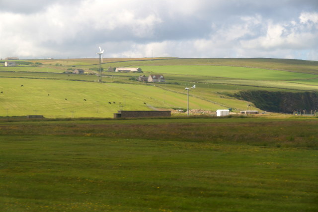
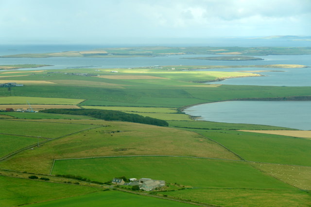
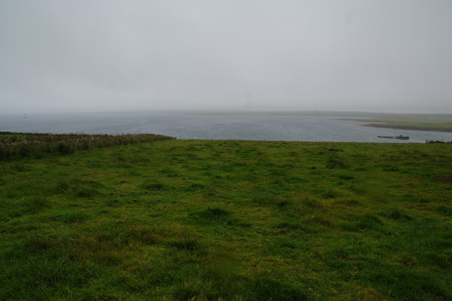
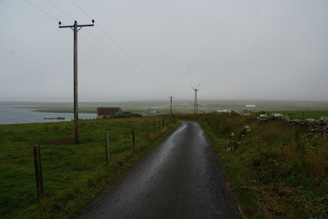
The Bay of Berstane is located on the northeastern coast of the Orkney Islands, Scotland. Situated approximately 7 miles south of the town of Stromness, it is a picturesque bay with a rich history and diverse natural beauty.

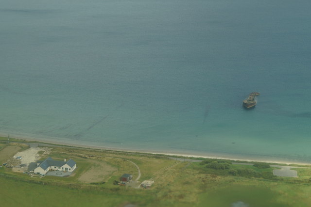
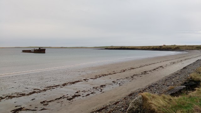
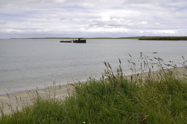
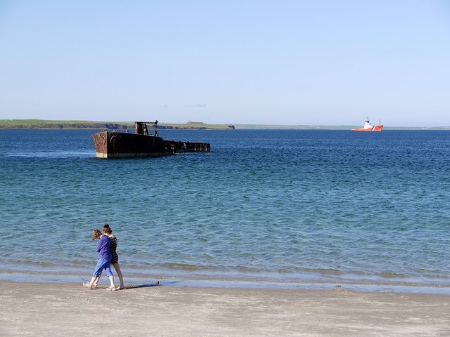
The bay stretches for about 2 miles and is characterized by its sandy beach, clear blue waters, and stunning cliffs that surround it. The bay offers breathtaking views of the Atlantic Ocean and is a popular spot for tourists and locals alike. Its tranquil atmosphere and scenic surroundings make it a perfect destination for nature enthusiasts, photographers, and those seeking a peaceful retreat.

The Bay of Berstane also holds historical significance, with ancient burial mounds and archaeological sites scattered along its coastline. These remnants of Neolithic and Bronze Age settlements provide insights into the early inhabitants of the Orkney Islands and their way of life.

The bay is home to a variety of wildlife, including seabirds, seals, and occasional sightings of dolphins and whales. It also serves as a habitat for various marine plants and algae. The surrounding cliffs offer nesting grounds for seabirds such as fulmars, guillemots, and puffins, making it a haven for birdwatchers.

Access to the Bay of Berstane is relatively easy, with a car park and footpath leading visitors to the beach. The bay offers opportunities for leisurely walks, picnics, and beachcombing. However, caution is advised when swimming or engaging in water activities due to the strong currents and unpredictable weather conditions typical of the area.

In summary, the Bay of Berstane in Orkney is a captivating destination that combines natural beauty, historical significance, and a peaceful ambiance, making it a must-visit location for anyone exploring the Orkney Islands.

If you have any feedback on the listing, please let us know in the comments section below.

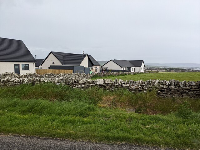
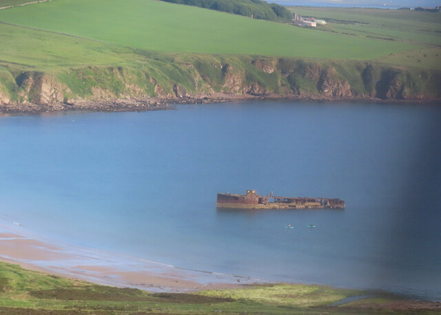
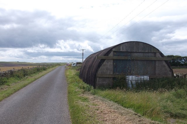
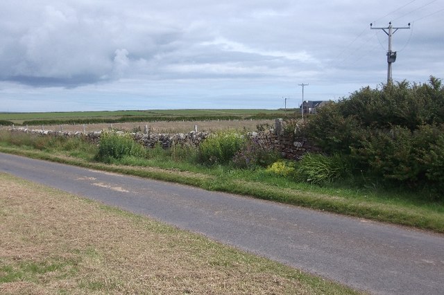
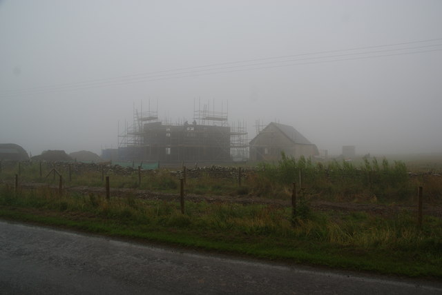
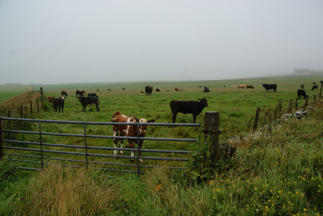
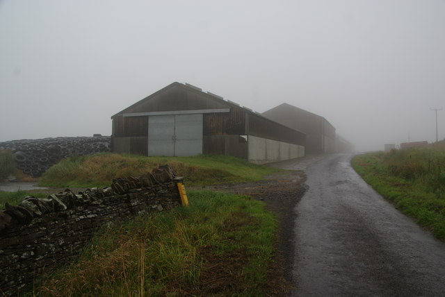
Bay of Berstane Images

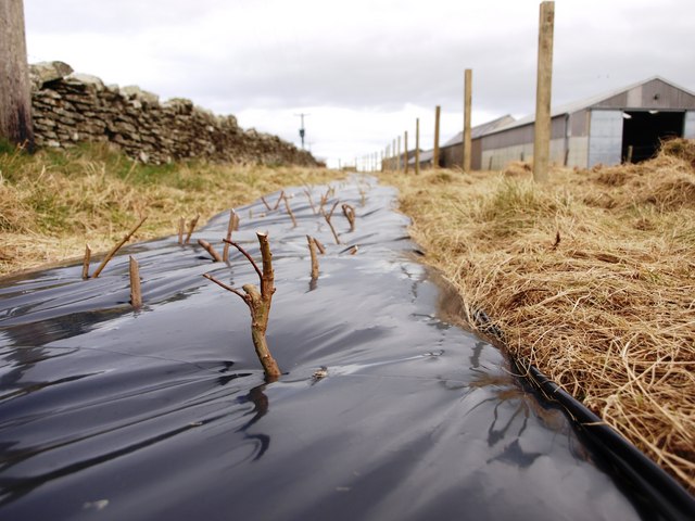
Images are sourced within 2km of 58.97975/-2.9166963 or Grid Reference HY4710. Thanks to Geograph Open Source API. All images are credited.

Bungalows near Towerhill
Wreck in Inganess Bay For more information see <a href="https://www.geograph.org.uk/photo/3094089">HY4708 : Wreck, Inganess Bay</a>.
Wreck in Inganess Bay
For more information see HY4708 : Wreck, Inganess Bay.
Nissen Hut above Kirkwall One of a pair of roadside huts on a hill to the southeast of Kirkwall.
Nissen Hut above Kirkwall
One of a pair of roadside huts on a hill to the southeast of Kirkwall.
Field off Bignold Park Road Between a couple of roads above Kirkwall.
Field off Bignold Park Road
Between a couple of roads above Kirkwall.
Towerhill Narrow road and pasture above Kirkwall.  The hill is between Kirkwall and the airport.
Towerhill
Narrow road and pasture above Kirkwall. The hill is between Kirkwall and the airport.
Towerhill from Kirkwall Airport
Sand of Wideford, from the air With the wreck of the Juniata just offshore.
Sand of Wideford, from the air
With the wreck of the Juniata just offshore.
Inganess and Berstane, from the air
Inganess Beach Some maps insist on calling this beach the "Sands of Wideford", named after the burn that enters the sea at the far end. But among local swimmers this is known simply as Inganess beach. Inganess road runs from Kirkwall to a parking area just next to the bay.
Inganess Beach
Some maps insist on calling this beach the "Sands of Wideford", named after the burn that enters the sea at the far end. But among local swimmers this is known simply as Inganess beach. Inganess road runs from Kirkwall to a parking area just next to the bay.
Shelter belt planting There is little natural tree growth in Orkney. Where there is sufficient shelter, trees like Sycamore and Whitebeam (and others) grow to almost full maturity. There are some good stands of trees but usually on private ground and planted by the owners. Given the right shelter, most tees will do well here.
In this picture, quick growing willow-stems are planted to produce habitat and shelter at the roadside.
The farm seen here is Quoydandy
Shelter belt planting
There is little natural tree growth in Orkney. Where there is sufficient shelter, trees like Sycamore and Whitebeam (and others) grow to almost full maturity. There are some good stands of trees but usually on private ground and planted by the owners. Given the right shelter, most tees will do well here. In this picture, quick growing willow-stems are planted to produce habitat and shelter at the roadside. The farm seen here is Quoydandy
Wreck of the Juniata, Inganess Bay Ian appears to have done more than enough research for this old wreck here <a href="https://www.geograph.org.uk/photo/1117966">HY4708 : Wreck of the Juniata, Inganess Bay</a>
Wreck of the Juniata, Inganess Bay
Ian appears to have done more than enough research for this old wreck here HY4708 : Wreck of the Juniata, Inganess Bay
Wreck, Inganess Bay The identity of this wreck seems to have been much disputed but a plausible explanation, confirming that of Ian Balcombe <a href="https://www.geograph.org.uk/photo/1117966">HY4708 : Wreck of the Juniata, Inganess Bay</a>, is provided by several correspondents here <span class="nowrap"><a title="http://www.orkneycommunities.co.uk/imagelibrary/picture/number849.asp" rel="nofollow ugc noopener" href="http://www.orkneycommunities.co.uk/imagelibrary/picture/number849.asp">Link</a><img style="margin-left:2px;" alt="External link" title="External link - shift click to open in new window" src="https://s1.geograph.org.uk/img/external.png" width="10" height="10"/></span>

R N Baird provided the following information in his post of 06 September 2007:

'The tanker Sprucol was built for the Admiralty by Short Bros, Sunderland in 1918. She had two screws and was powered by two Bolinders 8-cylinder oil engines, which gave her a speed of 9.5 knots. She was renamed Juniata in 1920 when acquired by the Anglo-American Oil Co. Ltd. In July 1934 she was sold to the French company Ste. Auxiliare de Transports, but in 1936 Anglo-American Oil bought her back again. On 17 April 1940 she was sunk as a block-ship in Water Sound, as part of No.4 Barrier, east of the Churchill Barrier linking the islands of South Ronaldsay and Burray. The wreck lay in the northern part of the channel, in the shallows of Burray, and remained there until July 1949, when she was raised for scrapping. It was found that her condition would not permit towing her to a shipbreaking yard, so she was towed to Inganess Bay and beached. Some scrapping work seems to have been carried out there, as the stern section has been separated from the wreck, leaving only the bow section still visible above the surface, only a short distance out from the sandy beach off the end of the main runway at Kirkwall airport.'
Wreck, Inganess Bay
The identity of this wreck seems to have been much disputed but a plausible explanation, confirming that of Ian Balcombe HY4708 : Wreck of the Juniata, Inganess Bay, is provided by several correspondents here LinkExternal link R N Baird provided the following information in his post of 06 September 2007: 'The tanker Sprucol was built for the Admiralty by Short Bros, Sunderland in 1918. She had two screws and was powered by two Bolinders 8-cylinder oil engines, which gave her a speed of 9.5 knots. She was renamed Juniata in 1920 when acquired by the Anglo-American Oil Co. Ltd. In July 1934 she was sold to the French company Ste. Auxiliare de Transports, but in 1936 Anglo-American Oil bought her back again. On 17 April 1940 she was sunk as a block-ship in Water Sound, as part of No.4 Barrier, east of the Churchill Barrier linking the islands of South Ronaldsay and Burray. The wreck lay in the northern part of the channel, in the shallows of Burray, and remained there until July 1949, when she was raised for scrapping. It was found that her condition would not permit towing her to a shipbreaking yard, so she was towed to Inganess Bay and beached. Some scrapping work seems to have been carried out there, as the stern section has been separated from the wreck, leaving only the bow section still visible above the surface, only a short distance out from the sandy beach off the end of the main runway at Kirkwall airport.'
Inganess Road, Kirkwall Bungalows right on the edge of Kirkwall, seen on a not untypical grey day.
Inganess Road, Kirkwall
Bungalows right on the edge of Kirkwall, seen on a not untypical grey day.
New building in the mist near Quoydandy The builders were still hard at work in these conditions.
New building in the mist near Quoydandy
The builders were still hard at work in these conditions.
Cows near Inganess They didn't look bothered by the grey conditions and undoubtedly are used to it.
Cows near Inganess
They didn't look bothered by the grey conditions and undoubtedly are used to it.
Farm buildings at Quoydandy Seen on a very grey day.
Farm buildings at Quoydandy
Seen on a very grey day.
Green field near Heatherquoy Overlooking Inganess Bay on a wet grey day.
Green field near Heatherquoy
Overlooking Inganess Bay on a wet grey day.
Road to Inganess Bay Heatherquoy is near on the left. Beyond the wind turbine can be seen Kirkwall Airport.
Road to Inganess Bay
Heatherquoy is near on the left. Beyond the wind turbine can be seen Kirkwall Airport.
Show me another place!

Bay of Berstane is located at Grid Ref: HY4710 (Lat: 58.97975, Lng: -2.9166963)

Unitary Authority: Orkney Islands

Police Authority: Highlands and Islands

What 3 Words

///remarking.bandstand.elephant. Near Kirkwall, Orkney Islands

Related Wikis

Kirkwall Grammar School

Kirkwall Grammar School is a secondary school in Kirkwall, Orkney, Scotland. It was established in c. 1200. The current school building was opened in 2014...

UHI Archaeology Institute

UHI Archaeology Institute is an academic department of the University of the Highlands and Islands in Scotland. It was founded in 2014, incorporating Orkney...

UHI Orkney

Orkney College (Scottish Gaelic: Colaiste Arcaibh) is a further and higher education college in Orkney, an archipelago in northern Scotland. It is an academic...

Earl's Palace, Kirkwall

The Earl's Palace is a ruined Renaissance-style palace near St Magnus's Cathedral in the centre of Kirkwall, Orkney, Scotland. Built by Patrick, Earl of...

Nearby Amenities

Located within 500m of 58.97975,-2.9166963
Bay of Berstane
Natural: bay
Lat/Long: 58.9797008/-2.9160977
The data included in this document is from www.openstreetmap.org. The data is made available under ODbL.

Have you been to Bay of Berstane?

Leave your review of Bay of Berstane below (or comments, questions and feedback).