Puil

Bay in Orkney

Scotland

Puil

Linkshouse Currently (2021) being converted to an Artists Residency Centre for the Pier Arts Centre, Stromness.
Linkshouse Credit: Graeme Yuill

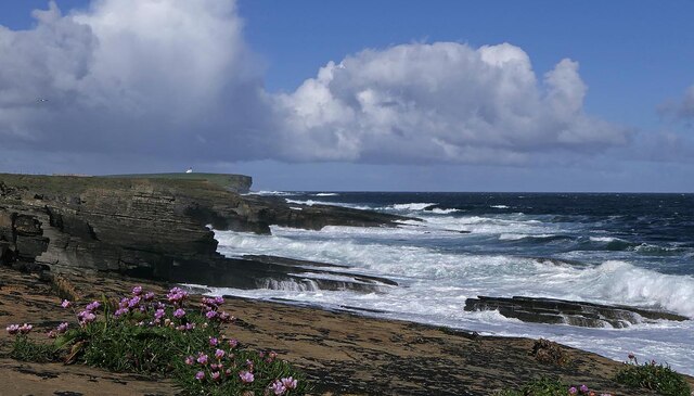
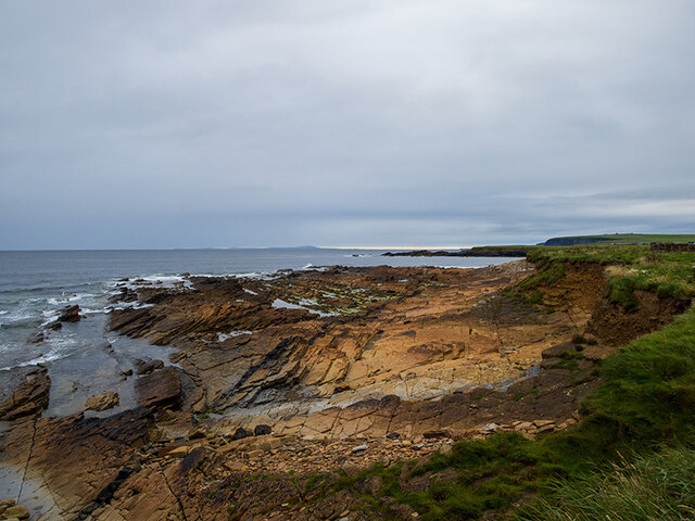
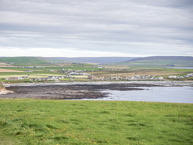
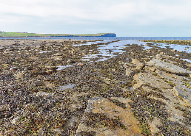
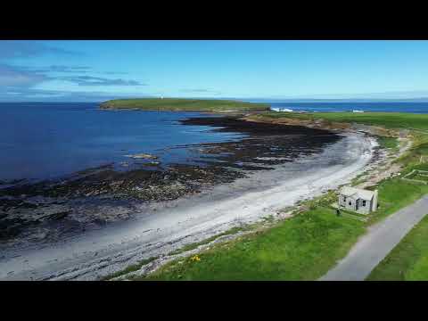
Puil, Orkney (Bay) is a picturesque bay located on the east coast of the Orkney Islands, Scotland. It is situated on the main island of Orkney, approximately 10 miles southeast of the town of Kirkwall. The bay stretches along a beautiful coastline, offering stunning views of the North Sea.

Puil Bay is known for its natural beauty and tranquility. The area is rich in wildlife, with various species of birds, seals, and even whales being spotted in the bay. The bay's sheltered waters also make it a popular spot for water sports enthusiasts, with activities such as kayaking and paddleboarding being enjoyed by locals and visitors alike.

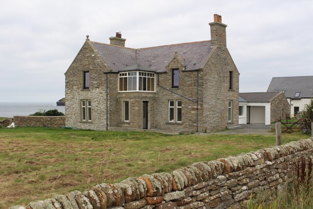
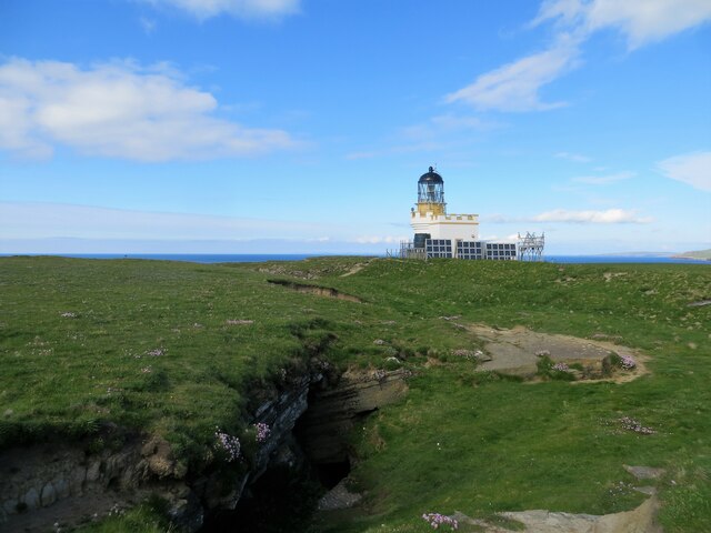
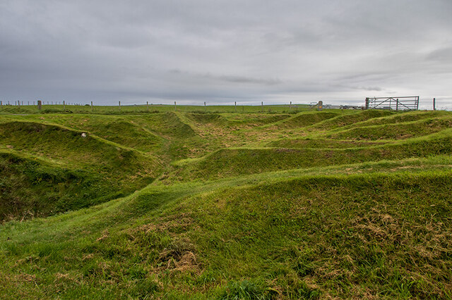
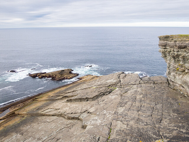
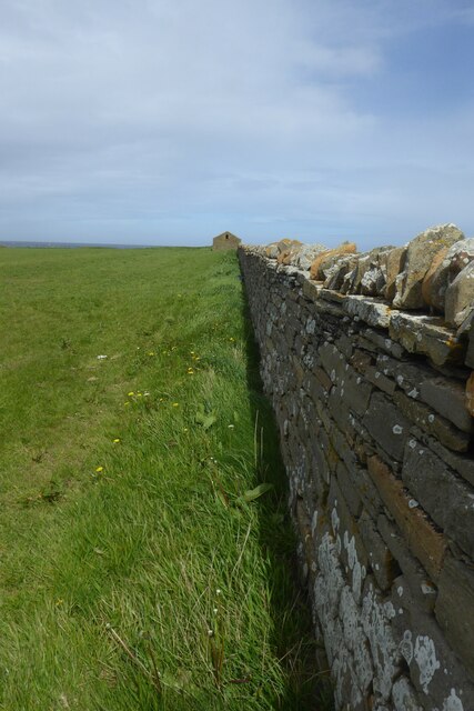
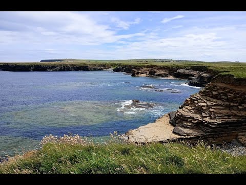
The bay is surrounded by rolling green hills and rugged cliffs, adding to its scenic charm. It is a great place for leisurely walks and hikes, as there are several well-maintained trails that run along the coastline. These trails offer breathtaking views of the bay and its surroundings.

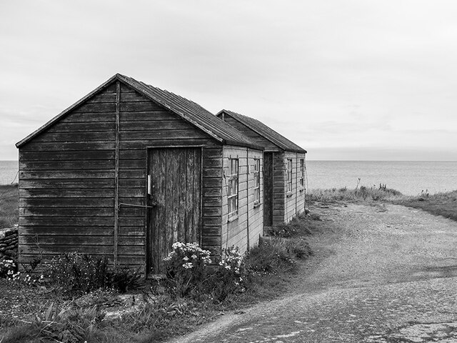
Puil Bay is also home to a small fishing community that relies on the sea for their livelihood. Fishing boats can often be seen coming and going from the bay, adding to its maritime atmosphere.

For those seeking a peaceful and idyllic coastal experience, Puil Bay in Orkney is a perfect destination. Its natural beauty, abundant wildlife, and recreational opportunities make it a must-visit location for nature lovers and outdoor enthusiasts.

If you have any feedback on the listing, please let us know in the comments section below.

Puil Images

Images are sourced within 2km of 59.130405/-3.321776 or Grid Reference HY2427. Thanks to Geograph Open Source API. All images are credited.

Linkshouse Currently (2021) being converted to an Artists Residency Centre for the Pier Arts Centre, Stromness.
Linkshouse
Currently (2021) being converted to an Artists Residency Centre for the Pier Arts Centre, Stromness.
Linkshouse Site Signboard Currently (2021) being converted to an Artists Residency Centre for the Pier Arts Centre, Stromness.
Linkshouse Site Signboard
Currently (2021) being converted to an Artists Residency Centre for the Pier Arts Centre, Stromness.
Coastline, Northside, Orkney Looking towards the lighthouse on the Brough of Birsay.
Coastline, Northside, Orkney
Looking towards the lighthouse on the Brough of Birsay.
Brough Head lighthouse
The western range of the Earl's Palace at Birsay
The eastern range of the Earl's Palace at Birsay
Huts on the shore at Birsay
Rocky shore at Brough Sounds
Nousts at Skiba Geo The nousts are the remains of huts used by fishermen for whom Skiba Geo was a natural harbour.
Note: Skiba Geo is the local spelling.
Nousts at Skiba Geo
The nousts are the remains of huts used by fishermen for whom Skiba Geo was a natural harbour. Note: Skiba Geo is the local spelling.
Tidal causeway across Brough Sounds
Lower Palace from the Brough of Birsay
Rocks below the cliffs at Brough Head On the Brough of Birsay.
Rocks below the cliffs at Brough Head
On the Brough of Birsay.
Brough of Birsay lighthouse
Looking towards Marwick Head and the Kitchener Memorial Taken from the clifftops of Brough Head on the Brough of Birsay.
Looking towards Marwick Head and the Kitchener Memorial
Taken from the clifftops of Brough Head on the Brough of Birsay.
Slipway at the Point of Buckquoy Marwick Head and the Kitchener Memorial in the distance.
Slipway at the Point of Buckquoy
Marwick Head and the Kitchener Memorial in the distance.
Grassland by Birsay Bay, Orkney
Old wall and building at Point of Buckquoy, Orkney
Rocky Shore The shore south of the causeway that gives access to the Brough of Birsay, with Marwick Head in the distance. The causeway is under water at high tide, so you need to be sure to get off the island in good time.
Rocky Shore
The shore south of the causeway that gives access to the Brough of Birsay, with Marwick Head in the distance. The causeway is under water at high tide, so you need to be sure to get off the island in good time.
Show me another place!

Puil is located at Grid Ref: HY2427 (Lat: 59.130405, Lng: -3.321776)

Unitary Authority: Orkney Islands

Police Authority: Highlands and Islands

What 3 Words

///sideboard.grain.splendid. Near Birsay, Orkney Islands

Related Wikis

St Magnus Church, Birsay

St Magnus Church, Birsay is a 17th-century church located in the parish of Birsay on Mainland, Orkney in Scotland. Built in 1664 on the site of an earlier...

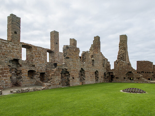
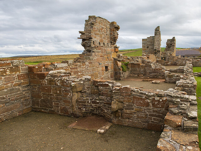
Earl's Palace, Birsay

The Earl's Palace in Birsay, Orkney, Scotland, is a ruined 16th-century castle. It was built by Robert Stewart, 1st Earl of Orkney (1533–1593), illegitimate...

Buckquoy spindle-whorl

The Buckquoy spindle-whorl is an Ogham-inscribed spindle-whorl dating from the Early Middle Ages, probably the 8th century, which was found in 1970 in...

Brough of Birsay

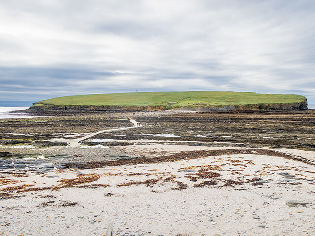
The Brough of Birsay is an uninhabited tidal island off the north-west coast of The Mainland of Orkney, Scotland, in the parish of Birsay. It is located...

Related Videos

Walking Orkney Birsay, a walk of coves & coastline

A short walk which takes you along the coastline from the Brough of Birsay car park to the viewpoint across the Bay.

Walking Orkney, Birsay around the bay

This short film takes you around the Bay in Birsay, part of the St Magnus Way.

The Brough of Birsay in Orkney

A visit to the Brough of Birsay and some information about the early settlers - the Picts and Vikings.

Nearby Amenities

Located within 500m of 59.130405,-3.321776
Toilets
Fee: no
Source: survey
Wheelchair: no
Lat/Long: 59.128613/-3.3156631
Palace Stores
Addr City: Orkney
Addr Postcode: KW17 2LX
Shop: convenience
Lat/Long: 59.1290868/-3.3158928
Fuel
Source: survey
Lat/Long: 59.1290398/-3.3157081
Point of Snusan Volunteers' Gun Battery
Historic: ruins
Lat/Long: 59.1267294/-3.3200641
Post Box
Collection Times: Mo-Sa 14:15
Operator: Royal Mail
Post Box Type: wall
Ref: KW17 108
Royal Cypher: scottish_crown
Lat/Long: 59.1291643/-3.3156692
Birsay
Name En: Birsay
Name Non: Birgisherað
Place: village
Lat/Long: 59.1295359/-3.3133698
Power: pole
Lat/Long: 59.129072/-3.3154014
Power: pole
Lat/Long: 59.1287726/-3.3141668
Man Made: water_tap
Lat/Long: 59.1296455/-3.3154151
Site of the Bishop's Palace
Tourism: attraction
Lat/Long: 59.1287349/-3.31671
Historic: memorial
Memorial: plaque
Lat/Long: 59.1291494/-3.3158254
The data included in this document is from www.openstreetmap.org. The data is made available under ODbL.

Have you been to Puil?

Leave your review of Puil below (or comments, questions and feedback).