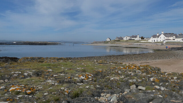
Porth Nobla

Bay in Anglesey

Wales

Porth Nobla
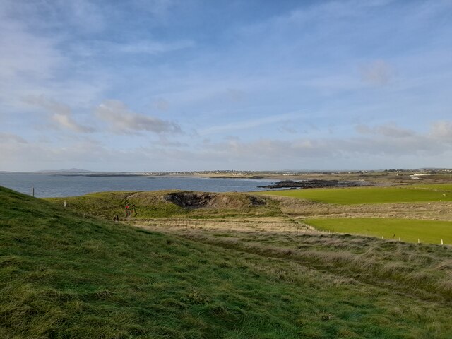
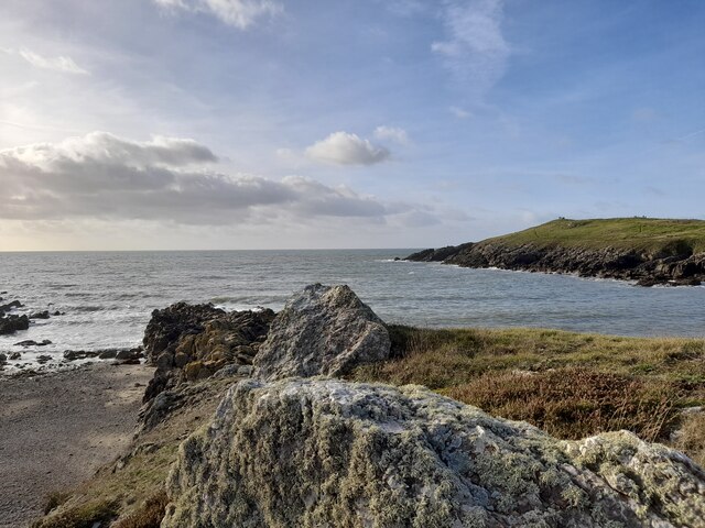
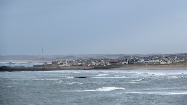
View to Rhosneigr Taken from the Isle of Anglesey Coastal Path north of Cable Bay. Part of the path can be seen in the photograph and Rhosneigr lies distant.
View to Rhosneigr Credit: David Bremner

The requested URL returned error: 429 Too Many Requests

If you have any feedback on the listing, please let us know in the comments section below.

Porth Nobla Images

Images are sourced within 2km of 53.210874/-4.5036844 or Grid Reference SH3271. Thanks to Geograph Open Source API. All images are credited.

View to Rhosneigr Taken from the Isle of Anglesey Coastal Path north of Cable Bay. Part of the path can be seen in the photograph and Rhosneigr lies distant.
View to Rhosneigr
Taken from the Isle of Anglesey Coastal Path north of Cable Bay. Part of the path can be seen in the photograph and Rhosneigr lies distant.
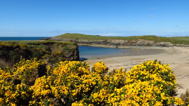
Porth Trecastell or Cable Bay A lovely spot we have visited several times over quite a few years.
Porth Trecastell or Cable Bay
A lovely spot we have visited several times over quite a few years.
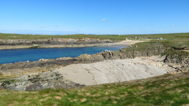
A View at Porth Trecastell A lovely spot on the west side of Anglesey.
A View at Porth Trecastell
A lovely spot on the west side of Anglesey.
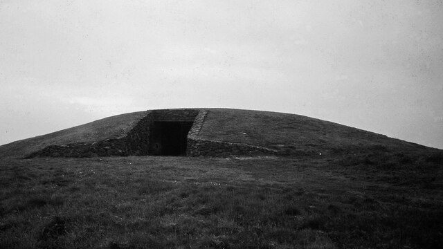
Barclodiad y Gawres Neolithic Passage Grave <span class="nowrap"><a title="https://www.megalithic.co.uk/article.php?sid=1492" rel="nofollow ugc noopener" href="https://www.megalithic.co.uk/article.php?sid=1492">Link</a><img style="margin-left:2px;" alt="External link" title="External link - shift click to open in new window" src="https://s1.geograph.org.uk/img/external.png" width="10" height="10"/></span>
Barclodiad y Gawres Neolithic Passage Grave
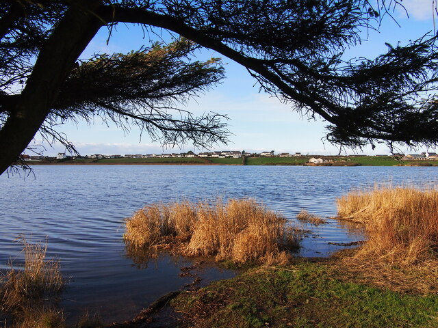
Llyn Maelog
Llyn Maelog
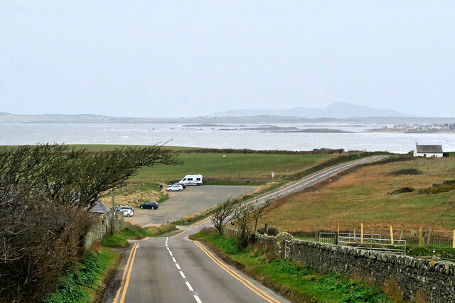
Car Park, Porth Trecastell The A4080 road runs for 24½ miles along the southwestern side of Anglesey. It starts on the A5 at Llanfair Pwllgwyngyll and passes through several villages before terminating on the A5 between Bryngwran and Gwalchmai.
Car Park, Porth Trecastell
The A4080 road runs for 24½ miles along the southwestern side of Anglesey. It starts on the A5 at Llanfair Pwllgwyngyll and passes through several villages before terminating on the A5 between Bryngwran and Gwalchmai.
Tyn Towyn An early eighteenth-century single-storey labourers cottage set back from the west side of the A4080 (Aberffraw to Rhosneigr) road in an isolated location at the southeast side of Porth Nobla. It is a Grade II listed building (Cadw reference 5274 <span class="nowrap"><a title="http://cadwpublic-api.azurewebsites.net/reports/listedbuilding/FullReport?lang=en&id=5274" rel="nofollow ugc noopener" href="http://cadwpublic-api.azurewebsites.net/reports/listedbuilding/FullReport?lang=en&id=5274">Link</a><img style="margin-left:2px;" alt="External link" title="External link - shift click to open in new window" src="https://s1.geograph.org.uk/img/external.png" width="10" height="10"/></span> ). Now used as self-catering holiday accommodation.
Tyn Towyn
An early eighteenth-century single-storey labourers cottage set back from the west side of the A4080 (Aberffraw to Rhosneigr) road in an isolated location at the southeast side of Porth Nobla. It is a Grade II listed building (Cadw reference 5274 LinkExternal link ). Now used as self-catering holiday accommodation.
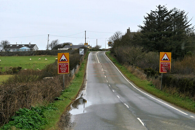
A4080 near Llanfaelog The A4080 road runs for 24½ miles along the southwestern side of Anglesey. It starts on the A5 at Llanfair Pwllgwyngyll and passes through several villages before terminating on the A5 between Bryngwran and Gwalchmai.
A4080 near Llanfaelog
The A4080 road runs for 24½ miles along the southwestern side of Anglesey. It starts on the A5 at Llanfair Pwllgwyngyll and passes through several villages before terminating on the A5 between Bryngwran and Gwalchmai.
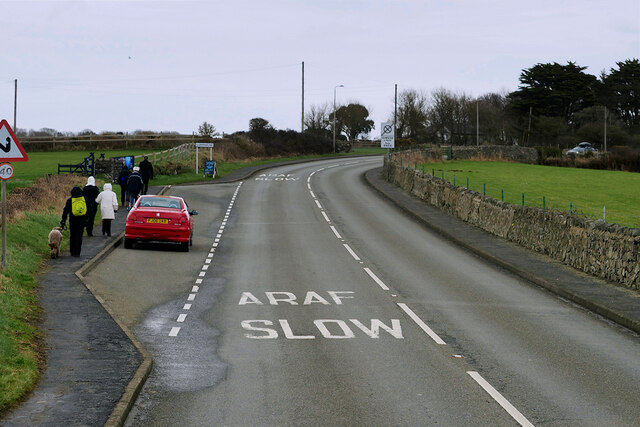
A4080 Rhosneigr Rhosneigr is a seaside village on the southwest coast of Anglesey.
A4080 Rhosneigr
Rhosneigr is a seaside village on the southwest coast of Anglesey.
Layby on the A4080 above Rhosneigr The A4080 road runs for 24½ miles along the southwestern side of Anglesey. It starts on the A5 at Llanfair Pwllgwyngyll and passes through several villages before terminating on the A5 between Bryngwran and Gwalchmai.
Layby on the A4080 above Rhosneigr
The A4080 road runs for 24½ miles along the southwestern side of Anglesey. It starts on the A5 at Llanfair Pwllgwyngyll and passes through several villages before terminating on the A5 between Bryngwran and Gwalchmai.
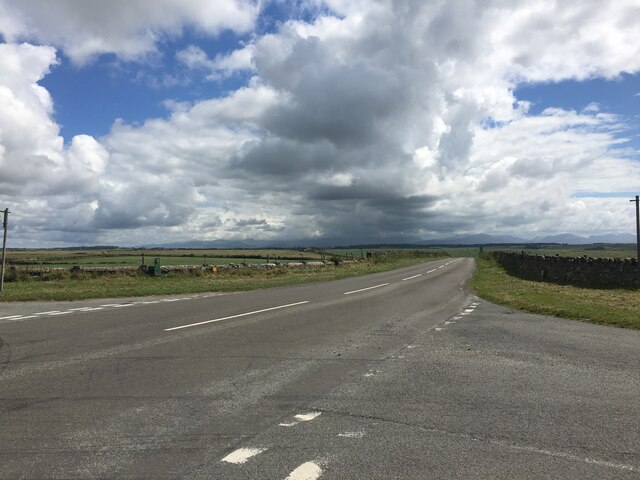
Junction on the A4080 near Anglesey Circuit
Looking across to Pen Bryn
Golygfa tuag at Rhosneigr The view towards Rhosneigr from the headland of Barclodiad y Gawres.
Golygfa tuag at Rhosneigr
The view towards Rhosneigr from the headland of Barclodiad y Gawres.
Porth Terfyn with Porth Trecastell behind
Beach at Porth Trecastell
St Mary's Church, Llangwyfan The Victorian replacement for the original parish church.
St Mary's Church, Llangwyfan
The Victorian replacement for the original parish church.
Rhosneigr o Fraich Parlwr / Rhosneigr from Braich Parlwr
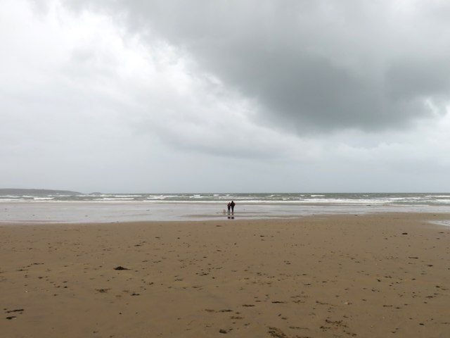
Walking the dog on a damp day Just a few hardy dog walkers were braving the elements on a damp and windy day at Traeth Llydan.
Walking the dog on a damp day
Just a few hardy dog walkers were braving the elements on a damp and windy day at Traeth Llydan.
Show me another place!

Porth Nobla is located at Grid Ref: SH3271 (Lat: 53.210874, Lng: -4.5036844)

Unitary Authority: Isle of Anglesey

Police Authority: North Wales

What 3 Words

///though.circling.apart. Near Rhosneigr, Isle of Anglesey

Related Wikis

Barclodiad y Gawres

Barclodiad y Gawres (Welsh for 'The Giantess's Apronful'; Welsh pronunciation: [barkˌlɔdjad ə ˈgau̯rɛs]) is a Neolithic burial chamber between Rhosneigr...

Trecastell

Trecastell is a farm and historical site in the community of Aberffraw, Anglesey, Wales. == History == Llywelyn the Great, Prince of the Kingdom of Gwynedd...

Llangwyfan, Anglesey

Llangwyfan named after St. Cwyfan is a hamlet in the community of Aberffraw, Anglesey, Wales, which is 130.8 miles (210.6 km) from Cardiff and 218 miles...

St Maelog's Church, Llanfaelog

St Maelog's Church is a church in the village of Llanfaelog, situated in the Isle of Anglesey, Wales. The present building dates from the 19th century...

Nearby Amenities

Located within 500m of 53.210874,-4.5036844
Source: PGS
Lat/Long: 53.2151551/-4.5036576
Source: PGS
Lat/Long: 53.2147574/-4.5035682
Source: PGS
Lat/Long: 53.2145484/-4.5035946
Created By: dmgroom_coastlines
Source: PGS
Lat/Long: 53.21416/-4.502923
Created By: dmgroom_coastlines
Source: PGS
Lat/Long: 53.213807/-4.5026
Created By: dmgroom_coastlines
Source: PGS
Lat/Long: 53.2135064/-4.5025352
Created By: dmgroom_coastlines
Source: PGS
Lat/Long: 53.213139/-4.5024331
Source: PGS
Lat/Long: 53.2127891/-4.5023037
Source: PGS
Lat/Long: 53.2124372/-4.5018226
Source: PGS
Lat/Long: 53.2121516/-4.5015884
Source: PGS
Lat/Long: 53.2119451/-4.5013798
Source: PGS
Lat/Long: 53.2117029/-4.5011115
Created By: dmgroom_coastlines
Source: PGS
Lat/Long: 53.2113954/-4.5010529
Created By: dmgroom_coastlines
Source: PGS
Lat/Long: 53.211106/-4.501323
Created By: dmgroom_coastlines
Source: PGS
Lat/Long: 53.2108693/-4.5016572
Created By: dmgroom_coastlines
Source: PGS
Lat/Long: 53.210703/-4.502802
Created By: dmgroom_coastlines
Source: PGS
Lat/Long: 53.210441/-4.50322
Created By: dmgroom_coastlines
Source: PGS
Lat/Long: 53.210174/-4.504064
Created By: dmgroom_coastlines
Source: PGS
Lat/Long: 53.209913/-4.504482
Created By: dmgroom_coastlines
Source: PGS
Lat/Long: 53.20978/-4.504904
Created By: dmgroom_coastlines
Source: PGS
Lat/Long: 53.209265/-4.5051
Created By: dmgroom_coastlines
Source: PGS
Lat/Long: 53.208747/-4.505509
Created By: dmgroom_coastlines
Source: PGS
Lat/Long: 53.208491/-4.5055
Created By: dmgroom_coastlines
Source: PGS
Lat/Long: 53.208235/-4.505491
Created By: dmgroom_coastlines
Source: PGS
Lat/Long: 53.2080043/-4.5051865
Created By: dmgroom_coastlines
Source: PGS
Lat/Long: 53.207853/-4.505263
Created By: dmgroom_coastlines
Source: PGS
Lat/Long: 53.207728/-4.505046
Created By: dmgroom_coastlines
Source: PGS
Lat/Long: 53.207221/-4.504602
Source: PGS
Lat/Long: 53.2069348/-4.5046534
Source: PGS
Lat/Long: 53.2068545/-4.5041438
Source: PGS
Lat/Long: 53.2066456/-4.5029636
Source: PGS
Lat/Long: 53.2067741/-4.5018854
Source: PGS
Lat/Long: 53.2070183/-4.5004477
Source: PGS
Lat/Long: 53.2073685/-4.4991334
Parking
Created By: Potlatch 0.10f
Lat/Long: 53.2104541/-4.4995486
Barclodiad y Gawres
Historic: archaeological_site
Website: http://cadw.wales.gov.uk/daysout/barclodiad-burial-chamber/?lang=en
Wikidata: Q807965
Lat/Long: 53.2072818/-4.5035215
Mynydd Bach Round Cairn
Historic: archaeological_site
Lat/Long: 53.2082041/-4.5049872
The data included in this document is from www.openstreetmap.org. The data is made available under ODbL.

Have you been to Porth Nobla?

Leave your review of Porth Nobla below (or comments, questions and feedback).