Aber Geirch

Bay in Caernarfonshire

Wales

Aber Geirch

Path down to Aber Geirch Aber Geirch - a small inlet west of Morfa Nefyn - the path runs from the campsite at Porthdinllaen Farm
Path down to Aber Geirch Credit: Eirian Evans

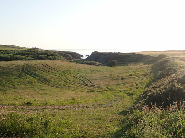
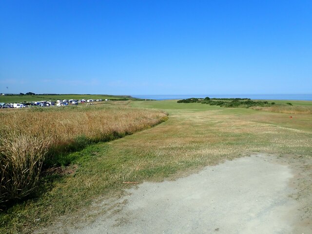
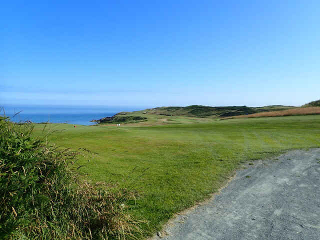
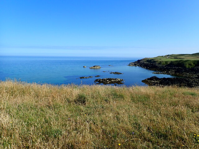
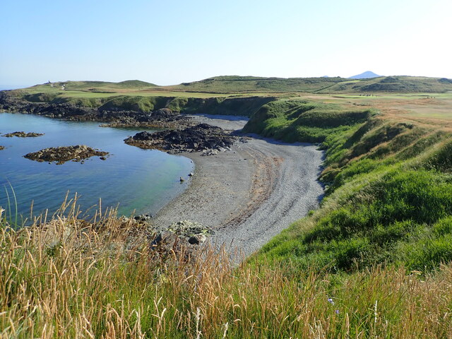
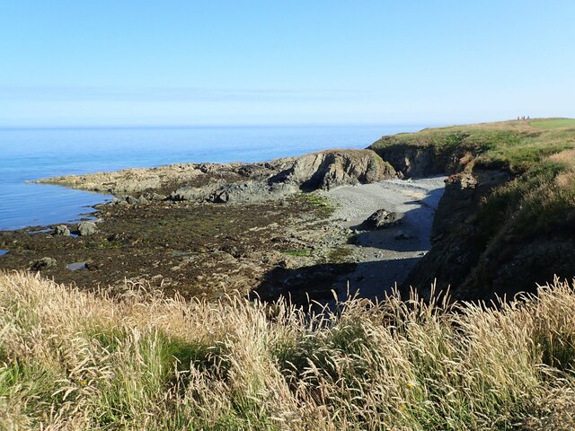
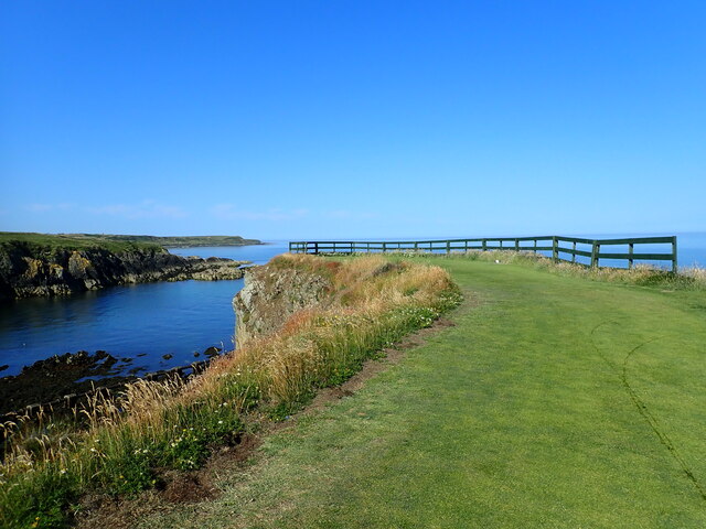
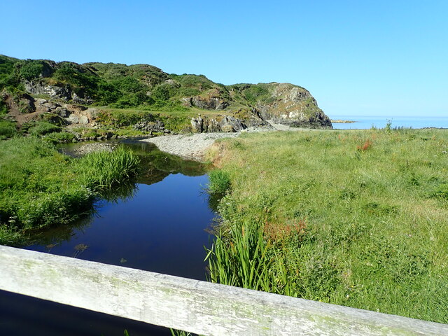
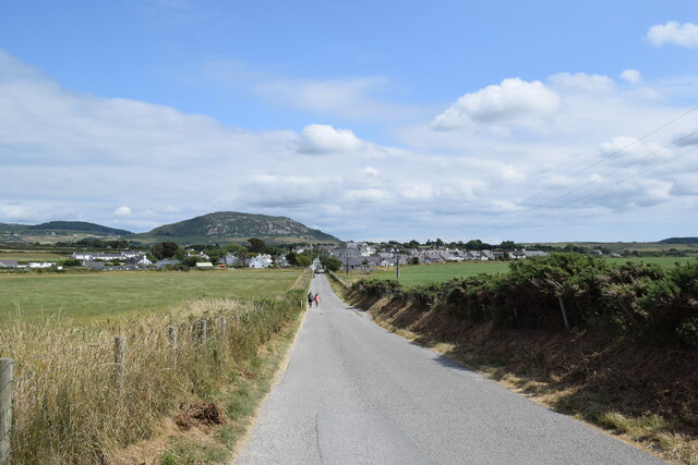
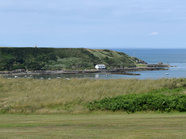
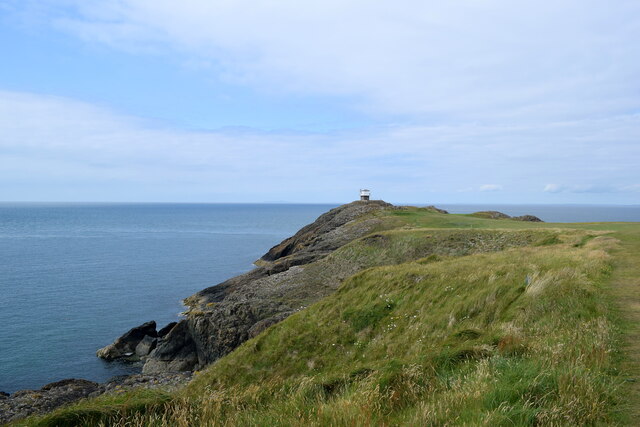
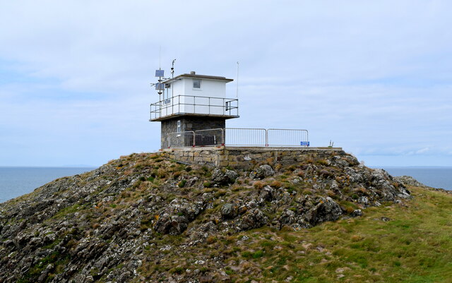
Aber Geirch is a small bay located in the county of Caernarfonshire in northwestern Wales. Situated on the Llŷn Peninsula, it is nestled between the towns of Pwllheli and Abersoch. The bay is known for its picturesque beauty, with stunning views of the Irish Sea and the surrounding rugged coastline.

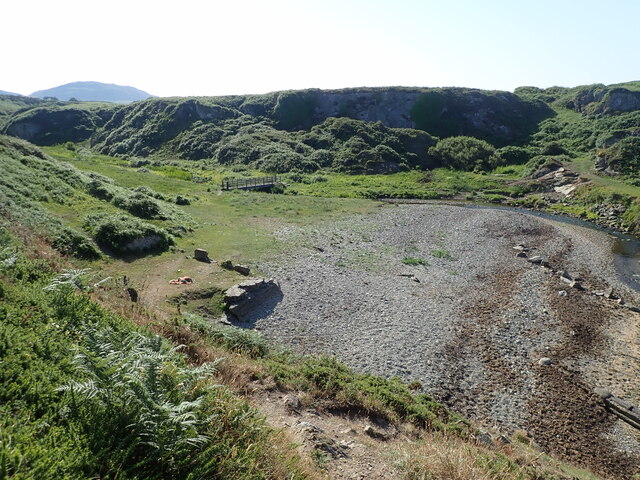
The main attraction of Aber Geirch is its sandy beach, which stretches for approximately 1.5 miles. The beach is popular among locals and tourists alike, offering opportunities for sunbathing, swimming, and beachcombing. During low tide, the bay reveals interesting rock formations and rock pools, providing a fascinating habitat for various marine creatures.

Aber Geirch is also renowned for its water sports activities, particularly sailing and windsurfing. The bay's geographical location and prevailing winds make it an ideal spot for enthusiasts of these sports. Additionally, the bay attracts anglers who can try their luck at catching a variety of fish, including mackerel and bass.

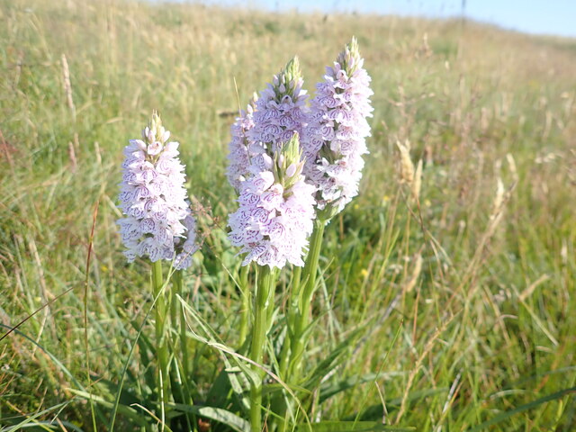
Nature lovers will appreciate the wildlife that can be found in and around Aber Geirch. The bay is home to a diverse array of bird species, such as oystercatchers, curlews, and sandpipers. Seals can also be spotted, basking on nearby rocks or swimming in the clear waters.

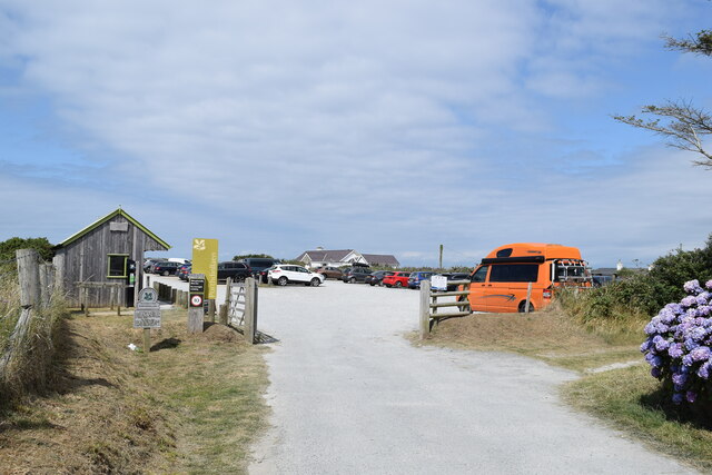
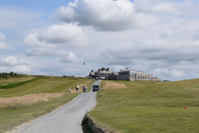
Facilities in Aber Geirch are limited, although there is a small car park available for visitors. The bay offers a tranquil and serene environment, away from the hustle and bustle of larger towns. Its unspoiled beauty and natural charm make Aber Geirch an idyllic destination for those seeking a peaceful coastal retreat.

If you have any feedback on the listing, please let us know in the comments section below.
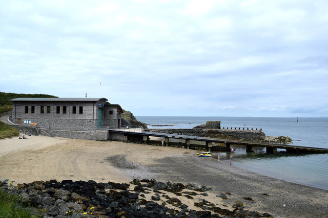
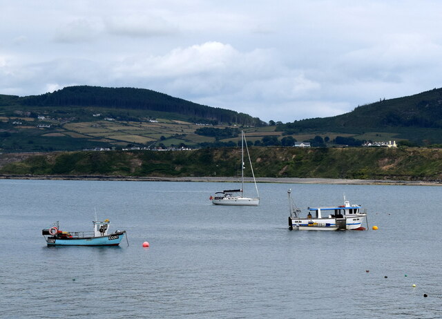
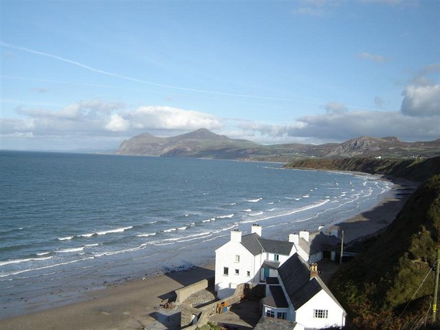
Aber Geirch Images

Images are sourced within 2km of 52.933583/-4.5827938 or Grid Reference SH2640. Thanks to Geograph Open Source API. All images are credited.

Path down to Aber Geirch Aber Geirch - a small inlet west of Morfa Nefyn - the path runs from the campsite at Porthdinllaen Farm
Path down to Aber Geirch
Aber Geirch - a small inlet west of Morfa Nefyn - the path runs from the campsite at Porthdinllaen Farm
Nefyn Golf Links With the campsite at Porth Dinllaen Farm on the left.
Nefyn Golf Links
With the campsite at Porth Dinllaen Farm on the left.
Nefyn Golf Course
Nefyn Golf Course
Borth Wen A small rocky bay west of Porth Dinllaen
Borth Wen
A small rocky bay west of Porth Dinllaen
Borth Wen Shingle beach at Borth Wen. Nefyn golf course runs along the headland.
Borth Wen
Shingle beach at Borth Wen. Nefyn golf course runs along the headland.
Heath Spotted Orchid  Beside the Welsh Coast Path at Nefyn Golf Course
Heath Spotted Orchid
Beside the Welsh Coast Path at Nefyn Golf Course
Rocky reef and cove near Nefyn Golf Course
Extreme tee site On a rock outcrop to the north of Aber Geirch
Extreme tee site
On a rock outcrop to the north of Aber Geirch
Aber Geirch The estuary of the River Geirch. The Coast Path crosses it by the footbridge.
Aber Geirch
The estuary of the River Geirch. The Coast Path crosses it by the footbridge.
Crossing Aber Geirch on the Coast Path
National Trust car park, Morfa Nefyn
Long walk to Porth Dinllaen Cars are banned from Porth Dinllean with its beach-side inn, which necessitates a 1-km walk from the village.
Long walk to Porth Dinllaen
Cars are banned from Porth Dinllean with its beach-side inn, which necessitates a 1-km walk from the village.
Looking towards Porth Dinllaen... ...from about 1 km to the south.
Looking towards Porth Dinllaen...
...from about 1 km to the south.
Clubhouse, Nefyn Golf Club
Looking towards the lookout The coastguard lookout at Trwyn Porth Dinllaen can just be seen in the distance.  The rocks to the left are breccia from the Gwna group, being sedimentary bedrock formed between 635 and 508 million years ago during the Ediacaran and Cambrian periods.
Looking towards the lookout
The coastguard lookout at Trwyn Porth Dinllaen can just be seen in the distance. The rocks to the left are breccia from the Gwna group, being sedimentary bedrock formed between 635 and 508 million years ago during the Ediacaran and Cambrian periods.
Coastguard lookout, Trwyn Porth Dinllaen
Porth Dinllaen lifeboat station and slipway
Boats, Porth Dinllaen harbour Two Caernarfon registered fishing boats (CO276 and CO36) and farther back, a yacht.   What I think are bags of mussels are being unloaded from CO36 to transport to the shore.
Boats, Porth Dinllaen harbour
Two Caernarfon registered fishing boats (CO276 and CO36) and farther back, a yacht. What I think are bags of mussels are being unloaded from CO36 to transport to the shore.
Show me another place!

Aber Geirch is located at Grid Ref: SH2640 (Lat: 52.933583, Lng: -4.5827938)

Unitary Authority: Gwynedd

Police Authority: North Wales

What 3 Words

///birthing.skews.minimums. Near Nefyn, Gwynedd

Nearby Locations

Aber Geirch

Related Wikis

Edern, Gwynedd

Edern, formerly known as Edeyrn, is a village and until 1939 a civil parish, in the Welsh county of Gwynedd. It is about 1 km southwest of the larger village...

Porthdinllaen

Porthdinllaen (in English sometimes Porth Dinllaen) is a small coastal village on the Llŷn Peninsula in the Dwyfor area of Gwynedd, Wales, built on a small...

Porthdinllaen Lifeboat Station

Porthdinllaen Lifeboat Station (Welsh Gorsaf Bad Achub Porthdinllaen) is a Royal National Lifeboat Institution (RNLI) operated lifeboat station in the...

Morfa Nefyn

Morfa Nefyn is a village on the northern coast of the Llŷn Peninsula in Gwynedd, Wales. It lies on the crossroads of the B4417 and B4412. The village has...

Nearby Amenities

Located within 500m of 52.933583,-4.5827938
Created By: dmgroom_coastlines
Source: PGS
Lat/Long: 52.937211/-4.580038
Created By: dmgroom_coastlines
Source: PGS
Lat/Long: 52.936955/-4.580028
Created By: dmgroom_coastlines
Source: PGS
Lat/Long: 52.9367278/-4.5807612
Source: PGS
Lat/Long: 52.9363317/-4.5810319
Source: PGS
Lat/Long: 52.9343638/-4.582322
Source: PGS
Lat/Long: 52.9340886/-4.5821101
Source: PGS
Lat/Long: 52.9339265/-4.5816575
Created By: dmgroom_coastlines
Source: PGS
Lat/Long: 52.933739/-4.58097
Created By: dmgroom_coastlines
Source: PGS
Lat/Long: 52.933745/-4.580547
Created By: dmgroom_coastlines
Source: PGS
Lat/Long: 52.93362/-4.580331
Created By: dmgroom_coastlines
Source: PGS
Lat/Long: 52.933364/-4.580321
Created By: dmgroom_coastlines
Source: PGS
Lat/Long: 52.9331185/-4.5816877
Created By: dmgroom_coastlines
Source: PGS
Lat/Long: 52.9331119/-4.5822634
Created By: dmgroom_coastlines
Source: PGS
Lat/Long: 52.9331402/-4.5830188
Created By: dmgroom_coastlines
Source: PGS
Lat/Long: 52.9331062/-4.5835335
Created By: dmgroom_coastlines
Source: PGS
Lat/Long: 52.9330163/-4.5842739
Created By: dmgroom_coastlines
Source: PGS
Lat/Long: 52.9326489/-4.5852494
Created By: dmgroom_coastlines
Source: PGS
Lat/Long: 52.932266/-4.585794
Created By: dmgroom_coastlines
Source: PGS
Lat/Long: 52.932004/-4.586209
Created By: dmgroom_coastlines
Source: PGS
Lat/Long: 52.9316035/-4.5865033
Created By: dmgroom_coastlines
Source: PGS
Lat/Long: 52.931305/-4.5868642
Source: PGS
Lat/Long: 52.9309814/-4.5876257
Created By: dmgroom_coastlines
Source: PGS
Lat/Long: 52.930704/-4.587644
Barrier: kissing_gate
Foot: yes
Lat/Long: 52.9303257/-4.5872553
Barrier: kissing_gate
Foot: yes
Lat/Long: 52.9304844/-4.5867637
Barrier: kissing_gate
Foot: yes
Lat/Long: 52.9304191/-4.5861223
Barrier: kissing_gate
Foot: yes
Lat/Long: 52.9326115/-4.581404
Barrier: kissing_gate
Foot: yes
Lat/Long: 52.9338453/-4.5806822
Barrier: kissing_gate
Foot: yes
Lat/Long: 52.9334973/-4.5796028
Barrier: kissing_gate
Foot: yes
Lat/Long: 52.9319477/-4.5859516
Barrier: kissing_gate
Foot: yes
Lat/Long: 52.9333949/-4.5795773
Aber Geirch
Natural: bay
Lat/Long: 52.9335885/-4.5835262
The data included in this document is from www.openstreetmap.org. The data is made available under ODbL.

Have you been to Aber Geirch?

Leave your review of Aber Geirch below (or comments, questions and feedback).