Aberporth Bay

Bay in Cardiganshire

Wales

Aberporth Bay

Tresaith Beach A busy Tresaith Beach
Tresaith Beach Credit: Shaun Ferguson

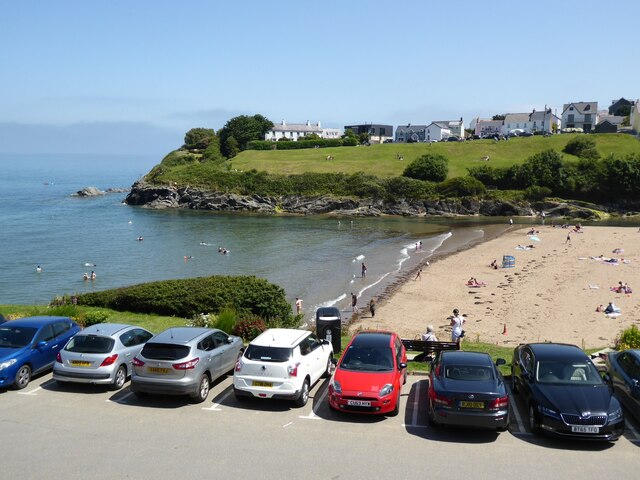
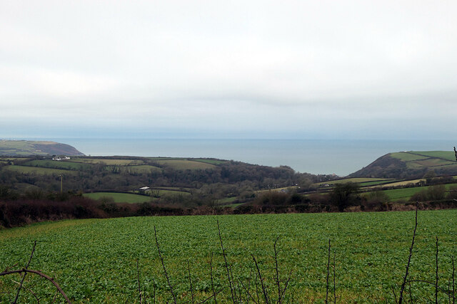
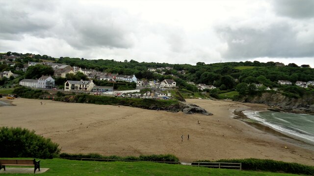
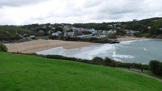
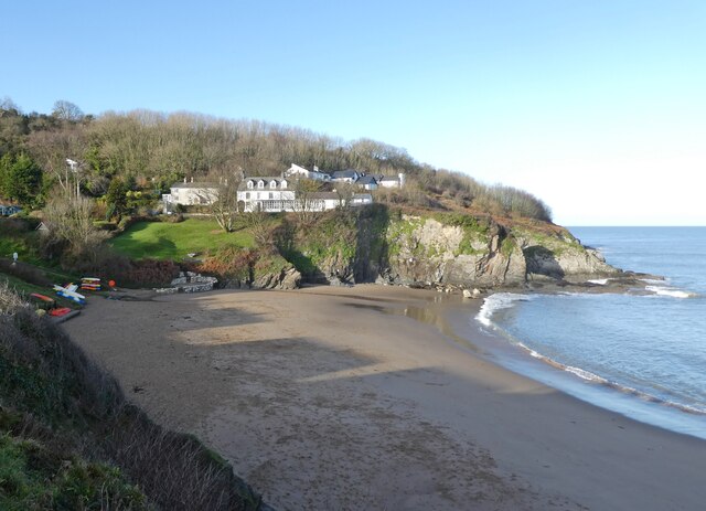
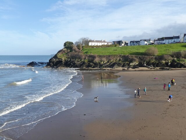
Aberporth Bay is a picturesque coastal area located in Cardiganshire, Wales. It is nestled between the towns of Aberporth and Tresaith and is renowned for its natural beauty and tranquil atmosphere. The bay stretches along the Ceredigion Heritage Coast, providing visitors with stunning panoramic views of the Irish Sea.

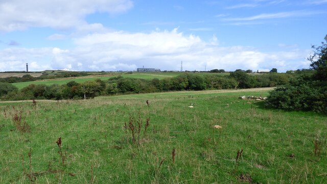
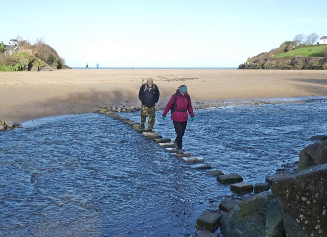
The bay is characterized by its golden sandy beach, which is backed by rolling hills and lush greenery. The beach is a popular destination for both locals and tourists, offering a range of activities such as swimming, sunbathing, and beachcombing. Its calm waters make it suitable for families and water sports enthusiasts alike.

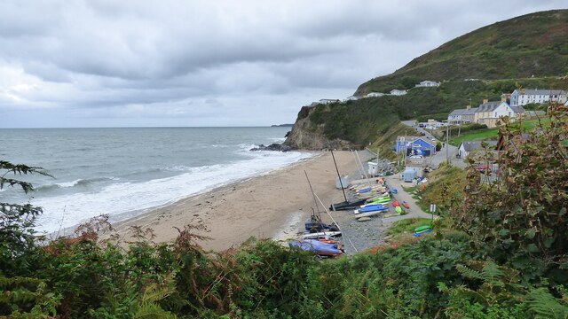
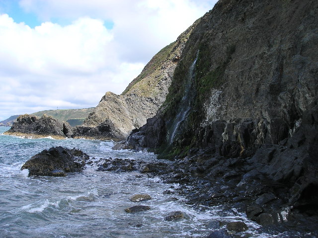
Aberporth Bay is surrounded by cliffs and rocky outcrops, creating a dramatic and picturesque backdrop. These cliffs are home to a variety of bird species, including puffins, razorbills, and guillemots, making it a haven for birdwatchers. In fact, the bay is designated as a Special Protection Area due to its importance for breeding seabirds.

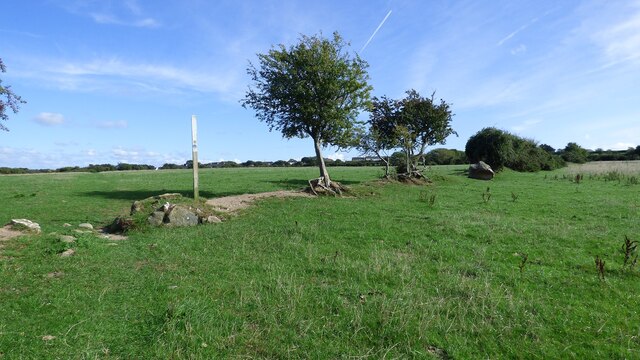
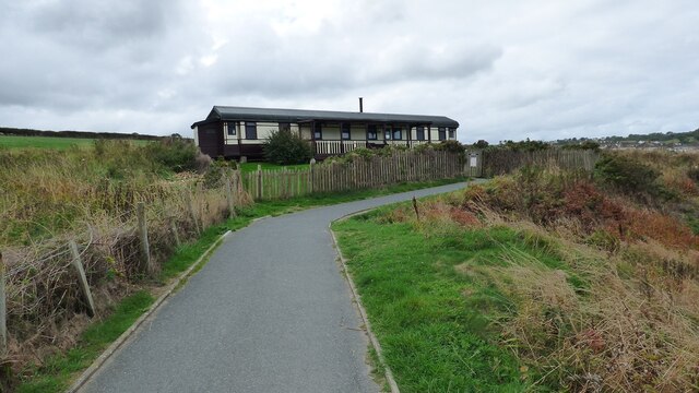
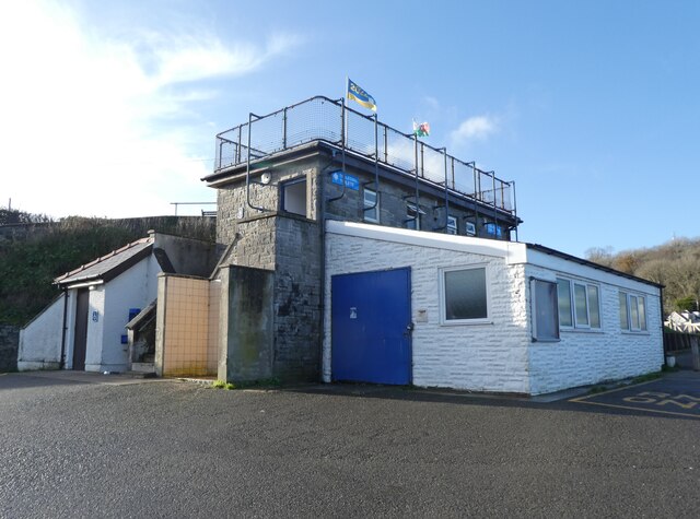
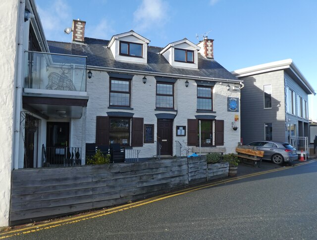
The bay is also known for its coastal paths and walking trails, which provide visitors with the opportunity to explore the surrounding area and enjoy the stunning views. The nearby village of Aberporth offers a range of amenities, including cafes, pubs, and shops, providing visitors with everything they need for a memorable visit.

Overall, Aberporth Bay is a hidden gem on the Welsh coast, offering visitors a chance to escape the hustle and bustle of everyday life and immerse themselves in the beauty of nature.

If you have any feedback on the listing, please let us know in the comments section below.

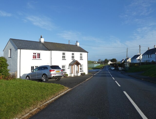
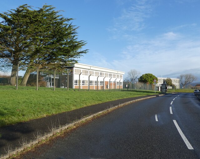
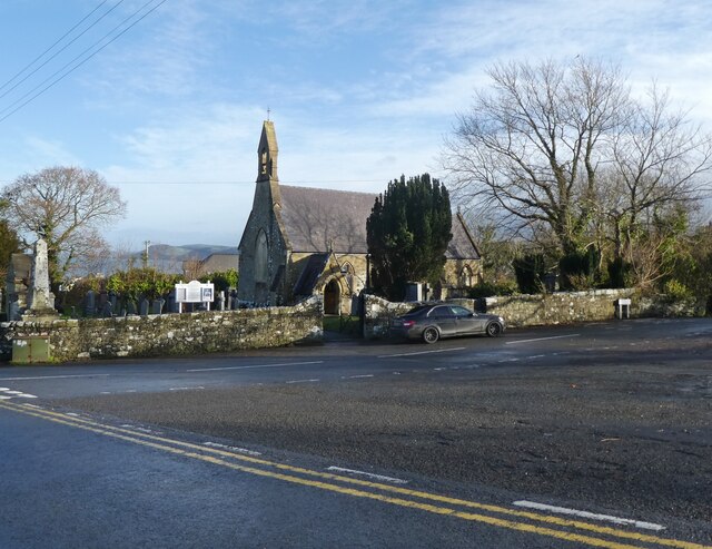
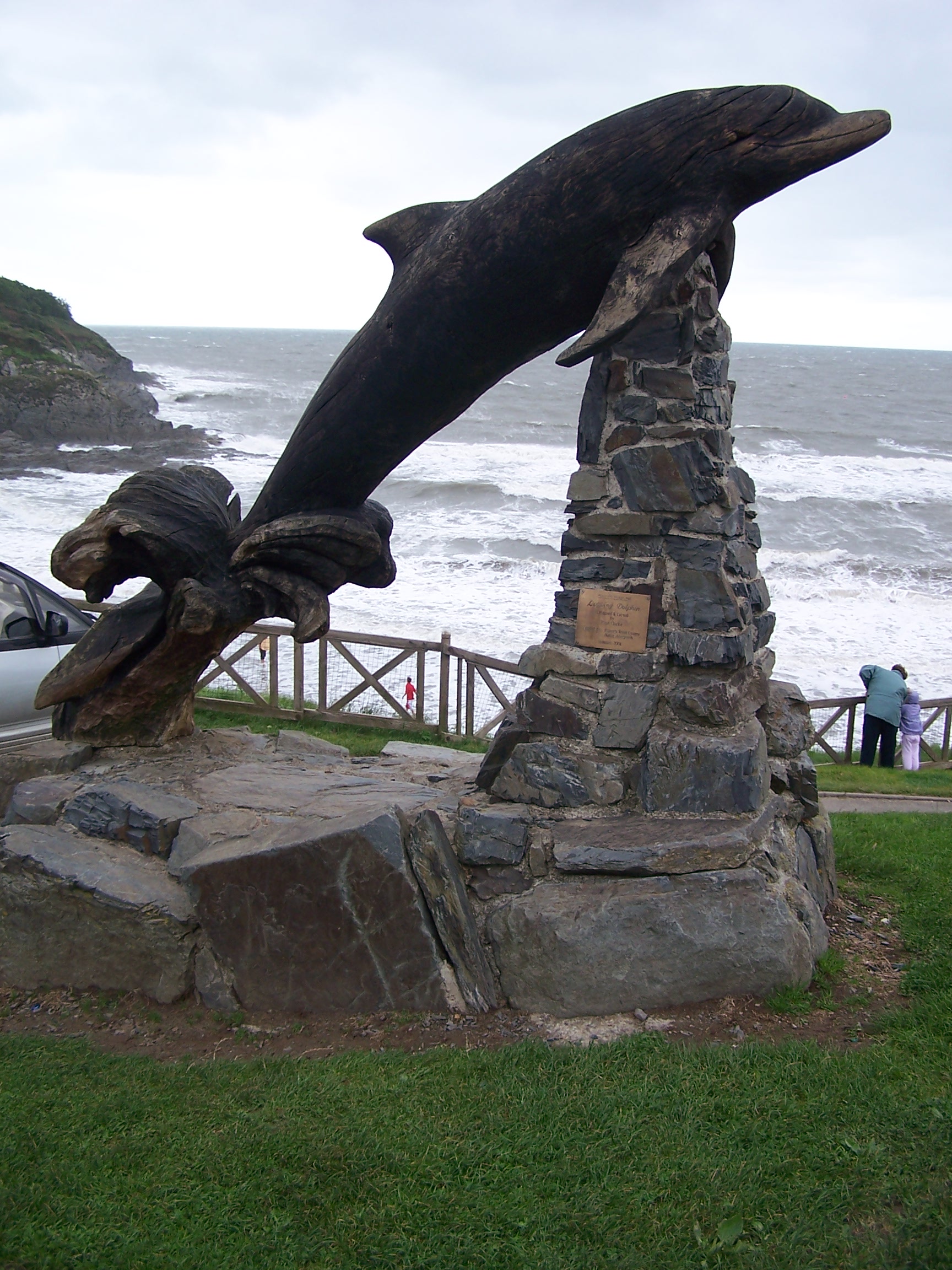
Aberporth Bay Images

Images are sourced within 2km of 52.135653/-4.5461225 or Grid Reference SN2551. Thanks to Geograph Open Source API. All images are credited.

Tresaith Beach A busy Tresaith Beach
Tresaith Beach
A busy Tresaith Beach
The beach at Aberporth A hot summer's day and people are relaxing and enjoying the weather on the beach at Aberporth.
The beach at Aberporth
A hot summer's day and people are relaxing and enjoying the weather on the beach at Aberporth.
The coast near Aberporth Viewed from a lay-by on the A487 road.
The coast near Aberporth
Viewed from a lay-by on the A487 road.
Aberporth Sands From the public garden on the headland
Aberporth Sands
From the public garden on the headland
Abraded Field Boundary at Penarnewydd
Ministry of Defence Site at Aberporth
Aberporth Bay and Village On a rather overcast day.
Aberporth Bay and Village
On a rather overcast day.
Converted Railway Carriage Known as Wendy
Tresaith Beach
Tresaith Beach
Penar Cottage
Penar Cottage
MOD buildings, Aberporth
St Cynwyl's Church, Aberporth
Aberporth Bay
Aberporth Bay
Beach at Aberporth
Beach at Aberporth
Seafront toilets, Aberporth Open on Boxing day. Well Done!
Seafront toilets, Aberporth
Open on Boxing day. Well Done!
The Ship Inn, Aberporth
West-Cliffe, Aberporth
Stepping stones, Aberporth
Show me another place!

Aberporth Bay is located at Grid Ref: SN2551 (Lat: 52.135653, Lng: -4.5461225)

Unitary Authority: Ceredigion

Police Authority: Dyfed Powys

What 3 Words

///router.relieves.fuel. Near Aberporth, Ceredigion

Related Wikis

Nearby Amenities

Located within 500m of 52.135653,-4.5461225
Aberporth
Is In: Ceredigion, Wales, UK
Name Cy: Aberporth
Place: village
Population: 2374
Population Date: 2011
Source: npe
Source Population: Census
Wikidata: Q319672
Lat/Long: 52.1341692/-4.5462206
Mini Roundabout
Direction: clockwise
Lat/Long: 52.1325564/-4.5417633
Access: foot
Barrier: bollard
Lat/Long: 52.1354052/-4.5435828
Golchi & Sychu Launderette
Shop: laundry
Lat/Long: 52.1326548/-4.5420595
London House Stores
Addr Postcode: SA43 2EU
Fhrs Id: 863639
Phone: +44 1239 810064
Shop: convenience
Source Addr Postcode: FHRS Open Data
Lat/Long: 52.1328293/-4.5417884
Bench
Backrest: no
Lat/Long: 52.1352588/-4.5441417
Bench
Backrest: yes
Source: Bing
Lat/Long: 52.1339742/-4.5436719
Bench
Backrest: yes
Source: Bing
Lat/Long: 52.1349523/-4.5440507
Life Ring
Emergency: life_ring
Lat/Long: 52.1344902/-4.5439149
Waste Basket
Lat/Long: 52.1345715/-4.543211
Leisure: picnic_table
Tourism: picnic_site
Lat/Long: 52.1339425/-4.5436605
Waste Basket
Lat/Long: 52.1338962/-4.5429163
Bench
Backrest: yes
Source: Bing
Lat/Long: 52.1350628/-4.5440906
Toilets
Lat/Long: 52.1345648/-4.5461842
Shower
Lat/Long: 52.1345822/-4.5460835
Pharmacy
Dispensing: yes
Lat/Long: 52.1331567/-4.5420581
Bus Stop
Kerb: raised
Shelter: yes
Lat/Long: 52.1324759/-4.5425307
Post Box
Post Box Type: pillar
Royal Cypher: EIIR
Royal Cypher Wikidata: Q33102113
Lat/Long: 52.1328494/-4.5418564
Ceredigion Marine Conservation
Information: map
Tourism: information
Lat/Long: 52.1348313/-4.5484043
Bench
Backrest: no
Lat/Long: 52.1346903/-4.5475707
Bench
Backrest: no
Lat/Long: 52.1346657/-4.5476262
Life Ring
Emergency: life_ring
Lat/Long: 52.1349426/-4.5481109
Bench
Backrest: no
Lat/Long: 52.1346828/-4.5476515
Life Ring
Emergency: life_ring
Lat/Long: 52.1346626/-4.5475027
Pub
The Ship Inn Aberporth
Addr City: Aberporth
Addr Postcode: SA43 2DB
Addr Street: Ffordd yr Odyn
Fhrs Id: 863559
Outdoor Seating: yes
Smoking: outside
Source Addr: FHRS Open Data
Website: https://www.shipaberporth.co.uk/
Lat/Long: 52.134083/-4.5461024
Bench
Lat/Long: 52.1346661/-4.5395533
Bench
Source: GPS, observation
Lat/Long: 52.1335623/-4.5447268
Information: board
Source: GPS, observation
Tourism: information
Lat/Long: 52.133892/-4.5437567
Information: board
Source: GPS, observation
Tourism: information
Lat/Long: 52.1345657/-4.5469938
Bench
Source: GPS, Bing
Lat/Long: 52.1346681/-4.5434478
Bench
Source: GPS, Bing
Lat/Long: 52.1347661/-4.5435561
Bench
Source: GPS, observation
Lat/Long: 52.1349602/-4.5402957
Bench
Source: GPS, observation
Lat/Long: 52.1350223/-4.540258
Bench
Source: GPS, observation
Lat/Long: 52.1352807/-4.54156
Bench
Source: GPS, observation
Lat/Long: 52.1353621/-4.5415381
Bench
Source: Bing
Lat/Long: 52.1348694/-4.5436317
Bench
Source: GPS, Bing
Lat/Long: 52.1349884/-4.5436932
Bench
Source: GPS, Bing
Lat/Long: 52.1351062/-4.5437455
Bench
Source: GPS, Bing
Lat/Long: 52.1352262/-4.5438111
Pen Trwyn Cynwyl
Natural: cape
Lat/Long: 52.1348496/-4.5460346
Communication Mobile Phone: yes
Height: 15
Man Made: mast
Operator: Vodafone
Tower Construction: lattice
Tower Type: communication
Lat/Long: 52.1348728/-4.5524292
Cafe
Lat/Long: 52.1342515/-4.5461067
Cafe
The Waters Edge Cafe
Addr Postcode: SA43 2DD
Addr Street: Ffordd yr Odyn
Fhrs Id: 863859
Source Addr: FHRS Open Data
Lat/Long: 52.1342799/-4.5470956
Cafe
Y Cwtch
Outdoor Seating: yes
Lat/Long: 52.1343851/-4.5435461
Bench
Lat/Long: 52.1347316/-4.5460986
Bench
Lat/Long: 52.1346462/-4.5459335
Bench
Lat/Long: 52.134468/-4.545845
Information: board
Tourism: information
Lat/Long: 52.1345539/-4.5464131
Bench
Backrest: yes
Direction: 355
Lat/Long: 52.1324948/-4.5424747
Direction: 175
Generator Method: photovoltaic
Generator Output Electricity: yes
Generator Solar Modules: 12
Generator Source: solar
Generator Type: solar_photovoltaic_panel
Location: roof
Power: generator
Lat/Long: 52.134792/-4.5411509
Direction: WSW
Generator Method: photovoltaic
Generator Output Electricity: yes
Generator Solar Modules: 5
Generator Source: solar
Generator Type: solar_photovoltaic_panel
Location: roof
Power: generator
Lat/Long: 52.1330223/-4.5419428
Direction: WSW
Generator Method: photovoltaic
Generator Output Electricity: yes
Generator Solar Modules: 5
Generator Source: solar
Generator Type: solar_photovoltaic_panel
Location: roof
Power: generator
Lat/Long: 52.1329881/-4.541916
Artwork Type: sculpture
Tourism: artwork
Lat/Long: 52.133807/-4.5438948
Bench
Lat/Long: 52.1324845/-4.5419126
Bench
Lat/Long: 52.1324891/-4.5421922
Bench
Lat/Long: 52.1324944/-4.5420407
Bench
Lat/Long: 52.1324454/-4.5419703
Bench
Lat/Long: 52.1324339/-4.5421238
Bench
Lat/Long: 52.1324319/-4.5421781
Direction: SSW
Generator Method: photovoltaic
Generator Output Electricity: yes
Generator Solar Modules: 20
Generator Source: solar
Generator Type: solar_photovoltaic_panel
Location: roof
Power: generator
Lat/Long: 52.1325249/-4.5475888
Direction: WSW
Generator Method: photovoltaic
Generator Output Electricity: yes
Generator Solar Modules: 16
Generator Source: solar
Generator Type: solar_photovoltaic_panel
Location: roof
Power: generator
Lat/Long: 52.1323372/-4.5414157
Direction: 175
Generator Method: photovoltaic
Generator Output Electricity: yes
Generator Solar Modules: 6
Generator Source: solar
Generator Type: solar_photovoltaic_panel
Location: roof
Power: generator
Lat/Long: 52.1323084/-4.5444882
Direction: 265
Generator Method: photovoltaic
Generator Output Electricity: yes
Generator Solar Modules: 10
Generator Source: solar
Generator Type: solar_photovoltaic_panel
Location: roof
Power: generator
Lat/Long: 52.1323808/-4.5444681
Direction: 175
Generator Method: photovoltaic
Generator Output Electricity: yes
Generator Solar Modules: 7
Generator Source: solar
Generator Type: solar_photovoltaic_panel
Location: roof
Power: generator
Lat/Long: 52.1319425/-4.5441502
Direction: 175
Generator Method: photovoltaic
Generator Output Electricity: yes
Generator Solar Modules: 9
Generator Source: solar
Generator Type: solar_photovoltaic_panel
Location: roof
Power: generator
Lat/Long: 52.1319678/-4.5441573
The data included in this document is from www.openstreetmap.org. The data is made available under ODbL.

Have you been to Aberporth Bay?

Leave your review of Aberporth Bay below (or comments, questions and feedback).