Tintagel Haven
Bay in Cornwall
England
Tintagel Haven

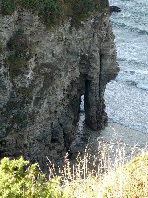
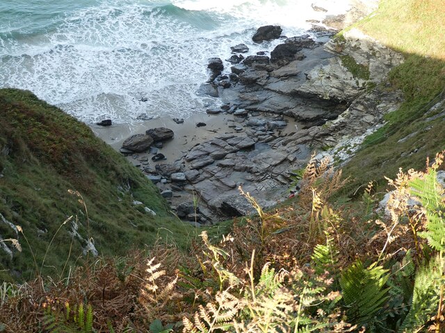
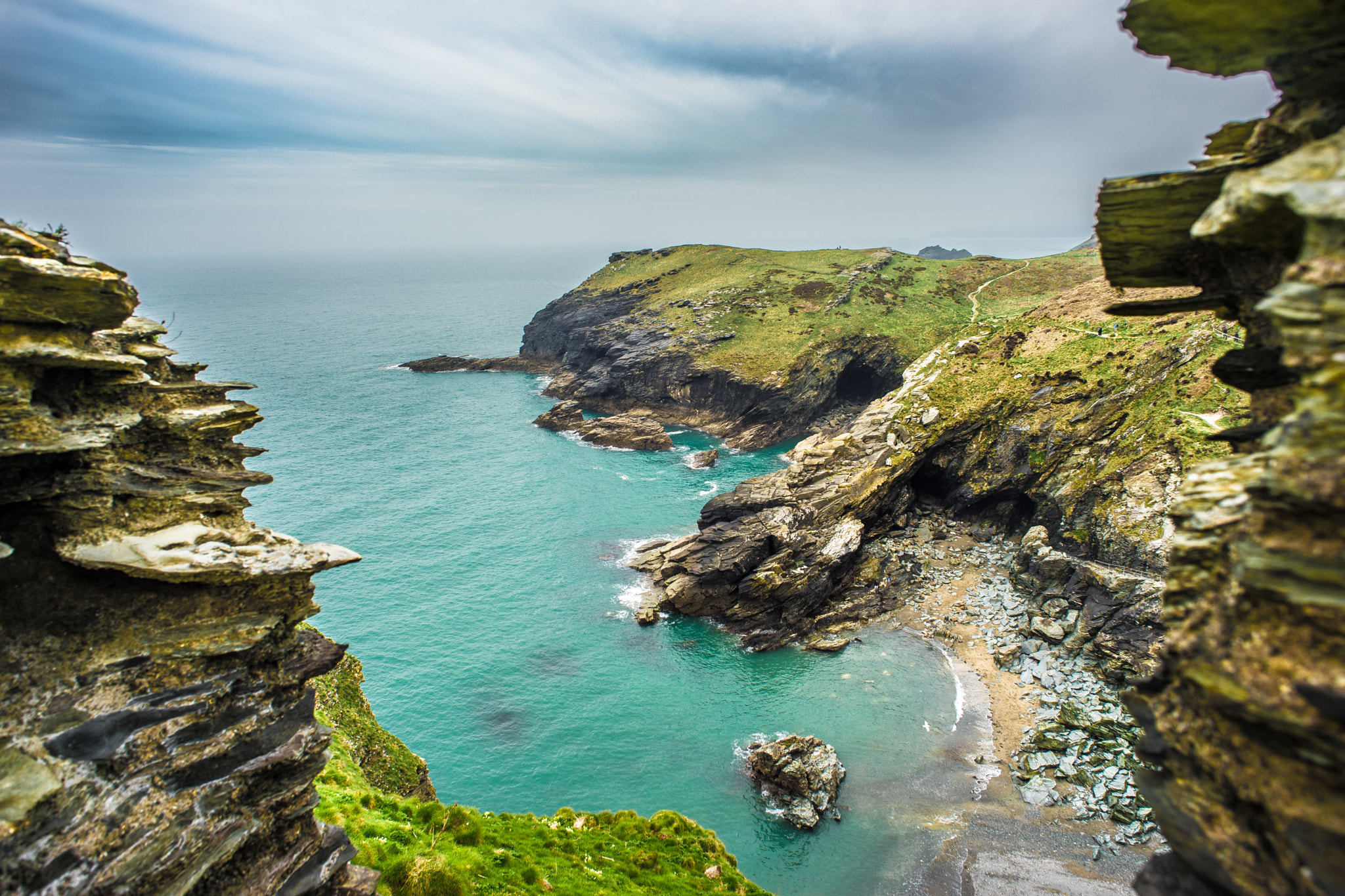
Tintagel Haven, located on the north coast of Cornwall, England, is a picturesque bay renowned for its stunning natural beauty and historical significance. Situated near the village of Tintagel, the bay is surrounded by towering cliffs, lush green hills, and crystal-clear waters, making it a popular destination for both locals and tourists.
The bay is most famous for its association with the legendary King Arthur, with Tintagel Castle perched dramatically on the cliffs above. This medieval fortification, believed to be the birthplace of King Arthur, adds an air of mystique and enchantment to the bay. Visitors can explore the castle ruins and learn about its rich history through informative displays and exhibits.
Tintagel Haven itself offers a rugged and unspoiled coastline, perfect for nature lovers and outdoor enthusiasts. The bay is renowned for its scenic walks along the South West Coast Path, offering breathtaking views of the Atlantic Ocean and the opportunity to spot a variety of wildlife, including seabirds and seals.
For those seeking adventure, Tintagel Haven also offers excellent opportunities for rock climbing and sea kayaking. The bay's dramatic cliffs provide a challenging terrain for climbers, while its calm waters are ideal for exploring by kayak.
With its captivating history, stunning scenery, and range of outdoor activities, Tintagel Haven is a must-visit destination for anyone exploring the rugged beauty of Cornwall.
If you have any feedback on the listing, please let us know in the comments section below.
Tintagel Haven Images
Images are sourced within 2km of 50.669507/-4.7591607 or Grid Reference SX0589. Thanks to Geograph Open Source API. All images are credited.


Tintagel Haven is located at Grid Ref: SX0589 (Lat: 50.669507, Lng: -4.7591607)
Unitary Authority: Cornwall
Police Authority: Devon and Cornwall
What 3 Words
///shocking.converged.wriggle. Near Tintagel, Cornwall
Nearby Locations
Related Wikis
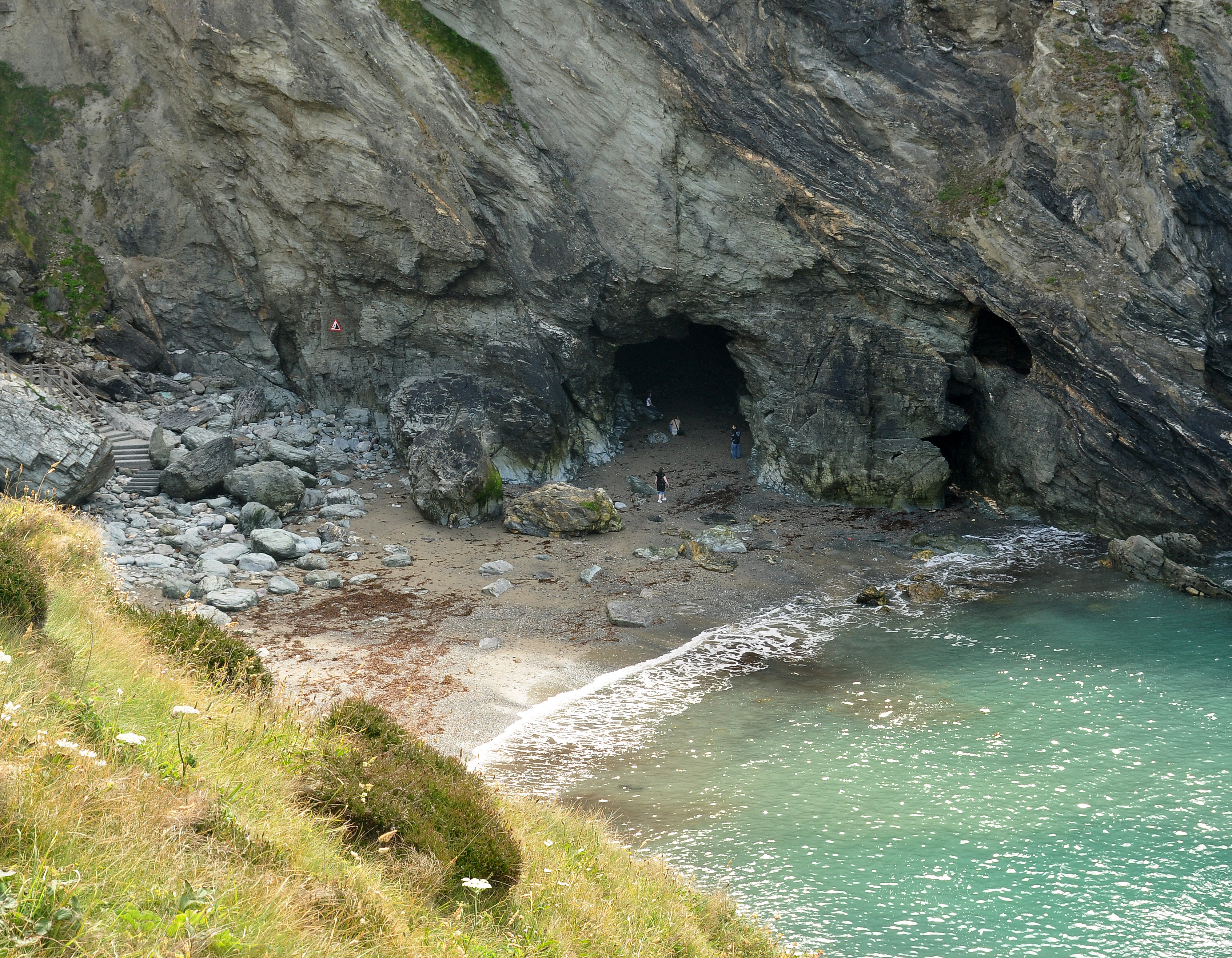
Merlin's Cave
Merlin's Cave is a cave located beneath Tintagel Castle, 5 kilometres (3.1 mi) south-west of Boscastle, Cornwall, England. It is 100 metres (330 ft) long...
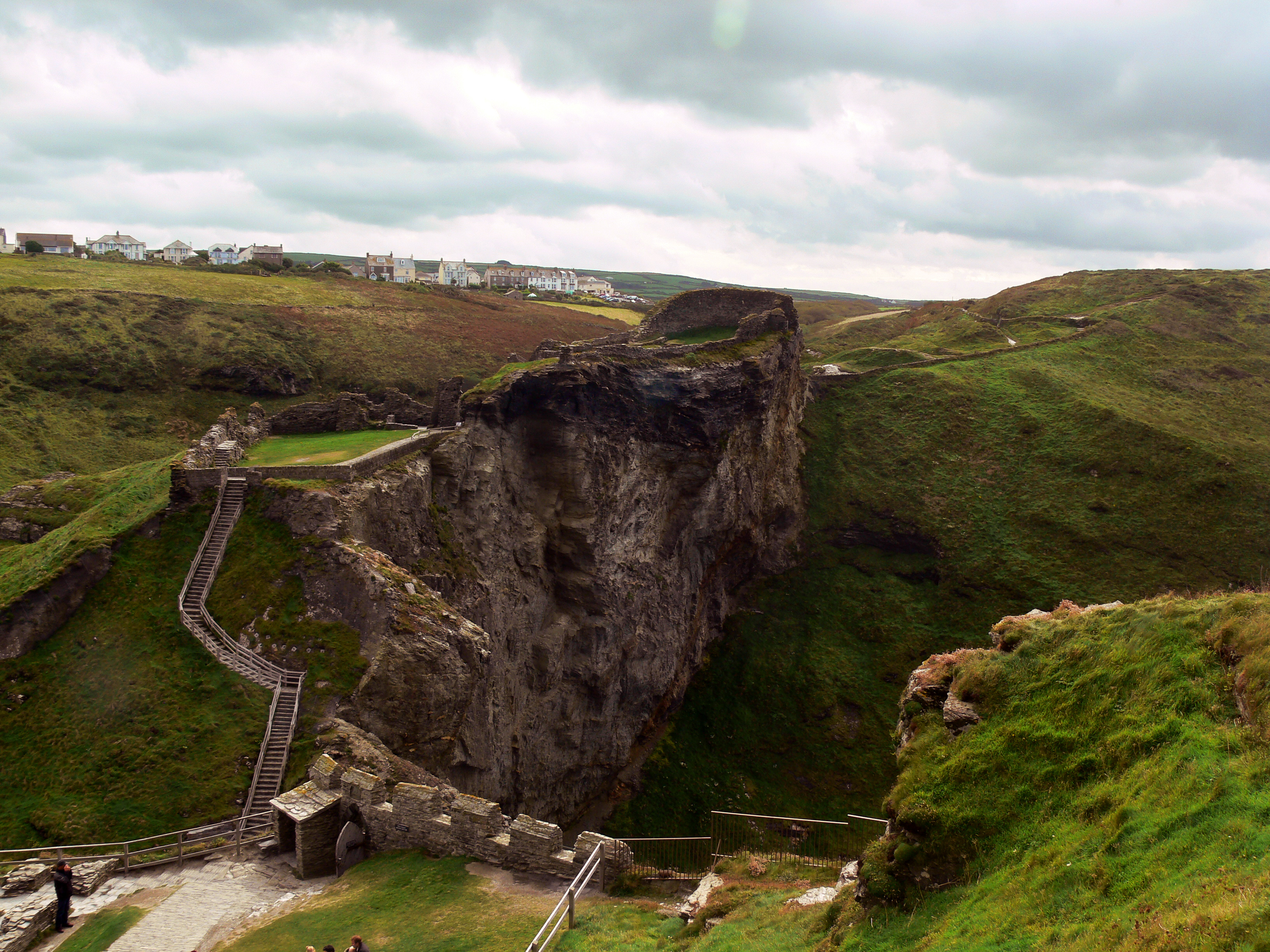
Tintagel Castle
Tintagel Castle (Cornish: Dintagel) is a medieval fortification located on the peninsula of Tintagel Island adjacent to the village of Tintagel (Trevena...
Tintagel Haven
Tintagel Haven also known as Castle Cove is a small beach on the north side of Tintagel Island on the north coast of Cornwall, South West England. Slate...
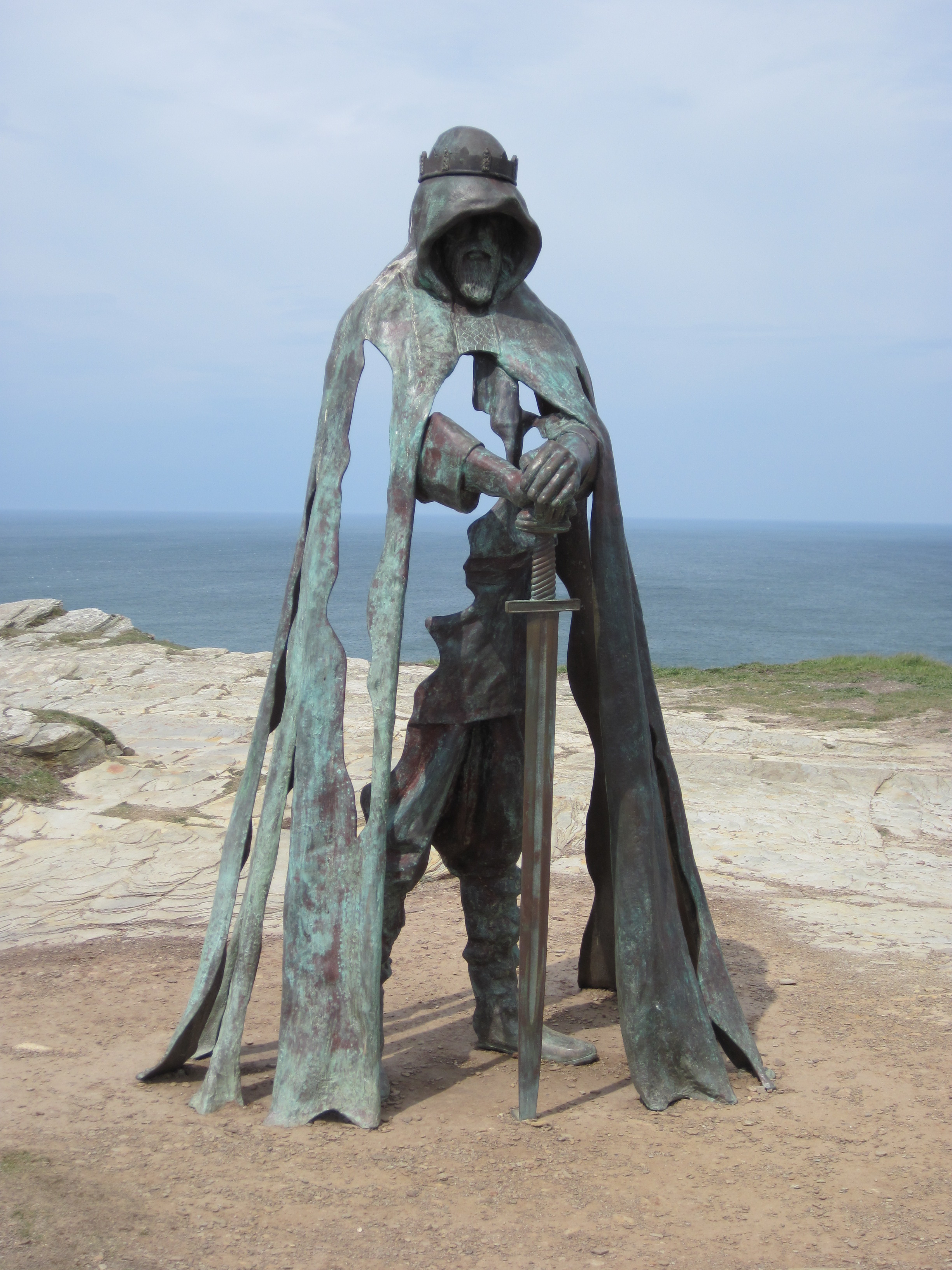
Gallos (sculpture)
Gallos is an 8-foot-tall (2.4 m) bronze sculpture by Rubin Eynon located at Tintagel Castle, a medieval fortification located on the peninsula of Tintagel...

Gillow Slate Quarry
Gillow State Quarry is a small, disused slate quarry between Tintagel and Trebarwith on the north coast of Cornwall, South West England. The quarry was...
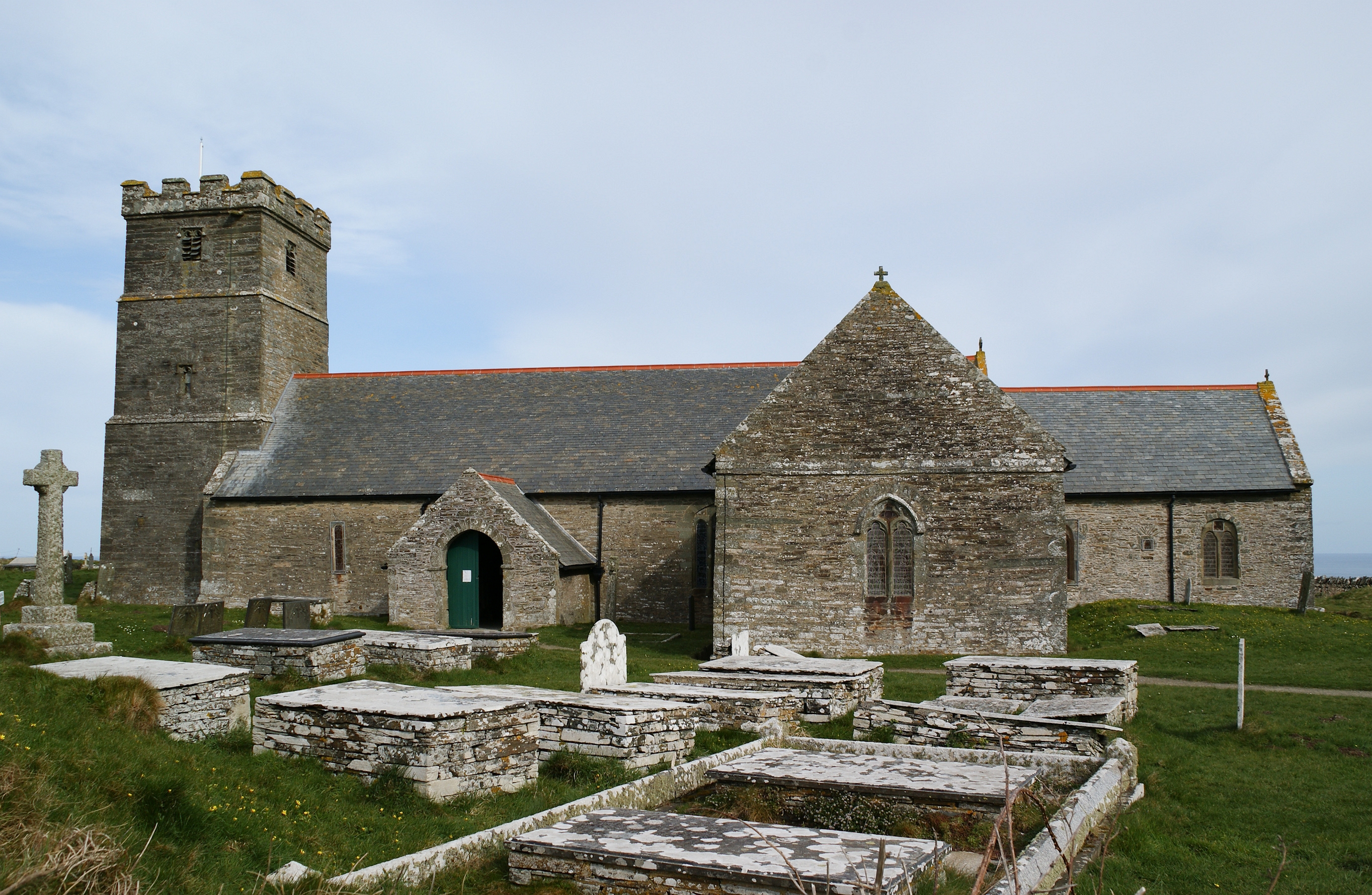
St Materiana's Church, Tintagel
The Parish Church of Saint Materiana at Tintagel is a Church of England parish church in the Church of England Diocese of Truro in Cornwall, England, UK...
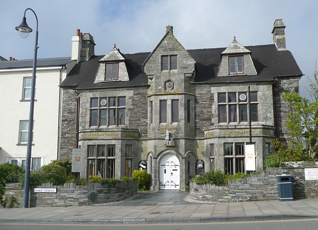
King Arthur's Great Halls
King Arthur's Great Halls (opened 1933) is a Grade II* listed building in Fore Street, Tintagel, Cornwall, England, UK. Built in the early 1930s by Frederick...
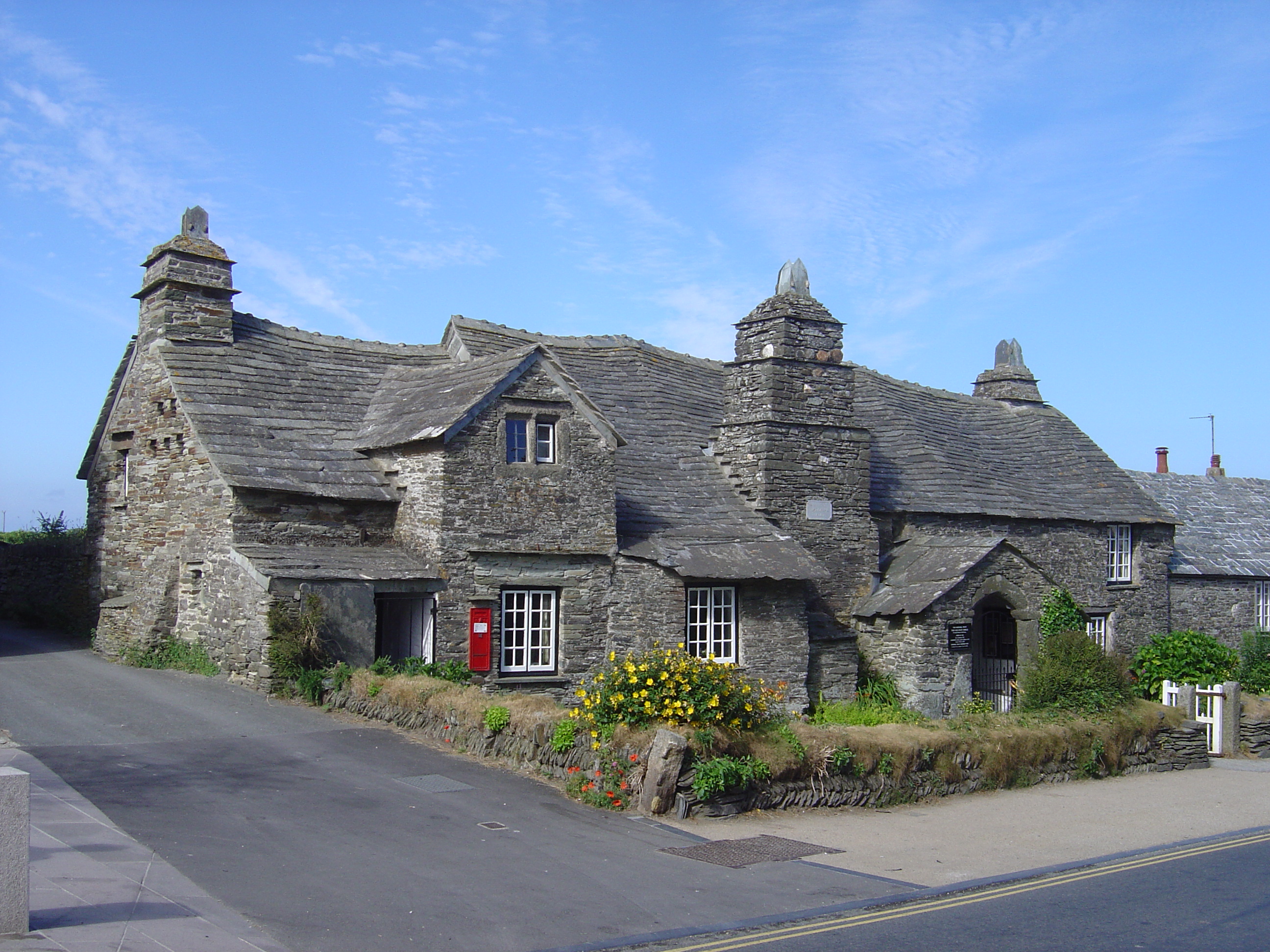
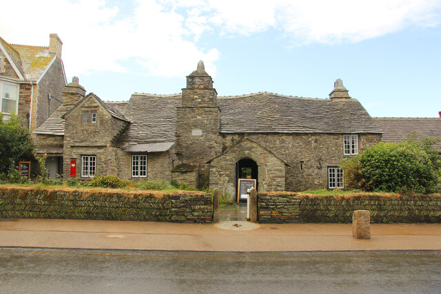
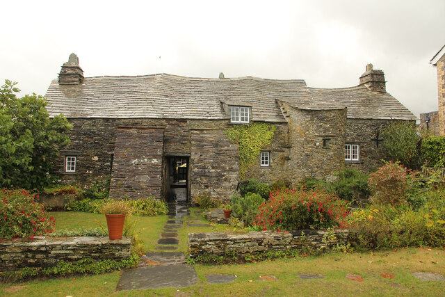
Tintagel Old Post Office
Tintagel Old Post Office is a 14th-century stone house, built to the plan of a medieval manor house, situated in Tintagel, Cornwall, England. The house...
Nearby Amenities
Located within 500m of 50.669507,-4.7591607Have you been to Tintagel Haven?
Leave your review of Tintagel Haven below (or comments, questions and feedback).