Asgog Bay

Bay in Argyllshire

Scotland

Asgog Bay

Stillaig Farm This is the view down to the shore if you stop and look over the tall bracken on the roadside west of Portavadie.
Stillaig Farm Credit: Anne Burgess

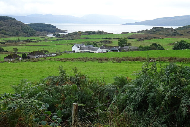
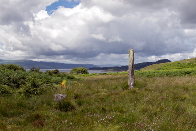
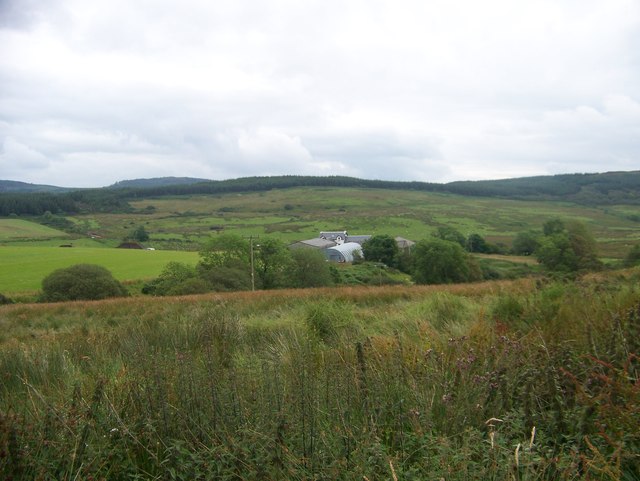
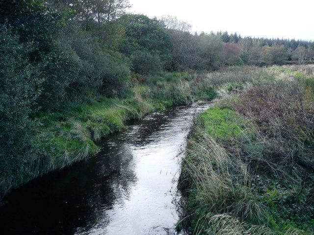
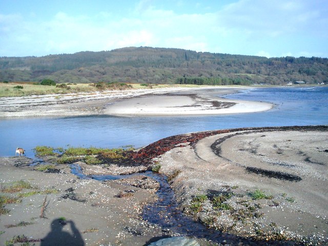
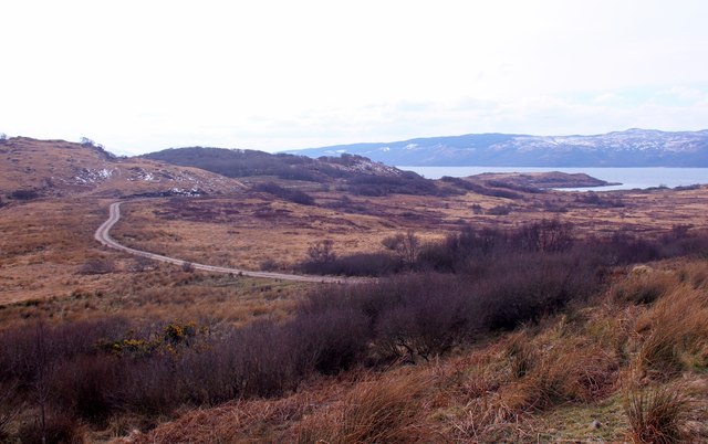
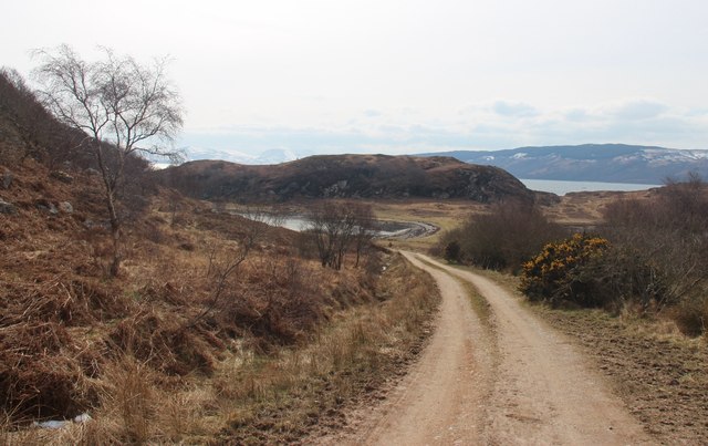
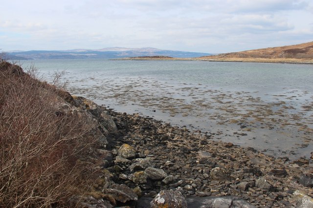
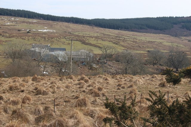
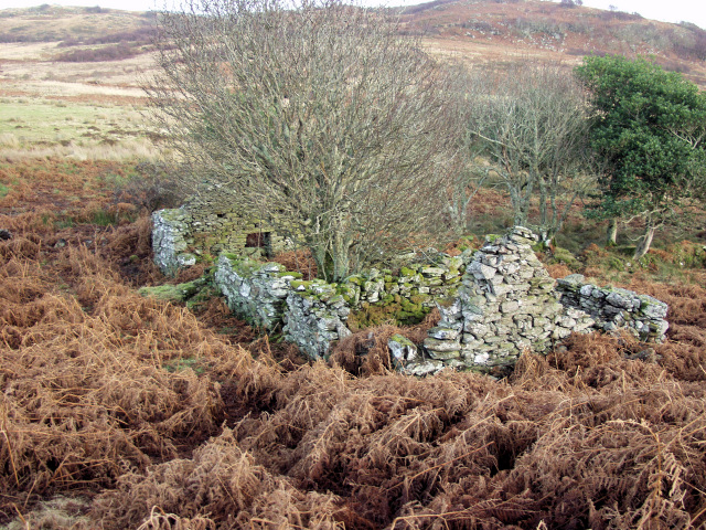
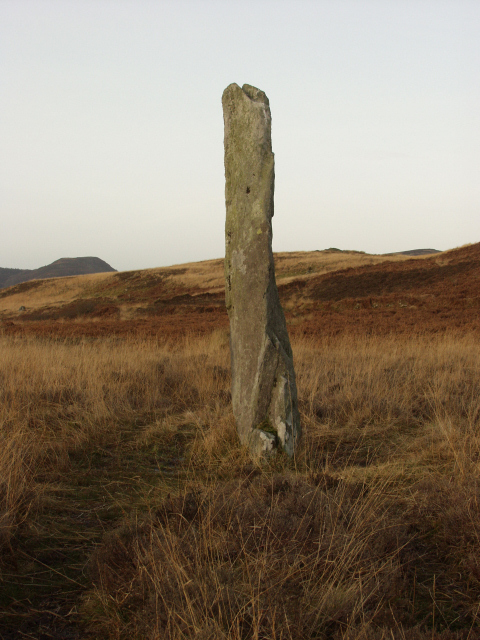
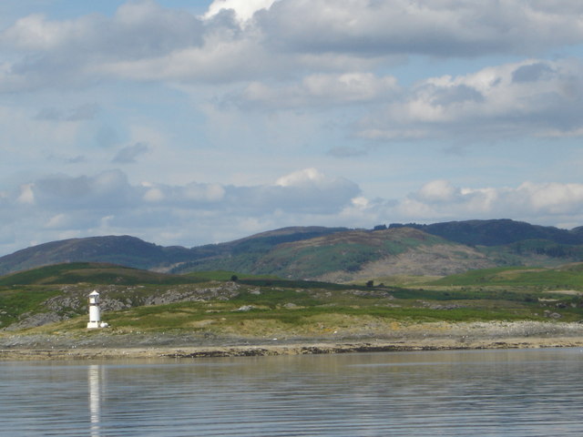
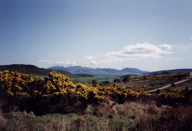
Asgog Bay is a picturesque bay located in Argyllshire, Scotland. Situated on the west coast of the country, it is known for its stunning natural beauty and tranquil atmosphere. The bay is surrounded by rolling hills and lush green landscapes, providing a perfect backdrop for visitors to relax and unwind.

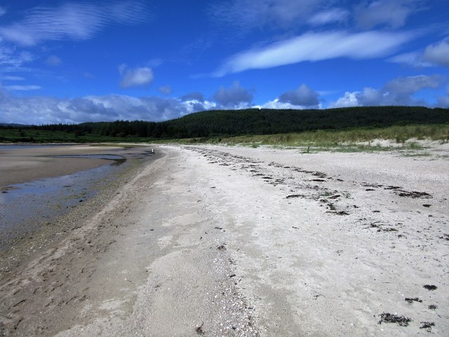
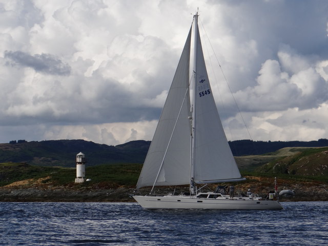
Asgog Bay is characterized by its sandy beaches and crystal-clear waters, making it a popular destination for beachgoers and water sports enthusiasts. The bay offers a range of activities such as swimming, snorkeling, and kayaking, allowing visitors to fully immerse themselves in the natural surroundings.

The bay is also home to a diverse array of wildlife, making it a haven for nature lovers. Birdwatchers can spot a variety of seabirds, including gannets, puffins, and cormorants. In addition, seals and otters can often be seen lounging on the rocks or swimming in the bay.

Asgog Bay is easily accessible by road and is located just a short distance from the nearby town of Oban. The town offers a range of amenities, including accommodation options, restaurants, and shops, making it a convenient base for exploring the bay and its surrounding areas.

Overall, Asgog Bay is a hidden gem in Argyllshire, offering visitors a chance to escape the hustle and bustle of everyday life and immerse themselves in the natural beauty of Scotland's west coast.

If you have any feedback on the listing, please let us know in the comments section below.
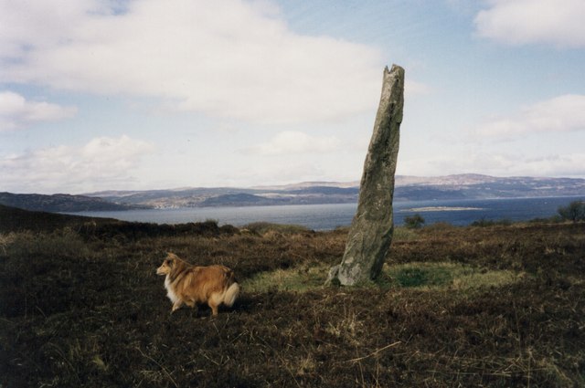
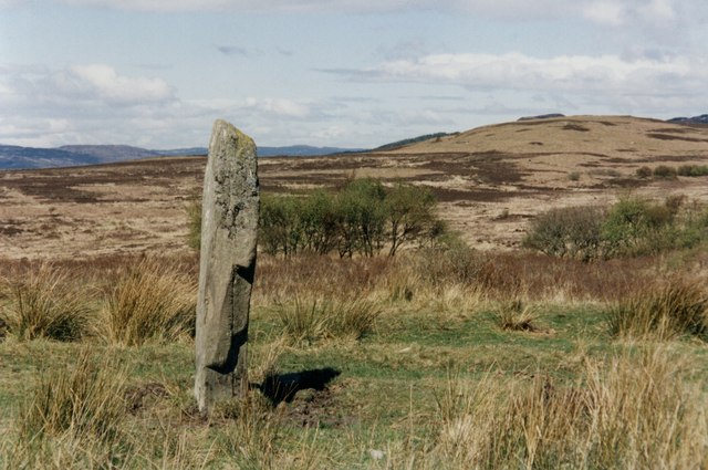
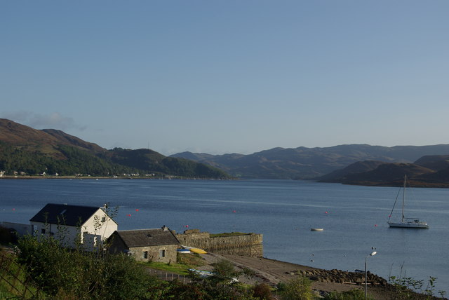
Asgog Bay Images

Images are sourced within 2km of 55.852449/-5.2947461 or Grid Reference NR9367. Thanks to Geograph Open Source API. All images are credited.

Stillaig Farm This is the view down to the shore if you stop and look over the tall bracken on the roadside west of Portavadie.
Stillaig Farm
This is the view down to the shore if you stop and look over the tall bracken on the roadside west of Portavadie.
Alignment Standing Stones of Stillaig The main stone is c.3 metres tall and is visible from its alignment stone which is approximately 700 metres to the south-east. Although described on the map as 'Standing Stones' the second stone is a stump. There is a marked but indistinct path from Pollphail Village and the football field at Port Leathan. 
See <a href="https://www.geograph.org.uk/photo/1650175">NR9367 : Standing Stone near Low Stillaig</a>. Heath Spotted Orchids add colour to the moorland grass.
Alignment Standing Stones of Stillaig
The main stone is c.3 metres tall and is visible from its alignment stone which is approximately 700 metres to the south-east. Although described on the map as 'Standing Stones' the second stone is a stump. There is a marked but indistinct path from Pollphail Village and the football field at Port Leathan. See NR9367 : Standing Stone near Low Stillaig. Heath Spotted Orchids add colour to the moorland grass.
Kilbride Bay
Kilbride Bay
Stillaig Farm
Stillaig Farm
A view from the footbridge over the Allt Osda at Kilbride Bay Kilbride Bay is the best beach on the Cowal Peninsula.
A view from the footbridge over the Allt Osda at Kilbride Bay
Kilbride Bay is the best beach on the Cowal Peninsula.
The river meets the sea at Kilbride Bay This always looks different, depending on the state of the tide, and what the action of the wind and sea have done to the beach in the preceding days.
The river meets the sea at Kilbride Bay
This always looks different, depending on the state of the tide, and what the action of the wind and sea have done to the beach in the preceding days.
Track to Asgog Bay
Track to Asgog Bay
Eilean Aoidhe Although island by name, it is joined to the mainland by an isthmus.
Eilean Aoidhe
Although island by name, it is joined to the mainland by an isthmus.
Across Port Leathan to Rubha Stillaig At the Southwest tip of the Cowal peninsula
Across Port Leathan to Rubha Stillaig
At the Southwest tip of the Cowal peninsula
Stillaig Farm
Stillaig Farm
Boysterous 5545 off Sgat Mòr light Cruising past the lighthouse on the small island.  At night, the light emits a white flash every three seconds.
Boysterous 5545 off Sgat Mòr light
Cruising past the lighthouse on the small island. At night, the light emits a white flash every three seconds.
Low Stillaig The second ruin that straddles this and the next square can be seen amongst the trees to the left
Low Stillaig
The second ruin that straddles this and the next square can be seen amongst the trees to the left
Low Stillaig Second Ruin This ruin straddles this square and the one to the left
Low Stillaig Second Ruin
This ruin straddles this square and the one to the left
Standing Stone This is the western stone of the two, the other is only about 18 inches high.
Standing Stone
This is the western stone of the two, the other is only about 18 inches high.
Island of Sgat Mor off the southern end of the Cowal Peninsula, Loch Fyne Uninhabited island with beacon viewed from PS Waverley
Island of Sgat Mor off the southern end of the Cowal Peninsula, Loch Fyne
Uninhabited island with beacon viewed from PS Waverley
Asgog Bay and Arran from near Stillaig Farm of the Portavadie Road.
Asgog Bay and Arran
from near Stillaig Farm of the Portavadie Road.
Standing Stone near Stillaig with Loch Fyne in the background.
Standing Stone near Stillaig
with Loch Fyne in the background.
Standing Stone near Low Stillaig
Show me another place!

Asgog Bay is located at Grid Ref: NR9367 (Lat: 55.852449, Lng: -5.2947461)

Unitary Authority: Argyll and Bute

Police Authority: Argyll and West Dunbartonshire

What 3 Words

///imprinted.track.enlighten. Near Tarbert, Argyll & Bute

Related Wikis

Sgat Mòr and Sgat Beag

Sgat Mòr and Sgat Beag (Scottish Gaelic pronunciation: [s̪kat̪ moːrˠ ɪs̪ s̪kat̪ pɛk]; English: The Skate Islands or, less commonly, Skate Island and Wee...

Polphail

Polphail was a ghost village in Scotland. It was demolished in 2016. == Location == Polphail was located at Portavadie on the west coast of the Cowal Peninsula...

Portavadie

Portavadie (Scottish Gaelic: Port a' Mhadaidh) is a village on the shores of Loch Fyne in Argyll and Bute, Scotland.The Portavadie complex was built in...

Asgog Loch

Asgog Loch is a natural freshwater loch in Argyll and Bute, Scotland. It is located about 4 kilometres (2.5 mi) southwest of Tighnabruaich, on the Cowal...

Millhouse, Argyll

Millhouse is a village in the parish of Kilfinan. Located on the B8000 inland from Kames in the east and Portavadie in the west, on the Cowal peninsula...

Ardlamont House

Ardlamont House is a Georgian estate house lying at the tip of the Cowal peninsula, 5.5 kilometres (3.4 mi) south of Kames, in Argyll, Scotland. The house...

Kames, Argyll

Kames (Scottish Gaelic: Camas nam Muclach) is a small village on the Cowal peninsula in Argyll and Bute, Scotland, on the shore of the west arm of the...

East Loch Tarbert, Argyll

East Loch Tarbert, Argyll is a small sea loch on the eastern side of the Kintyre peninsula in Scotland. It is a part of the much larger Loch Fyne. The...

Nearby Amenities

Located within 500m of 55.852449,-5.2947461
Source: PGS
Lat/Long: 55.8517623/-5.3015798
Source: PGS
Lat/Long: 55.8519124/-5.3012428
Created By: dmgroom_coastlines
Source: PGS
Lat/Long: 55.852332/-5.30068
Source: PGS
Lat/Long: 55.8527018/-5.299956
Source: PGS
Lat/Long: 55.8526421/-5.2993937
Source: PGS
Lat/Long: 55.8529634/-5.2989472
Source: PGS
Lat/Long: 55.8533458/-5.2988871
Created By: dmgroom_coastlines
Source: PGS
Lat/Long: 55.853646/-5.298936
Created By: dmgroom_coastlines
Source: PGS
Lat/Long: 55.853756/-5.299853
Created By: dmgroom_coastlines
Source: PGS
Lat/Long: 55.854003/-5.300323
Source: PGS
Lat/Long: 55.8540881/-5.3016056
Source: PGS
Lat/Long: 55.8550771/-5.2992766
Source: PGS
Lat/Long: 55.8552185/-5.2986499
Source: PGS
Lat/Long: 55.8550308/-5.2978043
Created By: dmgroom_coastlines
Source: PGS
Lat/Long: 55.854839/-5.296729
Created By: dmgroom_coastlines
Source: PGS
Lat/Long: 55.854848/-5.296274
Source: PGS
Lat/Long: 55.8550411/-5.2959837
Created By: dmgroom_coastlines
Source: PGS
Lat/Long: 55.8555/-5.295631
Created By: dmgroom_coastlines
Source: PGS
Lat/Long: 55.855632/-5.29541
Created By: dmgroom_coastlines
Source: PGS
Lat/Long: 55.855765/-5.295191
Created By: dmgroom_coastlines
Source: PGS
Lat/Long: 55.856276/-5.295221
Created By: dmgroom_coastlines
Source: PGS
Lat/Long: 55.856532/-5.295236
Created By: dmgroom_coastlines
Source: PGS
Lat/Long: 55.854357/-5.288277
Created By: dmgroom_coastlines
Source: PGS
Lat/Long: 55.853581/-5.288687
Created By: dmgroom_coastlines
Source: PGS
Lat/Long: 55.852549/-5.289081
Created By: dmgroom_coastlines
Source: PGS
Lat/Long: 55.851773/-5.289491
Source: PGS
Lat/Long: 55.849988/-5.2892916
Source: PGS
Lat/Long: 55.8495809/-5.2888518
The data included in this document is from www.openstreetmap.org. The data is made available under ODbL.

Have you been to Asgog Bay?

Leave your review of Asgog Bay below (or comments, questions and feedback).