Port a' Mheirlich

Sea, Estuary, Creek in Argyllshire

Scotland

Port a' Mheirlich

Alignment Standing Stones of Stillaig The main stone is c.3 metres tall and is visible from its alignment stone which is approximately 700 metres to the south-east. Although described on the map as 'Standing Stones' the second stone is a stump. There is a marked but indistinct path from Pollphail Village and the football field at Port Leathan. 
See <a href="https://www.geograph.org.uk/photo/1650175">NR9367 : Standing Stone near Low Stillaig</a>. Heath Spotted Orchids add colour to the moorland grass.
Alignment Standing Stones of Stillaig Credit: Greg Fitchett

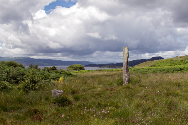
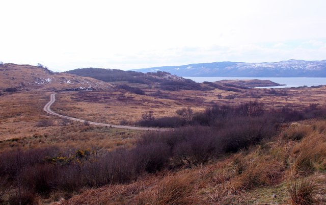
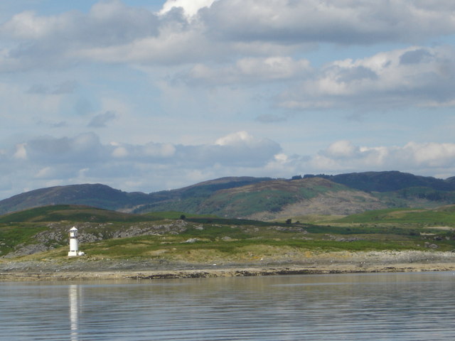
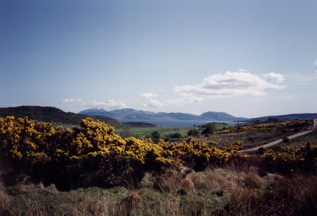
Port a' Mheirlich is a small coastal settlement located in Argyllshire, Scotland. Situated on the western coast of the country, it is nestled between the picturesque Loch Long and the towering peaks of the Arrochar Alps. This idyllic location offers residents and visitors breathtaking views of the sea, estuary, and nearby creek.

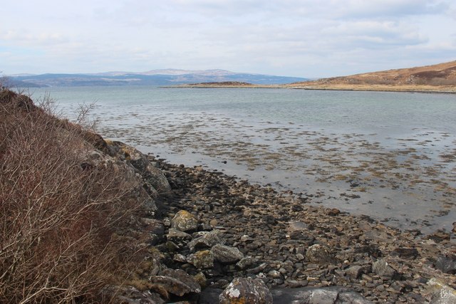
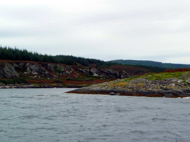
The village is known for its stunning natural beauty and tranquil atmosphere. The sea surrounding Port a' Mheirlich is a vibrant shade of blue, complemented by the rugged coastline and rocky outcrops. The estuary, fed by the nearby rivers, adds a touch of serenity as it merges with the sea, creating a unique and ever-changing landscape.

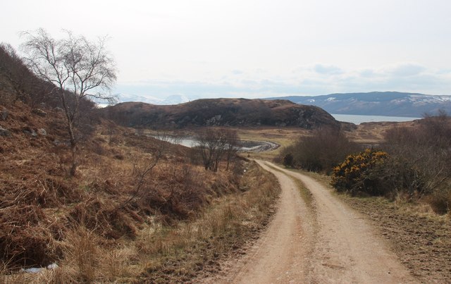
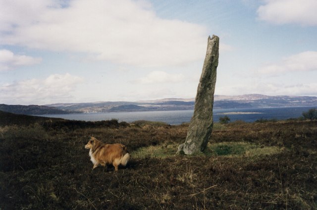
The local creek, which winds its way through the village, is a popular spot for fishermen and nature enthusiasts. Its calm waters provide a haven for a variety of wildlife, including otters, herons, and seals, which can often be spotted basking on the rocks.

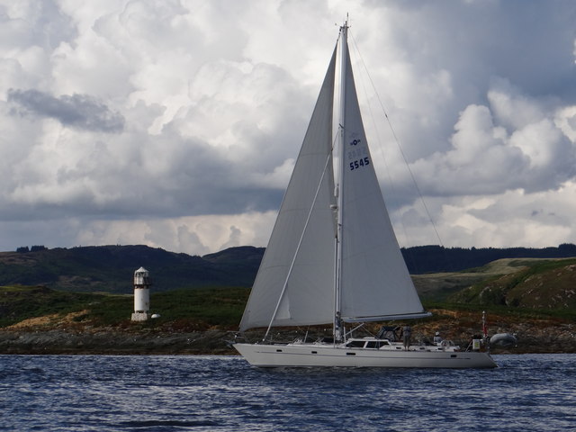
Port a' Mheirlich offers a range of activities for visitors to enjoy. From leisurely walks along the shoreline to adrenaline-fueled water sports, there is something for everyone. The village also boasts a charming harbor where fishing boats and yachts can be seen bobbing in the water, adding to the picturesque setting.

In addition to its natural beauty, Port a' Mheirlich is home to a close-knit community. The village has a small population, with residents often taking part in local events and supporting the few shops and amenities available.

Overall, Port a' Mheirlich, with its stunning sea, estuary, and creek, is a hidden gem in Argyllshire, offering visitors a peaceful and scenic retreat away from the hustle and bustle of modern life.

If you have any feedback on the listing, please let us know in the comments section below.

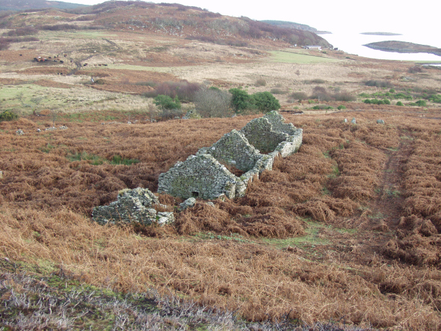
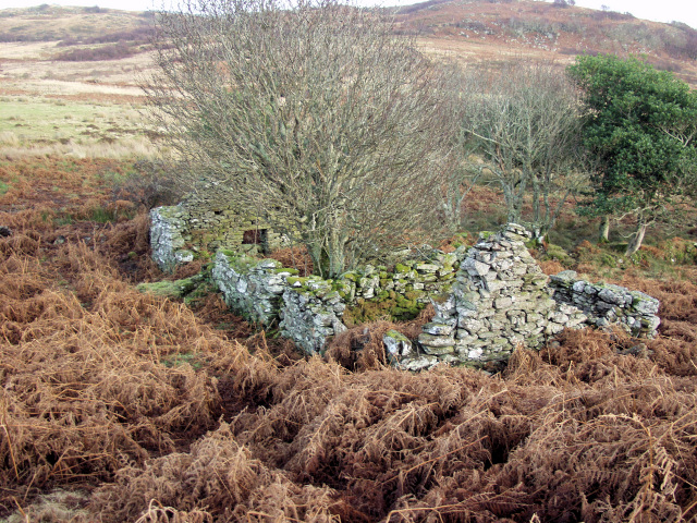
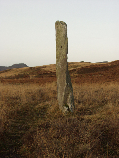
Port a' Mheirlich Images

Images are sourced within 2km of 55.85222/-5.306282 or Grid Reference NR9367. Thanks to Geograph Open Source API. All images are credited.

Alignment Standing Stones of Stillaig The main stone is c.3 metres tall and is visible from its alignment stone which is approximately 700 metres to the south-east. Although described on the map as 'Standing Stones' the second stone is a stump. There is a marked but indistinct path from Pollphail Village and the football field at Port Leathan. 
See <a href="https://www.geograph.org.uk/photo/1650175">NR9367 : Standing Stone near Low Stillaig</a>. Heath Spotted Orchids add colour to the moorland grass.
Alignment Standing Stones of Stillaig
The main stone is c.3 metres tall and is visible from its alignment stone which is approximately 700 metres to the south-east. Although described on the map as 'Standing Stones' the second stone is a stump. There is a marked but indistinct path from Pollphail Village and the football field at Port Leathan. See NR9367 : Standing Stone near Low Stillaig. Heath Spotted Orchids add colour to the moorland grass.
Ruins of Pollphail village
Track to Asgog Bay
Track to Asgog Bay
Eilean Aoidhe Although island by name, it is joined to the mainland by an isthmus.
Eilean Aoidhe
Although island by name, it is joined to the mainland by an isthmus.
Across Port Leathan to Rubha Stillaig At the Southwest tip of the Cowal peninsula
Across Port Leathan to Rubha Stillaig
At the Southwest tip of the Cowal peninsula
Pollphail The derelict village of Pollphail
Pollphail
The derelict village of Pollphail
Boysterous 5545 off Sgat Mòr light Cruising past the lighthouse on the small island.  At night, the light emits a white flash every three seconds.
Boysterous 5545 off Sgat Mòr light
Cruising past the lighthouse on the small island. At night, the light emits a white flash every three seconds.
Portavadie village This village was built during the North Sea oil boom to provide accommodation for the workers at the construction site nearby in NR9269.  The bulk of the village is in NR9369 but the right edge is in NR9368.  Picture is taken from Portavadie-Tarbert ferry which is probably in NR9269 or NR9169 when the picture was taken - I arrived just in time to catch the ferry so had no time to explore on shore!  The village has never been used since it was built in the 1970s.
Portavadie village
This village was built during the North Sea oil boom to provide accommodation for the workers at the construction site nearby in NR9269. The bulk of the village is in NR9369 but the right edge is in NR9368. Picture is taken from Portavadie-Tarbert ferry which is probably in NR9269 or NR9169 when the picture was taken - I arrived just in time to catch the ferry so had no time to explore on shore! The village has never been used since it was built in the 1970s.
Low Stillaig The second ruin that straddles this and the next square can be seen amongst the trees to the left
Low Stillaig
The second ruin that straddles this and the next square can be seen amongst the trees to the left
Low Stillaig Second Ruin This ruin straddles this square and the one to the left
Low Stillaig Second Ruin
This ruin straddles this square and the one to the left
Standing Stone This is the western stone of the two, the other is only about 18 inches high.
Standing Stone
This is the western stone of the two, the other is only about 18 inches high.
Island of Sgat Mor off the southern end of the Cowal Peninsula, Loch Fyne Uninhabited island with beacon viewed from PS Waverley
Island of Sgat Mor off the southern end of the Cowal Peninsula, Loch Fyne
Uninhabited island with beacon viewed from PS Waverley
Asgog Bay and Arran from near Stillaig Farm of the Portavadie Road.
Asgog Bay and Arran
from near Stillaig Farm of the Portavadie Road.
Standing Stone near Stillaig with Loch Fyne in the background.
Standing Stone near Stillaig
with Loch Fyne in the background.
Standing Stone near Low Stillaig
Sgat Mor in Loch Fyne and its light
Sgat Beag "Small skate island" as opposed to Sgat Mor "Big skate island" which has a light and lies to the west.
Sgat Beag
"Small skate island" as opposed to Sgat Mor "Big skate island" which has a light and lies to the west.
Northern tip of Sgat Beag Mainland just behind this small island.
Northern tip of Sgat Beag
Mainland just behind this small island.
Show me another place!

Port a' Mheirlich is located at Grid Ref: NR9367 (Lat: 55.85222, Lng: -5.306282)

Unitary Authority: Argyll and Bute

Police Authority: Argyll and West Dunbartonshire

What 3 Words

///shopper.dressing.reclined. Near Tarbert, Argyll & Bute

Related Wikis

Sgat Mòr and Sgat Beag

Sgat Mòr and Sgat Beag (Scottish Gaelic pronunciation: [s̪kat̪ moːrˠ ɪs̪ s̪kat̪ pɛk]; English: The Skate Islands or, less commonly, Skate Island and Wee...
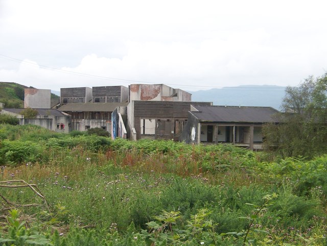
Polphail

Polphail was a ghost village in Scotland. It was demolished in 2016. == Location == Polphail was located at Portavadie on the west coast of the Cowal Peninsula...

Portavadie

Portavadie (Scottish Gaelic: Port a' Mhadaidh) is a village on the shores of Loch Fyne in Argyll and Bute, Scotland.The Portavadie complex was built in...

Asgog Loch

Asgog Loch is a natural freshwater loch in Argyll and Bute, Scotland. It is located about 4 kilometres (2.5 mi) southwest of Tighnabruaich, on the Cowal...

Nearby Amenities

Located within 500m of 55.85222,-5.306282
Created By: dmgroom_coastlines
Source: PGS
Lat/Long: 55.856298/-5.307745
Source: PGS
Lat/Long: 55.8560257/-5.3074271
Source: PGS
Lat/Long: 55.8558493/-5.3070774
Source: PGS
Lat/Long: 55.8556012/-5.306056
Source: PGS
Lat/Long: 55.8555221/-5.3048253
Source: PGS
Lat/Long: 55.854787/-5.3052635
Created By: dmgroom_coastlines
Source: PGS
Lat/Long: 55.854652/-5.306737
Created By: dmgroom_coastlines
Source: PGS
Lat/Long: 55.854873/-5.308572
Source: PGS
Lat/Long: 55.8547577/-5.3098716
Source: PGS
Lat/Long: 55.8546985/-5.3103632
Source: PGS
Lat/Long: 55.854539/-5.3110972
Created By: dmgroom_coastlines
Source: PGS
Lat/Long: 55.854558/-5.311741
Created By: dmgroom_coastlines
Source: PGS
Lat/Long: 55.854293/-5.31218
Source: PGS
Lat/Long: 55.8537034/-5.3131366
Created By: dmgroom_coastlines
Source: PGS
Lat/Long: 55.853121/-5.31325
Source: PGS
Lat/Long: 55.852877/-5.3130312
Source: PGS
Lat/Long: 55.8525055/-5.3127357
Source: PGS
Lat/Long: 55.8521737/-5.3115461
Source: PGS
Lat/Long: 55.8521545/-5.3107005
Source: PGS
Lat/Long: 55.8521775/-5.3102196
Source: PGS
Lat/Long: 55.8522167/-5.3094857
Source: PGS
Lat/Long: 55.852336/-5.3084908
Source: PGS
Lat/Long: 55.8523681/-5.3068683
Source: PGS
Lat/Long: 55.8524935/-5.3060227
Created By: dmgroom_coastlines
Source: PGS
Lat/Long: 55.851991/-5.305213
Source: PGS
Lat/Long: 55.8519186/-5.3048504
Source: PGS
Lat/Long: 55.8518499/-5.3044249
Created By: dmgroom_coastlines
Source: PGS
Lat/Long: 55.851632/-5.303826
Source: PGS
Lat/Long: 55.8517623/-5.3015798
Source: PGS
Lat/Long: 55.8519124/-5.3012428
Created By: dmgroom_coastlines
Source: PGS
Lat/Long: 55.852332/-5.30068
Source: PGS
Lat/Long: 55.8527018/-5.299956
Source: PGS
Lat/Long: 55.8526421/-5.2993937
Source: PGS
Lat/Long: 55.8529634/-5.2989472
Source: PGS
Lat/Long: 55.8533458/-5.2988871
Created By: dmgroom_coastlines
Source: PGS
Lat/Long: 55.853646/-5.298936
Created By: dmgroom_coastlines
Source: PGS
Lat/Long: 55.853756/-5.299853
Created By: dmgroom_coastlines
Source: PGS
Lat/Long: 55.854003/-5.300323
Source: PGS
Lat/Long: 55.8540881/-5.3016056
Source: PGS
Lat/Long: 55.8542303/-5.3023638
Source: PGS
Lat/Long: 55.8545217/-5.3032604
Created By: dmgroom_coastlines
Source: PGS
Lat/Long: 55.85484/-5.30356
Source: PGS
Lat/Long: 55.8552031/-5.3037374
Created By: dmgroom_coastlines
Source: PGS
Lat/Long: 55.855001/-5.301748
Bbq
BBs' hut
Lat/Long: 55.8560651/-5.302559
The data included in this document is from www.openstreetmap.org. The data is made available under ODbL.

Have you been to Port a' Mheirlich?

Leave your review of Port a' Mheirlich below (or comments, questions and feedback).