Bullslaughter Bay
Bay in Pembrokeshire
Wales
Bullslaughter Bay

The requested URL returned error: 429 Too Many Requests
If you have any feedback on the listing, please let us know in the comments section below.
Bullslaughter Bay Images
Images are sourced within 2km of 51.609222/-4.9755896 or Grid Reference SR9494. Thanks to Geograph Open Source API. All images are credited.


Bullslaughter Bay is located at Grid Ref: SR9494 (Lat: 51.609222, Lng: -4.9755896)
Unitary Authority: Pembrokeshire
Police Authority: Dyfed Powys
What 3 Words
///freezers.gratitude.rephrase. Near Bosherston, Pembrokeshire
Nearby Locations
Related Wikis
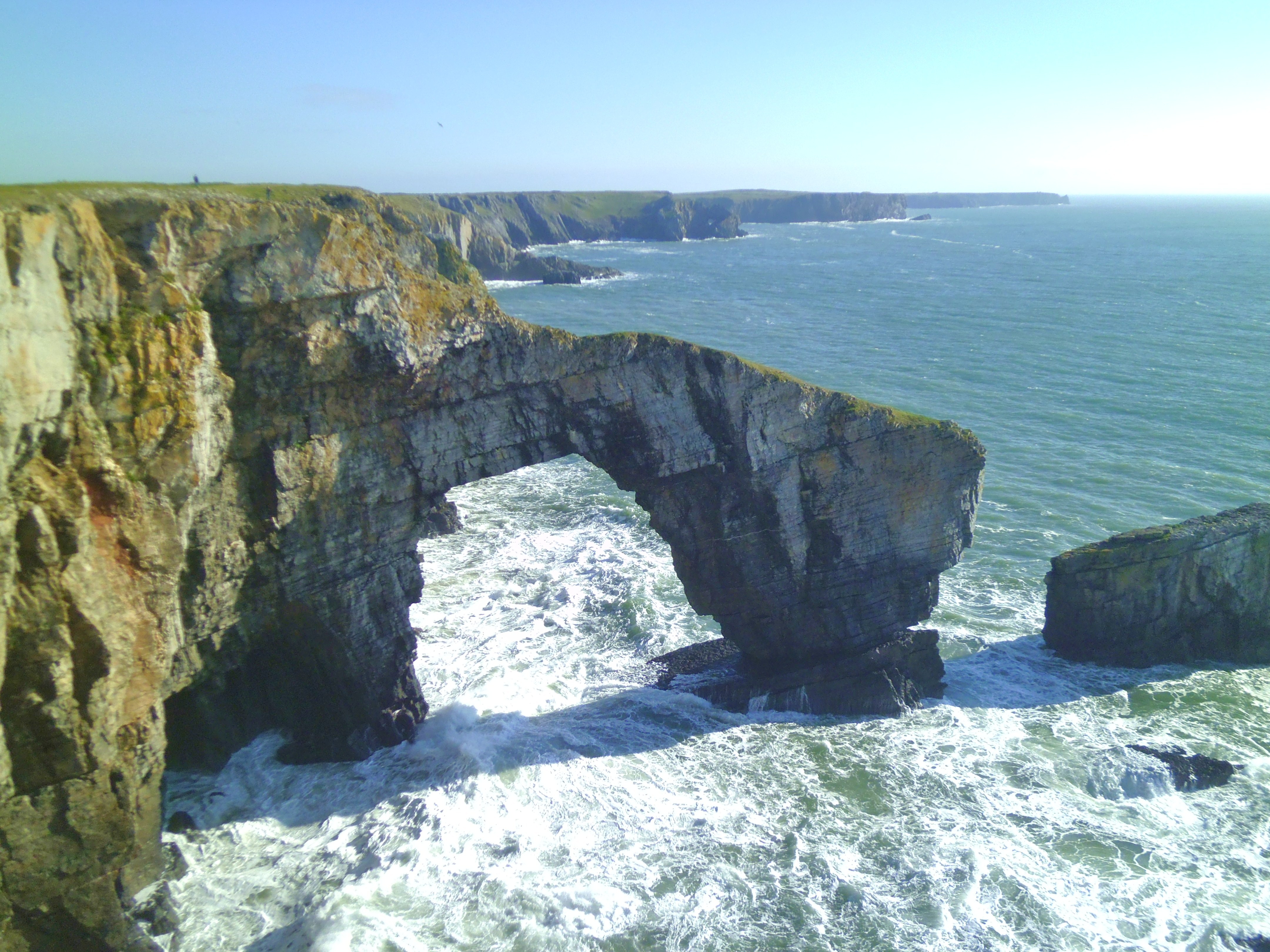
Green Bridge of Wales
The Green Bridge of Wales (Welsh: Pont Werdd Cymru) is a natural arch formed from Carboniferous Limestone within the Pembrokeshire Coast National Park...

Castlemartin Training Area
Castlemartin Training Area is a British Army military training area and armoured fighting vehicle range located in the Welsh county of Pembrokeshire. It...

Stackpole and Castlemartin
Stackpole and Castlemartin is a community in Pembrokeshire, Wales, 4 miles (6.4 km) south of Pembroke.It was formed in 2011 by the amalgamation of the...

Huntsman's Leap
Huntsman's Leap is a deep, narrow and sheer-sided coastal chasm or geo developed in the Carboniferous Limestone of the Pembrokeshire Coast National Park...
Nearby Amenities
Located within 500m of 51.609222,-4.9755896Have you been to Bullslaughter Bay?
Leave your review of Bullslaughter Bay below (or comments, questions and feedback).