Aber Felin

Bay in Pembrokeshire

Wales

Aber Felin

N.T. gate into Pen Anglas The Pembrokeshire Coast Path passes through this headland maintained by the National Trust.
N.T. gate into Pen Anglas Credit: Jeremy Bolwell

Aber Felin, also known as Aber Bay, is a picturesque coastal village located in the county of Pembrokeshire, Wales. Situated on the western side of the country, Aber Felin is nestled within the Pembrokeshire Coast National Park, renowned for its stunning natural beauty and diverse wildlife.

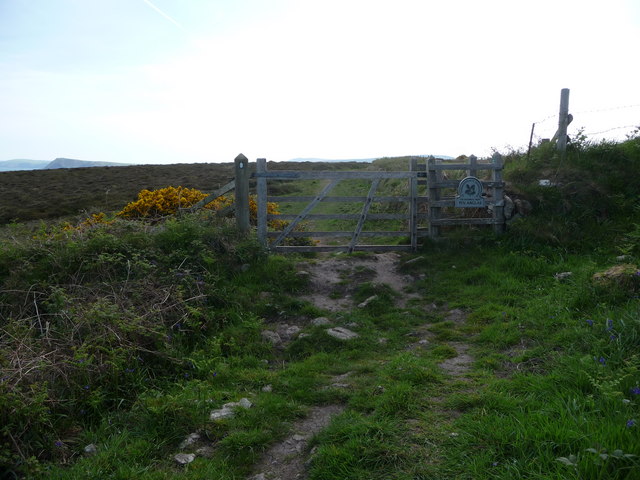
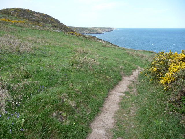
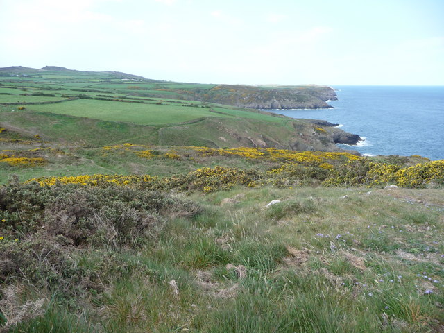
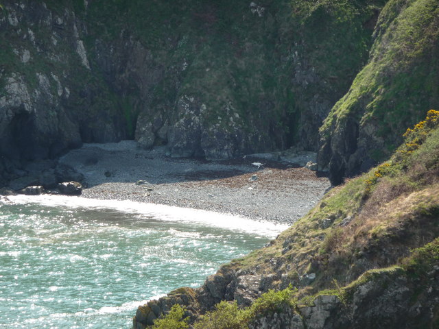
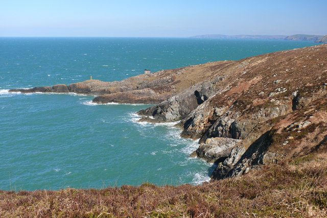
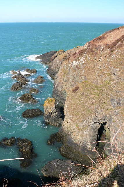
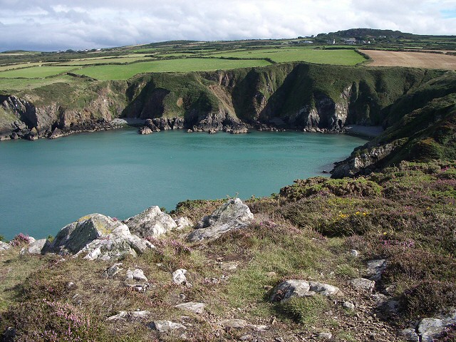
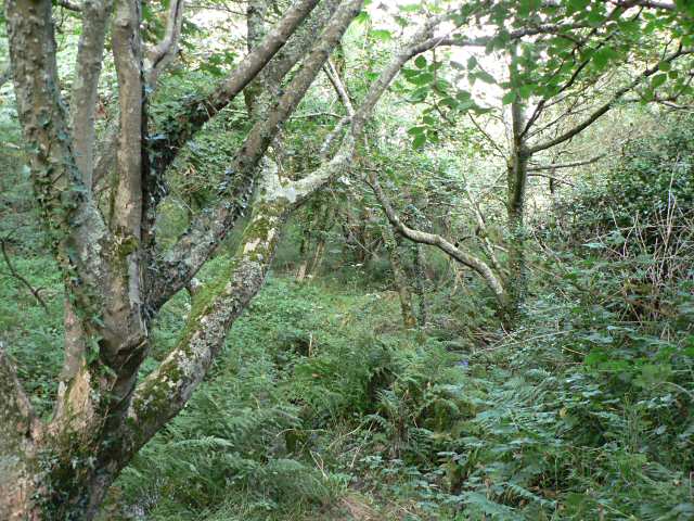
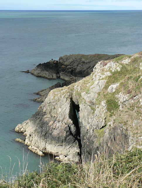
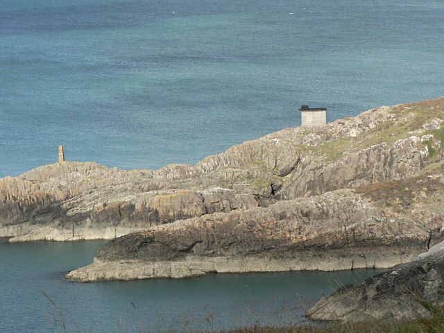
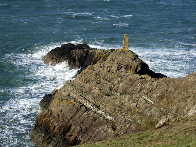
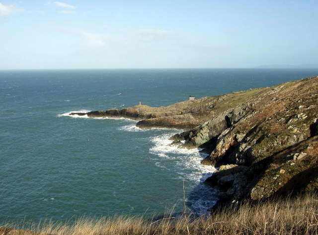
The village is set against a backdrop of rolling green hills and overlooks a pristine sandy beach, stretching for miles along the rugged coastline. The bay itself is sheltered by towering cliffs, providing a tranquil and secluded atmosphere.

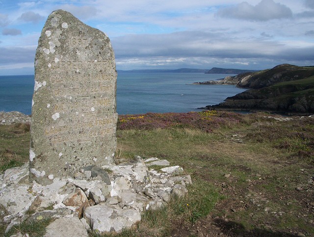
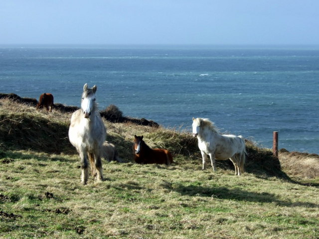
Aber Felin offers visitors a range of recreational activities. The bay is a popular spot for swimming, surfing, and kayaking, attracting water sports enthusiasts from far and wide. Nature lovers can explore the surrounding area on foot, with scenic coastal walks offering breathtaking views of the Irish Sea and the chance to spot seals, dolphins, and a variety of bird species.

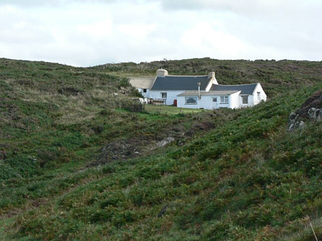
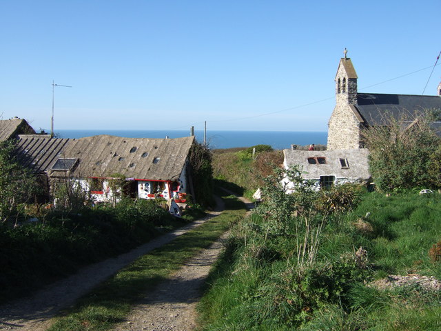
The village itself exudes charm and character, with quaint cottages lining the narrow, winding streets. There are a few local shops and cafes, providing essential amenities and a taste of traditional Welsh hospitality. The nearby town of Fishguard offers a wider range of amenities, including supermarkets, restaurants, and historical attractions.

Aber Felin is also known for its annual summer festival, which showcases local talent, music, and arts, adding to the vibrant and friendly community spirit that permeates the village throughout the year.

In summary, Aber Felin is a hidden gem along the Pembrokeshire coastline, offering visitors a combination of natural beauty, outdoor activities, and a warm community atmosphere.

If you have any feedback on the listing, please let us know in the comments section below.
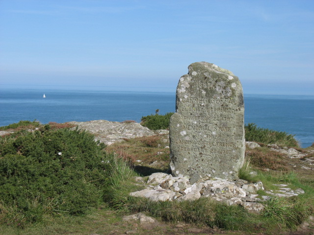
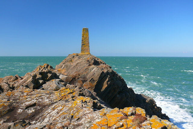
Aber Felin Images

Images are sourced within 2km of 52.022656/-5.019869 or Grid Reference SM9240. Thanks to Geograph Open Source API. All images are credited.

N.T. gate into Pen Anglas The Pembrokeshire Coast Path passes through this headland maintained by the National Trust.
N.T. gate into Pen Anglas
The Pembrokeshire Coast Path passes through this headland maintained by the National Trust.
Carnfathach looking west From this distinctive knoll you get excellent views down the coastline westwards towards Carregwastad Point.
Carnfathach looking west
From this distinctive knoll you get excellent views down the coastline westwards towards Carregwastad Point.
Part of the Pembrokeshire Coast Path Yes, that little grey figure down there is a walker ahead of me on the coastal path, no doubt also enjoying this section of varied coastline, even if the harmless St. Mark's flies are thick in the air, the gorse tugs at your clothing and small loose stones slip under your boots.
Part of the Pembrokeshire Coast Path
Yes, that little grey figure down there is a walker ahead of me on the coastal path, no doubt also enjoying this section of varied coastline, even if the harmless St. Mark's flies are thick in the air, the gorse tugs at your clothing and small loose stones slip under your boots.
Monument stone on Carregwastad Point An ideal place for a rest, a brew, something to eat and a chat with some Aussie backpackers doing the whole Pembrokeshire Coast Path, a couple with huge rucksacks and an indomitable Aussie spirit to match.
Monument stone on Carregwastad Point
An ideal place for a rest, a brew, something to eat and a chat with some Aussie backpackers doing the whole Pembrokeshire Coast Path, a couple with huge rucksacks and an indomitable Aussie spirit to match.
Beach flotsam below Carregwastad Point I had seen a grey seal bottling in Aber Felin cove here and scanning the beach for other seals I spied what appears to be a large portion of dead pony. A grey pony seems to have fallen down the very steep gully above this beach and either been injured or trapped on the beach (though I can't believe that if this was the case that a rescue wasn't attempted) and subsequently died. Gulls were interested in the carcase and vulture-like hopped on and off, chased each other and generally set off a macabre scene.
Beach flotsam below Carregwastad Point
I had seen a grey seal bottling in Aber Felin cove here and scanning the beach for other seals I spied what appears to be a large portion of dead pony. A grey pony seems to have fallen down the very steep gully above this beach and either been injured or trapped on the beach (though I can't believe that if this was the case that a rescue wasn't attempted) and subsequently died. Gulls were interested in the carcase and vulture-like hopped on and off, chased each other and generally set off a macabre scene.
On Carregwastad Point The memorial marks the invasion on 22 February 1797 by a small French force. It is difficult to work out what they hoped to achieve, landing in such a remote spot, though they no doubt assumed that it would take some time for a defending army to be sent there. However they appear to have been a somewhat ill-disciplined bunch, for it is said that they got drunk and surrendered to the local population two days later!
On Carregwastad Point
The memorial marks the invasion on 22 February 1797 by a small French force. It is difficult to work out what they hoped to achieve, landing in such a remote spot, though they no doubt assumed that it would take some time for a defending army to be sent there. However they appear to have been a somewhat ill-disciplined bunch, for it is said that they got drunk and surrendered to the local population two days later!
Pen Anglas
Pen Anglas
Bae Anglas Bay
Bae Anglas Bay
Aber Felin
Aber Felin
Aber Felin View from Carregwastad Point
Aber Felin
View from Carregwastad Point
Last invasion of Britain - Carregwastad Point The inscription on the stone reads:
1897 CARREG GOFFA GLANIAD Y FFRANCOD CHWEFROR 22 1797
MEMORIAL STONE OF THE LANDING OF THE FRENCH FEBRUARY 22 1797
The story of this invasion can be read from information boards in Goodwick. It failed; the French troops discovered a cache of liquor saved from a shipwreck and were easily overcome by local men and women.
Last invasion of Britain - Carregwastad Point
The inscription on the stone reads: 1897 CARREG GOFFA GLANIAD Y FFRANCOD CHWEFROR 22 1797 MEMORIAL STONE OF THE LANDING OF THE FRENCH FEBRUARY 22 1797 The story of this invasion can be read from information boards in Goodwick. It failed; the French troops discovered a cache of liquor saved from a shipwreck and were easily overcome by local men and women.
Cottage The Pembrokeshire Coastal Path runs in front of the cottage. A beautiful location, seen from the north.
Cottage
The Pembrokeshire Coastal Path runs in front of the cottage. A beautiful location, seen from the north.
Cwm Felin This deep wooded george makes a striking contrast to the rest of the coastal path in this area.
Cwm Felin
This deep wooded george makes a striking contrast to the rest of the coastal path in this area.
Natural arch
Natural arch
Pen Anglas
Pen Anglas
Geology at Pen Anglas Rocky headland is owned by the National Trust and famed for its remarkable rock formations.  "Pen Anglas is formed of a dolerite intrusion, and on the NE-facing cliffs below the stone pillar there are some excellent examples of columnar jointing. This inclined rock face shows sections through the columns demonstrating the hexagonal cooling joints. Climb over the ridge to the SW side of the headland where the long axes of the columns can be seen. The whole intrusion therefore appears to be dipping at about 450 towards the NE where the upper surface is exposed." Information from <span class="nowrap"><a title="http://www.jdgeology.co.uk/Ordovician/Ordovician.htm" rel="nofollow ugc noopener" href="http://www.jdgeology.co.uk/Ordovician/Ordovician.htm">Link</a><img style="margin-left:2px;" alt="External link" title="External link - shift click to open in new window" src="https://s1.geograph.org.uk/img/external.png" width="10" height="10"/></span> (unfortunately this site appears to be no longer extant).
Geology at Pen Anglas
Rocky headland is owned by the National Trust and famed for its remarkable rock formations. "Pen Anglas is formed of a dolerite intrusion, and on the NE-facing cliffs below the stone pillar there are some excellent examples of columnar jointing. This inclined rock face shows sections through the columns demonstrating the hexagonal cooling joints. Climb over the ridge to the SW side of the headland where the long axes of the columns can be seen. The whole intrusion therefore appears to be dipping at about 450 towards the NE where the upper surface is exposed." Information from LinkExternal link (unfortunately this site appears to be no longer extant).
Anglas Bay Looking northeast towards the spectacular rock formations around Pen Anglas. A fine but windy February day, hence the rough sea.
In 1797 it was when the French ships rounded the point here into Fishguard Bay, and were warned off by a cannon shot across the bows from Fishguard Fort, that they turned back and landed at Carregwasted a little to the west.
Anglas Bay
Looking northeast towards the spectacular rock formations around Pen Anglas. A fine but windy February day, hence the rough sea. In 1797 it was when the French ships rounded the point here into Fishguard Bay, and were warned off by a cannon shot across the bows from Fishguard Fort, that they turned back and landed at Carregwasted a little to the west.
Windswept ponies on Ciliau moor They are here for a purpose, as part of the management plan for this area of coastal heathland. Their grazing controls invasive scrub in the most natural manner possible, allowing other plants to survive. This is an important habitat for heathloving birds too.
Windswept ponies on Ciliau moor
They are here for a purpose, as part of the management plan for this area of coastal heathland. Their grazing controls invasive scrub in the most natural manner possible, allowing other plants to survive. This is an important habitat for heathloving birds too.
Show me another place!

Aber Felin is located at Grid Ref: SM9240 (Lat: 52.022656, Lng: -5.019869)

Unitary Authority: Pembrokeshire

Police Authority: Dyfed Powys

What 3 Words

///processes.diverting.juggler. Near Goodwick, Pembrokeshire

Related Wikis

Pencaer

Pencaer is a community which covers an area of dispersed settlement in Pembrokeshire, Wales, on the peninsula of Pen Caer and comprises the village of...

Llanwnda, Pembrokeshire

Llanwnda is a rural village and parish to the north of the Welsh county of Pembrokeshire and part of the community of Pencaer. It lies some two miles northwest...

Fishguard Harbour railway station

Fishguard Harbour railway station serves the port of Fishguard Harbour, Wales. It is the terminus of one of the branches of the West Wales Line from Swansea...

Fishguard Lifeboat Station

Fishguard Lifeboat Station (based in Goodwick, Pembrokeshire, Wales) is a Royal National Lifeboat Institution (RNLI) station. Located on the quay between...

Nearby Amenities

Located within 500m of 52.022656,-5.019869
Carregwasted Point
Created By: POI Editor
Note: Site of French landing 1797
Source: npe
Tourism: attraction
Lat/Long: 52.0249547/-5.0238584
Barrier: stile
Steps: 1
Lat/Long: 52.0219387/-5.0247227
Barrier: stile
Steps: 1
Lat/Long: 52.0226253/-5.0247427
Carregwestad Point
Historic: monument
Note: The Last Invasion of Britain 1797
Lat/Long: 52.0234983/-5.0239981
Barrier: stile
Note: check
Steps: 1
Lat/Long: 52.0208121/-5.0239975
Barrier: stile
Steps: 1
Lat/Long: 52.0186934/-5.0222037
Aber Felin
Natural: bay
Lat/Long: 52.0232355/-5.0203575
The data included in this document is from www.openstreetmap.org. The data is made available under ODbL.

Have you been to Aber Felin?

Leave your review of Aber Felin below (or comments, questions and feedback).