Aber Bach

Bay in Pembrokeshire

Wales

Aber Bach

Pebble Beach, Aberbach, 1989 View from Carreg Golchfa of the pebble bank at Aberbach on a hot and sunny day in 1989.
Pebble Beach, Aberbach, 1989 Credit: Martyn Harries

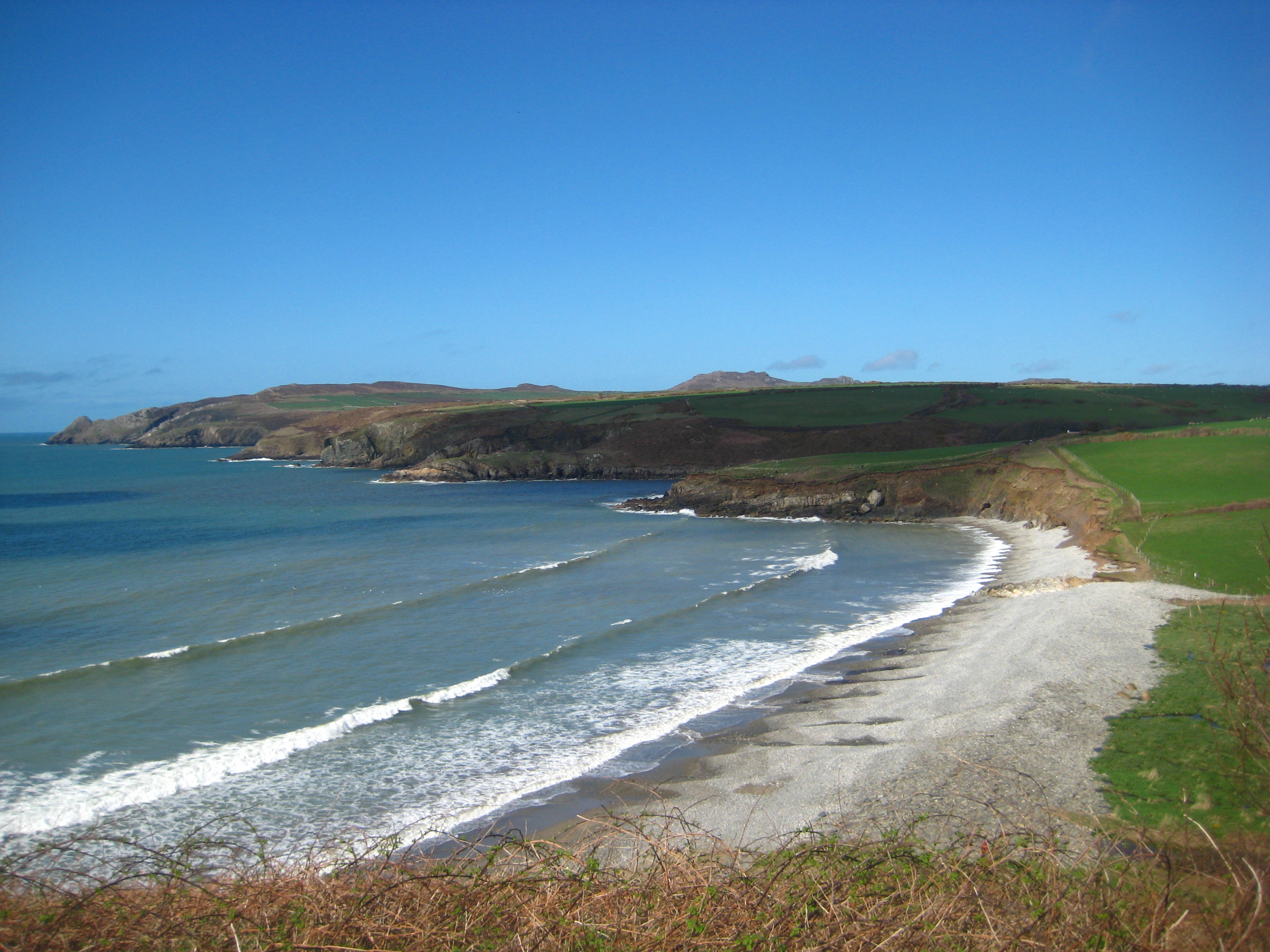
Aber Bach is a picturesque bay located in the county of Pembrokeshire, Wales. Situated on the western coast of the country, it offers stunning natural beauty and a tranquil atmosphere. The bay is nestled between rugged cliffs and rolling green hills, creating a dramatic backdrop for visitors.

The beach at Aber Bach is a mixture of sand and pebbles, providing a unique texture and appearance. It stretches for approximately 500 meters and is backed by low dunes covered in wildflowers. The crystal-clear waters of the bay are ideal for swimming, making it a popular spot for locals and tourists alike during the summer months.

Aber Bach is also renowned for its diverse marine life and is a haven for wildlife enthusiasts. The rocky shoreline and rock pools teem with various species of fish, crabs, and other marine creatures, making it a great place for exploring and snorkeling.

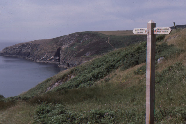
For those seeking outdoor activities, the bay offers fantastic opportunities for coastal walks, with a well-maintained footpath that winds its way along the cliffs. The views from the path are simply breathtaking, providing panoramic vistas of the bay and the surrounding countryside.

Facilities at Aber Bach include a car park and toilets, ensuring visitors' convenience. However, it is worth noting that there are no lifeguards on duty, so caution should be exercised when swimming or venturing into the water.

Aber Bach truly embodies the beauty of the Pembrokeshire coast, offering a peaceful and unspoiled environment for visitors to enjoy nature at its finest.

If you have any feedback on the listing, please let us know in the comments section below.

Aber Bach Images

Images are sourced within 2km of 51.973467/-5.0834141 or Grid Reference SM8835. Thanks to Geograph Open Source API. All images are credited.

Pebble Beach, Aberbach, 1989 View from Carreg Golchfa of the pebble bank at Aberbach on a hot and sunny day in 1989.
Pebble Beach, Aberbach, 1989
View from Carreg Golchfa of the pebble bank at Aberbach on a hot and sunny day in 1989.
Spring flowers at Granston Churchyard A display of daffodils, celandine and primroses together with a few snowdrops viewed from the entrance to the churchyard.
Spring flowers at Granston Churchyard
A display of daffodils, celandine and primroses together with a few snowdrops viewed from the entrance to the churchyard.
Aber Bach
Aber Bach
Melin Tregwynt
Melin Tregwynt
Narrow road to Felin Dwarch Beyond the entrance to Morfa Farm, is the narrow single track road with high hedge banks heading for Felin Dwarch and Duffryn Dwarch, which is unsuitable for long vehicles.
Narrow road to Felin Dwarch
Beyond the entrance to Morfa Farm, is the narrow single track road with high hedge banks heading for Felin Dwarch and Duffryn Dwarch, which is unsuitable for long vehicles.
Rev. Evan Davies, Llangloffan Baptist Chapel Evan Davies was minister at Llangloffan Baptist Chapel <a href="https://www.geograph.org.uk/photo/383629">SM9032 : Llangloffan Baptist chapel</a> for thirty five years after his arrival from Dowlais in 1874 till his death in 1909.
He is buried with his wife and one of his daughters in Granston churchyard when many years ago, members of the parish church and chapel ( Granston) were buried in the churchyard before Llangloffan had its own cemetery, established around 1920.
Evan Davies was the father of Vincent Davies who established the 'Pioneer Stores' in Bridge Street , Haverfordwest and the business has expanded as the 'Vincent Davies' independent out-of-town department store between Withybush and Haverfordwest<a href="https://www.geograph.org.uk/photo/1590061">SM9517 : Vincent Davies store</a>.
The words at the bottom of the headstone describe the Rev Evan Davies as follows :

                              In Loving Remembrance 
                                        of
                               Rev. Evan Davies.
                              Born March 5th, 1840.
                            Died December 27th, 1909.
                 A good musician, a powerful preacher, a faithful
                 minister, and an Israelite indeed, in whom there
                                    was no guile.

A photograph of the Rev.Davies in 1885, taken by the Welsh Victorian photographer John Thomas 1838-1905, can be seen using the National Library of Wales weblink: <span class="nowrap"><a title="http://delwedd.llgc.org.uk/delweddau/jth/jth01569.jpg" rel="nofollow ugc noopener" href="http://delwedd.llgc.org.uk/delweddau/jth/jth01569.jpg">Link</a><img style="margin-left:2px;" alt="External link" title="External link - shift click to open in new window" src="https://s1.geograph.org.uk/img/external.png" width="10" height="10"/></span>.
Rev. Evan Davies, Llangloffan Baptist Chapel
Evan Davies was minister at Llangloffan Baptist Chapel SM9032 : Llangloffan Baptist chapel for thirty five years after his arrival from Dowlais in 1874 till his death in 1909. He is buried with his wife and one of his daughters in Granston churchyard when many years ago, members of the parish church and chapel ( Granston) were buried in the churchyard before Llangloffan had its own cemetery, established around 1920. Evan Davies was the father of Vincent Davies who established the 'Pioneer Stores' in Bridge Street , Haverfordwest and the business has expanded as the 'Vincent Davies' independent out-of-town department store between Withybush and HaverfordwestSM9517 : Vincent Davies store. The words at the bottom of the headstone describe the Rev Evan Davies as follows : In Loving Remembrance of Rev. Evan Davies. Born March 5th, 1840. Died December 27th, 1909. A good musician, a powerful preacher, a faithful minister, and an Israelite indeed, in whom there was no guile. A photograph of the Rev.Davies in 1885, taken by the Welsh Victorian photographer John Thomas 1838-1905, can be seen using the National Library of Wales weblink: LinkExternal link.
Pwllcrochan from the south
Footpath junction near Abermawr A footpath junction near Abermawr. The way to the right is the official Pembrokeshire Coast Path heading for Penmorfa. The way to the left was part of a road from Tregwynt and Abermawr to Abercastle, but is now a narrow path.
Footpath junction near Abermawr
A footpath junction near Abermawr. The way to the right is the official Pembrokeshire Coast Path heading for Penmorfa. The way to the left was part of a road from Tregwynt and Abermawr to Abercastle, but is now a narrow path.
Penmorfa View of the cliffs on the south side of Trwyn Llwynog below the Pembrokeshire Coast Path near Porth Glastwr. Garn Fawr and Garn Fechan can be seen in the distance.
Penmorfa
View of the cliffs on the south side of Trwyn Llwynog below the Pembrokeshire Coast Path near Porth Glastwr. Garn Fawr and Garn Fechan can be seen in the distance.
Ruin near Aber Bach The ruined cottage is located by the path to Aber Bach beach between Garn Barcud and Aber-bach cottages, on the north side of the valley above Felin Fawr (Great Mill). This is the front view of the ruin which was abandoned around the late 19th century. It is not marked on present OS maps, but on the 1889 OS map (1:2500), the name Temple appears between Garn Barcud and Aber-bach.
In the 19th century census returns for the parish of Granston, the name Pantyffynnon appears between Garn Barcud and Aber-bach cottage entries. The last record of occupants living in Temple or Pantyffynnon was in the 1881 census.
Ruin near Aber Bach
The ruined cottage is located by the path to Aber Bach beach between Garn Barcud and Aber-bach cottages, on the north side of the valley above Felin Fawr (Great Mill). This is the front view of the ruin which was abandoned around the late 19th century. It is not marked on present OS maps, but on the 1889 OS map (1:2500), the name Temple appears between Garn Barcud and Aber-bach. In the 19th century census returns for the parish of Granston, the name Pantyffynnon appears between Garn Barcud and Aber-bach cottage entries. The last record of occupants living in Temple or Pantyffynnon was in the 1881 census.
Tregwynt Woollen Mill Working mill producing contemporary fabrics.
Tregwynt Woollen Mill
Working mill producing contemporary fabrics.
Roadside House This road runs across the Aber Bach valley. If you want to get to the coast from here a footpath runs to Aber Bach from the side of this house.
Roadside House
This road runs across the Aber Bach valley. If you want to get to the coast from here a footpath runs to Aber Bach from the side of this house.
Aber Bach A steep pebble beach and a calm blue sea. I guess it's not always like this!
Aber Bach
A steep pebble beach and a calm blue sea. I guess it's not always like this!
Aber Mawr Looking over the pebble beach of Aber Mawr and the valley behind.
Aber Mawr
Looking over the pebble beach of Aber Mawr and the valley behind.
The Western Cliffs of Penmorfa Beyond the promontory of Penmorfa there is a view of the landscape across the bay and several miles to the north.
The Western Cliffs of Penmorfa
Beyond the promontory of Penmorfa there is a view of the landscape across the bay and several miles to the north.
Rugged Cliffs A view south along the cliff face from Trwyn Llwynog.
Rugged Cliffs
A view south along the cliff face from Trwyn Llwynog.
Prehistoric trees at Aber Mawr Dating back to between 5000 and 6000BC, when sea levels rose rapidly after the last glacial period. See also <a href="https://www.geograph.org.uk/photo/307497">SM8834 : Drowned forest at Abermawr</a>
Prehistoric trees at Aber Mawr
Dating back to between 5000 and 6000BC, when sea levels rose rapidly after the last glacial period. See also SM8834 : Drowned forest at Abermawr
8000 year old wood Exposed at Aber Mawr at low tide, with corrasion weathering causing potholes as pebbles are spun round by wave action, gradually enlarging the hole by abrasion. See also <a href="https://www.geograph.org.uk/photo/307497">SM8834 : Drowned forest at Abermawr</a> and <a href="https://www.geograph.org.uk/photo/4101140">SM8834 : Prehistoric trees at Aber Mawr</a>
8000 year old wood
Exposed at Aber Mawr at low tide, with corrasion weathering causing potholes as pebbles are spun round by wave action, gradually enlarging the hole by abrasion. See also SM8834 : Drowned forest at Abermawr and SM8834 : Prehistoric trees at Aber Mawr
Show me another place!

Aber Bach is located at Grid Ref: SM8835 (Lat: 51.973467, Lng: -5.0834141)

Unitary Authority: Pembrokeshire

Police Authority: Dyfed Powys

What 3 Words

///shoulders.daredevil.lonely. Near Mathry, Pembrokeshire

Related Wikis

Abermawr

Abermawr is a stretch of coastline and is regarded as a Site of Special Scientific Interest in Pembrokeshire, Wales. Abermawr is a mostly shingle beach...

Tregwynt Hoard

The Tregwynt Hoard is a mid-17th-century hoard of coins found at Tregwynt Mansion near Fishguard in Pembrokeshire, Wales, in 1996. The hoard is now in...

Tregwynt Mansion

Tregwynt Mansion is a house in the parish of Granston in Pembrokeshire, Wales. The Tregwynt Hoard was found during renovations in 1996. == Location... ==
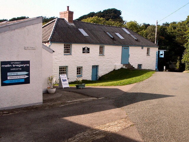
Melin Tregwynt

Melin Tregwynt (Tregwynt Mill) is a woollen mill in the hamlet of Tregwynt in the parish of Granston, Pembrokeshire, Wales. A mill has stood on this site...

Granston

Granston (Welsh: Treopert) is a hamlet and parish in Pembrokeshire, Wales. The parish was in the Hundred of Dewisland and includes the settlements of Llangloffan...

Trefasser

Trefasser (variations: Tref-Asser, or Trêf Asser, or Asserton; translation: "town" of "Asser") is a hamlet, located to the west of Fishguard in western...

Mathry

Mathry (Welsh: Mathri) is a village, community and parish in Pembrokeshire, Wales. The hilltop village is 6 miles (9.7 km) southwest of Fishguard, close...

Abercastle

Abercastle (Welsh: Abercastell) is a village in Pembrokeshire, Wales. Abercastle has a working harbour which is managed by Abercastle Boat Owners Association...

Related Videos

Abermawr Beach (Traeth Abermawr), Melin Tregwynt, Pembrokeshire (Sir Benfro)

Abermawr is another beautiful beach off the beaten path. The best way to get to Abermawr is with the T11 Bus and ask to be ...

Aberbach Beach (Traeth Aberbach), Melin Tregwynt, Pembrokeshire (Sir Benfro)

The beautiful little beach of Aberbach is the little sister of bigger brother Abermawr which is only 5 minutes walk away. Like with ...

Nearby Amenities

Located within 500m of 51.973467,-5.0834141
Aberbach
Place: locality
Lat/Long: 51.9737109/-5.0818965
Abermawr
Place: locality
Lat/Long: 51.9695112/-5.0837794
Ford: yes
Lat/Long: 51.9740227/-5.0818258
The data included in this document is from www.openstreetmap.org. The data is made available under ODbL.

Have you been to Aber Bach?

Leave your review of Aber Bach below (or comments, questions and feedback).