Llech Dafad

Coastal Feature, Headland, Point in Pembrokeshire

Wales

Llech Dafad

Pebble Beach, Aberbach, 1989 View from Carreg Golchfa of the pebble bank at Aberbach on a hot and sunny day in 1989.
Pebble Beach, Aberbach, 1989 Credit: Martyn Harries

Llech Dafad is a prominent coastal feature located in Pembrokeshire, Wales. It is a headland that juts out into the sea, forming a point that offers stunning views of the surrounding coastline. The name "Llech Dafad" translates to "sheep slab" in English, which is believed to refer to the flat, rocky surface of the headland.

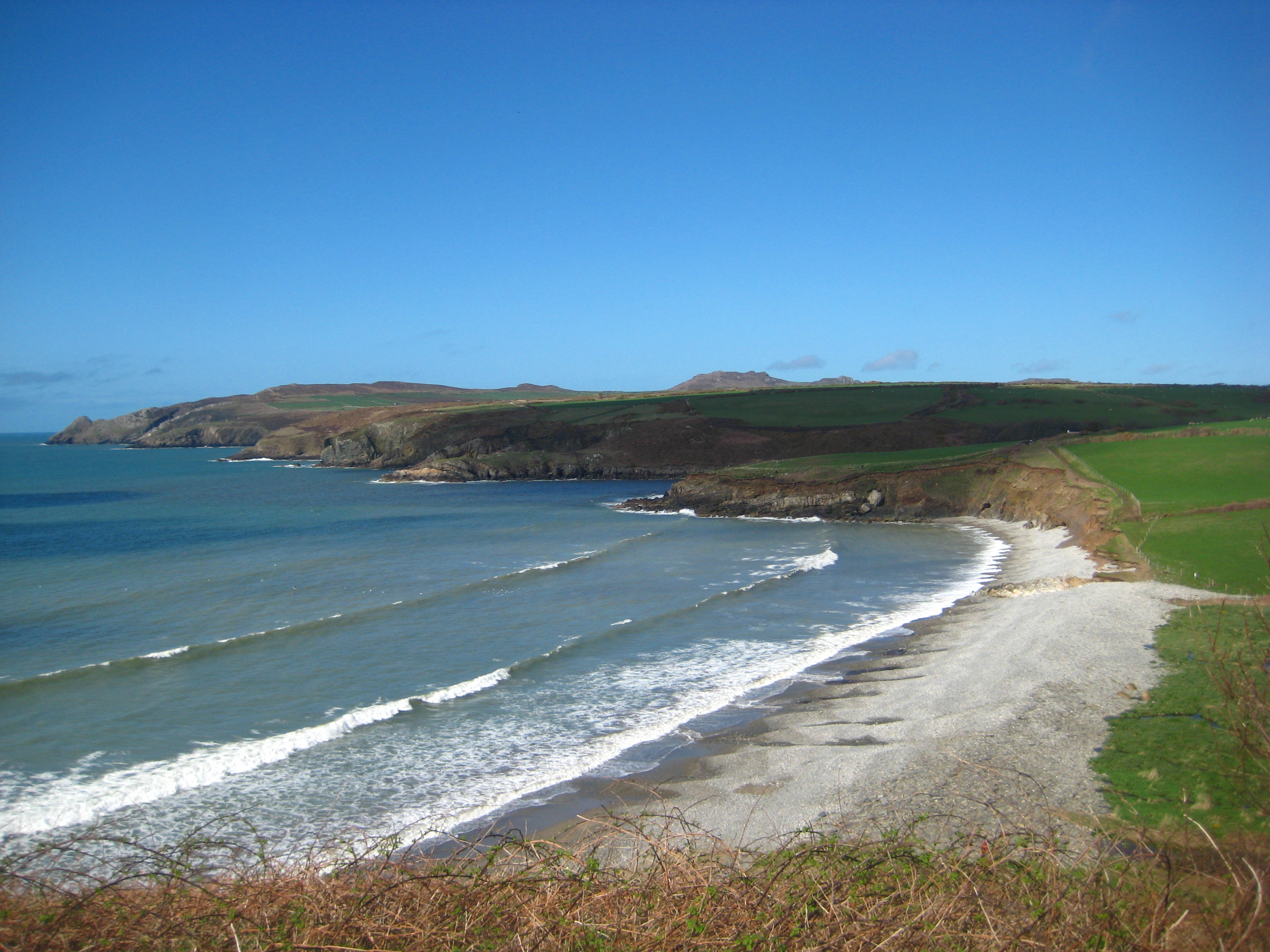
The headland is characterized by its rugged and rocky terrain, with steep cliffs that drop down into the sea below. These cliffs are composed of sedimentary rocks, including sandstone and limestone, which have been shaped and eroded over time by the relentless force of the waves.

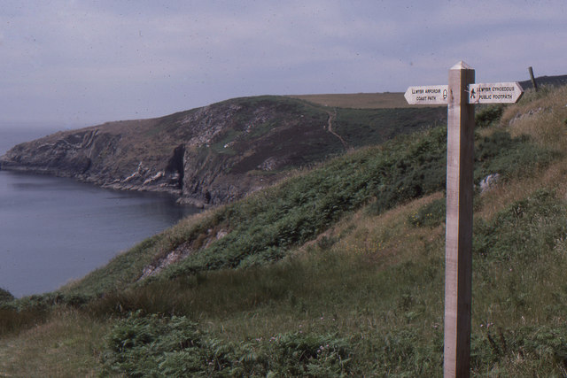
Llech Dafad is a popular destination for outdoor enthusiasts and nature lovers. The headland offers numerous walking trails that lead visitors along its clifftops, providing breathtaking panoramic views of the coastline and the vast expanse of the sea. It is also a haven for birdwatching, with a variety of seabirds and other coastal species frequenting the area.

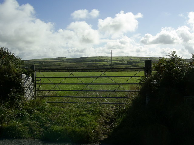
Access to Llech Dafad is relatively easy, with a car park located nearby and a well-maintained footpath leading to the headland. However, caution is advised while exploring the area, as the cliffs can be steep and unstable in places.

Overall, Llech Dafad is a remarkable coastal feature that showcases the stunning natural beauty of Pembrokeshire. Its rugged cliffs, panoramic views, and diverse wildlife make it a must-visit destination for anyone seeking to experience the wild and untamed beauty of the Welsh coast.

If you have any feedback on the listing, please let us know in the comments section below.

Llech Dafad Images

Images are sourced within 2km of 51.980094/-5.086899 or Grid Reference SM8835. Thanks to Geograph Open Source API. All images are credited.

Pebble Beach, Aberbach, 1989 View from Carreg Golchfa of the pebble bank at Aberbach on a hot and sunny day in 1989.
Pebble Beach, Aberbach, 1989
View from Carreg Golchfa of the pebble bank at Aberbach on a hot and sunny day in 1989.
Aber Bach
Aber Bach
Melin Tregwynt
Melin Tregwynt
Field gate with a view near Llanferran Entrance to the field from the minor road near Llanferran. The Strumble VOR/DME aviation navigational aid can just be seen in the distance. <a href="https://www.geograph.org.uk/photo/1497633">SM9137 : The Strumble VOR</a>
Field gate with a view near Llanferran
Entrance to the field from the minor road near Llanferran. The Strumble VOR/DME aviation navigational aid can just be seen in the distance. SM9137 : The Strumble VOR
Pwllcrochan from the south
Footpath junction near Abermawr A footpath junction near Abermawr. The way to the right is the official Pembrokeshire Coast Path heading for Penmorfa. The way to the left was part of a road from Tregwynt and Abermawr to Abercastle, but is now a narrow path.
Footpath junction near Abermawr
A footpath junction near Abermawr. The way to the right is the official Pembrokeshire Coast Path heading for Penmorfa. The way to the left was part of a road from Tregwynt and Abermawr to Abercastle, but is now a narrow path.
Penmorfa View of the cliffs on the south side of Trwyn Llwynog below the Pembrokeshire Coast Path near Porth Glastwr. Garn Fawr and Garn Fechan can be seen in the distance.
Penmorfa
View of the cliffs on the south side of Trwyn Llwynog below the Pembrokeshire Coast Path near Porth Glastwr. Garn Fawr and Garn Fechan can be seen in the distance.
Ruin near Aber Bach The ruined cottage is located by the path to Aber Bach beach between Garn Barcud and Aber-bach cottages, on the north side of the valley above Felin Fawr (Great Mill). This is the front view of the ruin which was abandoned around the late 19th century. It is not marked on present OS maps, but on the 1889 OS map (1:2500), the name Temple appears between Garn Barcud and Aber-bach.
In the 19th century census returns for the parish of Granston, the name Pantyffynnon appears between Garn Barcud and Aber-bach cottage entries. The last record of occupants living in Temple or Pantyffynnon was in the 1881 census.
Ruin near Aber Bach
The ruined cottage is located by the path to Aber Bach beach between Garn Barcud and Aber-bach cottages, on the north side of the valley above Felin Fawr (Great Mill). This is the front view of the ruin which was abandoned around the late 19th century. It is not marked on present OS maps, but on the 1889 OS map (1:2500), the name Temple appears between Garn Barcud and Aber-bach. In the 19th century census returns for the parish of Granston, the name Pantyffynnon appears between Garn Barcud and Aber-bach cottage entries. The last record of occupants living in Temple or Pantyffynnon was in the 1881 census.
Tregwynt Woollen Mill Working mill producing contemporary fabrics.
Tregwynt Woollen Mill
Working mill producing contemporary fabrics.
Roadside House This road runs across the Aber Bach valley. If you want to get to the coast from here a footpath runs to Aber Bach from the side of this house.
Roadside House
This road runs across the Aber Bach valley. If you want to get to the coast from here a footpath runs to Aber Bach from the side of this house.
Aber Bach A steep pebble beach and a calm blue sea. I guess it's not always like this!
Aber Bach
A steep pebble beach and a calm blue sea. I guess it's not always like this!
Aber Mawr Looking over the pebble beach of Aber Mawr and the valley behind.
Aber Mawr
Looking over the pebble beach of Aber Mawr and the valley behind.
The Western Cliffs of Penmorfa Beyond the promontory of Penmorfa there is a view of the landscape across the bay and several miles to the north.
The Western Cliffs of Penmorfa
Beyond the promontory of Penmorfa there is a view of the landscape across the bay and several miles to the north.
Rugged Cliffs A view south along the cliff face from Trwyn Llwynog.
Rugged Cliffs
A view south along the cliff face from Trwyn Llwynog.
Prehistoric trees at Aber Mawr Dating back to between 5000 and 6000BC, when sea levels rose rapidly after the last glacial period. See also <a href="https://www.geograph.org.uk/photo/307497">SM8834 : Drowned forest at Abermawr</a>
Prehistoric trees at Aber Mawr
Dating back to between 5000 and 6000BC, when sea levels rose rapidly after the last glacial period. See also SM8834 : Drowned forest at Abermawr
8000 year old wood Exposed at Aber Mawr at low tide, with corrasion weathering causing potholes as pebbles are spun round by wave action, gradually enlarging the hole by abrasion. See also <a href="https://www.geograph.org.uk/photo/307497">SM8834 : Drowned forest at Abermawr</a> and <a href="https://www.geograph.org.uk/photo/4101140">SM8834 : Prehistoric trees at Aber Mawr</a>
8000 year old wood
Exposed at Aber Mawr at low tide, with corrasion weathering causing potholes as pebbles are spun round by wave action, gradually enlarging the hole by abrasion. See also SM8834 : Drowned forest at Abermawr and SM8834 : Prehistoric trees at Aber Mawr
Pembrokeshire Coast Path walkers Along the storm beach at Aber Mawr.
Pembrokeshire Coast Path walkers
Along the storm beach at Aber Mawr.
Recent erosion at Aber Mawr Caused by a very windy winter.
Recent erosion at Aber Mawr
Caused by a very windy winter.
Show me another place!

Llech Dafad is located at Grid Ref: SM8835 (Lat: 51.980094, Lng: -5.086899)

Unitary Authority: Pembrokeshire

Police Authority: Dyfed Powys

What 3 Words

///mouse.hurricane.collides. Near Mathry, Pembrokeshire

Related Wikis

Abermawr

Abermawr is a stretch of coastline and is regarded as a Site of Special Scientific Interest in Pembrokeshire, Wales. Abermawr is a mostly shingle beach...
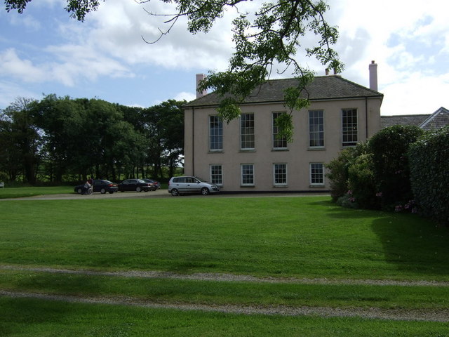
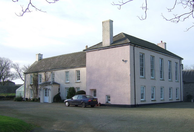
Tregwynt Mansion

Tregwynt Mansion is a house in the parish of Granston in Pembrokeshire, Wales. The Tregwynt Hoard was found during renovations in 1996. == Location... ==

Tregwynt Hoard

The Tregwynt Hoard is a mid-17th-century hoard of coins found at Tregwynt Mansion near Fishguard in Pembrokeshire, Wales, in 1996. The hoard is now in...
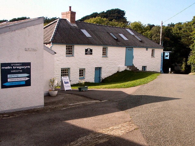
Melin Tregwynt

Melin Tregwynt (Tregwynt Mill) is a woollen mill in the hamlet of Tregwynt in the parish of Granston, Pembrokeshire, Wales. A mill has stood on this site...

Trefasser

Trefasser (variations: Tref-Asser, or Trêf Asser, or Asserton; translation: "town" of "Asser") is a hamlet, located to the west of Fishguard in western...

Granston

Granston (Welsh: Treopert) is a hamlet and parish in Pembrokeshire, Wales. The parish was in the Hundred of Dewisland and includes the settlements of Llangloffan...

Strumble Head - Llechdafad Cliffs

Strumble Head - Llechdafad Cliffs is a Site of Special Scientific Interest (SSSI) in Pembrokeshire, South Wales. It has been designated as a SSSI since...

Abercastle

Abercastle (Welsh: Abercastell) is a village in Pembrokeshire, Wales. Abercastle has a working harbour which is managed by Abercastle Boat Owners Association...

Have you been to Llech Dafad?

Leave your review of Llech Dafad below (or comments, questions and feedback).