Angle Bay

Bay in Pembrokeshire

Wales

Angle Bay

Angle Point View from Angle Point looking east towards the Texaco refinery
Angle Point Credit: John Smitten

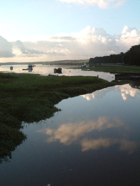
Angle Bay is a picturesque natural harbor located in the county of Pembrokeshire, Wales. Situated on the western side of the Milford Haven Waterway, the bay offers stunning views and a peaceful environment for visitors to enjoy.

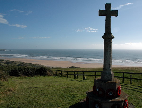
The bay is surrounded by rolling hills and rugged cliffs, creating a scenic backdrop for its sandy beach and calm waters. The beach itself stretches for approximately 2 kilometers and is a popular spot for sunbathing, swimming, and picnicking. At low tide, the shallow waters reveal extensive mudflats, providing a habitat for a variety of bird species, making it a haven for birdwatchers.

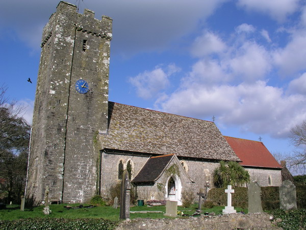
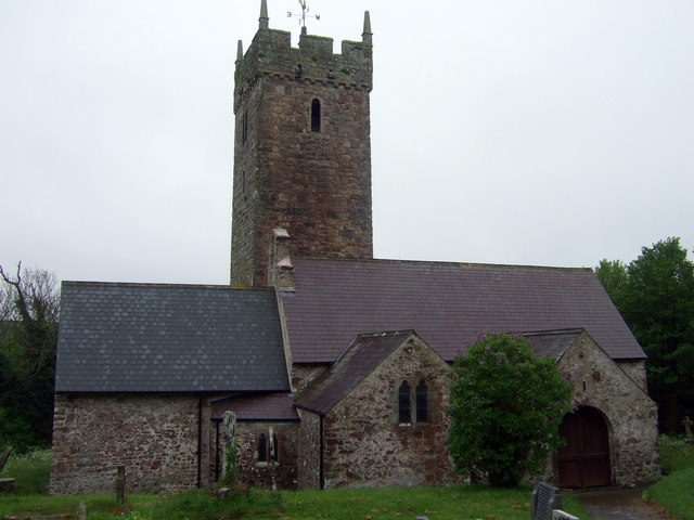
Angle Bay is also home to a small village called Angle, which sits on the eastern side of the bay. The village has a rich history, with evidence of settlements dating back to the Neolithic period. Visitors can explore the historic St. Mary's Church, which dates back to the 13th century and offers insight into the area's past.

For those seeking outdoor activities, Angle Bay offers excellent opportunities for kayaking, paddleboarding, and sailing. The calm waters and scenic surroundings make it an ideal spot for water sports enthusiasts of all levels.

Overall, Angle Bay provides a tranquil and idyllic setting for visitors to enjoy the natural beauty and rich history of Pembrokeshire. Whether it's relaxing on the beach, exploring the village, or partaking in water sports, there is something for everyone to enjoy in this charming bay.

If you have any feedback on the listing, please let us know in the comments section below.

Angle Bay Images

Images are sourced within 2km of 51.682486/-5.0623735 or Grid Reference SM8802. Thanks to Geograph Open Source API. All images are credited.

Angle Point View from Angle Point looking east towards the Texaco refinery
Angle Point
View from Angle Point looking east towards the Texaco refinery
Angle Bay An inlet of Angle Bay near the village of Angle.
Angle Bay
An inlet of Angle Bay near the village of Angle.
Back to Nature Don't know what used to be on this site. It's fenced off with barbed wire. Looked like it might have been military though it could also have been to do with the nearby oil refineries.
Back to Nature
Don't know what used to be on this site. It's fenced off with barbed wire. Looked like it might have been military though it could also have been to do with the nearby oil refineries.
Former refinery pier, Milford Haven Pier that supplied the closed Exxon refinery. Much activity here now, including work on pipes. Unsure if demolition work or that the pier is now used by another enterprise. Stack Rock fort in the distance.
Former refinery pier, Milford Haven
Pier that supplied the closed Exxon refinery. Much activity here now, including work on pipes. Unsure if demolition work or that the pier is now used by another enterprise. Stack Rock fort in the distance.
Old refinery pier Pipe sections on the old Exxon refinery pier. There is a lot of work going on here, floating cranes, hard hats swarming over the remains of the loading pier. Not sure if it's being demolished, or used for another purpose.  My guess is that these sections are awaiting offloading.
Milford Haven is a very fine deepwater harbour, hence the oil industry. A pier like this could find new uses, but as there is nearly 3km of it, upkeep could be a problem without the backing of "Big Oil".
Old refinery pier
Pipe sections on the old Exxon refinery pier. There is a lot of work going on here, floating cranes, hard hats swarming over the remains of the loading pier. Not sure if it's being demolished, or used for another purpose. My guess is that these sections are awaiting offloading. Milford Haven is a very fine deepwater harbour, hence the oil industry. A pier like this could find new uses, but as there is nearly 3km of it, upkeep could be a problem without the backing of "Big Oil".
Oil terminal, Popton Point One of the two Texaco piers.
Oil terminal, Popton Point
One of the two Texaco piers.
Tanker, Popton point Smallish tanker, probably loading with refined products from the Texaco refinery
Tanker, Popton point
Smallish tanker, probably loading with refined products from the Texaco refinery
Oil jetty Loading/unloading for the Total refinery, Milford Haven
Oil jetty
Loading/unloading for the Total refinery, Milford Haven
War Memorial at Freshwater West
Angle Church
Angle Church
RNLI Lifeboat house at Angle The present lifeboat here (may 2007) is an all weather "Tyne" class boat , "The Lady Rank"
RNLI Lifeboat house at Angle
The present lifeboat here (may 2007) is an all weather "Tyne" class boat , "The Lady Rank"
Old lifeboat house at Angle Situated just to the west of the new station
Old lifeboat house at Angle
Situated just to the west of the new station
Ancient Tower, Angle This ancient tower is next to Castle Farm on a track to the rear of the village of Angle. It is a few years now since I visited it. It is (or at least was) open to the public and I was able to look around inside including climbing stairs to an upper floor and there are some informative plaques. Despite this I have been able to find nothing about it on the web.
The tower is just north of the gridline and the photo was taken from practically astride it by my estimation.
See also a close-up of the tower here <a href="https://www.geograph.org.uk/photo/478401">SM8603 : The Tower, Angle</a>
Ancient Tower, Angle
This ancient tower is next to Castle Farm on a track to the rear of the village of Angle. It is a few years now since I visited it. It is (or at least was) open to the public and I was able to look around inside including climbing stairs to an upper floor and there are some informative plaques. Despite this I have been able to find nothing about it on the web. The tower is just north of the gridline and the photo was taken from practically astride it by my estimation. See also a close-up of the tower here SM8603 : The Tower, Angle
The Tower, Angle A close-up picture of the <a href="https://www.geograph.org.uk/photo/478398">SM8603 : Ancient Tower, Angle</a>. The tower is on a track that runs roughly parallel and to the north of the main lane through the village of Angle. It is situated next to Castle Farm, though I think this structure was never more than a fortified house as opposed to a castle.
The Tower, Angle
A close-up picture of the SM8603 : Ancient Tower, Angle. The tower is on a track that runs roughly parallel and to the north of the main lane through the village of Angle. It is situated next to Castle Farm, though I think this structure was never more than a fortified house as opposed to a castle.
Grazing land to oil refinery View along the line of a footpath to Broomhill Farm with the Texaco refinery at Rhoscrowther dominating the scene.
Grazing land to oil refinery
View along the line of a footpath to Broomhill Farm with the Texaco refinery at Rhoscrowther dominating the scene.
Rough grazing land and Popton refinery Gleaming in the afternoon sunshine.
Rough grazing land and Popton refinery
Gleaming in the afternoon sunshine.
Oil terminal, Popton Point Oil tanker moored at the oil terminal off Popton Point, Milford Haven.
Oil terminal, Popton Point
Oil tanker moored at the oil terminal off Popton Point, Milford Haven.
Rhoscrowther: Texaco Oil refinery jetty An oil product tanker, the deadweight 14,845 tonne Bro Designer, built in 2006 and owned by the Swedish company Broström, is moored alongside the western end of one of the Texaco refinery jetties. Popton Point is the headland behind from which the jetty has been built.
Rhoscrowther: Texaco Oil refinery jetty
An oil product tanker, the deadweight 14,845 tonne Bro Designer, built in 2006 and owned by the Swedish company Broström, is moored alongside the western end of one of the Texaco refinery jetties. Popton Point is the headland behind from which the jetty has been built.
Show me another place!

Angle Bay is located at Grid Ref: SM8802 (Lat: 51.682486, Lng: -5.0623735)

Unitary Authority: Pembrokeshire

Police Authority: Dyfed Powys

What 3 Words

///flies.habits.closed. Near Milford Haven, Pembrokeshire

Nearby Locations

Angle Bay

Related Wikis

Angle Lifeboat Station

Angle Lifeboat Station, Angle, Pembrokeshire, Wales, first opened in 1868 after a request from the local Coastguard for a lifeboat station to be opened...
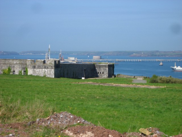
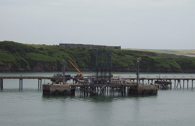
Popton Fort

Popton Fort, a Grade II* Listed Building, is a Palmerston fort completed in 1864 as part of the inner line of defence of Milford Haven together with Fort...

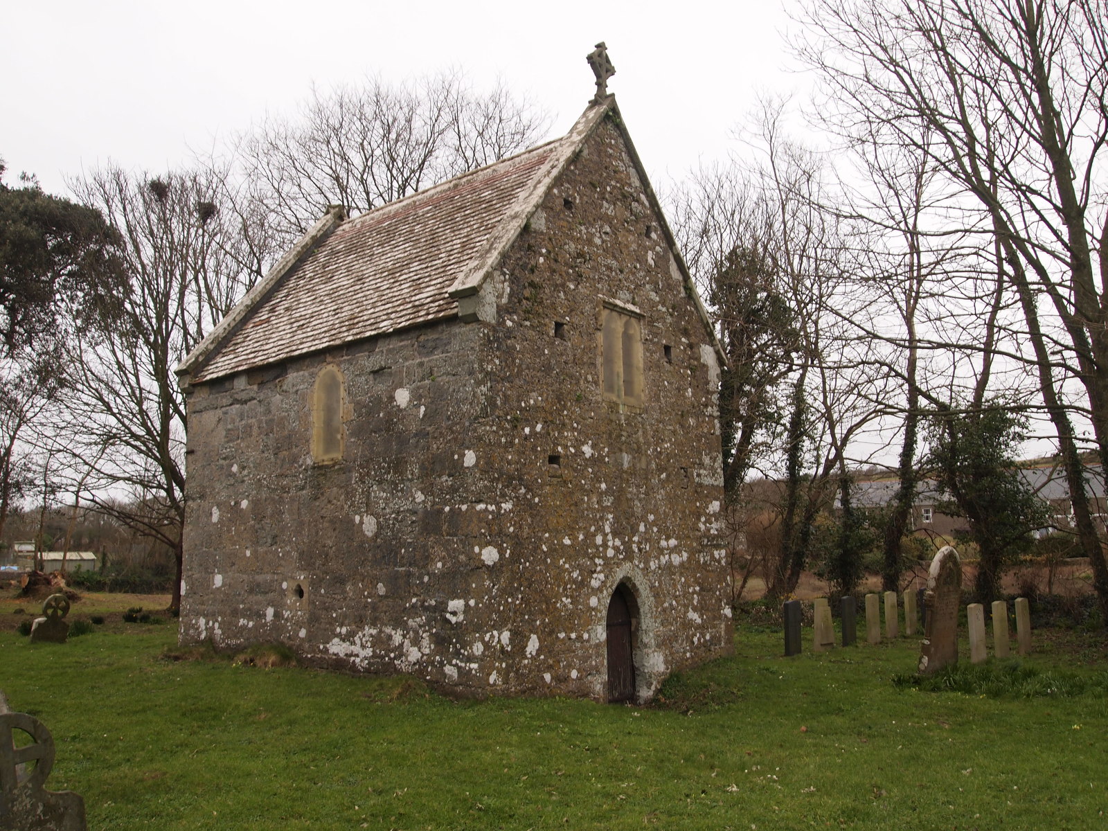
Sailors' Chapel, Angle

Sailors' Chapel, Seamen's Chapel or Fishermen's Chapel is a Grade I listed building in Angle, Pembrokeshire, Wales. The chapel, which is dedicated to St...

Angle, Pembrokeshire

Angle (Welsh: Angl) is a village, parish and community on the southern side of the entrance to the Milford Haven Waterway in Pembrokeshire, Wales. The...

St Decuman's Church, Rhoscrowther

St Decuman's is a Grade I listed building in Rhoscrowther, Pembrokeshire, Wales. == History == The parish church is on a very early Christian site and...

Rhoscrowther

Rhoscrowther (Welsh: Rhoscrowdder) was a village, ecclesiastical parish and civil parish in Pembrokeshire, Wales on the south shore of the Milford Haven...
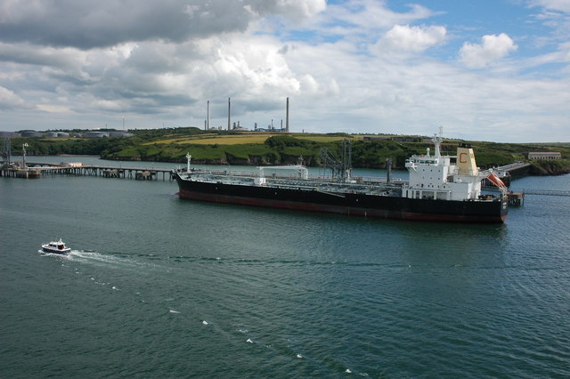
Pembroke Refinery

The Pembroke Refinery is an oil refinery situated on the Pembrokeshire coast in Wales at Rhoscrowther in the community of Angle. It first came on stream...

Angle Peninsula Coast

The Angle Peninsula Coast on the southern side of the entrance to the Milford Haven Waterway in Pembrokeshire, Wales, is a Site of Special Scientific Interest...

Nearby Amenities

Located within 500m of 51.682486,-5.0623735
Angle Bay
Name Cy: Bae Angle
Natural: bay
Lat/Long: 51.6832301/-5.0654997
The data included in this document is from www.openstreetmap.org. The data is made available under ODbL.

Have you been to Angle Bay?

Leave your review of Angle Bay below (or comments, questions and feedback).