Uamhag nan Gobhar

Bay in Ross-shire

Scotland

Uamhag nan Gobhar

Rubh' a' Choin
Rubh' a' Choin Credit: Mick Garratt

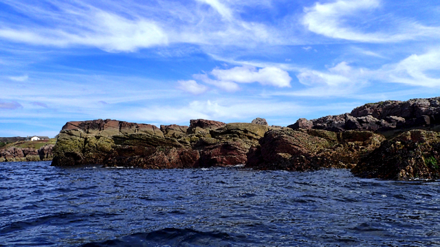
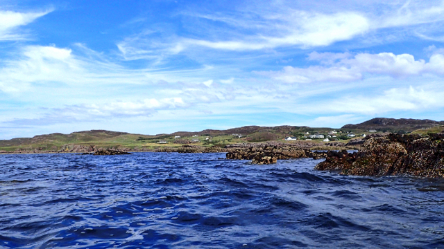
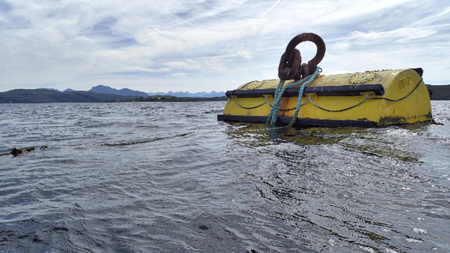
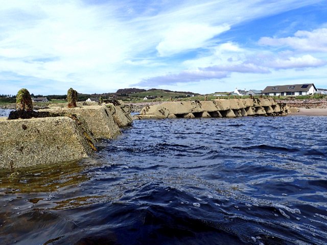
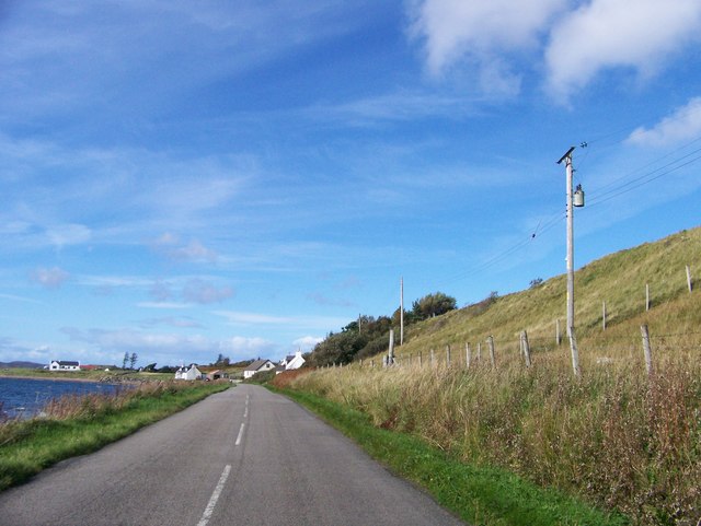
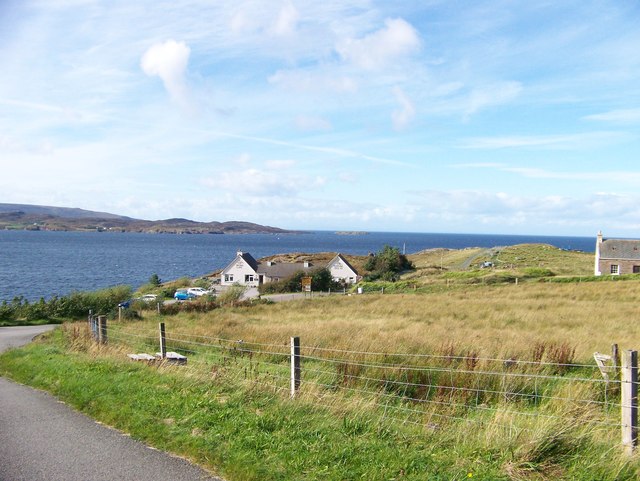
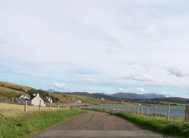
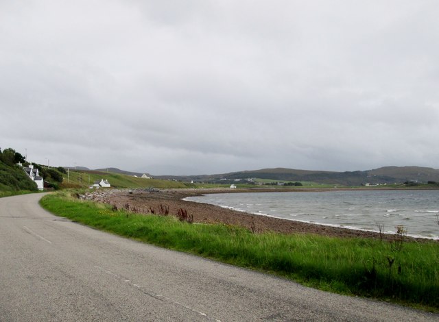
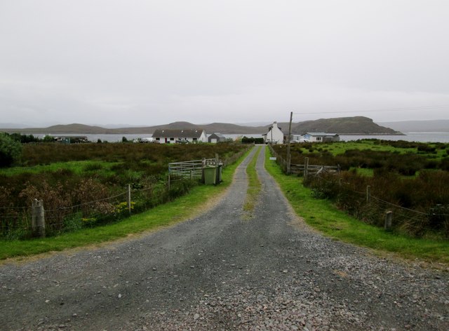
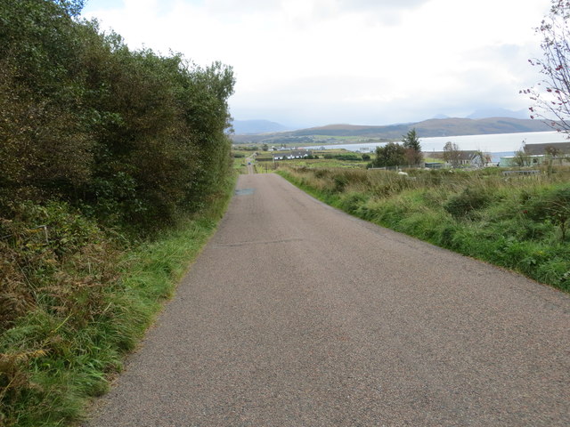
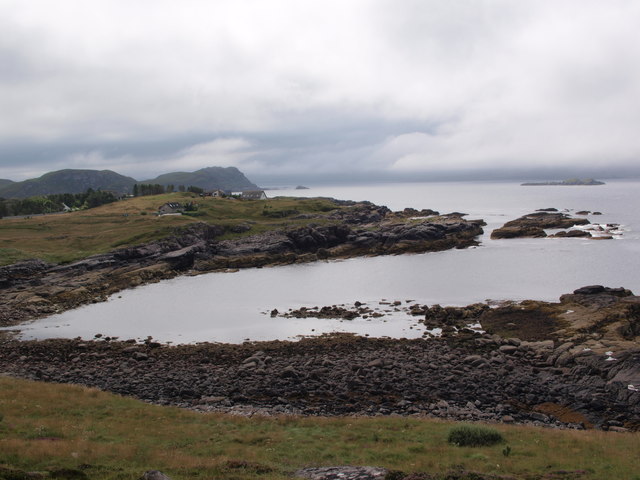
Uamhag nan Gobhar, located in Ross-shire, Scotland, is a picturesque bay that offers visitors breathtaking views and a serene atmosphere. The bay is nestled along the northwestern coast of Scotland, near the village of Ullapool. With its rugged cliffs, crystal-clear waters, and golden sandy beaches, Uamhag nan Gobhar is a hidden gem for nature enthusiasts and beach lovers alike.

The bay is surrounded by lush green hills, providing a dramatic backdrop to the stunning coastal scenery. The area is rich in wildlife, making it a popular spot for birdwatching and marine life observation. Visitors may be lucky enough to spot seals, dolphins, and various seabirds while exploring the bay.

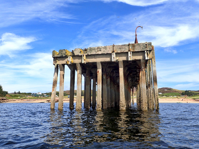
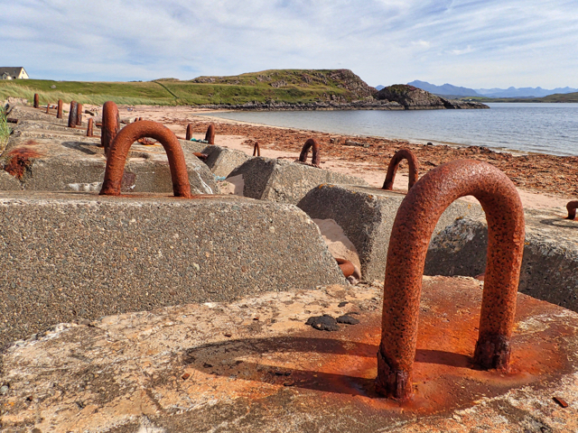
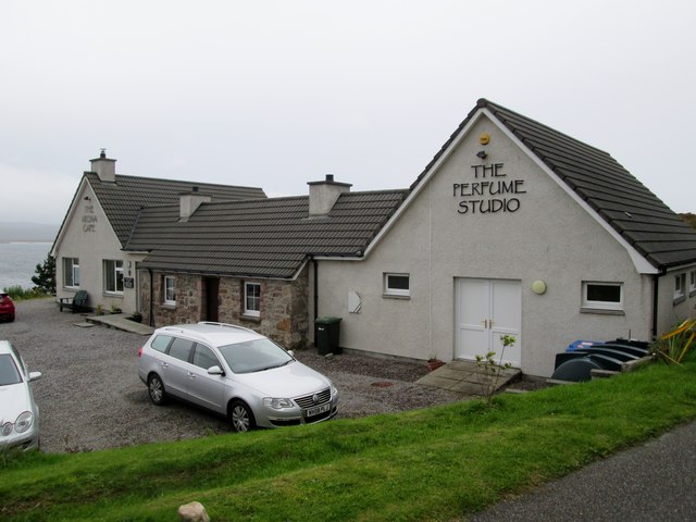
Uamhag nan Gobhar is also known for its historical significance. The bay was once a hub for fishing and trade, and remnants of old fishing huts and piers can still be seen along the shore. These remnants serve as a reminder of the area's maritime heritage.

For those seeking outdoor adventure, the bay offers opportunities for kayaking, paddleboarding, and sailing. The calm waters and gentle waves make it an ideal spot for beginners and experienced water sports enthusiasts alike. Hiking trails can also be found in the surrounding area, allowing visitors to explore the coastal cliffs and take in the panoramic views of the bay.

In summary, Uamhag nan Gobhar in Ross-shire, Scotland, is a stunning bay that combines natural beauty, historical significance, and outdoor recreational opportunities. Whether one is seeking tranquility, wildlife encounters, or thrilling activities, this bay has something to offer for everyone.

If you have any feedback on the listing, please let us know in the comments section below.

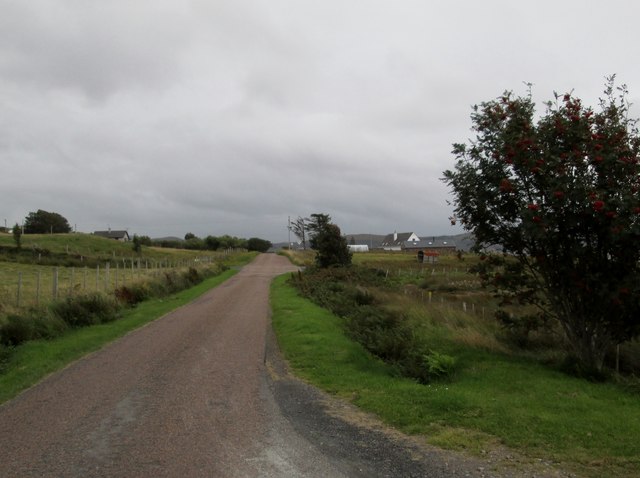
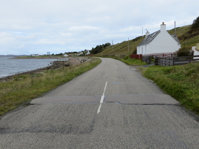
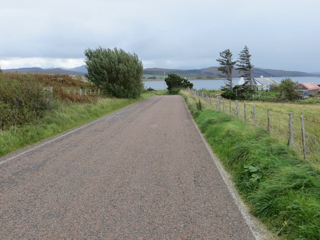
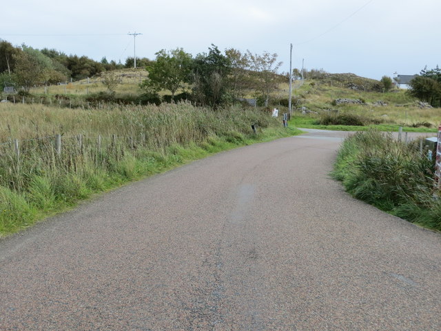
Uamhag nan Gobhar Images

Images are sourced within 2km of 57.846979/-5.6365652 or Grid Reference NG8489. Thanks to Geograph Open Source API. All images are credited.

Rubh' a' Choin
Rubh' a' Choin
Sgeirean Mòra
Sgeirean Mòra
Remains of Jetty, Mellon Charles I first visited Loch Ewe in 2013 and was amazed on discovering its role in World War II. An unassuming role modestly portrayed in a few information boards scattered around its coast. WW2 remains abound, anti aircraft gun emplacements, military buildings and foundations. Loch Ewe is a deep sea loch and during the war it was used to muster merchant shipping in relative safety before heading off with vital supplies to Murmansk in war torn Russia, in what has become known as the Arctic Convoys. The convoys, of up to 40 ships with Navy escorts, sailed close to the Arctic pack ice in an attempt to avoid German U Boats. Many were unsuccessful.

To protect the ships while in Loch Ewe an anti submarine net or boom was laid across the loch at its narrowest point, about 3km. Barrage balloons and anti aircraft guns provided protection against airborne attack. During the war military personnel outnumbered the local population by 3:1.

Mellon Charles was the Boom Defence Depot. The most visible remains is this concrete jetty forming an island that has been adopted by a colony of terns which took to divebombing us as we paddled past.

The seas around Mellon Charles are particularly rich in marine life and have been designated by the Scottish Wildlife Trust as part of their Snorkel Trail. Yet in spite this accolade the beach was exceptionally quiet. Golden sands but marred only by a thick tide mark of drying kelp. Only one other car arrived, an ex-serviceman looking up old haunts. He was stationed here for two weeks in 1972 as part of the Royal Marines Arctic warfare section.
Remains of Jetty, Mellon Charles
I first visited Loch Ewe in 2013 and was amazed on discovering its role in World War II. An unassuming role modestly portrayed in a few information boards scattered around its coast. WW2 remains abound, anti aircraft gun emplacements, military buildings and foundations. Loch Ewe is a deep sea loch and during the war it was used to muster merchant shipping in relative safety before heading off with vital supplies to Murmansk in war torn Russia, in what has become known as the Arctic Convoys. The convoys, of up to 40 ships with Navy escorts, sailed close to the Arctic pack ice in an attempt to avoid German U Boats. Many were unsuccessful. To protect the ships while in Loch Ewe an anti submarine net or boom was laid across the loch at its narrowest point, about 3km. Barrage balloons and anti aircraft guns provided protection against airborne attack. During the war military personnel outnumbered the local population by 3:1. Mellon Charles was the Boom Defence Depot. The most visible remains is this concrete jetty forming an island that has been adopted by a colony of terns which took to divebombing us as we paddled past. The seas around Mellon Charles are particularly rich in marine life and have been designated by the Scottish Wildlife Trust as part of their Snorkel Trail. Yet in spite this accolade the beach was exceptionally quiet. Golden sands but marred only by a thick tide mark of drying kelp. Only one other car arrived, an ex-serviceman looking up old haunts. He was stationed here for two weeks in 1972 as part of the Royal Marines Arctic warfare section.
Mellon Charles Beach
Ship mooring point An anchorage for ocean going ships.
Ship mooring point
An anchorage for ocean going ships.
Slipway at Ormiscaig Recycling the concrete anchor points used to hold the submarine netting across Loch Ewe.
Slipway at Ormiscaig
Recycling the concrete anchor points used to hold the submarine netting across Loch Ewe.
Shore road near Ormiscaig
The Perfume Studio at Mellon Charles
Leaving Ormiscaig heading to Aultbea
Perfume  Studio  Mellon  Charles At the end of the minor road from Aultbea, but well worth the trip for an excellent lunch in the cafe
Perfume Studio Mellon Charles
At the end of the minor road from Aultbea, but well worth the trip for an excellent lunch in the cafe
Road  following  loch  side  toward  Aultbea
Road following loch side toward Aultbea
Track  to  crofts  in  Ormiscaig The water beyond is Loch Ewe and the land beyond is the Isle of Ewe
Track to crofts in Ormiscaig
The water beyond is Loch Ewe and the land beyond is the Isle of Ewe
Minor  road  passing  through  Ormiscaig One of a number of crofting community's along this road
Minor road passing through Ormiscaig
One of a number of crofting community's along this road
Road beside Loch Ewe entering Ormiscaig Looking north-westward.
Road beside Loch Ewe entering Ormiscaig
Looking north-westward.
Road near Ormiscaig Looking south-eastward.
Road near Ormiscaig
Looking south-eastward.
Road at Mellon Charles Looking south-eastward.
Road at Mellon Charles
Looking south-eastward.
Road between Mellon Charles and Ormiscaig Looking south-eastward.
Road between Mellon Charles and Ormiscaig
Looking south-eastward.
Camus nan Gobhar The picture looks south across this wee bay from just behind the Perfume Studio, on a day of sunshine between low clouds.
Camus nan Gobhar
The picture looks south across this wee bay from just behind the Perfume Studio, on a day of sunshine between low clouds.
Show me another place!

Uamhag nan Gobhar is located at Grid Ref: NG8489 (Lat: 57.846979, Lng: -5.6365652)

Unitary Authority: Highland

Police Authority: Highlands and Islands

What 3 Words

///letters.remaining.hasten. Near Gairloch, Highland

Related Wikis

Mellon Charles

Mellon Charles (Scottish Gaelic: Meallan Theàrlaich) is a remote crofting village on the north east shore of Loch Ewe near Gairloch in Wester Ross, in...

Ormiscaig

Ormiscaig (Scottish Gaelic: Ormasgaig) is a remote crofting village on the north east shore of Loch Ewe in Achnasheen, Ross-shire, Scottish Highlands and...

Loch Ewe

Loch Ewe (Scottish Gaelic: Loch Iùbh) is a sea loch in the region of Wester Ross in the Northwest Highlands of Scotland. The shores are inhabited by a...

Isle of Ewe

The Isle of Ewe (Scottish Gaelic: Eilean Iùbh) is a small Scottish island on the west coast of Ross and Cromarty. The island is inhabited by a single family...

Aultbea

Aultbea (Gaelic: An t-Allt Beithe) is a small coastal fishing village in the North-West Highlands of Scotland. It is situated on the southeast shore of...

Cove, Highland

Cove is a remote hamlet located on the northwestern shore of the sea loch Loch Ewe, and 8 mi (13 km) northwest of Poolewe in Ross-shire, Scottish Highlands...

Loch Ewe distillery

Loch Ewe distillery in Drumchork near Aultbea in the Scottish Highlands was the smallest legally operated distillery in Scotland. It was set up in 2005...

Inverasdale

Inverasdale (Scottish Gaelic: Inbhir Àsdail) is a hamlet in the Northwest Highlands of Scotland, located by Loch Ewe, in the region of Wester Ross. �...

Nearby Amenities

Located within 500m of 57.846979,-5.6365652
Source: PGS
Lat/Long: 57.8443305/-5.6415679
Created By: almien_coastlines
Source: PGS
Lat/Long: 57.844708/-5.641027
Created By: almien_coastlines
Source: PGS
Lat/Long: 57.844845/-5.640556
Created By: almien_coastlines
Source: PGS
Lat/Long: 57.844855/-5.640077
Source: PGS
Lat/Long: 57.8449312/-5.6394238
Source: PGS
Lat/Long: 57.845052/-5.6391311
Source: PGS
Lat/Long: 57.8452809/-5.638946
Source: PGS
Lat/Long: 57.8456655/-5.6386115
Source: PGS
Lat/Long: 57.8463807/-5.6381218
Created By: almien_coastlines
Source: PGS
Lat/Long: 57.846824/-5.637819
Source: PGS
Lat/Long: 57.8470545/-5.6374648
Source: PGS
Lat/Long: 57.8471181/-5.6366764
Source: PGS
Lat/Long: 57.8471244/-5.6361329
Source: PGS
Lat/Long: 57.8475662/-5.6358104
Source: PGS
Lat/Long: 57.8479762/-5.6353087
Source: PGS
Lat/Long: 57.8482432/-5.6345383
Created By: almien_coastlines
Source: PGS
Lat/Long: 57.848182/-5.634076
Source: PGS
Lat/Long: 57.8479731/-5.63372
Created By: almien_coastlines
Source: PGS
Lat/Long: 57.847685/-5.63332
Created By: almien_coastlines
Source: PGS
Lat/Long: 57.84744/-5.632822
Created By: almien_coastlines
Source: PGS
Lat/Long: 57.846427/-5.632267
Source: PGS
Lat/Long: 57.8462154/-5.6321791
Source: PGS
Lat/Long: 57.8458848/-5.6323344
Source: PGS
Lat/Long: 57.8451855/-5.6324897
Source: PGS
Lat/Long: 57.8449725/-5.6327644
Source: PGS
Lat/Long: 57.8446197/-5.6329257
Source: PGS
Lat/Long: 57.8444004/-5.6331885
Source: PGS
Lat/Long: 57.844216/-5.6333676
Source: PGS
Lat/Long: 57.8435962/-5.6338216
Source: PGS
Lat/Long: 57.843345/-5.6337678
The data included in this document is from www.openstreetmap.org. The data is made available under ODbL.

Have you been to Uamhag nan Gobhar?

Leave your review of Uamhag nan Gobhar below (or comments, questions and feedback).