Fearnach Bay

Bay in Argyllshire

Scotland

Fearnach Bay

Horses grazing in field
Horses grazing in field Credit: Steven Brown

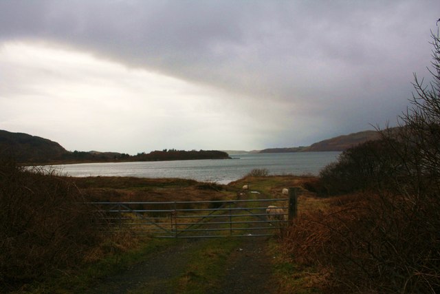
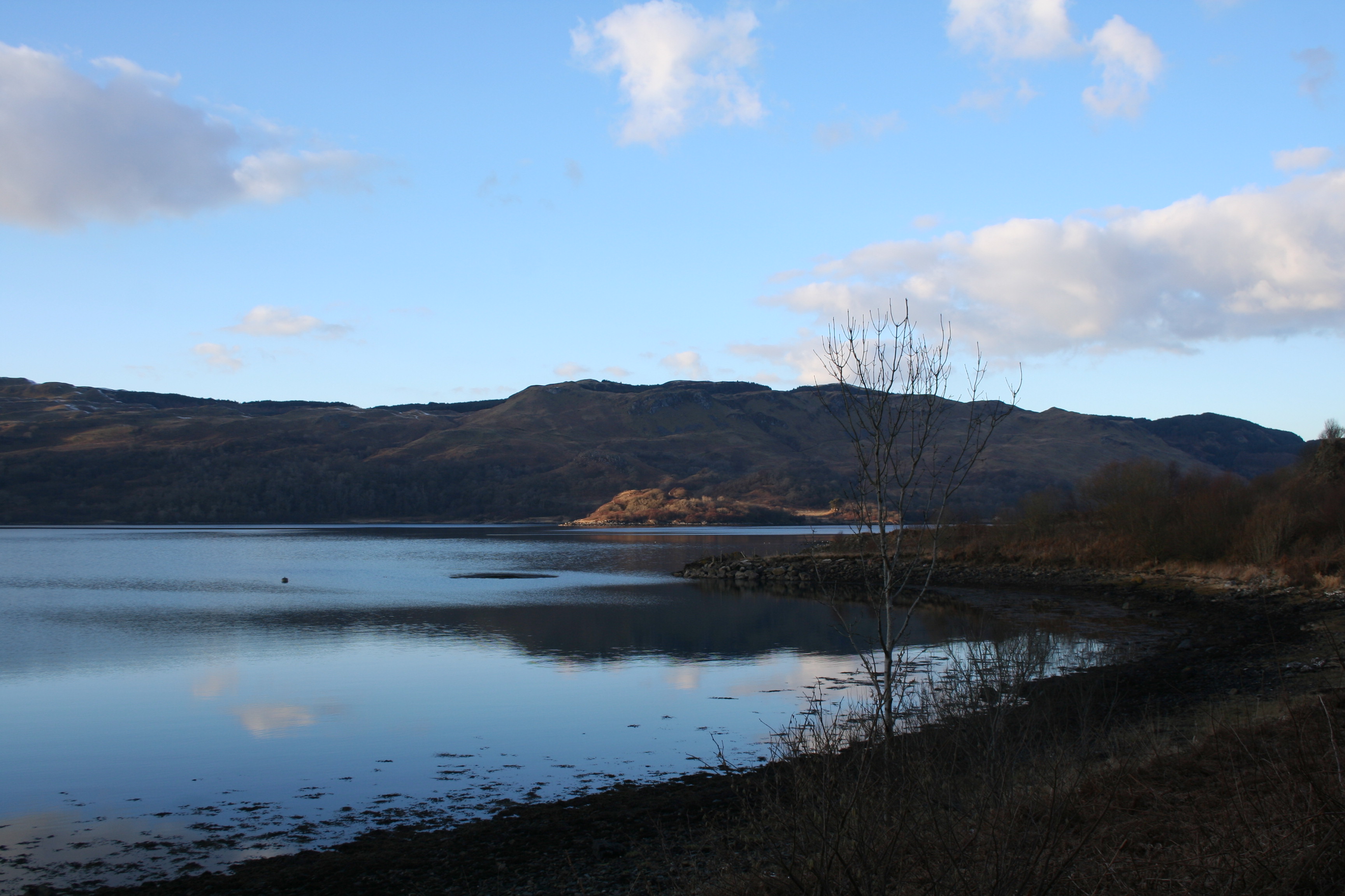
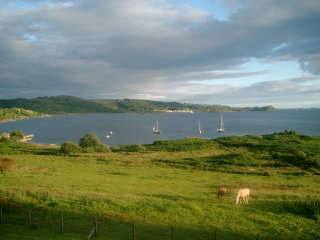
Fearnach Bay, located in Argyllshire, is a picturesque coastal bay situated on the western coast of Scotland. Known for its stunning natural beauty and tranquility, the bay offers visitors a peaceful retreat amidst its idyllic surroundings.

The bay is characterized by its pristine sandy beaches, crystal-clear waters, and rocky outcrops that dot the shoreline. It is a haven for nature enthusiasts and outdoor lovers, with opportunities for activities such as swimming, sunbathing, and exploring the diverse marine life.

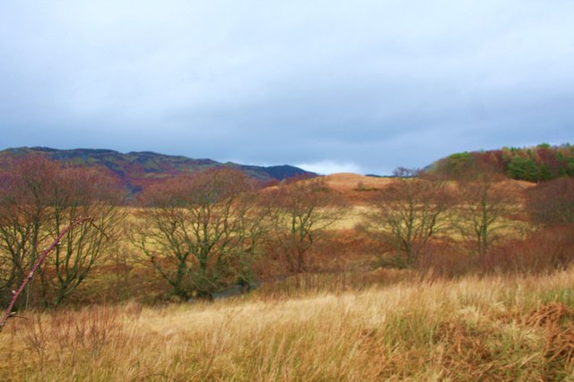
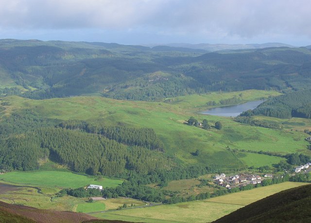
Surrounded by lush green hills and rolling landscapes, Fearnach Bay provides breathtaking views of the surrounding countryside. The bay is also home to a variety of bird species, making it a popular spot for birdwatchers. Seals can often be spotted basking on the rocks, adding to the bay's charm.

For those interested in history, Fearnach Bay boasts ancient ruins and historical sites, offering a glimpse into the area's rich cultural heritage. The bay is also conveniently located near several attractions, including charming villages, castles, and hiking trails, providing ample opportunities for exploration.

Visitors to Fearnach Bay can enjoy a tranquil getaway, away from the hustle and bustle of city life. With its natural beauty and serene atmosphere, Fearnach Bay is an ideal destination for those seeking relaxation and a connection with nature.

If you have any feedback on the listing, please let us know in the comments section below.

Fearnach Bay Images

Images are sourced within 2km of 56.26685/-5.5025031 or Grid Reference NM8313. Thanks to Geograph Open Source API. All images are credited.

Horses grazing in field
A816 near Glenmore
A816 near Glenmore
Hill track below Creag Fearna
Hill track near Cruach nam Fearna
Overgrown forestry track
Junction of overgrown forestry tracks
Overgrown forestry track near Cruach nam Fearna
Overgrown forestry track
Sheep and Track by Kames Sheep grazing by Kames Bay.
Sheep and Track by Kames
Sheep grazing by Kames Bay.
Trees by the Burn Trees growing by the Eas Mhic Aidh.
Trees by the Burn
Trees growing by the Eas Mhic Aidh.
House on the Hill A house on the hillside overlooking the hotel at Kilmelford.
House on the Hill
A house on the hillside overlooking the hotel at Kilmelford.
Road leading to Ardanstur Farm near Melfort
Single track road heading for Melfort in Argyll Below Creag an Sturra.
Single track road heading for Melfort in Argyll
Below Creag an Sturra.
Road heading along the banks of Loch na Cille
Pleasure craft at moor on Loch na Cille
Melfort Pier When constructed early in the 19th century this was known as Fearnach Pier. The water here was deep enough to enable deliveries of the raw materials that were needed for the manufacture of gunpowder at the nearby Melfort Estate and to distribute the finished product. A tramway connected the pier with the gunpowder works.

In recent years, Melfort Pier has been used for leisure-based activities, including yachting, wind-surfing and fishing.
Melfort Pier
When constructed early in the 19th century this was known as Fearnach Pier. The water here was deep enough to enable deliveries of the raw materials that were needed for the manufacture of gunpowder at the nearby Melfort Estate and to distribute the finished product. A tramway connected the pier with the gunpowder works. In recent years, Melfort Pier has been used for leisure-based activities, including yachting, wind-surfing and fishing.
Loch na Cille At the head of Loch Melfort
Loch na Cille
At the head of Loch Melfort
Show me another place!

Fearnach Bay is located at Grid Ref: NM8313 (Lat: 56.26685, Lng: -5.5025031)

Unitary Authority: Argyll and Bute

Police Authority: Argyll and West Dunbartonshire

What 3 Words

///backswing.lizard.slices. Near Oban, Argyll & Bute

Related Wikis

Kilmelfort Hydro-Electric Scheme

Kilmelfort Hydro-Electric Scheme is a small-scale hydro-electric power station, built by the North of Scotland Hydro-Electric Board and commissioned in...

Kilmelford

Kilmelford (Scottish Gaelic: Cill Mheallaird) is a village in Argyll and Bute, Scotland. It is situated near the head of the west coast sea loch, Loch...

Kames Bay, Loch Melfort

Kames Bay is small remote tidal north by northwest facing coastal embayment forming part of the southern coast of Loch Melfort within Argyll and Bute,...

Arduaine

Arduaine (Scottish Gaelic: An Àird Uaine, lit. 'green/fertile promontory or headland', pronounced "Ard oo an-ye") is a village in Argyll and Bute, Scotland...

Nearby Amenities

Located within 500m of 56.26685,-5.5025031
Passing Place
Lat/Long: 56.2669343/-5.4951487
Source: PGS
Lat/Long: 56.2646338/-5.497575
Restaurant
Melfort Mermaid
Lat/Long: 56.2697408/-5.5030727
Seamark Information: Shown Apr. 1 to Oct. 31
Seamark Light Character: F
Seamark Light Colour: red
Seamark Light Height: 6
Seamark Light Range: 3
Seamark Light Reference: A 4205
Seamark Status: occasional
Seamark Type: light_minor
Source: US NGA Pub. 114. 2011-05-26.
Lat/Long: 56.2690833/-5.50305
Addr City: Melfort Village
Addr Housename: Pier House 1
Entrance: yes
Lat/Long: 56.2702788/-5.504489
Addr City: Melfort Village
Addr Housename: Pier House 2
Entrance: yes
Lat/Long: 56.2702909/-5.5043336
Power: pole
Lat/Long: 56.2700224/-5.4984551
Material: wood
Power: pole
Lat/Long: 56.2711088/-5.5004405
Power: pole
Lat/Long: 56.2701799/-5.5071638
Passing Place
Lat/Long: 56.2662312/-5.4955466
Public Bookcase
Melfort Book Swap
Booth: K6
Disused Amenity: telephone
Man Made: telephone_box
Public Bookcase Type: phone_box
Lat/Long: 56.2702446/-5.5028549
The data included in this document is from www.openstreetmap.org. The data is made available under ODbL.

Have you been to Fearnach Bay?

Leave your review of Fearnach Bay below (or comments, questions and feedback).