Aber Dwyrain

Bay in Pembrokeshire

Wales

Aber Dwyrain

Solva harbour Low tide at Solva harbour, lime kilns on the far shore.
Solva harbour Credit: E Gammie

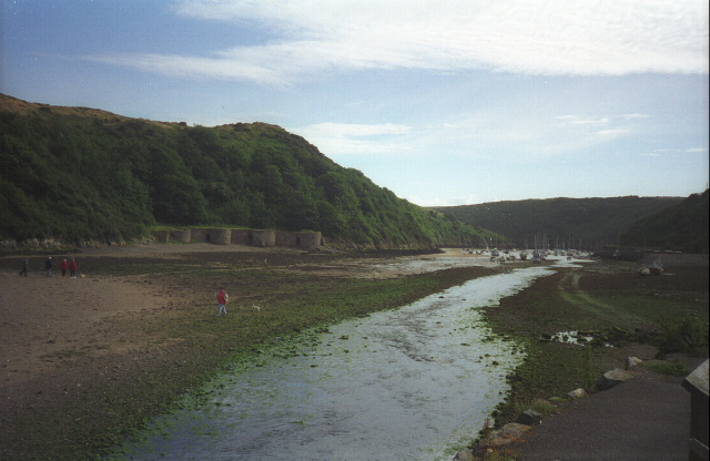
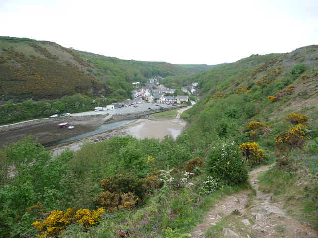
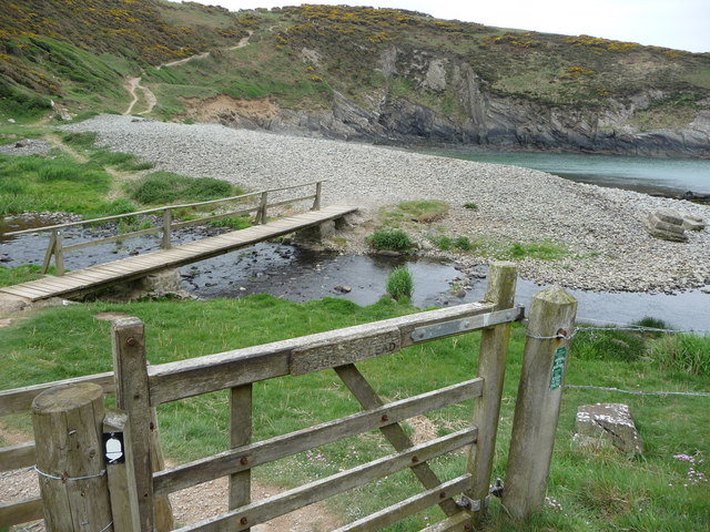
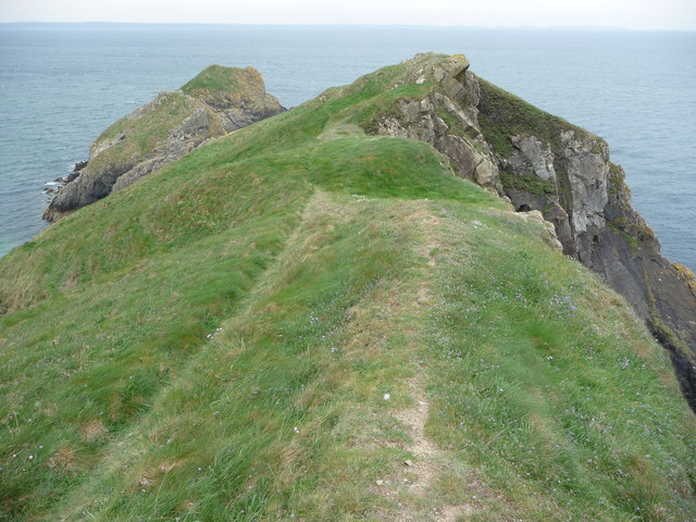
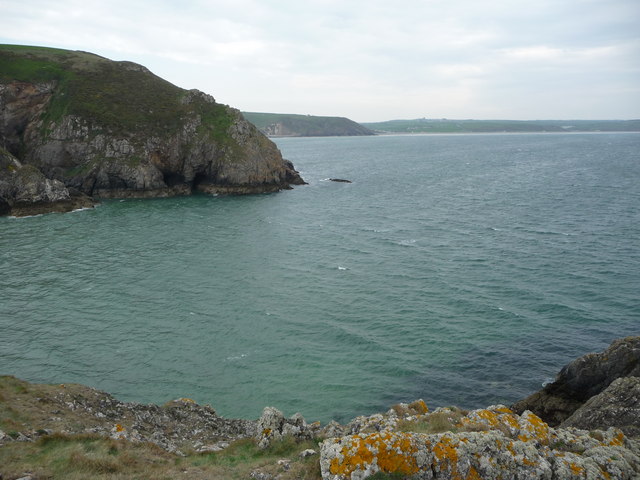
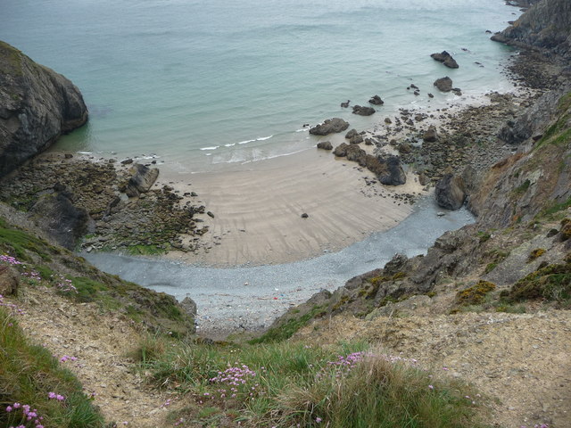
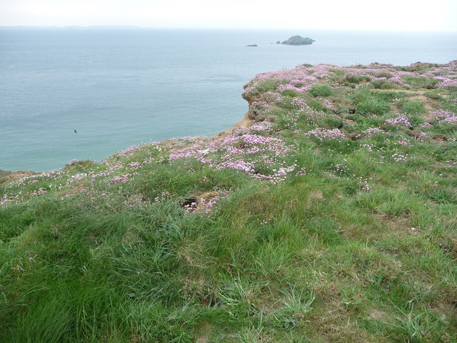
Aber Dwyrain, also known as East Aber, is a picturesque bay located on the eastern coast of Pembrokeshire, Wales. Nestled between the towns of Newport and Fishguard, this bay offers stunning views of the Irish Sea and is surrounded by rolling green hills.

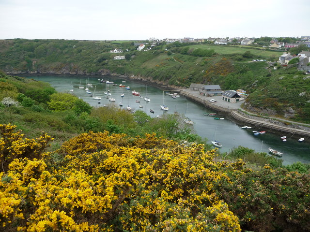
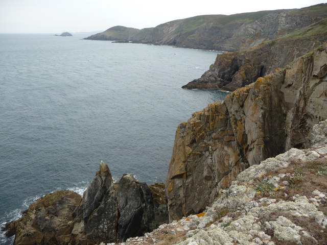
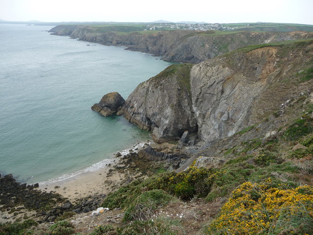
The bay itself features a crescent-shaped sandy beach, which stretches for approximately 1.5 kilometers at low tide. The beach is backed by high cliffs, adding to the area's natural beauty. The crystal-clear waters of Aber Dwyrain are perfect for swimming and other water activities, attracting both locals and tourists alike.

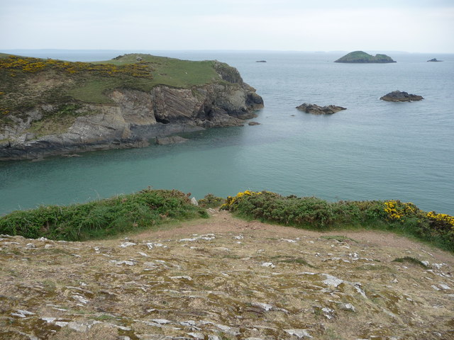
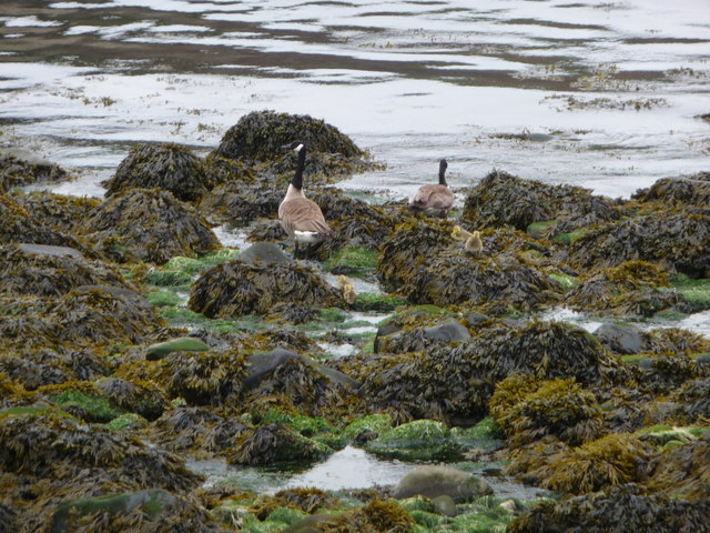
The bay is also a popular spot for wildlife enthusiasts, as it is home to a variety of seabirds and marine life. It is not uncommon to spot dolphins, seals, and even porpoises frolicking in the waters. The cliffs surrounding the bay are also important nesting sites for birds, including razorbills and guillemots.

Aber Dwyrain offers several amenities for visitors, including a car park, public toilets, and a café nearby. The bay is accessible via a short walk from the car park, making it convenient for families and those with limited mobility.

Overall, Aber Dwyrain is a hidden gem on the Pembrokeshire coastline, offering natural beauty, tranquility, and a chance to immerse oneself in the stunning Welsh coastal landscape.

If you have any feedback on the listing, please let us know in the comments section below.
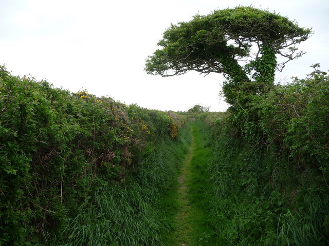
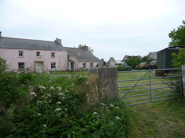
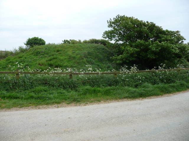
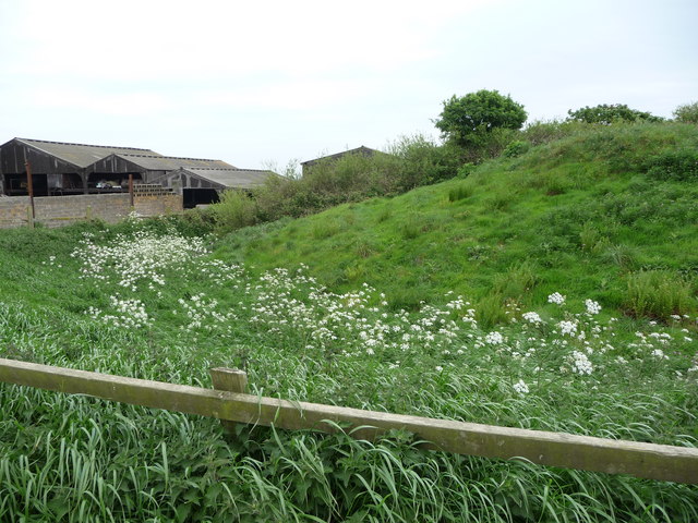
Aber Dwyrain Images

Images are sourced within 2km of 51.862823/-5.1759844 or Grid Reference SM8123. Thanks to Geograph Open Source API. All images are credited.

Solva harbour Low tide at Solva harbour, lime kilns on the far shore.
Solva harbour
Low tide at Solva harbour, lime kilns on the far shore.
Lower Solva from Gribin Lower Solva lies behind Solva Harbour, which itself is in a 'fjord-like' inlet in the coastline here. Gribin is also known as the Cribyn ridge locally.
Lower Solva from Gribin
Lower Solva lies behind Solva Harbour, which itself is in a 'fjord-like' inlet in the coastline here. Gribin is also known as the Cribyn ridge locally.
Solva harbour from Gribin The houses of Upper Solva lie above the inlet, some overlooking the picturesque harbour.
Solva harbour from Gribin
The houses of Upper Solva lie above the inlet, some overlooking the picturesque harbour.
Rocks and islands off Solva harbour Beyond Penrhyn Head are St. Elvis' Rock and Black Rock and out to sea is larger Green Scar with The Mare and Black Scar each side. Quite a coastline.
Rocks and islands off Solva harbour
Beyond Penrhyn Head are St. Elvis' Rock and Black Rock and out to sea is larger Green Scar with The Mare and Black Scar each side. Quite a coastline.
Gate and footbridge at Gwadn The pebbly storm beach here is interesting and it's a lovely spot.
Gate and footbridge at Gwadn
The pebbly storm beach here is interesting and it's a lovely spot.
Canada Geese with goslings on Gwadn This little family waddled off seawards at my approach, just as well as a dog off its lead came in a few minutes later.
Canada Geese with goslings on Gwadn
This little family waddled off seawards at my approach, just as well as a dog off its lead came in a few minutes later.
St. Elvis cromlech This Neolithic burial chamber is around 5,000 years old and sited between farm tracks. Saint Elvis was an Irish saint in the 6th century and baptised St. David and an old church dedicated to St. Elvis was sited nearby, now somewhere underneath St. Elvis Farm adjacent.
St. Elvis cromlech
This Neolithic burial chamber is around 5,000 years old and sited between farm tracks. Saint Elvis was an Irish saint in the 6th century and baptised St. David and an old church dedicated to St. Elvis was sited nearby, now somewhere underneath St. Elvis Farm adjacent.
St. Elvis cromlech One of the oldest man-made structures in Pembrokeshire lies sandwiched between farm tracks.
St. Elvis cromlech
One of the oldest man-made structures in Pembrokeshire lies sandwiched between farm tracks.
Footpath between St. Elvis Farm and Lochvane This narrow and quiet path between cow pastures is warm and sheltered and a haven for wildlife.
Footpath between St. Elvis Farm and Lochvane
This narrow and quiet path between cow pastures is warm and sheltered and a haven for wildlife.
Old farm at Lochvane A collection of classic Landy's outside but not much sign of life.
Old farm at Lochvane
A collection of classic Landy's outside but not much sign of life.
The motte of Pointz Castle Beside a farmyard this motte sits partly overgrown.
The motte of Pointz Castle
Beside a farmyard this motte sits partly overgrown.
The motte of Pointz Castle with ditch The ditch shows up as different vegetation.
The motte of Pointz Castle with ditch
The ditch shows up as different vegetation.
Dinas Fach A path wends down this narrow headland and offers excellent views up and down the coastline here.
Dinas Fach
A path wends down this narrow headland and offers excellent views up and down the coastline here.
The coastline between Dinas Fach and Solva An impressive stretch comprising numerous tall cliffs, small and medium sized bays and smaller inlets.
The coastline between Dinas Fach and Solva
An impressive stretch comprising numerous tall cliffs, small and medium sized bays and smaller inlets.
Part of Aber West and Dinas Fawr A medium sized bay with the headland jutting out and long Newgale Sands stretching out further around the coast eastward..
Part of Aber West and Dinas Fawr
A medium sized bay with the headland jutting out and long Newgale Sands stretching out further around the coast eastward..
Aber West bay looking west towards Solva It's easy to see how this section of coast is so popular with walkers.
Aber West bay looking west towards Solva
It's easy to see how this section of coast is so popular with walkers.
Bay near Solva The high tide line shows the usual collection of flotsam and jetsam, mainly plastic in various forms. Hardly surprising with all the traffic out to sea and inshore.
Bay near Solva
The high tide line shows the usual collection of flotsam and jetsam, mainly plastic in various forms. Hardly surprising with all the traffic out to sea and inshore.
Thrift growing on the cliff top near Solva Rabbits have colonised the fenced-off cliff edge and Thrift grows well here also, always a beautiful sight.
Thrift growing on the cliff top near Solva
Rabbits have colonised the fenced-off cliff edge and Thrift grows well here also, always a beautiful sight.
Show me another place!

Aber Dwyrain is located at Grid Ref: SM8123 (Lat: 51.862823, Lng: -5.1759844)

Unitary Authority: Pembrokeshire

Police Authority: Dyfed Powys

What 3 Words

///shrugging.warns.chosen. Near St Davids, Pembrokeshire

Related Wikis

Pembrokeshire Coast Path

The Pembrokeshire Coast Path (Welsh: Llwybr Arfordir Sir Benfro), often called the Pembrokeshire Coastal Path, is a designated National Trail in Pembrokeshire...

St Elvis, Pembrokeshire

St Elvis (Welsh: Llaneilfyw, [ɬanəilvəu]) is a parish in Pembrokeshire, Wales, about 4 miles (6 km) east of St David's. At 200 acres (81 ha) it is one...

Solva limekilns

The Solva limekilns are a row of disused limekilns in the harbour of the village of Solva, Pembrokeshire, Wales. The kilns have a Grade II heritage listing...

River Solva

The River Solva (Welsh: Afon Solfach) is a small river in Pembrokeshire, Wales. Its source is a few hundred metres southeast of Croesgoch and flows ten...

Nearby Amenities

Located within 500m of 51.862823,-5.1759844
Source: OS_Opendata_Vectormap_District
Lat/Long: 51.8621715/-5.1813935
Source: OS_Opendata_Vectormap_District
Lat/Long: 51.8622515/-5.1813316
Source: OS_Opendata_Vectormap_District
Lat/Long: 51.8623677/-5.1812534
Source: OS_Opendata_Vectormap_District
Lat/Long: 51.8625645/-5.1811362
Source: OS_Opendata_Vectormap_District
Lat/Long: 51.8626237/-5.1810047
Source: OS_Opendata_Vectormap_District
Lat/Long: 51.8626664/-5.1809562
Source: OS_Opendata_Vectormap_District
Lat/Long: 51.8627241/-5.1809613
Source: OS_Opendata_Vectormap_District
Lat/Long: 51.8627709/-5.1809404
Source: OS_Opendata_Vectormap_District
Lat/Long: 51.8628085/-5.1808716
Source: OS_Opendata_Vectormap_District
Lat/Long: 51.8628196/-5.1807457
Source: OS_Opendata_Vectormap_District
Lat/Long: 51.862842/-5.1778217
Source: OS_Opendata_Vectormap_District
Lat/Long: 51.8628807/-5.1806115
Source: OS_Opendata_Vectormap_District
Lat/Long: 51.8630306/-5.1803963
Source: OS_Opendata_Vectormap_District
Lat/Long: 51.8630215/-5.175696
Source: OS_Opendata_Vectormap_District
Lat/Long: 51.8631261/-5.1774467
Source: OS_Opendata_Vectormap_District
Lat/Long: 51.8631471/-5.1802576
Source: OS_Opendata_Vectormap_District
Lat/Long: 51.8632451/-5.1802649
Source: OS_Opendata_Vectormap_District
Lat/Long: 51.8633198/-5.1801871
Source: OS_Opendata_Vectormap_District
Lat/Long: 51.863365/-5.1801679
Source: OS_Opendata_Vectormap_District
Lat/Long: 51.863478/-5.1799537
Source: OS_Opendata_Vectormap_District
Lat/Long: 51.8636336/-5.1796737
Source: OS_Opendata_Vectormap_District
Lat/Long: 51.8654504/-5.1797727
Source: OS_Opendata_Vectormap_District
Lat/Long: 51.865606/-5.1802082
Source: OS_Opendata_Vectormap_District
Lat/Long: 51.865712/-5.1801809
Source: OS_Opendata_Vectormap_District
Lat/Long: 51.8657684/-5.1800904
Source: OS_Opendata_Vectormap_District
Lat/Long: 51.8658919/-5.1797077
The data included in this document is from www.openstreetmap.org. The data is made available under ODbL.

Have you been to Aber Dwyrain?

Leave your review of Aber Dwyrain below (or comments, questions and feedback).