Camas nan Gall

Bay in Ross-shire

Scotland

Camas nan Gall

Forest track above Glen Bernera Much of the plantation SW of Glas Bheinn has been clear felled.
Forest track above Glen Bernera Credit: Jim Barton

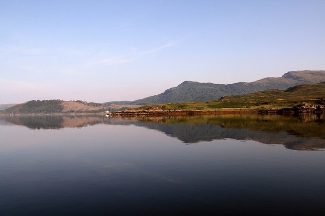
Camas nan Gall is a picturesque bay located in Ross-shire, Scotland. Situated on the northwest coast of the Highlands, it offers breathtaking views of rugged cliffs, sandy beaches, and the sparkling waters of the North Atlantic Ocean. The bay is nestled between the villages of Gairloch and Poolewe, making it easily accessible to visitors.

The name "Camas nan Gall" translates to "Bay of the Strangers" in Gaelic, referring to the historical presence of Vikings in the area. This bay has played a significant role in the region's rich history, with evidence of ancient settlements and archaeological finds. It is believed to have been an important trading and fishing hub in the past.

The bay is a haven for wildlife enthusiasts and nature lovers. Its diverse ecosystem supports a wide array of flora and fauna. Visitors can spot various bird species, including seabirds and waders, as well as seals and otters in the surrounding waters. The bay's sandy beaches are perfect for leisurely walks, beachcombing, and picnics.

Camas nan Gall also offers opportunities for outdoor activities such as kayaking, sailing, and fishing. The bay's clear waters and favorable winds make it a popular spot for water sports enthusiasts. Additionally, the surrounding landscape provides ample hiking trails and viewpoints for those seeking a more active adventure.

With its stunning natural beauty and historical significance, Camas nan Gall is a must-visit destination for anyone exploring the Ross-shire area in Scotland.

If you have any feedback on the listing, please let us know in the comments section below.

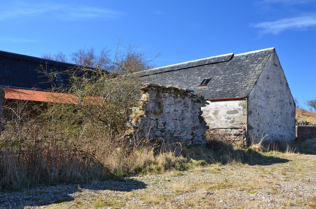
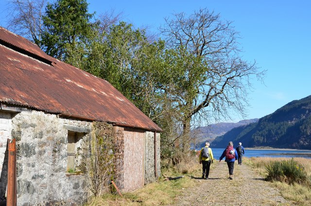
Camas nan Gall Images

Images are sourced within 2km of 57.251975/-5.625455 or Grid Reference NG8123. Thanks to Geograph Open Source API. All images are credited.

Forest track above Glen Bernera Much of the plantation SW of Glas Bheinn has been clear felled.
Forest track above Glen Bernera
Much of the plantation SW of Glas Bheinn has been clear felled.
Clear-felled hillside below Glas Bheinn
Descending to Glen Bernera On the forest track that skirts the S side of Glas Bheinn. The Sandaig Islands are in view off the headland L of centre and the island of Eigg is faintly visible on the horizon to the right.
Descending to Glen Bernera
On the forest track that skirts the S side of Glas Bheinn. The Sandaig Islands are in view off the headland L of centre and the island of Eigg is faintly visible on the horizon to the right.
Path to Ardintoul A pleasant walk through woodland above the coast alongside the Kyle Rhea narrows.
Path to Ardintoul
A pleasant walk through woodland above the coast alongside the Kyle Rhea narrows.
A boat in Kyle Rhea narrows Skippers of vessels passing through the narrows have to consider tidal streams of 7 or 8 knots. In the cattle-droving days, 8000 beasts a year crossed at the Kyle Rhea narrows at slack water, usually swimming six animals at a time led by a rowing boat - see 'The Famous Highland Drove Walk' by Irvine Butterfield (Grey Stone Books 1996).
A boat in Kyle Rhea narrows
Skippers of vessels passing through the narrows have to consider tidal streams of 7 or 8 knots. In the cattle-droving days, 8000 beasts a year crossed at the Kyle Rhea narrows at slack water, usually swimming six animals at a time led by a rowing boat - see 'The Famous Highland Drove Walk' by Irvine Butterfield (Grey Stone Books 1996).
Path to Ardintoul crossing a burn The path swings in to contour round a small re-entrant made by a burn.
Path to Ardintoul crossing a burn
The path swings in to contour round a small re-entrant made by a burn.
Coastal view from Garbhan Cosach A fine view towards Dornie from the coastal path from Kylerhea.
Coastal view from Garbhan Cosach
A fine view towards Dornie from the coastal path from Kylerhea.
Camas nan Gall Looking across the bay of Camas nan Gall to the flat ground of Ardintoul Point. On the far shore is Dornie with the peak of Sguman Coinntich prominent.
Camas nan Gall
Looking across the bay of Camas nan Gall to the flat ground of Ardintoul Point. On the far shore is Dornie with the peak of Sguman Coinntich prominent.
Coastal path at Garbhan Cosach The well-made path slowly descends to beach level after rounding the headland.
Coastal path at Garbhan Cosach
The well-made path slowly descends to beach level after rounding the headland.
Shingle beach, Camas nan Gall Dornie is ahead with the mountains near Loch Long in the background. The cylindrical object is part of a fish farm.
Shingle beach, Camas nan Gall
Dornie is ahead with the mountains near Loch Long in the background. The cylindrical object is part of a fish farm.
Fish farm, Camas nan Gall Near the coast beyond the exit from Kyle Rhea to Loch Alsh.
Fish farm, Camas nan Gall
Near the coast beyond the exit from Kyle Rhea to Loch Alsh.
Beach, Camas nan Gall Shingle and coarse sand on the beach not far from the flat grassy point at Ardintoul.
Beach, Camas nan Gall
Shingle and coarse sand on the beach not far from the flat grassy point at Ardintoul.
Coastal path at Ardintoul A waymark on the post indicates a turn right to the old farm buildings.
Coastal path at Ardintoul
A waymark on the post indicates a turn right to the old farm buildings.
Old farm buildings, Ardintoul Barns arranged around a courtyard, now overgrown.
Old farm buildings, Ardintoul
Barns arranged around a courtyard, now overgrown.
Track at Ardintoul The track passes old farm buildings and the burnt-out remains of Ardintoul House.
Track at Ardintoul
The track passes old farm buildings and the burnt-out remains of Ardintoul House.
Glas Bheinn Only 394m in height but the shapely steep side of this hill stands out above Glen Bernera. Much of the forest plantation on this side has been clear felled.
Glas Bheinn
Only 394m in height but the shapely steep side of this hill stands out above Glen Bernera. Much of the forest plantation on this side has been clear felled.
Path through the trees to Ardintoul
Path amongst the dandelions On the way to Ardintoul.
Path amongst the dandelions
On the way to Ardintoul.
Show me another place!

Camas nan Gall is located at Grid Ref: NG8123 (Lat: 57.251975, Lng: -5.625455)

Unitary Authority: Highland

Police Authority: Highlands and Islands

What 3 Words

///emulating.unzipped.fight. Near Glenelg, Highland

Related Wikis

Kyle Rhea

Kyle Rhea is a strait of water in the Highland area of Scotland. It runs from the Inner Seas off the West Coast of Scotland in the southwest to Loch Alsh...

Loch Alsh

Loch Alsh (from the Scottish Gaelic Loch Aillse, "foaming lake") is a sea inlet between the isle of Skye in the Inner Hebrides and the Northwest Highlands...

Avernish

Avernish (Scottish Gaelic: Abhairnis) is a small, scenic, rural community located in the Highlands of Scotland. Nearby attractions include The Eilean...

Balmacara Square

Balmacara Square (Scottish Gaelic: Ceàrnag Bhaile Mac Carra) is a small village, close to Balmacara, in Lochlash, Scottish Highlands and is in the council...

Nearby Amenities

Located within 500m of 57.251975,-5.625455
Source: PGS
Lat/Long: 57.2518091/-5.617908
Source: PGS
Lat/Long: 57.2516358/-5.6197727
Source: PGS
Lat/Long: 57.2515696/-5.6207142
Source: PGS
Lat/Long: 57.2514707/-5.6211476
Source: PGS
Lat/Long: 57.2512237/-5.6221797
Created By: almien_coastlines
Source: PGS
Lat/Long: 57.25101/-5.622963
Source: PGS
Lat/Long: 57.2507165/-5.6241565
Source: PGS
Lat/Long: 57.250576/-5.6255298
Source: PGS
Lat/Long: 57.2505836/-5.6261719
The data included in this document is from www.openstreetmap.org. The data is made available under ODbL.

Have you been to Camas nan Gall?

Leave your review of Camas nan Gall below (or comments, questions and feedback).