Preston, Little

Settlement in Yorkshire

England

Preston, Little

Billy Woods rock formation, Kippax
Billy Woods rock formation, Kippax Credit: derek dye

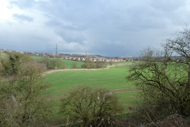
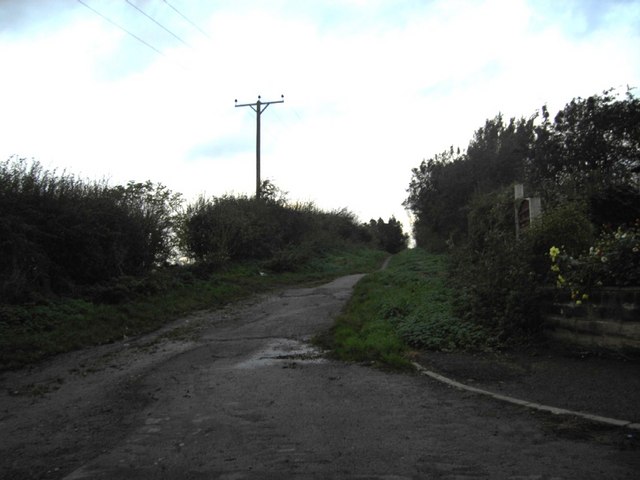
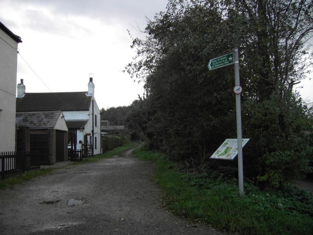
Preston, Little is a small village located in the county of Yorkshire, England. Situated in the northern part of the country, it is nestled amidst the picturesque countryside, surrounded by rolling hills and lush green landscapes. The village belongs to the district of Craven and lies in close proximity to the market town of Settle.

With a population of around 300 residents, Preston, Little exudes a tranquil and close-knit community atmosphere. The village is characterized by its charming stone cottages, which date back several centuries and showcase traditional Yorkshire architecture. These buildings, along with the well-maintained gardens and cobbled streets, contribute to the village's quaint and idyllic ambiance.

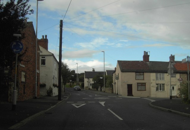
Preston, Little offers a range of amenities to its residents. The village boasts a local pub, serving as a social hub and offering traditional British fare. Additionally, a village hall provides a space for community gatherings, events, and recreational activities. The village is also home to a small primary school, providing education for the local children.

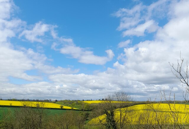
The surrounding area offers ample opportunities for outdoor pursuits and exploration. The nearby Yorkshire Dales National Park is a haven for nature lovers, offering breathtaking landscapes, hiking trails, and opportunities for wildlife spotting. The village's location also provides easy access to nearby attractions such as the historic market town of Skipton and the renowned Malham Cove, a limestone formation attracting visitors from far and wide.

Overall, Preston, Little is a charming and peaceful village, offering residents a picturesque countryside setting, a strong sense of community, and convenient access to the natural beauty of Yorkshire.

If you have any feedback on the listing, please let us know in the comments section below.

Preston, Little Images

Images are sourced within 2km of 53.767121/-1.4125981 or Grid Reference SE3830. Thanks to Geograph Open Source API. All images are credited.
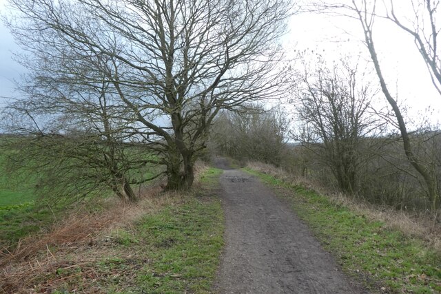
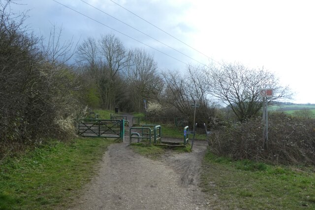
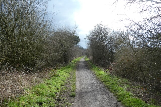
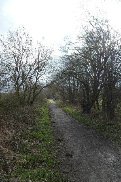
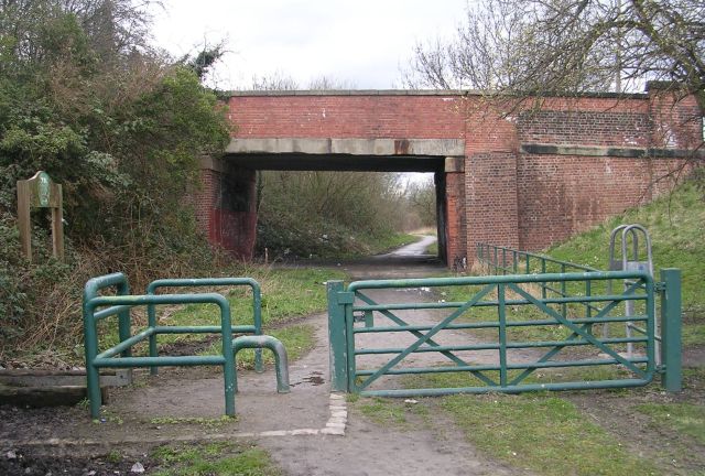
Billy Woods rock formation, Kippax
Lines Way south of Garforth The Lines Way is a cycle path from Garforth to Allerton Bywater along the former railway line. It is designated as part of National Cycle Network route 697.
Lines Way south of Garforth
The Lines Way is a cycle path from Garforth to Allerton Bywater along the former railway line. It is designated as part of National Cycle Network route 697.
Crossing Brecks Lane The Lines Way is a cycle path from Garforth to Allerton Bywater along the former railway line. It is designated as part of National Cycle Network route 697.
Crossing Brecks Lane
The Lines Way is a cycle path from Garforth to Allerton Bywater along the former railway line. It is designated as part of National Cycle Network route 697.
The Lines Way near Sparrowhall Farm The Lines Way is a cycle path from Garforth to Allerton Bywater along the former railway line. It is designated as part of National Cycle Network route 697.
The Lines Way near Sparrowhall Farm
The Lines Way is a cycle path from Garforth to Allerton Bywater along the former railway line. It is designated as part of National Cycle Network route 697.
Fields near Kippax Looking towards Kippax from the Lines Way path along the former railway line.
Fields near Kippax
Looking towards Kippax from the Lines Way path along the former railway line.
Lines Way to the west of Kippax The Lines Way is a cycle path from Garforth to Allerton Bywater along the former railway line. It is designated as part of National Cycle Network route 697.
Lines Way to the west of Kippax
The Lines Way is a cycle path from Garforth to Allerton Bywater along the former railway line. It is designated as part of National Cycle Network route 697.
Field near Kippax Looking towards Kippax from The Lines Way, a path along the old railway line.
Field near Kippax
Looking towards Kippax from The Lines Way, a path along the old railway line.
Cycle path to Allerton Bywater The Lines Way is a cycle path from Garforth to Allerton Bywater along the former railway line. It is designated as part of National Cycle Network route 697.
Cycle path to Allerton Bywater
The Lines Way is a cycle path from Garforth to Allerton Bywater along the former railway line. It is designated as part of National Cycle Network route 697.
Pond beside The Lines Way The Lines Way is a cycle path from Garforth to Allerton Bywater along the former railway line. It is designated as part of National Cycle Network route 697.
Pond beside The Lines Way
The Lines Way is a cycle path from Garforth to Allerton Bywater along the former railway line. It is designated as part of National Cycle Network route 697.
Above Townclose Wood Looking towards Kippax from The Lines Way.
Above Townclose Wood
Looking towards Kippax from The Lines Way.
Cycle path from Garforth The Lines Way is a cycle path from Garforth to Allerton Bywater along the former railway line. It is designated as part of National Cycle Network route 697.
Cycle path from Garforth
The Lines Way is a cycle path from Garforth to Allerton Bywater along the former railway line. It is designated as part of National Cycle Network route 697.
Cycle path to Garforth The Lines Way is a cycle path from Garforth to Allerton Bywater along the former railway line. It is designated as part of National Cycle Network route 697.
Cycle path to Garforth
The Lines Way is a cycle path from Garforth to Allerton Bywater along the former railway line. It is designated as part of National Cycle Network route 697.
Fields seen from Townclose Hills
Green Lane Bridleway Green Lane (Track or Bridleway) on the West side of Kippax leading to Brecks Lane.
Green Lane Bridleway
Green Lane (Track or Bridleway) on the West side of Kippax leading to Brecks Lane.
Green Lane Bridleway Green Lane (Track) on the West side of Kippax. Looking South towards Townclose Hills and Wood, leading to Station Road.
Green Lane Bridleway
Green Lane (Track) on the West side of Kippax. Looking South towards Townclose Hills and Wood, leading to Station Road.
Brecks Lane towards Kippax
Brecks Lane descends towards Brecks Wood
The Lines Way crossing Brecks Lane The Lines Way is the former railway line from Garforth to Allerton Bywater, now converted into a permitted bridleway. The Leeds Country Way turns west [right] here, down Brecks Lane. The picnic table here has been designed with wheelchair users in mind.
The Lines Way crossing Brecks Lane
The Lines Way is the former railway line from Garforth to Allerton Bywater, now converted into a permitted bridleway. The Leeds Country Way turns west [right] here, down Brecks Lane. The picnic table here has been designed with wheelchair users in mind.
Show me another place!

Preston, Little is located at Grid Ref: SE3830 (Lat: 53.767121, Lng: -1.4125981)

Division: West Riding

Unitary Authority: Leeds

Police Authority: West Yorkshire

What 3 Words

///committee.about.washable. Near Swillington, West Yorkshire

Related Wikis

St Mary's Church, Swillington

St Mary's Church is located on Church Lane next to Swillington Primary School, on Wakefield Road, Swillington, West Yorkshire, England. There has been...

Swillington

Swillington is a village and civil parish near Leeds, West Yorkshire, England, in the City of Leeds metropolitan borough. It is situated 5 miles (8 km...

Great Preston

Great Preston is a small rural village in the City of Leeds metropolitan borough, West Yorkshire, England. It has incorporated the once neighbouring hamlet...

Kippax railway station

Kippax railway station was a railway station on the Castleford–Garforth line in West Yorkshire, England. The station opened in 1878 and closed to passengers...

Nearby Amenities

Located within 500m of 53.767121,-1.4125981
Little Preston
Is In: West Yorkshire, England, UK
Place: village
Source: npe
Lat/Long: 53.7692151/-1.4107696
Power: tower
Lat/Long: 53.7640366/-1.4132851
Power: tower
Lat/Long: 53.7645328/-1.4071988
Bus Stop
Swillington Church
Bus: yes
Local Ref: 45010253
Naptan AtcoCode: 450010253
Naptan Bearing: SW
Naptan CommonName: Swillington Church
Naptan Crossing: Astley Lane
Naptan Indicator: Stop 45010253
Naptan Landmark: Public Library
Naptan Notes: LED LIGHTING INSTALLED
Naptan PlusbusZoneRef: LEEDS
Naptan ShortCommonName: Astley Lane
Naptan Street: Wakefield Road
Naptan Verified: yes
Public Transport: platform
Ref: 45010253
Shelter: yes
Source: naptan_import
Lat/Long: 53.7680668/-1.4182828
Bus Stop
Swillington Church
Bus: yes
Local Ref: 45010256
Naptan AtcoCode: 450010256
Naptan Bearing: NE
Naptan CommonName: Swillington Church
Naptan Crossing: Church Lane
Naptan Indicator: Stop 45010256
Naptan PlusbusZoneRef: LEEDS
Naptan ShortCommonName: Church Lane
Naptan Street: Wakefield Road
Naptan Verified: yes
Public Transport: platform
Ref: 45010256
Source: naptan_import
Lat/Long: 53.7685138/-1.4178177
Bus Stop
Swillington Church
Bus: yes
Local Ref: 45013310
Naptan AtcoCode: 450013310
Naptan Bearing: W
Naptan CommonName: Swillington Church
Naptan Crossing: Wakefield Road
Naptan Indicator: Stop 45013310
Naptan Landmark: Church
Naptan PlusbusZoneRef: LEEDS
Naptan ShortCommonName: Swillington Church
Naptan Street: Church Lane
Naptan Verified: yes
Public Transport: platform
Ref: 45013310
Source: naptan_import
Lat/Long: 53.768782/-1.418194
Traffic Calming: hump
Lat/Long: 53.7689006/-1.4188089
Bus Stop
Goody Cross Lane The Grove
Bus: yes
Local Ref: 45010143
Naptan AtcoCode: 450010143
Naptan Bearing: W
Naptan CommonName: Goody Cross Lane The Grove
Naptan Crossing: The Grove
Naptan Indicator: Stop 45010143
Naptan PlusbusZoneRef: LEEDS
Naptan ShortCommonName: The Grove
Naptan Street: Goody Cross Lane
Naptan Verified: no
Public Transport: platform
Source: naptan_import
Lat/Long: 53.7700903/-1.4110903
Bus Stop
Astley Lane Park Grove
Bus: yes
Local Ref: 45010158
Naptan AtcoCode: 450010158
Naptan Bearing: S
Naptan CommonName: Astley Lane Park Grove
Naptan Crossing: Park Grove
Naptan Indicator: Stop 45010158
Naptan PlusbusZoneRef: LEEDS
Naptan ShortCommonName: Park Grove
Naptan Street: Astley Lane
Naptan Verified: no
Public Transport: platform
Source: naptan_import
Lat/Long: 53.7645528/-1.4164774
Bus Stop
Astley Lane Astley Avenue
Bus: yes
Local Ref: 45010159
Naptan AtcoCode: 450010159
Naptan Bearing: S
Naptan CommonName: Astley Lane Astley Avenue
Naptan Crossing: Astley Drive
Naptan Indicator: Stop 45010159
Naptan PlusbusZoneRef: LEEDS
Naptan ShortCommonName: Astley Avenue
Naptan Street: Astley Lane
Naptan Verified: no
Public Transport: platform
Source: naptan_import
Lat/Long: 53.7661808/-1.4167127
Bus Stop
Astley Lane Park Avenue
Bus: yes
Local Ref: 45010160
Naptan AtcoCode: 450010160
Naptan Bearing: N
Naptan CommonName: Astley Lane Park Avenue
Naptan Crossing: Park Lane
Naptan Indicator: Stop 45010160
Naptan PlusbusZoneRef: LEEDS
Naptan ShortCommonName: Park Lane
Naptan Street: Astley Lane
Naptan Verified: no
Public Transport: platform
Source: naptan_import
Lat/Long: 53.7667846/-1.4170381
Bus Stop
Wakefield Road
Bus: yes
Local Ref: 45012868
Naptan AtcoCode: 450012868
Naptan Bearing: SW
Naptan CommonName: Wakefield Road
Naptan Crossing: St Marys Avenue
Naptan Indicator: Stop 45012868
Naptan Landmark: Social Club
Naptan PlusbusZoneRef: LEEDS
Naptan ShortCommonName: St. Marys Avenue
Naptan Street: Wakefield Road
Naptan Verified: yes
Public Transport: platform
Ref: 45012868
Source: naptan_import
Lat/Long: 53.7670873/-1.420144
Bus Stop
Astley Lane Park Grove
Bus: yes
Local Ref: 45012874
Naptan AtcoCode: 450012874
Naptan Bearing: N
Naptan CommonName: Astley Lane Park Grove
Naptan Crossing: Park Grove
Naptan Indicator: Stop 45012874
Naptan PlusbusZoneRef: LEEDS
Naptan ShortCommonName: Park Grove
Naptan Street: Astley Lane
Naptan Verified: no
Public Transport: platform
Source: naptan_import
Lat/Long: 53.7646975/-1.4166726
Bus Stop
Swillington Church
Bus: yes
Local Ref: 45013309
Naptan AtcoCode: 450013309
Naptan Bearing: E
Naptan CommonName: Swillington Church
Naptan Crossing: Wakefield Road
Naptan Indicator: Stop 45013309
Naptan Landmark: Church
Naptan PlusbusZoneRef: LEEDS
Naptan ShortCommonName: Swillington Church
Naptan Street: Church Lane
Naptan Verified: yes
Public Transport: platform
Ref: 45013309
Source: naptan_import
Lat/Long: 53.7688399/-1.417828
Post Box
Brand: Royal Mail
Brand Wikidata: Q638098
Operator: Royal Mail
Operator Wikidata: Q638098
Post Box Type: pillar
Ref: LS26 759
Royal Cypher: EIIR
Royal Cypher Wikidata: Q33102113
Lat/Long: 53.7683414/-1.417369
Post Box
Operator: Royal Mail
Post Box Type: wall
Ref: LS26 847
Royal Cypher: GVIR
Royal Cypher Wikidata: Q33102169
Lat/Long: 53.770021/-1.4116396
Mini Roundabout
Lat/Long: 53.7634274/-1.4145694
Turning Circle
Lat/Long: 53.7641536/-1.417524
Turning Circle
Lat/Long: 53.7642695/-1.4134338
Turning Circle
Lat/Long: 53.7643284/-1.4155314
Turning Circle
Lat/Long: 53.7643948/-1.4146834
Turning Circle
Lat/Long: 53.7645768/-1.4131456
Turning Circle
Lat/Long: 53.7647335/-1.4159298
Turning Circle
Lat/Long: 53.7649342/-1.4177132
Turning Circle
Lat/Long: 53.7652889/-1.4148211
Turning Circle
Lat/Long: 53.7653951/-1.4173077
Turning Circle
Lat/Long: 53.766137/-1.4148076
Turning Circle
Lat/Long: 53.7661039/-1.4160051
Turning Circle
Lat/Long: 53.7666764/-1.4188475
Barrier: bollard
Lat/Long: 53.7670119/-1.4193082
Barrier: bollard
Lat/Long: 53.7673778/-1.4194897
Post Box
Brand: Royal Mail
Brand Wikidata: Q638098
Operator: Royal Mail
Operator Wikidata: Q638098
Post Box Type: lamp
Ref: LS26 444
Royal Cypher: EIIR
Royal Cypher Wikidata: Q33102113
Lat/Long: 53.7653898/-1.4165793
Atm
Lat/Long: 53.7685788/-1.4178316
Londis Swillington
Addr City: Leeds
Addr Housenumber: 1
Addr Postcode: LS26 8UE
Addr Street: Astley Lane
Brand: Londis
Brand Wikidata: Q21008564
Brand Wikipedia: en:Londis (United Kingdom)
Fhrs Id: 321351
Shop: convenience
Lat/Long: 53.7682491/-1.4175044
Bench
Lat/Long: 53.7683632/-1.4176787
Fast Food
Indian Spice
Addr City: Leeds
Addr Housenumber: 30a
Addr Postcode: LS26 8UD
Addr Street: Astley Lane
Cuisine: indian
Fhrs Id: 322960
Takeaway: only
Lat/Long: 53.7667262/-1.4166436
Lauras Cakes And Bakes
Addr City: Leeds
Addr Housenumber: 22
Addr Postcode: LS26 8DS
Addr Street: Wakefield Road
Addr Suburb: Swillington
Craft: caterer
Fhrs Id: 809713
Lat/Long: 53.7680436/-1.418957
Crossing
Crossing: uncontrolled
Crossing Island: no
Crossing Ref: zebra
Tactile Paving: yes
Lat/Long: 53.7692419/-1.4183357
Crossing
Lat/Long: 53.7675628/-1.4194854
Crossing
Lat/Long: 53.7705428/-1.4162154
Crossing
Lat/Long: 53.7706904/-1.4161032
Post Office
Swillington Post Office
Addr City: Leeds
Addr Housenumber: 1
Addr Postcode: LS26 8UE
Addr Street: Astley Lane
Branch: Swillington
Brand: Post Office
Brand Wikidata: Q1783168
Brand Wikipedia: en:Post Office Ltd
Check Date: 2020-02-20
Contact Website: https://www.postoffice.co.uk/branch-finder/3243230/swillington
Ref Pol Id: 12854
Shop: convenience
Lat/Long: 53.7682187/-1.4174871
Waste Basket
Collection Times: Mo
Ref UK Leedscc Bin: 648
Lat/Long: 53.768902/-1.418221
Waste Basket
Collection Times: Mo
Ref UK Leedscc Bin: 3489
Lat/Long: 53.768553/-1.417634
Waste Basket
Collection Times: Mo
Ref UK Leedscc Bin: 3490
Lat/Long: 53.768445/-1.417522
Waste Basket
Collection Times: Mo
Ref UK Leedscc Bin: 3491
Lat/Long: 53.768443/-1.418427
Waste Basket
Collection Times: Mo
Ref UK Leedscc Bin: 3479
Lat/Long: 53.768286/-1.417856
Waste Basket
Collection Times: Mo
Ref UK Leedscc Bin: 3492
Lat/Long: 53.767531/-1.419616
Waste Basket
Collection Times: Mo
Ref UK Leedscc Bin: 119
Lat/Long: 53.767089/-1.416885
Waste Basket
Collection Times: Mo
Ref UK Leedscc Bin: 2592
Lat/Long: 53.76616/-1.416083
Waste Basket
Collection Times: Mo
Ref UK Leedscc Bin: 2593
Lat/Long: 53.765756/-1.415704
Waste Basket
Collection Times: Mo
Ref UK Leedscc Bin: 118
Lat/Long: 53.765277/-1.41648
Noexit: yes
Lat/Long: 53.7705112/-1.4143311
Crossing
Crossing: unmarked
Crossing Island: yes
Lat/Long: 53.7685126/-1.4174284
Noexit: yes
Lat/Long: 53.7691966/-1.4186143
Noexit: yes
Lat/Long: 53.7690388/-1.4186592
Entrance: main
Lat/Long: 53.769738/-1.4182942
Turning Circle
Lat/Long: 53.7670432/-1.419071
Turning Circle
Lat/Long: 53.768853/-1.4102358
Noexit: yes
Lat/Long: 53.7685316/-1.4113885
Line Management: termination
Location Transition: yes
Material: wood
Power: pole
Lat/Long: 53.7630313/-1.4125793
Material: wood
Power: pole
Lat/Long: 53.7633109/-1.4121481
Material: wood
Power: pole
Lat/Long: 53.7638716/-1.4112724
Fixme: Not sure what's happening here? This may not be a power pole at all
Power: pole
Lat/Long: 53.7641404/-1.4108701
Material: wood
Power: pole
Lat/Long: 53.7640078/-1.4098322
Material: wood
Power: pole
Lat/Long: 53.763747/-1.4084421
Power: pole
Lat/Long: 53.7642072/-1.4106479
Power: pole
Lat/Long: 53.7641451/-1.4112979
The data included in this document is from www.openstreetmap.org. The data is made available under ODbL.

Have you been to Preston, Little?

Leave your review of Preston, Little below (or comments, questions and feedback).