Lòn Bhearnuis

Bay in Argyllshire

Scotland

Lòn Bhearnuis
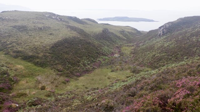
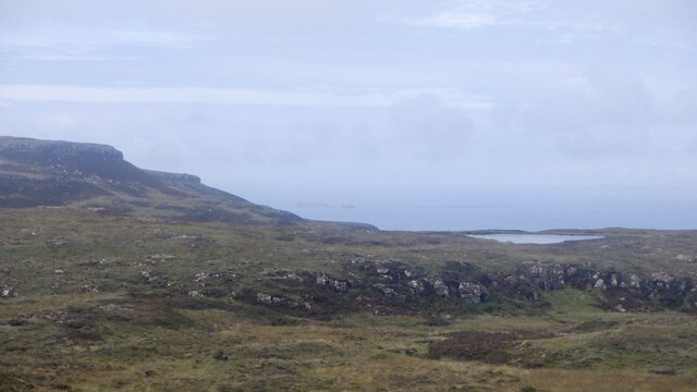
Slopes of Beinn Eolasary A sharp reentrant which is marked as a fault on the solid geology map.
Slopes of Beinn Eolasary Credit: Richard Webb

The requested URL returned error: 429 Too Many Requests

If you have any feedback on the listing, please let us know in the comments section below.

Lòn Bhearnuis Images

Images are sourced within 2km of 56.497059/-6.2356834 or Grid Reference NM3941. Thanks to Geograph Open Source API. All images are credited.

Slopes of Beinn Eolasary A sharp reentrant which is marked as a fault on the solid geology map.
Slopes of Beinn Eolasary
A sharp reentrant which is marked as a fault on the solid geology map.
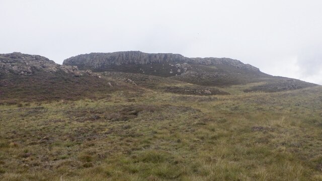
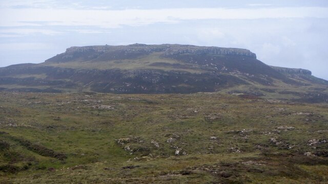
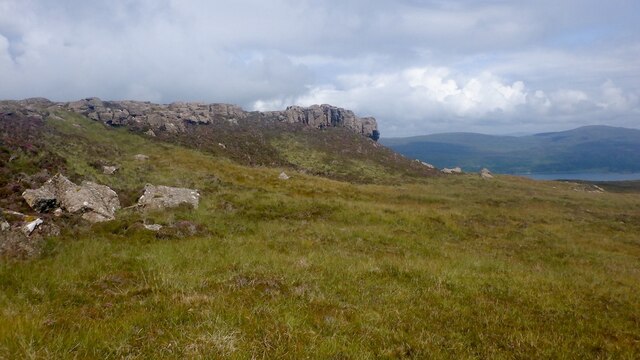
Top layer of the cake: Beinn Eolasary The highest lava flow in Ulva's traps makes an impressive crag. The rock is very slippery though as I found out the hard way when trying to get through at a weakness.
Top layer of the cake: Beinn Eolasary
The highest lava flow in Ulva's traps makes an impressive crag. The rock is very slippery though as I found out the hard way when trying to get through at a weakness.
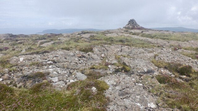
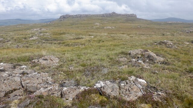
Summit, Beinn Eolasary A flat basalt table on top of Ulva's highest trap lava flow.
Summit, Beinn Eolasary
A flat basalt table on top of Ulva's highest trap lava flow.
On Beinn Eolasary The crags are the upper lava flow on Ulva, the top layer in the stepped landscape of the island.
On Beinn Eolasary
The crags are the upper lava flow on Ulva, the top layer in the stepped landscape of the island.
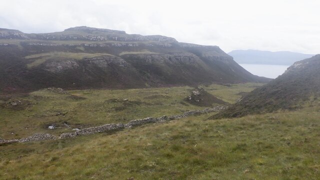
Dry stone dyke, Ulva A wall running across the island between Beinn Eolasary and Beinn Chreagach, the two main hills.
Dry stone dyke, Ulva
A wall running across the island between Beinn Eolasary and Beinn Chreagach, the two main hills.
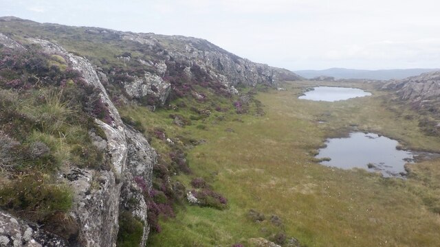
The lochan on Beinn an Lochain, Ulva Trap landscape seen from moorland on Beinn Chreagach
The lochan on Beinn an Lochain, Ulva
Trap landscape seen from moorland on Beinn Chreagach
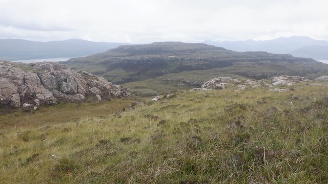
Traps, Beinn Eolasary Ulva's distinctive stepped landscape, seen from Beinn Chreagach.
Traps, Beinn Eolasary
Ulva's distinctive stepped landscape, seen from Beinn Chreagach.
Beinn Chreagach, Ulva View from Beinn Eolasary showing the Ulva trap landscape formed by successive lava flows.
Beinn Chreagach, Ulva
View from Beinn Eolasary showing the Ulva trap landscape formed by successive lava flows.
One step to go - Beinn Chreagach Approaching the summit of the stepped hill - caused by successive lava flows.
One step to go - Beinn Chreagach
Approaching the summit of the stepped hill - caused by successive lava flows.
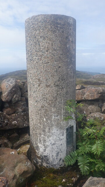
Beinn Chreagach trig pillar
Crag, Beinn Chreagach The stepped appearance of Ulva is due to a succession of lava flows.
Crag, Beinn Chreagach
The stepped appearance of Ulva is due to a succession of lava flows.
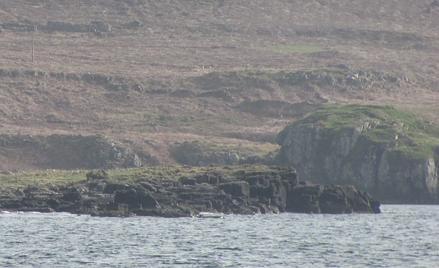
Eilean a' Choire A small flat island just off Ulva.
Eilean a' Choire
A small flat island just off Ulva.
Eilean a' Choire The northern end of a skerry off Ulva.
Eilean a' Choire
The northern end of a skerry off Ulva.
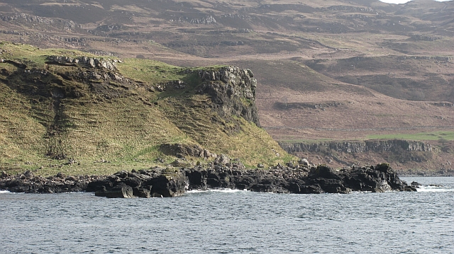
Rubha Chulinish Headland on the north coast of Ulva.
Rubha Chulinish
Headland on the north coast of Ulva.
Passing Rubha Chulinish Jessica Louise passes Rubha Chulinish bound for Ulva Ferry.
Passing Rubha Chulinish
Jessica Louise passes Rubha Chulinish bound for Ulva Ferry.
The entrance to Am Brù Am Brù is the narrow channel (dry at low tide) which separates the Isles of Ulva (to the left) from Gometra.
The entrance to Am Brù
Am Brù is the narrow channel (dry at low tide) which separates the Isles of Ulva (to the left) from Gometra.
Beinn Eolasary Sixth TuMP of a bright sunny day with Jim Bloomer and Richard Tibbetts.
Name: Beinn Eolasary
Hill number: 102179
Height: 306m / 1004ft
Area: 17E: Mull and Nearby Islands
Class: 3
Grid ref: NM389403 (est)
Drop: 69m
Col: 237m
Beinn Eolasary
Sixth TuMP of a bright sunny day with Jim Bloomer and Richard Tibbetts. Name: Beinn Eolasary Hill number: 102179 Height: 306m / 1004ft Area: 17E: Mull and Nearby Islands Class: 3 Grid ref: NM389403 (est) Drop: 69m Col: 237m
Cnoc Rubha Dubh First TuMP of a bright sunny day with Jim Bloomer and Richard Tibbetts after a military march from the Ulva Ferry.

Name: Cnoc Rubha Dubh
Hill number: 102451
Height: 67m / 220ft
Area: 17E: Mull and Nearby Islands
Class: 0
Grid ref: NM375412 (est)
Drop: 38m
Col: 29m
Cnoc Rubha Dubh
First TuMP of a bright sunny day with Jim Bloomer and Richard Tibbetts after a military march from the Ulva Ferry. Name: Cnoc Rubha Dubh Hill number: 102451 Height: 67m / 220ft Area: 17E: Mull and Nearby Islands Class: 0 Grid ref: NM375412 (est) Drop: 38m Col: 29m
Show me another place!

Lòn Bhearnuis is located at Grid Ref: NM3941 (Lat: 56.497059, Lng: -6.2356834)

Unitary Authority: Argyll and Bute

Police Authority: Argyll and West Dunbartonshire

What 3 Words

///victor.saddens.rafters. Near Calgary, Argyll & Bute

Nearby Locations

Lòn Bhearnuis

Related Wikis

Loch Tuath

Loch Tuath (Scottish Gaelic: Loch-a-Tuath) is a sea loch in the Inner Hebrides, Scotland that separates the Isle of Mull and the island of Ulva. Loch Tuath...

Ulva

Ulva (; Scottish Gaelic: Ulbha) is a small island in the Inner Hebrides of Scotland, off the west coast of Mull. It is separated from Mull by a narrow...

Achleck

Achleck is a small settlement in the north-west of the Isle of Mull in Argyll and Bute, Scotland. == References ==

Gometra

Gometra (Scottish Gaelic: Gòmastra) is an island in the Inner Hebrides of Scotland, lying west of Mull. It lies immediately west of Ulva, to which it is...

Nearby Amenities

Located within 500m of 56.497059,-6.2356834
Created By: dmgroom_coastlines
Source: PGS
Lat/Long: 56.49696/-6.24257
Source: PGS
Lat/Long: 56.496897/-6.2425921
Source: PGS
Lat/Long: 56.4965453/-6.2415648
Source: PGS
Lat/Long: 56.4963929/-6.2410741
Source: PGS
Lat/Long: 56.4962797/-6.2408887
Source: PGS
Lat/Long: 56.4959087/-6.2402564
Source: PGS
Lat/Long: 56.4956995/-6.2399586
Source: PGS
Lat/Long: 56.4955152/-6.2394836
Source: PGS
Lat/Long: 56.495008/-6.2385079
Source: PGS
Lat/Long: 56.4948522/-6.2379098
Source: PGS
Lat/Long: 56.4946323/-6.2376494
Source: PGS
Lat/Long: 56.4944645/-6.2374268
Source: PGS
Lat/Long: 56.4942912/-6.2363229
Source: PGS
Lat/Long: 56.4942397/-6.2359012
Source: PGS
Lat/Long: 56.4940775/-6.2345842
Source: PGS
Lat/Long: 56.4942115/-6.2332948
Source: PGS
Lat/Long: 56.4945185/-6.2314107
Source: PGS
Lat/Long: 56.4949367/-6.2305989
Source: PGS
Lat/Long: 56.4954959/-6.2298628
Source: PGS
Lat/Long: 56.4960551/-6.2299401
Source: PGS
Lat/Long: 56.4965218/-6.230002
Source: PGS
Lat/Long: 56.4970425/-6.2299835
Source: PGS
Lat/Long: 56.4973895/-6.2299259
Source: PGS
Lat/Long: 56.4977929/-6.2298959
Source: PGS
Lat/Long: 56.4981277/-6.2299625
Source: PGS
Lat/Long: 56.4984332/-6.2300598
Source: PGS
Lat/Long: 56.4986372/-6.2302422
Source: PGS
Lat/Long: 56.4988394/-6.2304086
Created By: dmgroom_coastlines
Source: PGS
Lat/Long: 56.49952/-6.23104
Created By: dmgroom_coastlines
Source: PGS
Lat/Long: 56.49978/-6.23102
Source: PGS
Lat/Long: 56.5003422/-6.2310658
Source: PGS
Lat/Long: 56.5007112/-6.2309386
Baligorton
Note: Gaelic name possibly Baile a' Ghoirtein but can't confirm
Place: hamlet
Lat/Long: 56.4953429/-6.2425214
The data included in this document is from www.openstreetmap.org. The data is made available under ODbL.

Have you been to Lòn Bhearnuis?

Leave your review of Lòn Bhearnuis below (or comments, questions and feedback).