Port an Obain

Bay in Argyllshire

Scotland

Port an Obain

Riasg Buidhe ruins Abandoned village
Riasg Buidhe ruins Credit: Fred Cass

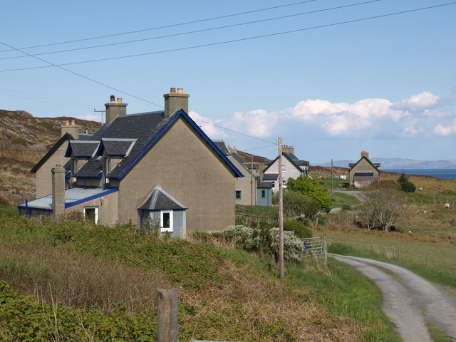
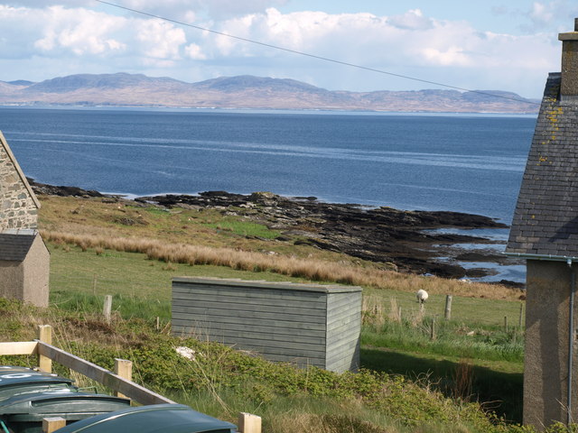
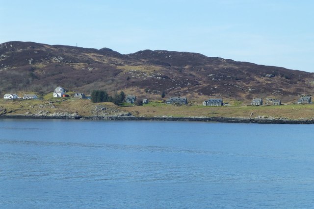
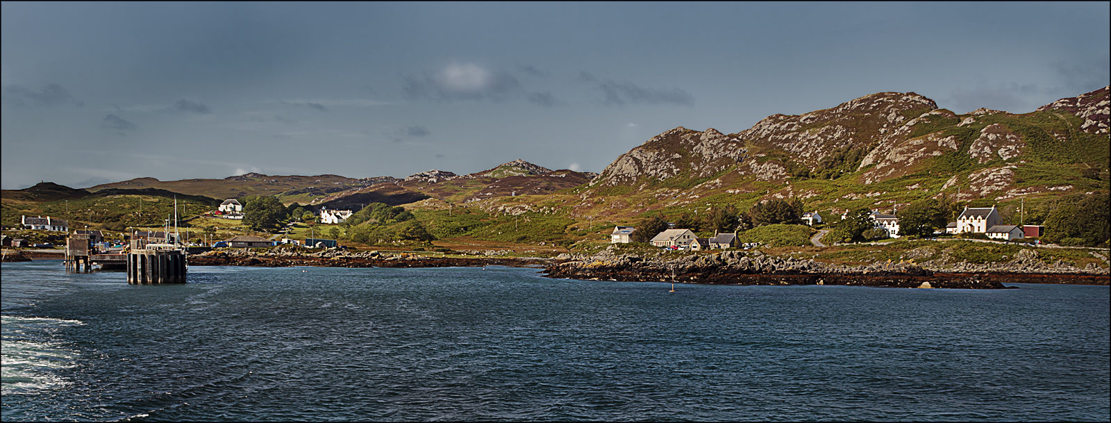
Port an Obain, located in Argyllshire, Scotland, is a small bay nestled along the west coast of the country. With its picturesque beauty and tranquil surroundings, it has become a popular destination for tourists and locals alike.

The bay is characterized by its stunning sandy beach, which stretches along the coast for approximately half a mile. The soft golden sand offers a perfect spot for sunbathing, picnicking, and leisurely walks. The clear turquoise waters of the bay are ideal for swimming, kayaking, and other water sports activities.

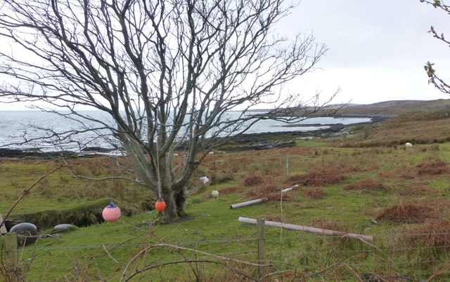
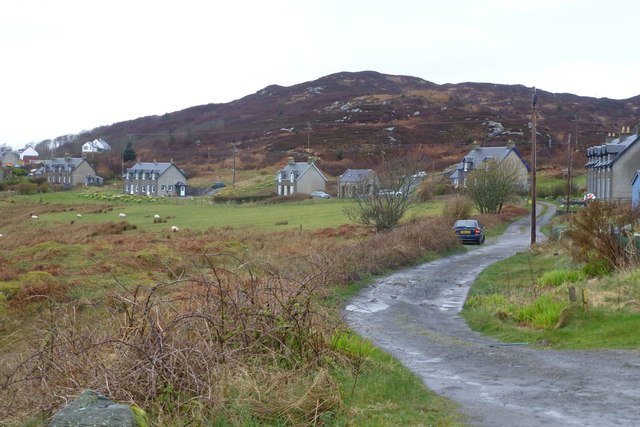
Surrounded by rolling hills and lush greenery, Port an Obain offers breathtaking views of the scenic Scottish countryside. The bay is also home to a diverse range of wildlife, making it a haven for nature enthusiasts. Visitors may catch a glimpse of seals, dolphins, and various species of seabirds while exploring the area.

Port an Obain is a peaceful and secluded spot, providing a peaceful retreat away from the hustle and bustle of city life. It offers a sense of tranquility and serenity, making it a perfect getaway for those seeking relaxation and rejuvenation.

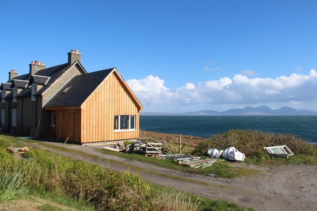
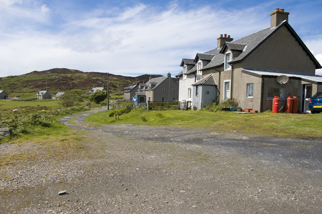
The bay is easily accessible by road, with parking facilities available nearby. There are also a few local accommodations and amenities in the vicinity, including cafes, restaurants, and guesthouses, providing visitors with convenience and comfort.

Overall, Port an Obain in Argyllshire is a hidden gem of Scotland, offering a combination of natural beauty, outdoor activities, and a peaceful atmosphere that attracts visitors from far and wide.

If you have any feedback on the listing, please let us know in the comments section below.

Port an Obain Images

Images are sourced within 2km of 56.068854/-6.1855634 or Grid Reference NR3994. Thanks to Geograph Open Source API. All images are credited.

Riasg Buidhe ruins Abandoned village
Riasg Buidhe ruins
Abandoned village
Houses at Glas Aird Wild goats are often seen in this area.
Houses at Glas Aird
Wild goats are often seen in this area.
Ruins of old fishing village Foreground is dominated by Juncus effusus and Pteridium aquilinum
Ruins of old fishing village
Foreground is dominated by Juncus effusus and Pteridium aquilinum
Ruined fishing village
Cottages at Glassard
An Dunan Mor
An Dunan Mor
Riasg Buidhe A fishing village abandoned early in the 20th century. The inhabitants were rehoused at Glassard.
Riasg Buidhe
A fishing village abandoned early in the 20th century. The inhabitants were rehoused at Glassard.
Nautical playground at Glas Aird The north west extremity of Scalasaig.
Nautical playground at Glas Aird
The north west extremity of Scalasaig.
Houses at Glassard Inhabitants were relocated to the newly built Glassard houses c.1922. from Riasg Buidhe further up the coast.
Houses at Glassard
Inhabitants were relocated to the newly built Glassard houses c.1922. from Riasg Buidhe further up the coast.
Glassard north east of Scalasaig Viewed from the Calmac ferry from Oban to Colonsay.
Glassard north east of Scalasaig
Viewed from the Calmac ferry from Oban to Colonsay.
Extended house at Glassard Jura on the horizon.
Extended house at Glassard
Jura on the horizon.
Moor at Glac na Mònadh
Derelict house at Riasg Buidhe This is one of the buildings that housed Colonsay folk before the move to new houses at Glassard.  Photos of the buildings when they were in use are to be found at the exhibition in the Baptist Chapel created by the Colonsay and Oronsay Heritage Trust.
Derelict house at Riasg Buidhe
This is one of the buildings that housed Colonsay folk before the move to new houses at Glassard. Photos of the buildings when they were in use are to be found at the exhibition in the Baptist Chapel created by the Colonsay and Oronsay Heritage Trust.
Abandoned settlement  of Riasg Buidhe
Abandoned settlement of Riasg Buidhe
Houses at Glassard
Houses at Glassard
Riasg Buidhe This is the main street of what was once a fishing hamlet abandoned in 1918 when the inhabitants were re-located at Glassard.
The house with the gable end and the one in front had a slate roof the other further down the hill were all thatched
Riasg Buidhe
This is the main street of what was once a fishing hamlet abandoned in 1918 when the inhabitants were re-located at Glassard. The house with the gable end and the one in front had a slate roof the other further down the hill were all thatched
Gate posts at Riasg Buidhe These have identical twins about 200 metres to the north with no visible signs of a track between them. If you are thinking of visiting here from Colonsay House the track soon runs out, carry on along the high ground eastward until you find two other ruined houses and then turn south and head for the gate posts. This skirts a large area of bog uncrossable after wet weather, Riasg Bhuide means Yellow Marsh. You have been warned.
Gate posts at Riasg Buidhe
These have identical twins about 200 metres to the north with no visible signs of a track between them. If you are thinking of visiting here from Colonsay House the track soon runs out, carry on along the high ground eastward until you find two other ruined houses and then turn south and head for the gate posts. This skirts a large area of bog uncrossable after wet weather, Riasg Bhuide means Yellow Marsh. You have been warned.
Leaving Colonsay
Leaving Colonsay
Show me another place!

Port an Obain is located at Grid Ref: NR3994 (Lat: 56.068854, Lng: -6.1855634)

Unitary Authority: Argyll and Bute

Police Authority: Argyll and West Dunbartonshire

What 3 Words

///corkscrew.puzzle.circling. Near Scalasaig, Argyll & Bute

Related Wikis

Scalasaig

Scalasaig (Scottish Gaelic: Sgalasaig) lies on the east coast of Colonsay in the Hebrides of Scotland. It is the main settlement on the island and its...

Colonsay Parish Church, Scalasaig

Colonsay Parish Church is a Category B listed Church of Scotland parish church in Scalasaig, Colonsay. == History == The church was built in 1801–04 at...

Colonsay Hotel

Colonsay Hotel is a Category B listed building in Scalasaig, Colonsay in the county of Argyll, in western Scotland. == History and architecture == The...

Dùn Eibhinn

Dùn Eibhinn, also known as Dun Evan, Dun Eivan or Fort of Eyvind, is a hillfort located on the Inner Hebridean island of Colonsay, Scotland. The site is...

Nearby Amenities

Located within 500m of 56.068854,-6.1855634
Scalasaig
Name En: Scalasaig
Name Gd: Sgalasaig
Place: village
Wikidata: Q7429691
Wikipedia: en:Scalasaig
Lat/Long: 56.0696324/-6.1885841
Post Office
Isle Of Colonsay Post Office
Addr Country: GB
Addr Postcode: PA61 7YW
Brand: Post Office
Brand Wikidata: Q1783168
Contact Website: https://www.postoffice.co.uk/branch-finder/1708589/colonsay-(isle-of)
Ref Pol Id: 4542
Lat/Long: 56.0703083/-6.188052
Seamark Light Category: upper
Seamark Light Character: Iso
Seamark Light Colour: green
Seamark Light Height: 10
Seamark Light Period: 4
Seamark Light Range: 2
Seamark Light Reference: A 4202.1
Seamark Type: light_minor
Source: US NGA Pub. 114. 2011-05-26.
Lat/Long: 56.0687457/-6.1847172
Seamark Light Category: lower
Seamark Light Character: Iso
Seamark Light Colour: green
Seamark Light Height: 8
Seamark Light Period: 4
Seamark Light Range: 2
Seamark Light Reference: A 4202
Seamark Type: light_minor
Source: US NGA Pub. 114. 2011-05-26.
Lat/Long: 56.0688577/-6.1835155
Man Made: lighthouse
Seamark Light 1 Character: Fl
Seamark Light 1 Colour: red
Seamark Light 1 Group: 2
Seamark Light 1 Height: 6
Seamark Light 1 Period: 10
Seamark Light 1 Range: 5
Seamark Light 1 Sector End: 230
Seamark Light 1 Sector Start: 200
Seamark Light 1 Sequence: 1.5+(1.5),1.5+(5.5)
Seamark Light 2 Character: Fl
Seamark Light 2 Colour: white
Seamark Light 2 Group: 2
Seamark Light 2 Height: 6
Seamark Light 2 Period: 10
Seamark Light 2 Range: 8
Seamark Light 2 Sector End: 337
Seamark Light 2 Sector Start: 230
Seamark Light 2 Sequence: 1.5+(1.5),1.5+(5.5)
Seamark Light 3 Character: Fl
Seamark Light 3 Colour: red
Seamark Light 3 Group: 2
Seamark Light 3 Height: 6
Seamark Light 3 Period: 10
Seamark Light 3 Range: 5
Seamark Light 3 Sector End: 354
Seamark Light 3 Sector Start: 337
Seamark Light 3 Sequence: 1.5+(1.5),1.5+(5.5)
Seamark Light Reference: A 4200
Seamark Type: light_minor
Source: US NGA Pub. 114. 2011-05-26.
Wikidata: Q29145125
Lat/Long: 56.0668344/-6.1817416
Leisure: slipway
Lat/Long: 56.0685088/-6.1853409
Ferry Terminal
Lat/Long: 56.068651/-6.1849416
Scalasaig
Harbour: yes
Seamark Type: harbour
Lat/Long: 56.0683512/-6.1871669
Post Box
Collection Times: Mo-Fr 12:00; Sa 13:00
Operator: Royal Mail
Operator Wikidata: Q638098
Post Box Type: lamp
Ref: PA61 23
Source: survey
Lat/Long: 56.0702914/-6.1879694
Telephone
Lat/Long: 56.0685501/-6.1886806
Power: pole
Lat/Long: 56.0702905/-6.1921108
Power: pole
Lat/Long: 56.070691/-6.190984
Power: pole
Lat/Long: 56.0710028/-6.1900864
Power: pole
Lat/Long: 56.071455/-6.1887705
Power: pole
Lat/Long: 56.0714549/-6.1877621
Power: pole
Lat/Long: 56.0714866/-6.1861687
Power: pole
Lat/Long: 56.0725292/-6.1853709
Power: pole
Lat/Long: 56.0728922/-6.1849929
Power: pole
Lat/Long: 56.0730713/-6.1850546
Power: pole
Lat/Long: 56.0672775/-6.1918567
Power: pole
Lat/Long: 56.0674146/-6.1903932
Power: pole
Lat/Long: 56.0675017/-6.1893964
Power: pole
Lat/Long: 56.0677113/-6.1930754
Power: pole
Lat/Long: 56.068485/-6.1932113
Port a Mhinisteir
Natural: bay
Source Name: OS_OpenData_StreetView
Lat/Long: 56.0714453/-6.1821686
Port an Obain
Natural: bay
Source Name: OS_OpenData_StreetView
Lat/Long: 56.069111/-6.1851982
Port na Feamainn
Natural: bay
Source Name: OS_OpenData_StreetView
Lat/Long: 56.0684158/-6.1843246
Historic: memorial
Memorial: war_memorial
Lat/Long: 56.0688739/-6.1886987
Power: pole
Lat/Long: 56.0725907/-6.1847362
Power: pole
Lat/Long: 56.0719189/-6.1858379
The data included in this document is from www.openstreetmap.org. The data is made available under ODbL.

Have you been to Port an Obain?

Leave your review of Port an Obain below (or comments, questions and feedback).