Butter Porth

Bay in Cornwall

England

Butter Porth

Lower Town Quay The smaller of the two quays on St Martin’s. The larger quay at Higher Town is the one used for freight deliveries, but is inaccessible at a low tide.

The island behind is the uninhabited Tean (pronounced tea-an).
Lower Town Quay Credit: David Lally

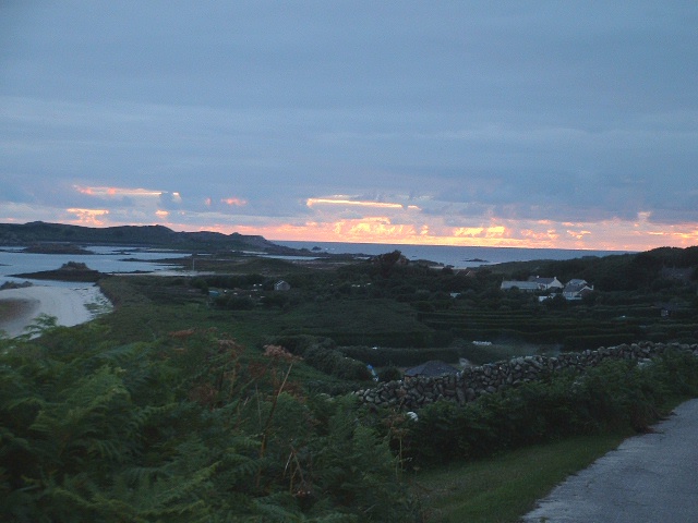
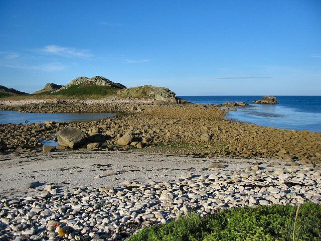
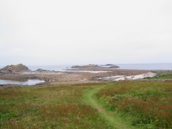
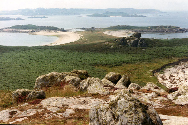
Butter Porth is a picturesque bay located in Cornwall, England. Situated on the rugged North coast, it offers stunning views of the Atlantic Ocean and is a popular destination for tourists and locals alike.

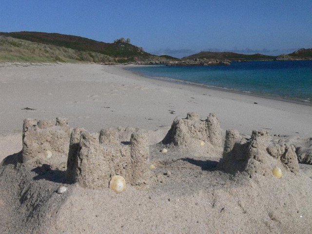
The bay is known for its golden sandy beach, which stretches for approximately one mile. The beach is surrounded by towering cliffs, providing a dramatic backdrop to the serene waters. During low tide, Butter Porth reveals a series of rock pools, perfect for exploring and discovering marine life.

The bay is also a popular spot for water sports enthusiasts, with opportunities for surfing, paddleboarding, and kayaking. The rolling waves and consistent swell make it an ideal location for experienced surfers, while beginners can take advantage of the surf schools located nearby.

Butter Porth is also home to a diverse range of wildlife, including seabirds, seals, and dolphins. Birdwatchers can often spot species such as gulls, cormorants, and oystercatchers along the cliffs and shoreline.

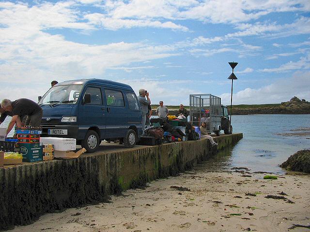
In terms of amenities, there is a car park located near the beach, as well as a seasonal café and restroom facilities. The bay can be accessed via a short walk from the parking area, and there are also coastal paths that lead to other nearby beaches and attractions.

Overall, Butter Porth offers a beautiful, unspoiled natural environment, perfect for those seeking a tranquil beach experience or outdoor adventure.

If you have any feedback on the listing, please let us know in the comments section below.
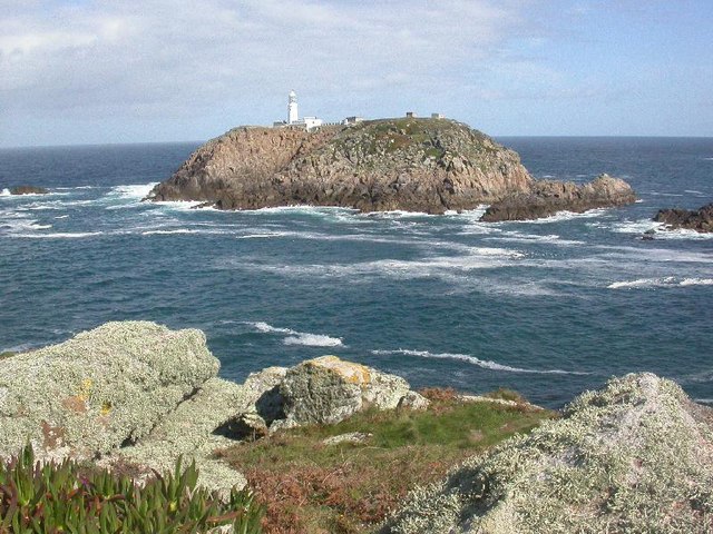
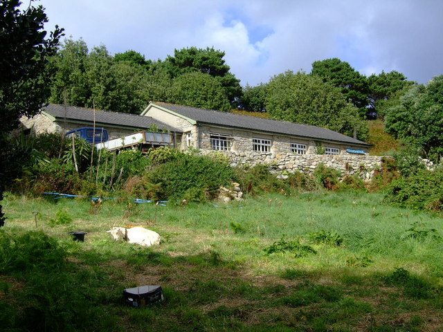
Butter Porth Images

Images are sourced within 2km of 49.974429/-6.2942955 or Grid Reference SV9217. Thanks to Geograph Open Source API. All images are credited.

Lower Town Quay The smaller of the two quays on St Martin’s. The larger quay at Higher Town is the one used for freight deliveries, but is inaccessible at a low tide.

The island behind is the uninhabited Tean (pronounced tea-an).
Lower Town Quay
The smaller of the two quays on St Martin’s. The larger quay at Higher Town is the one used for freight deliveries, but is inaccessible at a low tide. The island behind is the uninhabited Tean (pronounced tea-an).
Great Bay panorama On of the most beautiful spots on the islands.
Great Bay panorama
On of the most beautiful spots on the islands.
St Martins The beautiful St Martin's Bay
St Martins
The beautiful St Martin's Bay
Lower Town, St. Martin's Looking SW, Tresco in distance
Lower Town, St. Martin's
Looking SW, Tresco in distance
Middle Town - St Martin's, Scilly The westerly view from Middle Town. Tresco on the horizon.
Middle Town - St Martin's, Scilly
The westerly view from Middle Town. Tresco on the horizon.
St Martin's - Scillies The high street of Middle Town, St Martin's.
St Martin's - Scillies
The high street of Middle Town, St Martin's.
Sunset on St Martins looking westward
Looking out from gardens of Seven Stones pub View looking south from the pub
Looking out from gardens of Seven Stones pub
View looking south from the pub
St Martin's coastal path, looking towards Great Bay
St Martin's bay from Scilly point This is a beautiful beach of white sand.
St Martin's bay from Scilly point
This is a beautiful beach of white sand.
The tidal causeway to White Island, Scilly White Island is a part of St Martin's. This is the only land based way onto the island.
The tidal causeway to White Island, Scilly
White Island is a part of St Martin's. This is the only land based way onto the island.
Lower Town quay, St Martin's - Scilly A small quay - but very well used for loading and unloading all the things that are essential for island life.
Lower Town quay, St Martin's - Scilly
A small quay - but very well used for loading and unloading all the things that are essential for island life.
Scilly flower fields An example of the hedged in small fields that Scilly uses to grow its well known fragrant flowers. Photo taken near the church of Higher Town.
Scilly flower fields
An example of the hedged in small fields that Scilly uses to grow its well known fragrant flowers. Photo taken near the church of Higher Town.
Round Island from St Helens, Isles of Scilly St Helen's is an uninhabited Island.  I had landed, with others, from a vessel taking visitors around uninhabited islands on the northern edge of the Scillies archipelago.  I had been on St Helen's in (was it) 1999 for the eclipse - which we actually did see despite a certain amount of cloud.
Round Island from St Helens, Isles of Scilly
St Helen's is an uninhabited Island. I had landed, with others, from a vessel taking visitors around uninhabited islands on the northern edge of the Scillies archipelago. I had been on St Helen's in (was it) 1999 for the eclipse - which we actually did see despite a certain amount of cloud.
Seven Stones, St Martins, Scilly For many years requests for real beer were met with "it doesn't travel across water". Now the seas have changed their character around Scilly, proper beer is now plentiful at the Seven Stones. Views are pretty good too.
Seven Stones, St Martins, Scilly
For many years requests for real beer were met with "it doesn't travel across water". Now the seas have changed their character around Scilly, proper beer is now plentiful at the Seven Stones. Views are pretty good too.
The northern tip of St Martin's at low water.
Tean, Isles of Scilly. View from the Great Hill
Sandcastle on Great Bay, St Martins, Isles of Scilly As we came upon it in the morning the neap tide must have left it unscathed from the day before!
Sandcastle on Great Bay, St Martins, Isles of Scilly
As we came upon it in the morning the neap tide must have left it unscathed from the day before!
Show me another place!

Butter Porth is located at Grid Ref: SV9217 (Lat: 49.974429, Lng: -6.2942955)

Division: Isles of Scilly

Unitary Authority: Isles of Scilly

Police Authority: Devon and Cornwall

What 3 Words

///disputes.masterful.learns. Near St Martin's, Isles of Scilly

Related Wikis

White Island, Isles of Scilly

White Island (Cornish: Ar Nor, "facing the mainland" or Enys Wynn "white island" ) is one of the larger unpopulated islands of the Isles of Scilly, part...

Middle Town, St Martin's

Middle Town (Cornish: Tregres) is a small settlement on the island of St Martin's in the Isles of Scilly, England. It is situated slightly inland, approximately...

Lower Town, Isles of Scilly

Lower Town (Cornish: Trewoles) is the westernmost settlement on the island of St Martin's in the Isles of Scilly, England. One of the island's two quays...

St Martin's, Isles of Scilly

St Martin's (Cornish: Brechiek, lit. 'dappled island') is the northernmost populated island of the Isles of Scilly, England, United Kingdom. It has an...

Teän

Teän ( TEE-ən, sometimes written Tean without the diaeresis; Cornish: Enys Tian) is an uninhabited island to the north of the Isles of Scilly archipelago...

St Martin's Church, St Martin's

St Martin's Church, St Martin's is a Grade II listed parish church in the Church of England located in St Martin's, Isles of Scilly, UK. == History... ==

St Martin's Methodist Church, Isles of Scilly

The Methodist Church, St Martin's, Isles of Scilly is a Grade II listed chapel in St Martin's, Isles of Scilly. == History == Bible Christians arrived...

Higher Town, Isles of Scilly

Higher Town (Cornish: Trewartha) is the easternmost and largest settlement on the island of St Martin's in the Isles of Scilly, England. It is situated...

Nearby Amenities

Located within 500m of 49.974429,-6.2942955
Source: PGS
Lat/Long: 49.9743195/-6.292359
Source: PGS
Lat/Long: 49.9713339/-6.2920597
Source: PGS
Lat/Long: 49.9716753/-6.2918261
Source: PGS
Lat/Long: 49.971808/-6.2914795
Source: PGS
Lat/Long: 49.9709854/-6.2925103
Source: PGS
Lat/Long: 49.9703985/-6.2923327
Source: PGS
Lat/Long: 49.9716599/-6.2909607
Porth Morran
Natural: beach
Lat/Long: 49.9769301/-6.2926134
Little Bay
Natural: bay
Lat/Long: 49.9705862/-6.2907458
Source: PGS
Lat/Long: 49.973574/-6.292948
Source: PGS
Lat/Long: 49.9734284/-6.2920744
Top Rock Hill
Natural: peak
Lat/Long: 49.9721537/-6.2949656
Natural: peak
Lat/Long: 49.9754956/-6.2903704
The data included in this document is from www.openstreetmap.org. The data is made available under ODbL.

Have you been to Butter Porth?

Leave your review of Butter Porth below (or comments, questions and feedback).