Underland Girt

Bay in Cornwall

England

Underland Girt

Lower Town Quay The smaller of the two quays on St Martin’s. The larger quay at Higher Town is the one used for freight deliveries, but is inaccessible at a low tide.

The island behind is the uninhabited Tean (pronounced tea-an).
Lower Town Quay Credit: David Lally

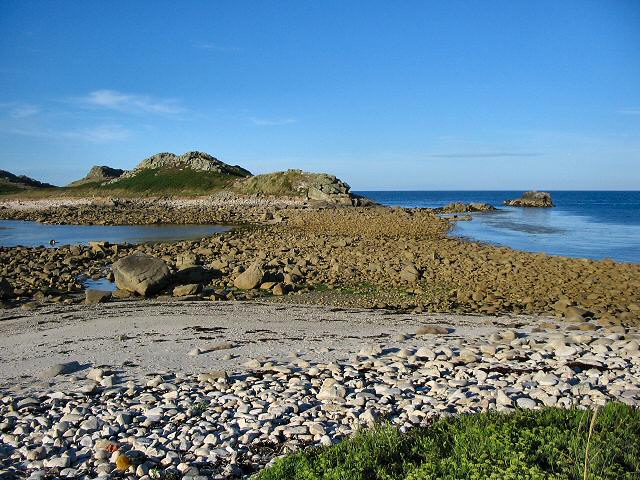
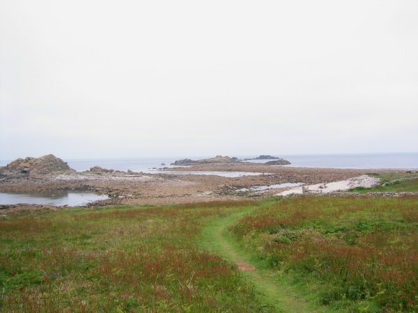
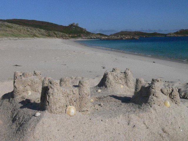
Underland Girt, Cornwall Bay, is a charming coastal area located in Cornwall, England. Situated on the southern coast, it offers breathtaking views of the Atlantic Ocean and is renowned for its stunning natural beauty. The bay is named after the village of Underland Girt, which lies nearby.

The bay boasts pristine sandy beaches that stretch for miles, making it a popular destination for sunbathers and beach enthusiasts. The crystal-clear waters are perfect for swimming, and the bay is also a haven for water sports such as surfing, kayaking, and paddleboarding.

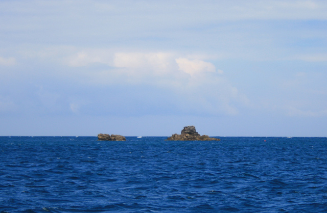
Nature lovers will be delighted by the diverse wildlife found in the area. Underland Girt is home to a variety of seabirds, including puffins and gannets, which can be observed nesting along the rocky cliffs. The bay is also a great spot for birdwatching, with many species of migratory birds passing through during different seasons.

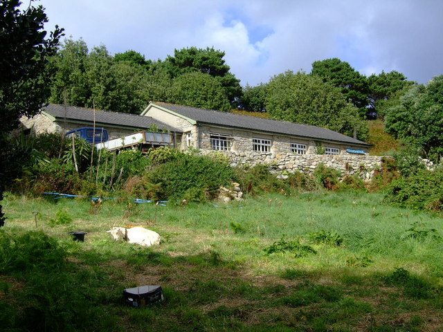
For those interested in history and culture, Underland Girt offers several attractions worth exploring. The nearby village features traditional Cornish architecture and quaint shops selling local crafts and delicacies. The area is also known for its rich mining heritage, with remnants of old tin mines dotting the landscape.

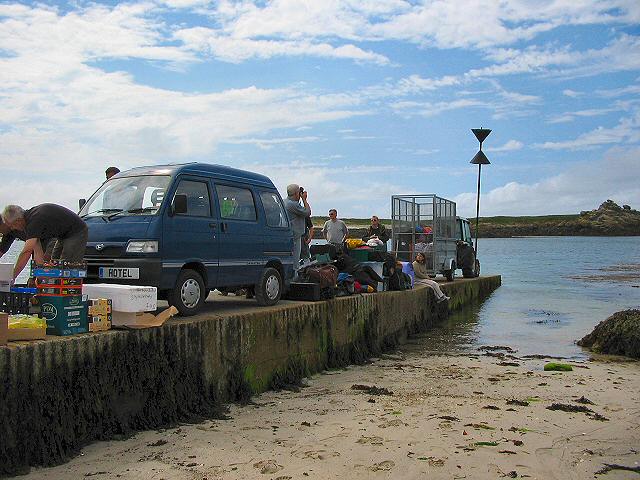
Visitors to Underland Girt can enjoy a range of amenities, including cafes, restaurants, and accommodations that cater to different budgets. Whether seeking relaxation on the beach, adventure on the water, or a glimpse into Cornwall's past, Underland Girt, Cornwall Bay, offers something for everyone.

If you have any feedback on the listing, please let us know in the comments section below.

Underland Girt Images

Images are sourced within 2km of 49.978404/-6.2889988 or Grid Reference SV9217. Thanks to Geograph Open Source API. All images are credited.

Lower Town Quay The smaller of the two quays on St Martin’s. The larger quay at Higher Town is the one used for freight deliveries, but is inaccessible at a low tide.

The island behind is the uninhabited Tean (pronounced tea-an).
Lower Town Quay
The smaller of the two quays on St Martin’s. The larger quay at Higher Town is the one used for freight deliveries, but is inaccessible at a low tide. The island behind is the uninhabited Tean (pronounced tea-an).
Great Bay panorama On of the most beautiful spots on the islands.
Great Bay panorama
On of the most beautiful spots on the islands.
St Martins The beautiful St Martin's Bay
St Martins
The beautiful St Martin's Bay
Lower Town, St. Martin's Looking SW, Tresco in distance
Lower Town, St. Martin's
Looking SW, Tresco in distance
St Martin's - Scillies The high street of Middle Town, St Martin's.
St Martin's - Scillies
The high street of Middle Town, St Martin's.
Looking out from gardens of Seven Stones pub View looking south from the pub
Looking out from gardens of Seven Stones pub
View looking south from the pub
St Martin's coastal path, looking towards Great Bay
St Martin's bay from Scilly point This is a beautiful beach of white sand.
St Martin's bay from Scilly point
This is a beautiful beach of white sand.
The tidal causeway to White Island, Scilly White Island is a part of St Martin's. This is the only land based way onto the island.
The tidal causeway to White Island, Scilly
White Island is a part of St Martin's. This is the only land based way onto the island.
Lower Town quay, St Martin's - Scilly A small quay - but very well used for loading and unloading all the things that are essential for island life.
Lower Town quay, St Martin's - Scilly
A small quay - but very well used for loading and unloading all the things that are essential for island life.
Seven Stones, St Martins, Scilly For many years requests for real beer were met with "it doesn't travel across water". Now the seas have changed their character around Scilly, proper beer is now plentiful at the Seven Stones. Views are pretty good too.
Seven Stones, St Martins, Scilly
For many years requests for real beer were met with "it doesn't travel across water". Now the seas have changed their character around Scilly, proper beer is now plentiful at the Seven Stones. Views are pretty good too.
The northern tip of St Martin's at low water.
Sandcastle on Great Bay, St Martins, Isles of Scilly As we came upon it in the morning the neap tide must have left it unscathed from the day before!
Sandcastle on Great Bay, St Martins, Isles of Scilly
As we came upon it in the morning the neap tide must have left it unscathed from the day before!
White Island viewed from Top Rock, St Martins, Isles of Scilly White Island is attached to St Martins except at high tide.
White Island viewed from Top Rock, St Martins, Isles of Scilly
White Island is attached to St Martins except at high tide.
His 'n' Hers Regulars down the Seven Stone Inn on St Martin's, Isles of Scilly.
His 'n' Hers
Regulars down the Seven Stone Inn on St Martin's, Isles of Scilly.
Black Rock From just North of Tean.
Black Rock
From just North of Tean.
Scilly Point Looking towards St Martin's Bay.
Scilly Point
Looking towards St Martin's Bay.
Moorings in Tean Sound Looking south west from just outside the hotel on the western end of St. Martin's, past the southern tip of Tean, across towards Tresco.
Moorings in Tean Sound
Looking south west from just outside the hotel on the western end of St. Martin's, past the southern tip of Tean, across towards Tresco.
Show me another place!

Underland Girt is located at Grid Ref: SV9217 (Lat: 49.978404, Lng: -6.2889988)

Division: Isles of Scilly

Unitary Authority: Isles of Scilly

Police Authority: Devon and Cornwall

What 3 Words

///gateway.nerves.just. Near St Martin's, Isles of Scilly

Related Wikis

White Island, Isles of Scilly

White Island (Cornish: Ar Nor, "facing the mainland" or Enys Wynn "white island" ) is one of the larger unpopulated islands of the Isles of Scilly, part...

Middle Town, St Martin's

Middle Town (Cornish: Tregres) is a small settlement on the island of St Martin's in the Isles of Scilly, England. It is situated slightly inland, approximately...

St Martin's, Isles of Scilly

St Martin's (Cornish: Brechiek, lit. 'dappled island') is the northernmost populated island of the Isles of Scilly, England, United Kingdom. It has an...

Lower Town, Isles of Scilly

Lower Town (Cornish: Trewoles) is the westernmost settlement on the island of St Martin's in the Isles of Scilly, England. One of the island's two quays...

Nearby Amenities

Located within 500m of 49.978404,-6.2889988
Porth Morran
Natural: beach
Lat/Long: 49.9769301/-6.2926134
Natural: peak
Lat/Long: 49.9794697/-6.2924304
Natural: peak
Lat/Long: 49.9793939/-6.2947263
Natural: peak
Lat/Long: 49.9754956/-6.2903704
The data included in this document is from www.openstreetmap.org. The data is made available under ODbL.

Have you been to Underland Girt?

Leave your review of Underland Girt below (or comments, questions and feedback).