Bàgh Teileam

Bay in Inverness-shire

Scotland

Bàgh Teileam

Peaty pool by the roadside Cotton grass by the roadside, looking south east towards the hills beyond Lochmaddy.
Peaty pool by the roadside Credit: Gordon Hatton

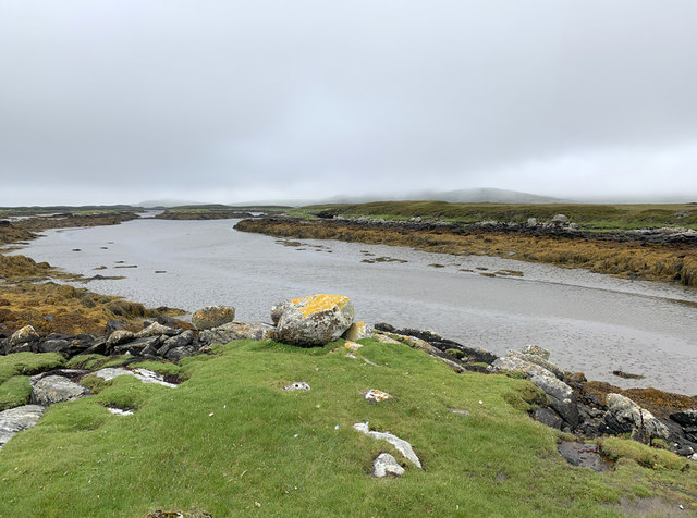
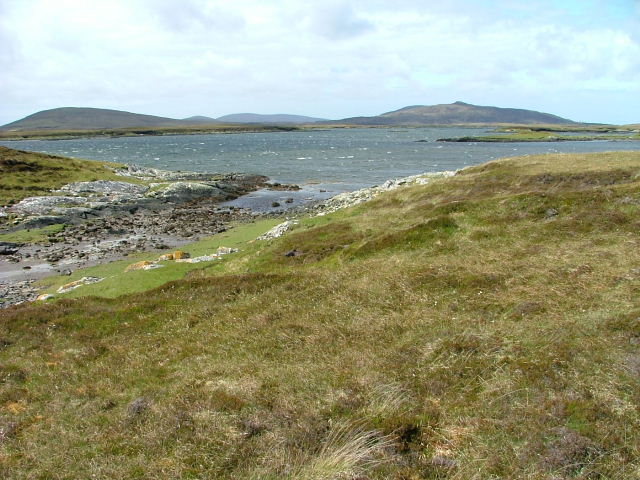
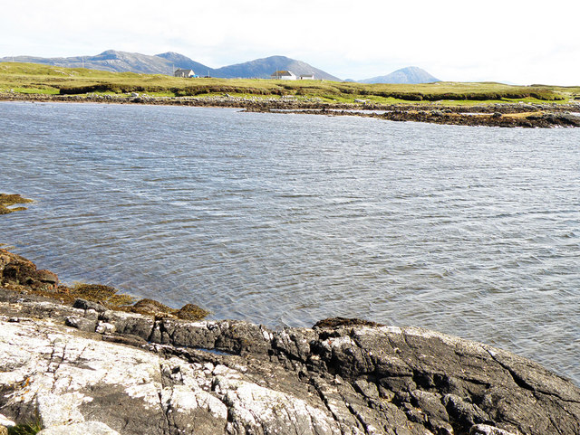
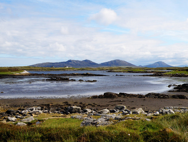
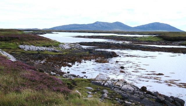
Bàgh Teileam, also known as Bay of Teileam, is a picturesque bay located in Inverness-shire, Scotland. Situated on the west coast of the Highlands, it is surrounded by stunning natural beauty and offers breathtaking views of the surrounding landscapes.

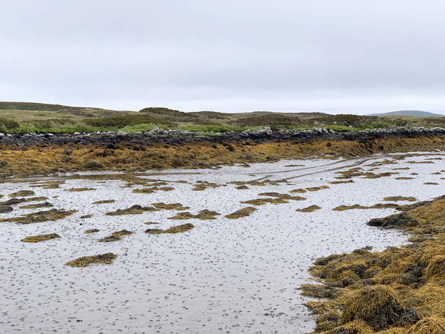
The bay is characterized by its sandy beach, which stretches for approximately 1.5 miles and is ideal for long walks and leisurely strolls. The beach is backed by dunes and grassy areas, providing ample space for picnics and relaxation. Bàgh Teileam is also a popular spot for water sports enthusiasts, with opportunities for activities such as kayaking, windsurfing, and sailing.

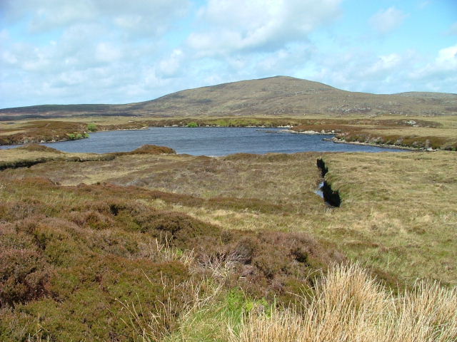
The bay is known for its diverse wildlife, making it a haven for nature lovers. Visitors can often spot various bird species, including oystercatchers, curlews, and terns, along with occasional sightings of seals and dolphins in the waters. The surrounding hills and cliffs are home to a variety of flora and fauna, adding to the bay's natural charm.

Bàgh Teileam is easily accessible, with a car park located nearby, making it a popular destination for locals and tourists alike. The bay offers a peaceful and tranquil atmosphere, making it the perfect place to escape the hustle and bustle of everyday life. Whether it's enjoying a scenic walk along the beach or simply admiring the stunning views, Bàgh Teileam is a must-visit location for those seeking to immerse themselves in the beauty of the Scottish Highlands.

If you have any feedback on the listing, please let us know in the comments section below.
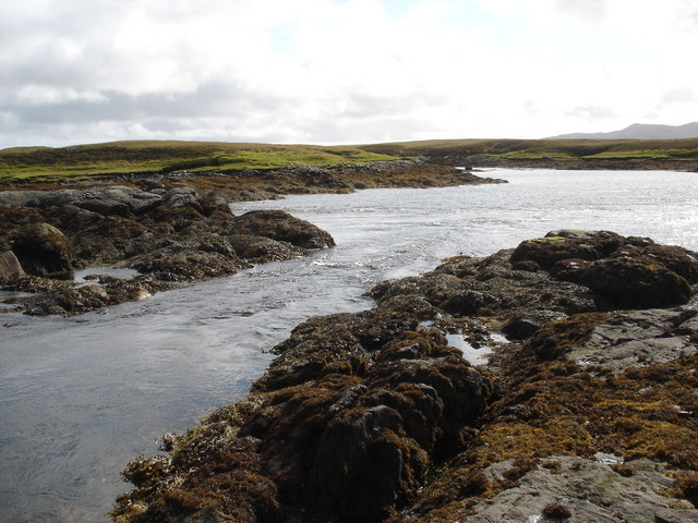
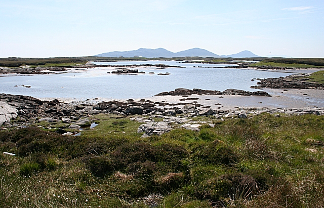
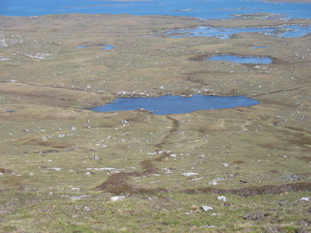
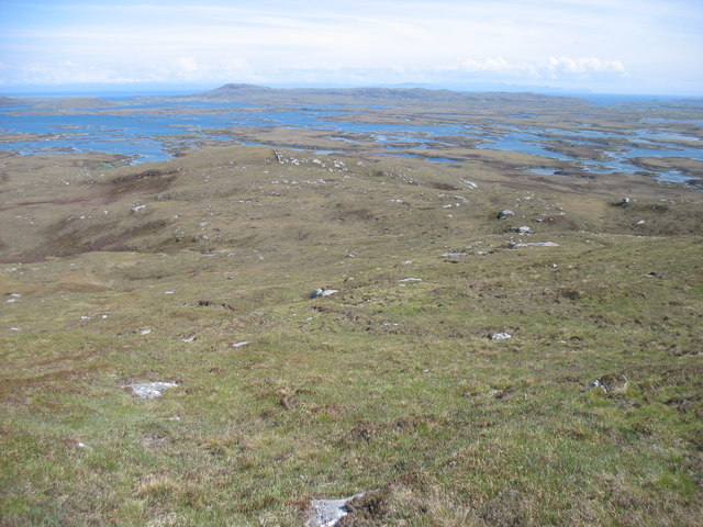
Bàgh Teileam Images

Images are sourced within 2km of 57.654375/-7.170449 or Grid Reference NF9174. Thanks to Geograph Open Source API. All images are credited.

Peaty pool by the roadside Cotton grass by the roadside, looking south east towards the hills beyond Lochmaddy.
Peaty pool by the roadside
Cotton grass by the roadside, looking south east towards the hills beyond Lochmaddy.
Peat stacks at Stolie Moorland dropping gently to a tidal channel, with Beinn Mhor in the distance.
Peat stacks at Stolie
Moorland dropping gently to a tidal channel, with Beinn Mhor in the distance.
Tidal channels and mud flats Having squeezed into a corner of this square, further progress across the tidal mud flats would appear to be a foolish move. The unnamed islet some 150m away is, according to the OS map, surrounded by sand. In reality it appears to be a rather sicky mud.
Tidal channels and mud flats
Having squeezed into a corner of this square, further progress across the tidal mud flats would appear to be a foolish move. The unnamed islet some 150m away is, according to the OS map, surrounded by sand. In reality it appears to be a rather sicky mud.
A maze of muddy channels Looking east from the Rubha Dubh promontory across a maze of muddy channels, exposed rocks and little islands.
A maze of muddy channels
Looking east from the Rubha Dubh promontory across a maze of muddy channels, exposed rocks and little islands.
Tidal channel from Rubha Dubh There's a maze of muddy tidal channels here. The OS map indicates sand, but only the foolish, or those with chest waders would be tempted to cross these muddy channels.
Tidal channel from Rubha Dubh
There's a maze of muddy tidal channels here. The OS map indicates sand, but only the foolish, or those with chest waders would be tempted to cross these muddy channels.
Tidal channel between Aird Innis and Aird nan Laogh Seen close to low tide. Aird Innis, almost a separate island is on the far side of the mud.
Tidal channel between Aird Innis and Aird nan Laogh
Seen close to low tide. Aird Innis, almost a separate island is on the far side of the mud.
Tidal channel between Aird Innis and Aird nan Laogh Seen close to low tide. Aird Innis, almost a separate island is on the far side of the mud.
Tidal channel between Aird Innis and Aird nan Laogh
Seen close to low tide. Aird Innis, almost a separate island is on the far side of the mud.
Cama Lochan Beinn Mhor in the background.
Cama Lochan
Beinn Mhor in the background.
Peat Bank By the Lochportain road.
Peat Bank
By the Lochportain road.
Loch Dheoir From the Lochportain road.
Loch Dheoir
From the Lochportain road.
Loch Dheoir In the distance can be seen Li a Tuath (250m), Li a Deas (281m) and Eabhal (347m)
Loch Dheoir
In the distance can be seen Li a Tuath (250m), Li a Deas (281m) and Eabhal (347m)
Loch Dheoir In the distance can be seen Li a Tuath (250m), Li a Deas (281m) and Eabhal (347m)
Loch Dheoir
In the distance can be seen Li a Tuath (250m), Li a Deas (281m) and Eabhal (347m)
Electricity Pole Crossing the soggy peat, as seen at the forefront of the photograph
Electricity Pole
Crossing the soggy peat, as seen at the forefront of the photograph
Tidal rapid draining Loch Dheoir Behind Lochmaddy is an area of shallow lagoons filled and drained by the tides each day. Where the tide runs between the rocks, tidal rapids are formed like this one in a narrows which drains Loch Dheoir towards Loch Blathaisbhal during the ebb.
Tidal rapid draining Loch Dheoir
Behind Lochmaddy is an area of shallow lagoons filled and drained by the tides each day. Where the tide runs between the rocks, tidal rapids are formed like this one in a narrows which drains Loch Dheoir towards Loch Blathaisbhal during the ebb.
Loch Dheoir In the distance are Li a Tuath (North Less), Li a Deas (South Lee) and Eabhal (Eaval), all in the south-east of North Uist.
Loch Dheoir
In the distance are Li a Tuath (North Less), Li a Deas (South Lee) and Eabhal (Eaval), all in the south-east of North Uist.
Loch Dubh na Moine Taken from the east slopes of Beinn Mhor. What was presumably an old enclosure boundary leads down to the loch.
Loch Dubh na Moine
Taken from the east slopes of Beinn Mhor. What was presumably an old enclosure boundary leads down to the loch.
South-east slopes of Beinn Mhor, North Uist
A corner of Loch Dheoir Loch Dheoir has an intricate shoreline with many tiny bays and inlets. Looking towards the hills beyond Lochmaddy.
A corner of Loch Dheoir
Loch Dheoir has an intricate shoreline with many tiny bays and inlets. Looking towards the hills beyond Lochmaddy.
Show me another place!

Bàgh Teileam is located at Grid Ref: NF9174 (Lat: 57.654375, Lng: -7.170449)

Unitary Authority: Na h-Eileanan an Iar

Police Authority: Highlands and Islands

What 3 Words

///countries.envoy.cherub. Near Lochmaddy, Na h-Eileanan Siar

Related Wikis

Loch an Duin

Loch an Duin is a complex system of freshwater, brackish and sea lochs, tidal channels and islands, on and close to North Uist off the west coast of Scotland...

Stromay

Stromay (Scottish Gaelic: Sròmaigh) is a tidal island off North Uist in the Sound of Harris, Scotland. The low island of Stromay lies between two wide...

Ceallasaigh Mòr

Ceallasaigh Mòr (or Keallasay More) is a low-lying island in Loch Maddy off North Uist in the Outer Hebrides of Scotland. This an area of shallow lagoons...

Ceallasaigh Beag

Ceallasaigh Beag (or Keallasay Beg) is a low-lying island in Loch Maddy off North Uist in the Outer Hebrides of Scotland. This an area of shallow lagoons...

Dun an Sticir

Dun an Sticir (Scottish Gaelic: Dùn an Sticir [ˈt̪un əɲ ˈʃtʲiçkʲɪɾʲ]) is an Iron Age broch situated approximately 9.5 kilometers north of Lochmaddy in...

Na Fir Bhrèige

Na Fir Bhrèige (pronounced [nə fiɾʲ ˈvɾʲeːkʲə]; can be translated from Gaelic into English as "The False Men") is a set of three standing stones on the...

Newtonferry

Newtonferry (Scottish Gaelic: Port nan Long, "the harbour of the ships") is a small crofting community on the island of North Uist in the Western Isles...

Sursaigh

Sursaigh (Scottish Gaelic: Sursaigh) is an island off North Uist in the Sound of Harris, Scotland. It lies 8 kilometres (5.0 mi) northeast of the village...

Have you been to Bàgh Teileam?

Leave your review of Bàgh Teileam below (or comments, questions and feedback).