Bàgh Clann Neill

Bay in Inverness-shire

Scotland

Bàgh Clann Neill

Old Milestone by the A865, Druim nan Dearcag, North Uist parish Granite slab by the A865, in parish of North Uist (North Uist District), Druim nan Dearcag, in reeds on verge, on long straight near fence at right angles to road.

Inscription not recorded.

Surveyed

Milestone Society National ID: WI_NUCW10
Old Milestone by the A865, Druim nan Dearcag, North Uist parish Credit: Milestone Society

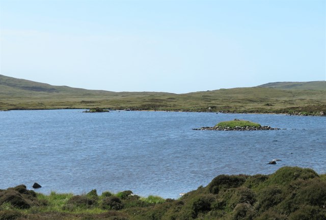
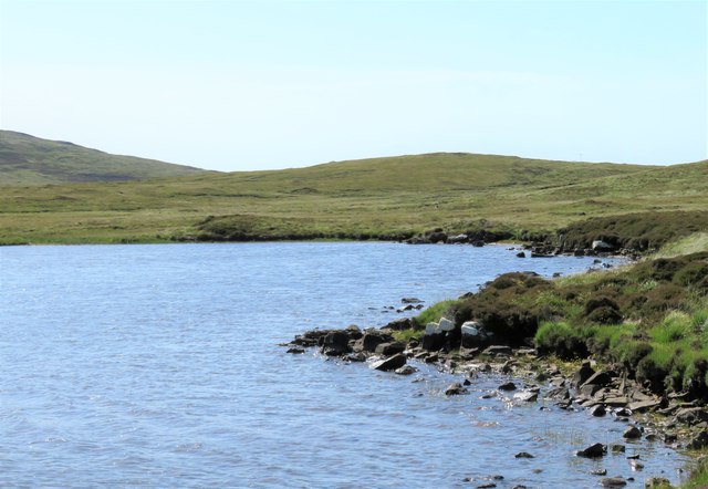
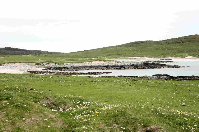
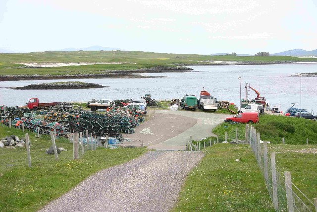
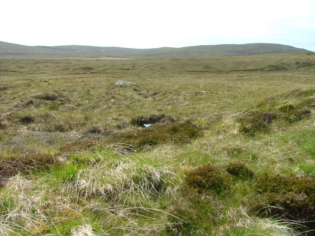
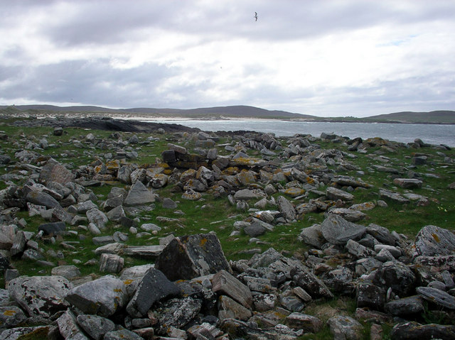
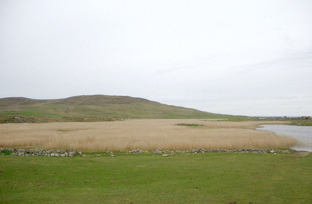
Bàgh Clann Neill, also known as the Bay of Clann Neill, is a picturesque bay located in the county of Inverness-shire, Scotland. Situated on the western coast of the Highlands, it offers stunning views of the surrounding landscape and the Atlantic Ocean.

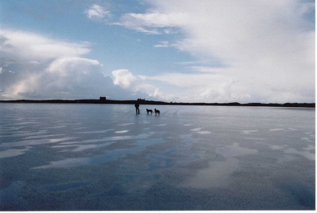
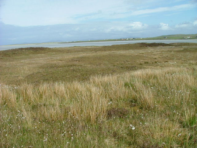
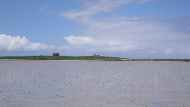
The bay is characterized by its pristine sandy beach, which stretches for approximately 2 miles. The beach is a popular spot for both locals and tourists, who come to enjoy the tranquil atmosphere and breathtaking scenery. The crystal-clear waters of the bay provide opportunities for swimming, snorkeling, and other water activities during the warmer months.

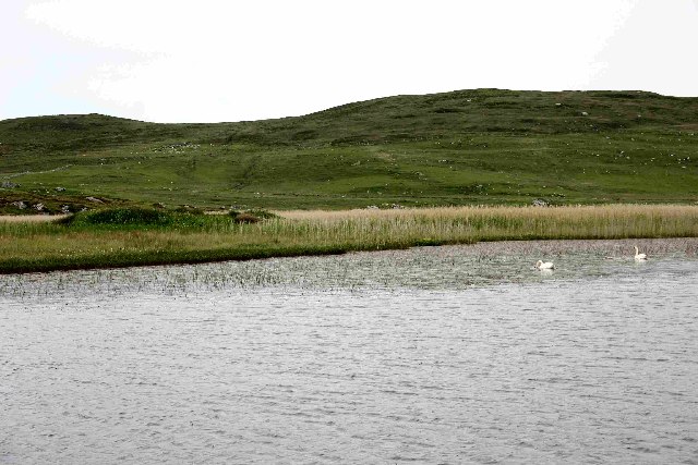
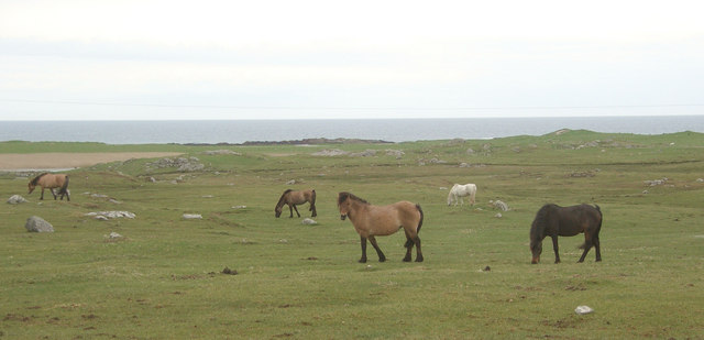
Bàgh Clann Neill is also home to a diverse range of wildlife, making it a haven for nature enthusiasts. The bay attracts various bird species, including herons, oystercatchers, and sandpipers, making it a great location for bird watching. Seals are often spotted basking on the rocks, adding to the charm of the area.

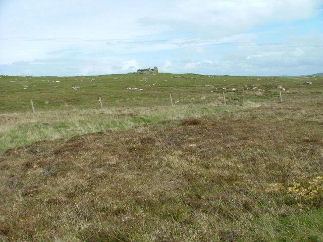
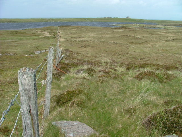
Surrounded by rolling hills and rugged cliffs, the bay offers numerous walking and hiking trails for outdoor enthusiasts. The nearby mountains provide a stunning backdrop for those looking to explore the surrounding countryside.

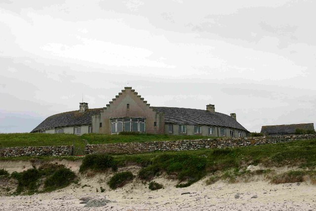
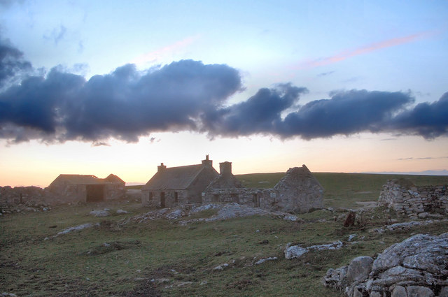
In terms of amenities, Bàgh Clann Neill has limited facilities, but there are a few local businesses that cater to visitors, including a cafe and a small shop. It is advised to bring any necessary supplies or equipment when visiting the bay.

Overall, Bàgh Clann Neill is a tranquil and picturesque bay that offers visitors a chance to connect with nature and enjoy the beauty of the Scottish Highlands.

If you have any feedback on the listing, please let us know in the comments section below.

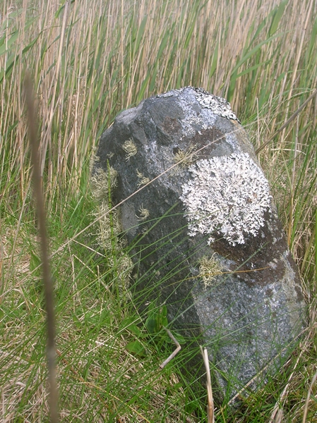
Bàgh Clann Neill Images

Images are sourced within 2km of 57.655828/-7.4355665 or Grid Reference NF7575. Thanks to Geograph Open Source API. All images are credited.

Old Milestone by the A865, Druim nan Dearcag, North Uist parish Granite slab by the A865, in parish of North Uist (North Uist District), Druim nan Dearcag, in reeds on verge, on long straight near fence at right angles to road.

Inscription not recorded.

Surveyed

Milestone Society National ID: WI_NUCW10
Old Milestone by the A865, Druim nan Dearcag, North Uist parish
Granite slab by the A865, in parish of North Uist (North Uist District), Druim nan Dearcag, in reeds on verge, on long straight near fence at right angles to road. Inscription not recorded. Surveyed Milestone Society National ID: WI_NUCW10
Loch na Gearrachun The tiny island is the site of a dun, whilst the stone causeway leading to it can just be seen to the right.
Loch na Gearrachun
The tiny island is the site of a dun, whilst the stone causeway leading to it can just be seen to the right.
Loch Fada na Gearrachun Small thin loch linked to its larger neighbour by a small channel.
Loch Fada na Gearrachun
Small thin loch linked to its larger neighbour by a small channel.
Erskine Beveridge's house on Bhalaigh The abandoned house of the historian Erskine Beveridge.
Erskine Beveridge's house on Bhalaigh
The abandoned house of the historian Erskine Beveridge.
Traigh Bhalaigh The island of Vallay (Bhalaigh), is only accessible by foot at low tide. It is situated on the North of North Uist. The island itself has standing stones and remnants of ancient settlements and the crumbling ruins of Vallay House. This, once grand, building and several outhouses was owned by Erskine Beveridge, who contributed greatly to the archaeology of North Uist and wrote a weighty book on the subject.
Traigh Bhalaigh
The island of Vallay (Bhalaigh), is only accessible by foot at low tide. It is situated on the North of North Uist. The island itself has standing stones and remnants of ancient settlements and the crumbling ruins of Vallay House. This, once grand, building and several outhouses was owned by Erskine Beveridge, who contributed greatly to the archaeology of North Uist and wrote a weighty book on the subject.
Callernish House Callernish House was built in 1961 by the 5th Earl Granville. Designed by Sir Martyn Beckett, it has 14 bedrooms and 8 bathrooms. It is listed as a folly in Headley and Meulenkamp's Follies, the standard guide to follies in Britain
Callernish House
Callernish House was built in 1961 by the 5th Earl Granville. Designed by Sir Martyn Beckett, it has 14 bedrooms and 8 bathrooms. It is listed as a folly in Headley and Meulenkamp's Follies, the standard guide to follies in Britain
View from Calarnais View from Calarnais over bay to the West
View from Calarnais
View from Calarnais over bay to the West
Dun in Loch an Eilean Picture taken from East side of the Loch
Dun in Loch an Eilean
Picture taken from East side of the Loch
Pier with Bhalaigh in the background
Machair Looking towards Tràigh Bhàlaigh.
Machair
Looking towards Tràigh Bhàlaigh.
Ruin on the Moorland Looking southwest from the A865.
Ruin on the Moorland
Looking southwest from the A865.
Fence running to Loch Olabhat Houses at Griminis in the distance.
Fence running to Loch Olabhat
Houses at Griminis in the distance.
Open Moorland Looking towards Beinn Riabhach.
Open Moorland
Looking towards Beinn Riabhach.
Teampull Orain The surf scattered ruin of Teampull Orain on Isle Oronsay
Teampull Orain
The surf scattered ruin of Teampull Orain on Isle Oronsay
Settlement ruins, Griminish Evening view of ruined buildings in a former settlement at Griminish.
Settlement ruins, Griminish
Evening view of ruined buildings in a former settlement at Griminish.
Reedbed, Loch an Eilean Looking westwards across a reedbed occupying a large part of Loch an Eilean. The hill in the background is Beinn Scolpaig.
Reedbed, Loch an Eilean
Looking westwards across a reedbed occupying a large part of Loch an Eilean. The hill in the background is Beinn Scolpaig.
Grazing land at Griminis, North Uist View looking north west of grazing land to the east of Loch an Eilean. The grazers here are horses and ponies of a riding centre.
Grazing land at Griminis, North Uist
View looking north west of grazing land to the east of Loch an Eilean. The grazers here are horses and ponies of a riding centre.
Bhalaigh House Bhalaigh viewed across Traigh Bhalaigh.  This vast expanse of sand dries to such an extent that at low tide cars can drive across to the island.
Bhalaigh House
Bhalaigh viewed across Traigh Bhalaigh. This vast expanse of sand dries to such an extent that at low tide cars can drive across to the island.
Show me another place!

Bàgh Clann Neill is located at Grid Ref: NF7575 (Lat: 57.655828, Lng: -7.4355665)

Unitary Authority: Na h-Eileanan an Iar

Police Authority: Highlands and Islands

What 3 Words

///clauses.undivided.flinches. Near Lochmaddy, Na h-Eileanan Siar

Related Wikis

Eilean Dòmhnuill

Ian Armit identifies the islet of Eilean Dòmhnuill (Scottish Gaelic: Eilean Dòmhnaill, Scottish Gaelic pronunciation: [elan ˈt̪õː.ɪʎ], "The Isle of Donald...

Vallay

Vallay (Scottish Gaelic: Bhàlaigh) is an uninhabited tidal island in the Scottish Outer Hebrides. It can be reached from North Uist by a long beach at...

Scolpaig Tower

Scolpaig Tower (also known as Dùn Scolpaig or MacLeod’s Folly) is a Georgian folly located near the village of Scolpaig on the island of North Uist in...

Scolpaig

Scolpaig (Scottish Gaelic: Sgolpaig) is a district on the north-west coast of the island of North Uist in the Outer Hebrides of Scotland. In 2018 it was...

Nearby Amenities

Located within 500m of 57.655828,-7.4355665
Created By: dmgroom_coastlines
Lat/Long: 57.65431/-7.4289
Created By: dmgroom_coastlines
Lat/Long: 57.65482/-7.42888
Created By: dmgroom_coastlines
Lat/Long: 57.65482/-7.4284
Created By: dmgroom_coastlines
Lat/Long: 57.6543/-7.42842
Created By: dmgroom_coastlines
Lat/Long: 57.65434/-7.43176
Created By: dmgroom_coastlines
Lat/Long: 57.6546/-7.43175
Created By: dmgroom_coastlines
Lat/Long: 57.65459/-7.4308
Created By: dmgroom_coastlines
Lat/Long: 57.65433/-7.43057
Seamark Information: Shown Mar. to Oct.
Seamark Light Category: vertical
Seamark Light Character: F
Seamark Light Colour: green
Seamark Light Height: 6
Seamark Light Multiple: 2
Seamark Light Range: 4
Seamark Light Reference: A 3995.8
Seamark Type: light_minor
Source: US NGA Pub. 114. 2011-05-26.
Lat/Long: 57.6542167/-7.4395
Leisure: slipway
Lat/Long: 57.6536322/-7.4392717
Power: pole
Lat/Long: 57.6539245/-7.4406248
Power: pole
Lat/Long: 57.654101/-7.4419016
The data included in this document is from www.openstreetmap.org. The data is made available under ODbL.

Have you been to Bàgh Clann Neill?

Leave your review of Bàgh Clann Neill below (or comments, questions and feedback).