An Acairseid

Bay in Inverness-shire

Scotland

An Acairseid

Curachan A skerry off the east coast of Barra.
Curachan Credit: Anne Burgess

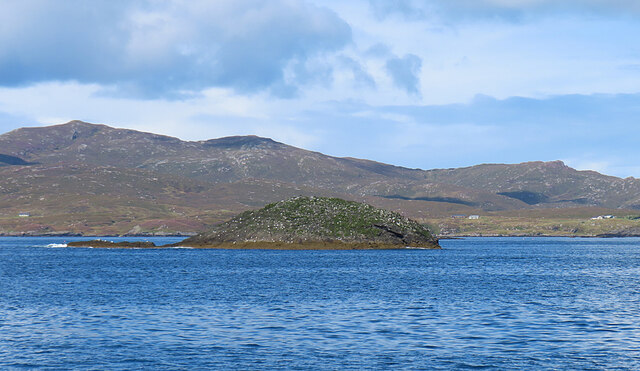
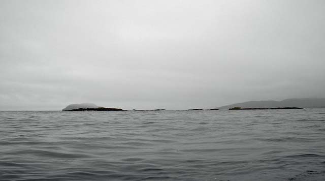
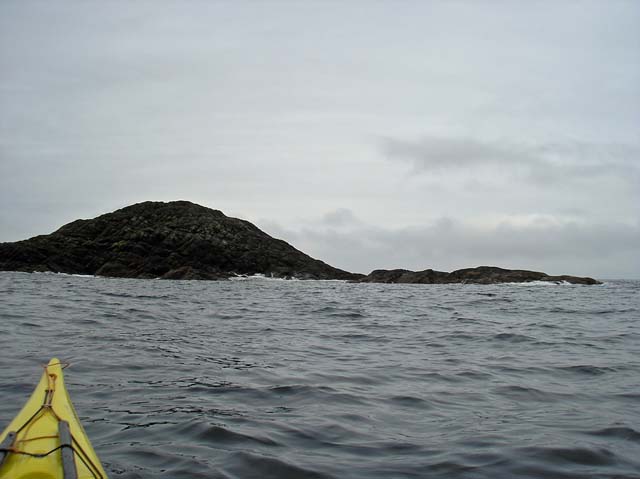
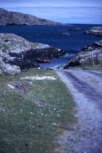
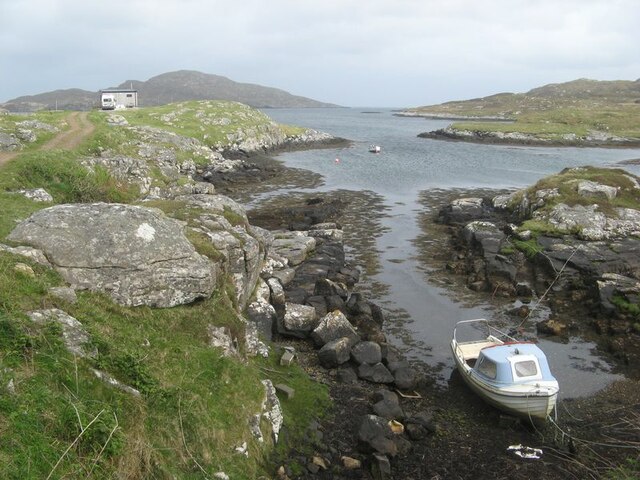
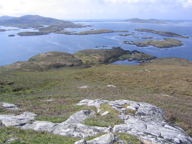
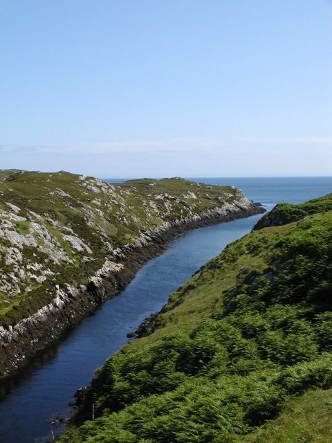
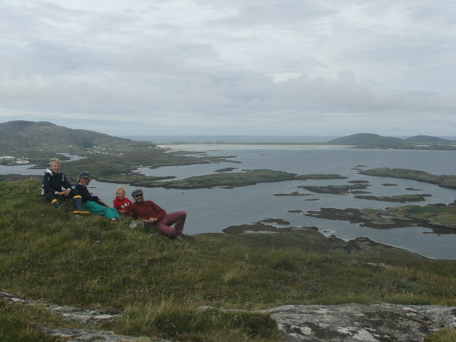
An Acairseid, located in Inverness-shire, Scotland, is a picturesque bay renowned for its natural beauty and rich history. Nestled along the western coast of Scotland, this bay offers stunning views of the surrounding mountains and a tranquil, idyllic setting.

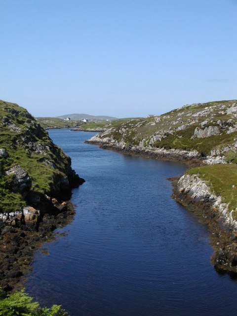
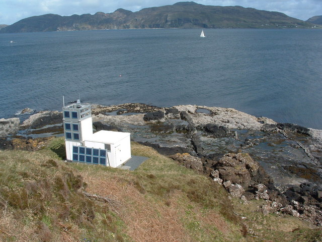
The bay is characterized by its calm, clear waters, which are ideal for various water activities such as sailing, kayaking, and fishing. Its sheltered location and gentle tides make it a popular spot for boating enthusiasts and nature lovers alike. The bay is also home to a diverse marine ecosystem, attracting a wide range of bird species and sea creatures.

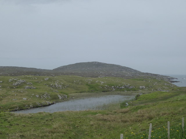
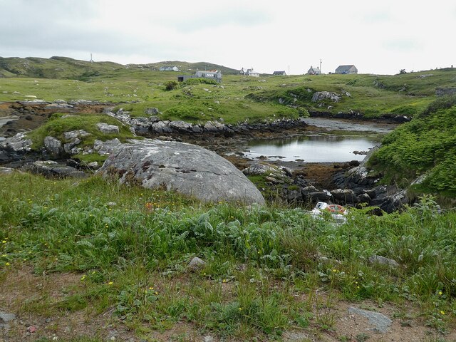
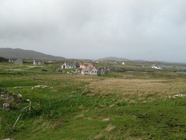
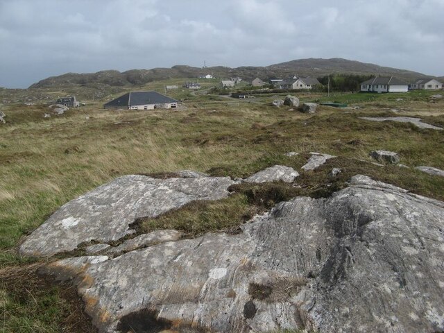
An Acairseid holds a significant historical importance as well. It was once a bustling fishing village, with evidence of its past evident in the remnants of old fishing huts and boat sheds that can still be seen along the shoreline. Visitors can immerse themselves in the area's rich heritage by exploring these historic landmarks and learning about the traditional fishing practices that were once prevalent in the bay.

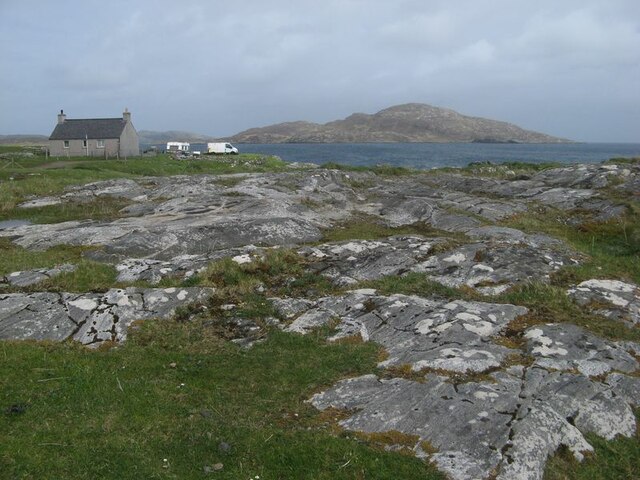
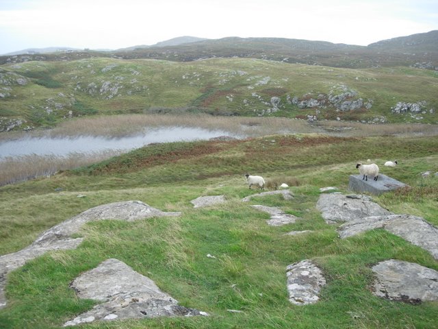
For those seeking a peaceful retreat, An Acairseid offers a tranquil atmosphere and stunning sunsets that are sure to captivate any visitor. The bay's natural beauty, combined with its historical significance, makes it a must-visit destination for anyone exploring the Inverness-shire region of Scotland.

If you have any feedback on the listing, please let us know in the comments section below.

An Acairseid Images

Images are sourced within 2km of 56.983736/-7.3781134 or Grid Reference NF7300. Thanks to Geograph Open Source API. All images are credited.

Curachan A skerry off the east coast of Barra.
Curachan
A skerry off the east coast of Barra.
Sgeir Fhiaclach Skerries Off the east coast of Barra. Maol Domhnaich in the background on the left, the dominant island at the entrance to Castlebay.
Sgeir Fhiaclach Skerries
Off the east coast of Barra. Maol Domhnaich in the background on the left, the dominant island at the entrance to Castlebay.
Curachan skerry A prominent skerry off the east coast of Barra.
Curachan skerry
A prominent skerry off the east coast of Barra.
Loch an Ail
Loch an Ail
Bruernish, Barra
Bruernish, Barra
Barra - Inlet near Bruernish (Bruairnis) This little inlet is to the south of the road leading to Rubha Chàrnain out of Bruernish (Bruairnis).
Barra - Inlet near Bruernish (Bruairnis)
This little inlet is to the south of the road leading to Rubha Chàrnain out of Bruernish (Bruairnis).
Crofts of Bruairnis Looking over the land at the extreme south east of the village.
Crofts of Bruairnis
Looking over the land at the extreme south east of the village.
Glaciated rock pavement A wide area of ice-scoured rock outcrop. The Lewisian Gneiss is wonderful to behold in locations like this where the rock is almost polished and it is possible to follow the pattern of folding and faulting for several metres across the surfaces. See also <a href="https://www.geograph.org.uk/photo/7199294">NF7202 : Lewisian gneiss outcrop</a>.
Glaciated rock pavement
A wide area of ice-scoured rock outcrop. The Lewisian Gneiss is wonderful to behold in locations like this where the rock is almost polished and it is possible to follow the pattern of folding and faulting for several metres across the surfaces. See also NF7202 : Lewisian gneiss outcrop.
Lewisian gneiss outcrop The Lewisian Gneiss, exposed in extensive glaciated outcrops at this location (see <a href="https://www.geograph.org.uk/photo/7199287">NF7202 : Glaciated rock pavement</a>) shows remarkable banded structure or foliation. This originates where the early-formed, pale granitic rock has been intruded by dark basaltic material and the composite then deformed in a more or less plastic state. Shearing has caused dark material to be stretched out in thin bands (top left) or thicker, more brittle blocks which have started to detach from each other. The last record is of transverse fractures which have been filled with new, quartz-rich mineralisation. This view is around 45 cms wide.
Lewisian gneiss outcrop
The Lewisian Gneiss, exposed in extensive glaciated outcrops at this location (see NF7202 : Glaciated rock pavement) shows remarkable banded structure or foliation. This originates where the early-formed, pale granitic rock has been intruded by dark basaltic material and the composite then deformed in a more or less plastic state. Shearing has caused dark material to be stretched out in thin bands (top left) or thicker, more brittle blocks which have started to detach from each other. The last record is of transverse fractures which have been filled with new, quartz-rich mineralisation. This view is around 45 cms wide.
Inlet with boat A tiny, natural harbour at the end of a linear channel. Features such as this channel have been eroded by glaciation which follows weaker rock adjacent to faults, one of which can be seen running parallel to the channel which has been cleared.
Inlet with boat
A tiny, natural harbour at the end of a linear channel. Features such as this channel have been eroded by glaciation which follows weaker rock adjacent to faults, one of which can be seen running parallel to the channel which has been cleared.
Bruairnis with rock outcrop Looking over rough ground towards the crofts of Buairnis. The glaciated rock outcrop show excellent and characteristic linear textures in the Lewisian Gneiss.
Bruairnis with rock outcrop
Looking over rough ground towards the crofts of Buairnis. The glaciated rock outcrop show excellent and characteristic linear textures in the Lewisian Gneiss.
Bruairnis, Barra
Bruairnis, Barra
Fuiay to the Black Isles
Loch an Ali Small, reasonably eutrophic, loch near the east coast of Barra.
Loch an Ali
Small, reasonably eutrophic, loch near the east coast of Barra.
Entrance to Loch Ob Looking into Loch Ob. This really is an arm of the sea - see next picture for the view in the opposite direction.
Entrance to Loch Ob
Looking into Loch Ob. This really is an arm of the sea - see next picture for the view in the opposite direction.
Entrance to Loch Ob Looking out to sea from the entrance to Loch Ob. An extraordinary geographical/geological feature - possibly a fault, it is navigable by small boats when the tide is in. The previous photo looks in the other direction.
Entrance to Loch Ob
Looking out to sea from the entrance to Loch Ob. An extraordinary geographical/geological feature - possibly a fault, it is navigable by small boats when the tide is in. The previous photo looks in the other direction.
Summit of Fuiay Fuiay is the highest of the small isles lying just off the northeast coast of Barra. The 107m summit affords a view to the northwest of numerous rocks and skerries and in the distance Traigh Mhor ("Big Beach"), which is the runway for Barra Airport.
Summit of Fuiay
Fuiay is the highest of the small isles lying just off the northeast coast of Barra. The 107m summit affords a view to the northwest of numerous rocks and skerries and in the distance Traigh Mhor ("Big Beach"), which is the runway for Barra Airport.
Bruairnis
Bruairnis
Show me another place!

An Acairseid is located at Grid Ref: NF7300 (Lat: 56.983736, Lng: -7.3781134)

Unitary Authority: Na h-Eileanan an Iar

Police Authority: Highlands and Islands

What 3 Words

///seriously.thighs.cracking. Near CastleBay, Na h-Eileanan Siar

Related Wikis

Fuiay

Fuiay (Scottish Gaelic: Fùidheigh) is an island in Scotland. It is one of ten islands in the Sound of Barra, a Site of Community Importance for conservation...

Flodday (Sound of Barra)

Flodday or Flodaigh (Scottish Gaelic), is a currently uninhabited island that lies to the north east of Barra and is one of ten islands in the Sound of...

Bogach

Bogach (Scottish Gaelic: A' Bhogach) is a village on the island of Barra in the Outer Hebrides, Scotland. Bogach is also within the parish of Barra, and...

Ardmore, Barra

Ardmhor (Scottish Gaelic: Aird Mhòr) is a small village in the north east of the Isle of Barra in the Outer Hebrides, Scotland. In 2002 a small ferry port...

Have you been to An Acairseid?

Leave your review of An Acairseid below (or comments, questions and feedback).