Kisdon Force

Waterfall in Yorkshire Richmondshire

England

Kisdon Force

Swinner Gill Ford This ford at Swinner Gill is found on the bridleway between Muker and Keld. A video of the ford can be viewed at:
<span class="nowrap"><a title="https://youtu.be/pRj-GMUVvRE" rel="nofollow ugc noopener" href="https://youtu.be/pRj-GMUVvRE">Link</a><img style="margin-left:2px;" alt="External link" title="External link - shift click to open in new window" src="https://s1.geograph.org.uk/img/external.png" width="10" height="10"/></span>
Swinner Gill Ford Credit: John Walton

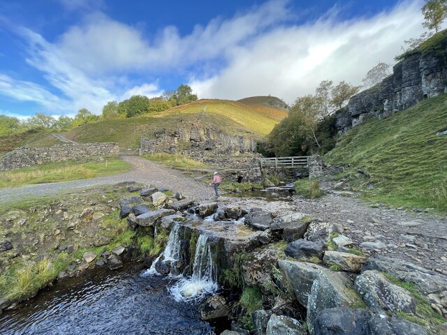
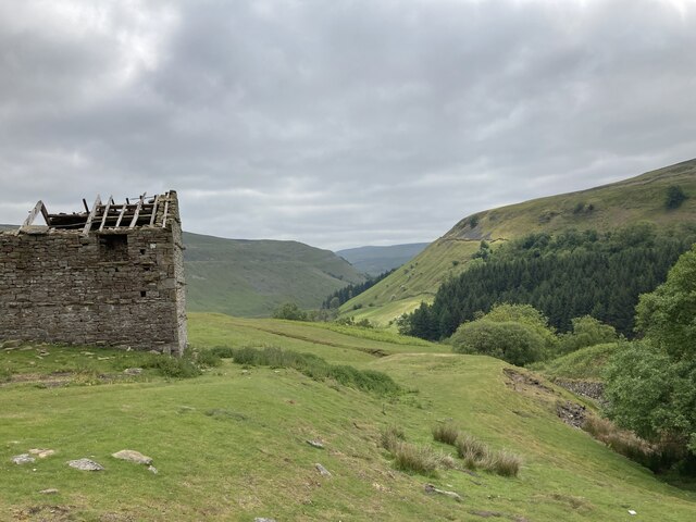
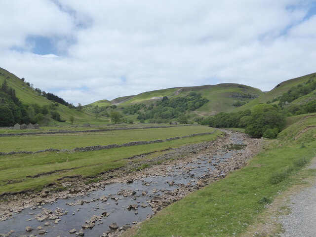
Kisdon Force, located in Yorkshire, England, is a captivating waterfall nestled within the scenic beauty of the Yorkshire Dales National Park. This natural wonder is situated near the charming village of Keld, making it easily accessible to visitors and locals alike.

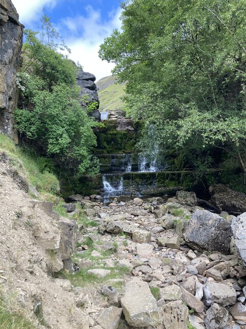
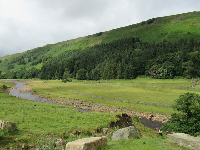
Standing at an impressive height of approximately 10 meters, Kisdon Force offers a breathtaking sight as the water cascades and tumbles down a series of rocky steps. The waterfall is fed by the Kisdon Beck, a river that meanders through the picturesque landscape before plunging down into a pool at the base of the falls.

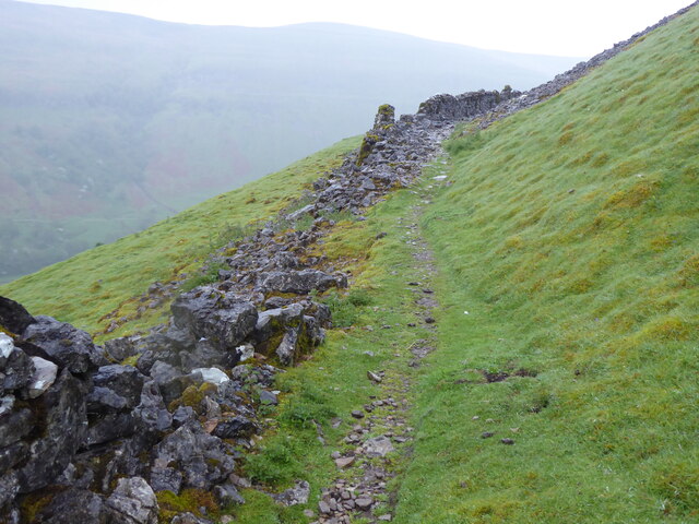
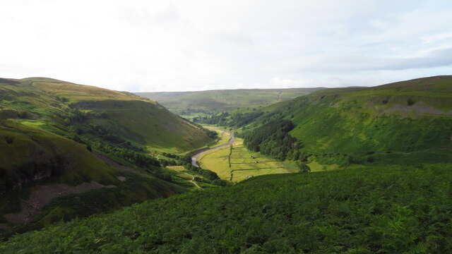
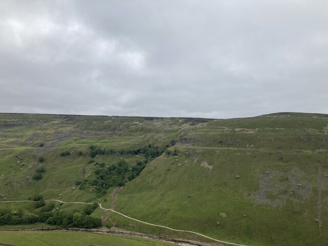
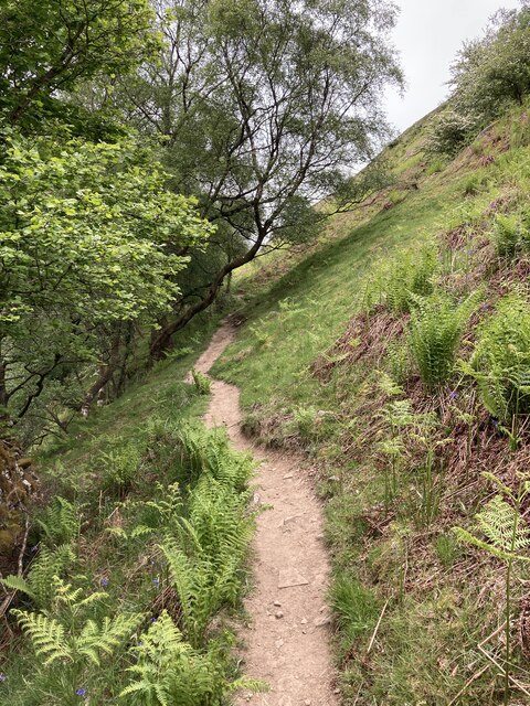
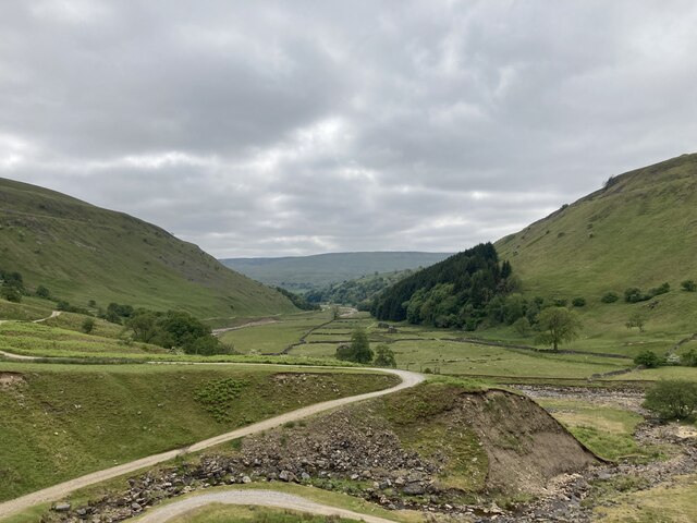
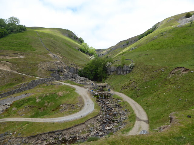
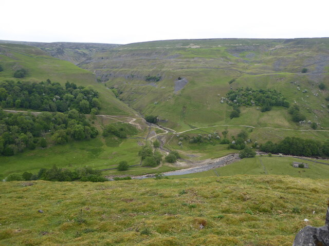
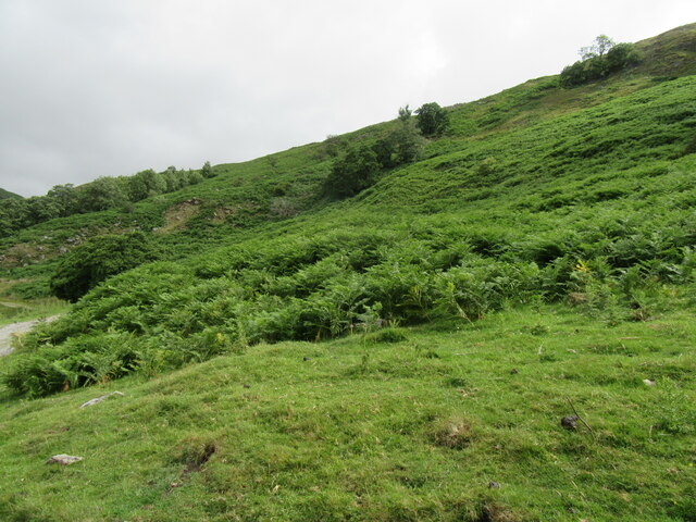
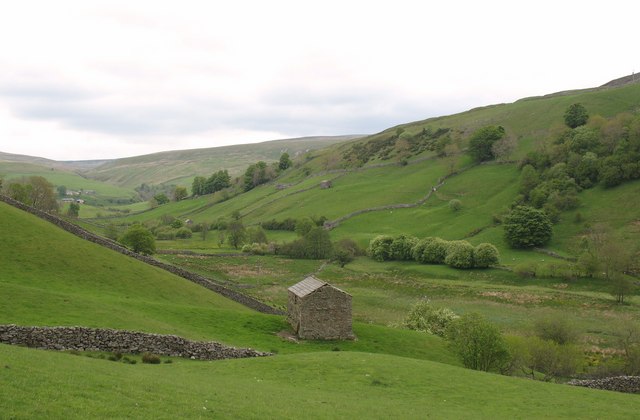
The surrounding area of Kisdon Force is abundant in lush vegetation, with verdant trees and shrubs providing a stunning backdrop to the roaring waters. Visitors can enjoy a leisurely stroll along the well-maintained footpaths that lead to the waterfall, allowing them to immerse themselves in the tranquility of the countryside.

Kisdon Force is a popular attraction for outdoor enthusiasts, nature lovers, and photographers, who flock to capture its beauty throughout the year. The waterfall offers a peaceful and serene atmosphere, making it an ideal spot for picnics or simply enjoying the sights and sounds of nature.

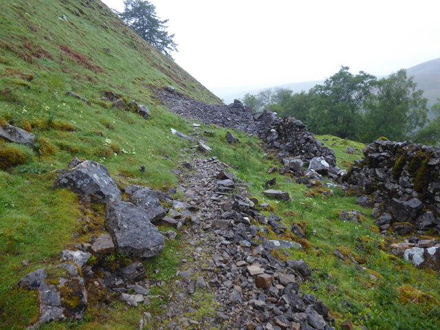
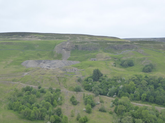
For those seeking a more adventurous experience, Kisdon Force is also a starting point for various hiking trails that crisscross the Yorkshire Dales. These trails provide opportunities for exploration and showcase the breathtaking landscapes that this region is renowned for.

In conclusion, Kisdon Force in Yorkshire is a stunning waterfall that offers a refreshing escape into nature's splendor. With its scenic surroundings and accessibility, it is a must-visit destination for anyone seeking to immerse themselves in the beauty of the Yorkshire Dales.

If you have any feedback on the listing, please let us know in the comments section below.

Kisdon Force Images

Images are sourced within 2km of 54.404098/-2.1575725 or Grid Reference NY8900. Thanks to Geograph Open Source API. All images are credited.

Swinner Gill Ford This ford at Swinner Gill is found on the bridleway between Muker and Keld. A video of the ford can be viewed at:
<span class="nowrap"><a title="https://youtu.be/pRj-GMUVvRE" rel="nofollow ugc noopener" href="https://youtu.be/pRj-GMUVvRE">Link</a><img style="margin-left:2px;" alt="External link" title="External link - shift click to open in new window" src="https://s1.geograph.org.uk/img/external.png" width="10" height="10"/></span>
Swinner Gill Ford
This ford at Swinner Gill is found on the bridleway between Muker and Keld. A video of the ford can be viewed at: LinkExternal link
East Gill from south of Long Gill The rather indistinct and intermittent quad bike tracks that form the only guide to the easiest route on the east bank of East Gill have just made a rather precarious and boggy crossing of Long Gill and ascended back onto firm ground. This pile of stones (it hardly qualifies as a cairn) commands a view over East Gill as it cuts down on its way to join the River Swale down a series of waterfalls into the Keld Gorge.
East Gill from south of Long Gill
The rather indistinct and intermittent quad bike tracks that form the only guide to the easiest route on the east bank of East Gill have just made a rather precarious and boggy crossing of Long Gill and ascended back onto firm ground. This pile of stones (it hardly qualifies as a cairn) commands a view over East Gill as it cuts down on its way to join the River Swale down a series of waterfalls into the Keld Gorge.
Lead mining scars at Beldi Hill Remarkably invisible from the popular public bridleway along the Swale left bank in Keld Gorge just a quarter kilometre to the south, the Beldi Hill workings have left a huge scar. A large chunk has been washed out of Hall Edge by hushing (a crude but effective form of hydraulic mining) over a long period, with the ore being transported to facilities downhill and to the east for smelting into lead.
Lead mining scars at Beldi Hill
Remarkably invisible from the popular public bridleway along the Swale left bank in Keld Gorge just a quarter kilometre to the south, the Beldi Hill workings have left a huge scar. A large chunk has been washed out of Hall Edge by hushing (a crude but effective form of hydraulic mining) over a long period, with the ore being transported to facilities downhill and to the east for smelting into lead.
The Pennine Way near Rukin Wood
The R Swale valley looking S from E of Crackpot Hall
West Arn Gill from North Gan Scar
The Pennine Way above Rukin Wood
Ruined barn above West Wood
Looking down Swaledale from Swinner Gill
Waterfall in Swinner Gill
Looking up Swinner Gill There are ruined buildings beside the footbridge which are remnants of the lead mining industry.
Looking up Swinner Gill
There are ruined buildings beside the footbridge which are remnants of the lead mining industry.
Looking up Swaledale
Looking across Swaledale towards Crackpot Hall
Looking across Swaledale towards Swinner Gill
Near West Arn Gill Looking SW.
Near West Arn Gill
Looking SW.
Near Swinner Gill In Swaledale.
Near Swinner Gill
In Swaledale.
Ruined mining building in Swinner Gill By the waterfall in Swinner Gill.
Ruined mining building in Swinner Gill
By the waterfall in Swinner Gill.
Show me another place!

Kisdon Force is located at Grid Ref: NY8900 (Lat: 54.404098, Lng: -2.1575725)

Division: North Riding

Administrative County: North Yorkshire

District: Richmondshire

Police Authority: North Yorkshire

What 3 Words

///corded.catapult.limit. Near Kirkby Stephen, Cumbria

Related Wikis

Kisdon Force

Kisdon Force is a series of waterfalls on the River Swale in Swaledale, England. The falls are situated within the Yorkshire Dales National Park in the...

East Gill Force

East Gill Force is a waterfall in Swaledale, 330 yards (300 m) east of the hamlet of Keld, in the Yorkshire Dales National Park, North Yorkshire, England...

Catrake Force

Catrake Force is a waterfall on the River Swale in North Yorkshire, England. It is not visible from the road but is accessible via a campsite in Keld....

Keld, North Yorkshire

Keld is a village in the English county of North Yorkshire. It is in Swaledale, and the Yorkshire Dales National Park. The name derives from the Viking...

Kisdon

Kisdon, also called Kisdon Hill, is a fell situated in upper Swaledale in the Yorkshire Dales National Park in North Yorkshire, England. == Geography... ==

Angram Bottoms

Angram Bottoms (grid reference SD891999) is a 9.8 hectares (24 acres) biological Site of Special Scientific Interest (SSSI) near to the village of Angram...

Wain Wath Force

Wain Wath Force is a waterfall on the River Swale in the Yorkshire Dales National Park, North Yorkshire, England. The falls are at grid reference NY883015...

West Stonesdale

West Stonesdale is a hamlet in the Yorkshire Dales, North Yorkshire, England. The secluded village is near Keld to the south, Tan Hill to the north and...

Nearby Amenities

Located within 500m of 54.404098,-2.1575725
East Gill Force (upper)
Image: https://www.geograph.org.uk/photo/5105644
Waterway: waterfall
Wikidata: Q5328445
Wikipedia: en:East Gill Force
Lat/Long: 54.4053284/-2.1610951
Kisdon Force
Image: https://www.geograph.org.uk/photo/613040
Waterway: waterfall
Wikidata: Q4584456
Wikipedia: en:Kisdon Force
Lat/Long: 54.4041573/-2.1576273
Birk Hill
Natural: peak
Source: OS OpenData StreetView
Lat/Long: 54.4035042/-2.158482
Landy Lead Level
Historic: mine
Mineral: lead
Photo: https://www.flickr.com/photos/theleadminer/2707649126/
Source: OS OpenData StreetView
Lat/Long: 54.40416/-2.1530532
Beldi Hill Lead Mines
Historic: mine
Mineral: lead
Source: OS OpenData StreetView
Lat/Long: 54.4059397/-2.1509504
Beldi Hill
Natural: peak
Source: OS OpenData StreetView
Lat/Long: 54.405259/-2.1539115
East Stonesdale
Place: farm
Lat/Long: 54.4066098/-2.1631967
Barrier: stile
Foot: yes
Lat/Long: 54.4020368/-2.156678
Information: guidepost
Tourism: information
Lat/Long: 54.4054867/-2.1611639
East Gill Force (lower)
Image: https://www.geograph.org.uk/photo/4636531
Waterway: waterfall
Lat/Long: 54.4048635/-2.1613949
Hiking: yes
Image: https://www.geograph.org.uk/photo/5837220
Information: guidepost
Tourism: information
Lat/Long: 54.404681/-2.1631722
Power: pole
Lat/Long: 54.4036733/-2.1639526
Power: pole
Lat/Long: 54.4040792/-2.1646486
Power: pole
Lat/Long: 54.4030722/-2.1644528
Beldi Hill Low Level leadmine and ore works
Historic: mine
Mineral: lead
Source: Bing imagery
Wikidata: Q17658330
Lat/Long: 54.4021167/-2.1507588
Bench
Backrest: yes
Source: survey
Lat/Long: 54.4054421/-2.161146
Bench
Backrest: yes
Source: survey
Lat/Long: 54.4054424/-2.1611948
Information: guidepost
Tourism: information
Lat/Long: 54.4032799/-2.1604954
Information: guidepost
Tourism: information
Lat/Long: 54.4031769/-2.1587647
Information: guidepost
Tourism: information
Lat/Long: 54.4020193/-2.1566905
The data included in this document is from www.openstreetmap.org. The data is made available under ODbL.

Have you been to Kisdon Force?

Leave your review of Kisdon Force below (or comments, questions and feedback).