Blake Beck Force

Waterfall in Yorkshire South Lakeland

England

Blake Beck Force

Meadow Sweet and foxgloves on NE side of Lea Yeat Brow
Meadow Sweet and foxgloves on NE side of Lea Yeat Brow Credit: Luke Shaw

Blake Beck Force, located in the Yorkshire Dales National Park, is a captivating waterfall that enchants visitors with its natural beauty and serene surroundings. This picturesque cascade is situated near the village of Buckden, in the heart of the stunning Yorkshire countryside.

The waterfall is formed by the Blake Beck, a small stream that tumbles down a series of rocky steps before plunging into a crystal-clear pool below. The cascading water creates a mesmerizing sight and a soothing soundtrack, providing a tranquil escape from the bustling city life.

The force is accessible via a short and pleasant walk through the enchanting woodlands, where visitors can immerse themselves in the peaceful ambiance of nature. The path leading to the waterfall is well-maintained and offers glimpses of the diverse flora and fauna found in the area.

Blake Beck Force is particularly picturesque during the spring and summer months when the surrounding vegetation is in full bloom, creating a vibrant and colorful backdrop to the cascading water. The tranquil pool beneath the waterfall invites visitors to take a refreshing dip on warmer days or simply sit back and enjoy the serene atmosphere.

For nature enthusiasts and photographers, Blake Beck Force provides ample opportunities to capture stunning shots of the waterfall and its surroundings. The force is also a popular spot for picnickers and those seeking a peaceful spot to relax and unwind amidst nature's splendor.

Overall, Blake Beck Force is a hidden gem in the Yorkshire Dales, offering a tranquil and captivating experience for visitors seeking a break from the hustle and bustle of everyday life.

If you have any feedback on the listing, please let us know in the comments section below.

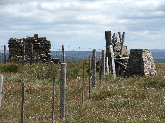
Blake Beck Force Images

Images are sourced within 2km of 54.264108/-2.3577723 or Grid Reference SD7685. Thanks to Geograph Open Source API. All images are credited.

Meadow Sweet and foxgloves on NE side of Lea Yeat Brow
Looking east along River Dee at Cowgill
Looking east along River Dee at Lea Yeat
Cowgill Bridge The road is the route from Dent to Garsdale Head. The bridge crosses the Cowgill Beck, and though modest in appearance, dates from 1702 and is grade II listed (list entry 1383839).
Cowgill Bridge
The road is the route from Dent to Garsdale Head. The bridge crosses the Cowgill Beck, and though modest in appearance, dates from 1702 and is grade II listed (list entry 1383839).
Cowgill Bridge - stone plaque The plaque marks the repair of the bridge in 1702 'at the charge of the West Riding'. The location is now in Cumbria rather than Yorkshire. See <a href="https://www.geograph.org.uk/photo/6961450">SD7586 : Cowgill Bridge</a> for context.
Cowgill Bridge - stone plaque
The plaque marks the repair of the bridge in 1702 'at the charge of the West Riding'. The location is now in Cumbria rather than Yorkshire. See SD7586 : Cowgill Bridge for context.
Cowgill chapel - south side Also known as Kirkthwaite Chapel, or the church of St John the Evangelist, a chapel of ease in the parish of Dent. Built 1837-8 and grade II listed. The wooden shingled bell turret is unusual for this part of the country. Dentdale was formerly part of the West Riding of Yorkshire and the parish belonged to the diocese of Bradford but now belongs to Cumbria and the diocese of Carlisle.
Cowgill chapel - south side
Also known as Kirkthwaite Chapel, or the church of St John the Evangelist, a chapel of ease in the parish of Dent. Built 1837-8 and grade II listed. The wooden shingled bell turret is unusual for this part of the country. Dentdale was formerly part of the West Riding of Yorkshire and the parish belonged to the diocese of Bradford but now belongs to Cumbria and the diocese of Carlisle.
Cowgill chapel - interior See <a href="https://www.geograph.org.uk/photo/6961469">SD7586 : Cowgill chapel - south side</a> for the outside, and the shared description for its history.
Cowgill chapel - interior
See SD7586 : Cowgill chapel - south side for the outside, and the shared description for its history.
Cowgill chapel - font See <a href="https://www.geograph.org.uk/photo/6961469">SD7586 : Cowgill chapel - south side</a> for the outside, and the shared description for the history of the church.
Cowgill chapel - font
See SD7586 : Cowgill chapel - south side for the outside, and the shared description for the history of the church.
Cowgill chapel - navvies memorial In addition to residents of the village buried over the years - and it's such a small place there can rarely have been more than a couple of funerals a year - 72 railway workers and their families (so several hundred people) died in the few years it took to build the Settle-Carlisle railway across the head of Dentdale.
Cowgill chapel - navvies memorial
In addition to residents of the village buried over the years - and it's such a small place there can rarely have been more than a couple of funerals a year - 72 railway workers and their families (so several hundred people) died in the few years it took to build the Settle-Carlisle railway across the head of Dentdale.
Cowgill chapel - organ Although it only has one manual (keyboard) it's surprisingly large for such a small church. Most small village chapels of this era would just have had a harmonium.
Cowgill chapel - organ
Although it only has one manual (keyboard) it's surprisingly large for such a small church. Most small village chapels of this era would just have had a harmonium.
Cowgill chapel - war memorial The memorial is a simple stone cross, smaller than many such. Even from this small village, six men lost their lives in the first worlds war and three in the second.
Cowgill chapel - war memorial
The memorial is a simple stone cross, smaller than many such. Even from this small village, six men lost their lives in the first worlds war and three in the second.
Signpost at the bottom of Coal Road The signpost is of a type common in the area, see <a href="https://www.geograph.org.uk/photo/1370306">SD7686 : Cowgill Signpost</a> for a close-up; adjacent is a community notice board.
Signpost at the bottom of Coal Road
The signpost is of a type common in the area, see SD7686 : Cowgill Signpost for a close-up; adjacent is a community notice board.
Coal Road, Cowgill A sign warns of a single track road ahead. It doesn't mention the gradient, shown on the map with a single arrow indicating 1:7 to 1:5. As I had to push my bicycle most of the way up, I suspect it was nearer the latter figure.
Coal Road, Cowgill
A sign warns of a single track road ahead. It doesn't mention the gradient, shown on the map with a single arrow indicating 1:7 to 1:5. As I had to push my bicycle most of the way up, I suspect it was nearer the latter figure.
Artengill viaduct from Lea Yeat Brow A well known feature of the Settle-Carlisle line, dramatic seen close up, but this photo shows its setting in the landscape of Upper Dentdale.  Unusually it is both a listed structure (grade II, list entry 1383817) and a scheduled monument (1007242).
Artengill viaduct from Lea Yeat Brow
A well known feature of the Settle-Carlisle line, dramatic seen close up, but this photo shows its setting in the landscape of Upper Dentdale. Unusually it is both a listed structure (grade II, list entry 1383817) and a scheduled monument (1007242).
Telecoms installation, Lea Yeat Brow The telecoms equipment has been added since the barn was last photographed from this site in 2015 <a href="https://www.geograph.org.uk/photo/4559611">SD7687 : Barn, Lea Yeat Brow</a>.
Telecoms installation, Lea Yeat Brow
The telecoms equipment has been added since the barn was last photographed from this site in 2015 SD7687 : Barn, Lea Yeat Brow.
Dentdale service reservoir Seen from above.  There's no impounding reservoir in this dale, so it's either spring-fed, or treated water is pumped up the dale.
Dentdale service reservoir
Seen from above. There's no impounding reservoir in this dale, so it's either spring-fed, or treated water is pumped up the dale.
Arten Gill Viaduct, 1968 On the Settle and Carlisle Line, a grade II listed structure. The train crossing, of nineteen hopper wagons and a brake van, appears to be hauled by a class 40 locomotive.
Arten Gill Viaduct, 1968
On the Settle and Carlisle Line, a grade II listed structure. The train crossing, of nineteen hopper wagons and a brake van, appears to be hauled by a class 40 locomotive.
Early morning Dent Head Viaduct
Show me another place!

Blake Beck Force is located at Grid Ref: SD7685 (Lat: 54.264108, Lng: -2.3577723)

Division: West Riding

Administrative County: Cumbria

District: South Lakeland

Police Authority: Cumbria

What 3 Words

///instructs.snoring.beam. Near Sedbergh, Cumbria

Related Wikis

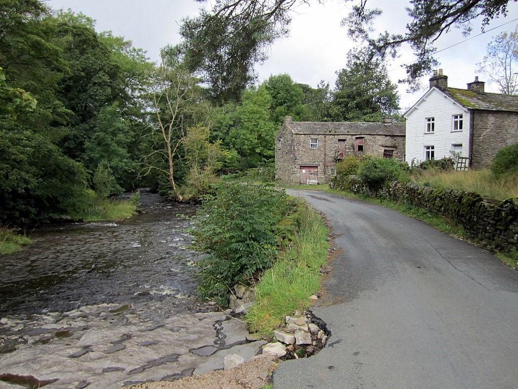
Stone House, Cumbria

Stone House is a locality at Dent Head on the River Dee, in the county of Cumbria, England, to the south-east of Cowgill and to the north-west of Newby...
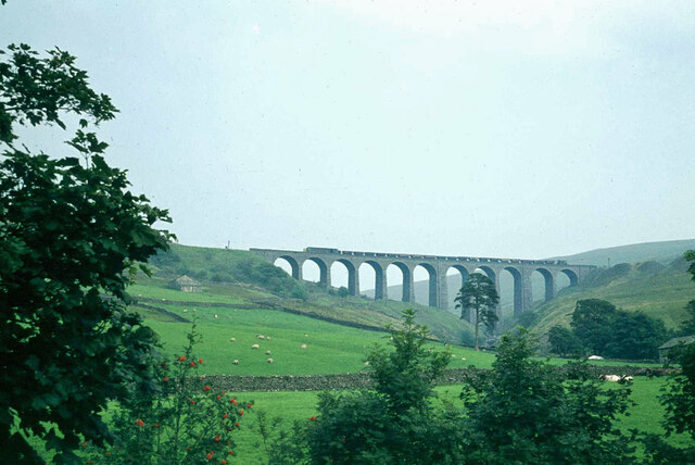
Arten Gill Viaduct

Arten Gill Viaduct is an eleven-arch railway bridge in Dentdale, Cumbria, England. The viaduct carries the Settle to Carlisle railway line over Artengill...

Dent Head Viaduct

Dent Head Viaduct is a railway viaduct on the Settle–Carlisle line in Dentdale, Cumbria, England. It is the second major viaduct on the line northwards...
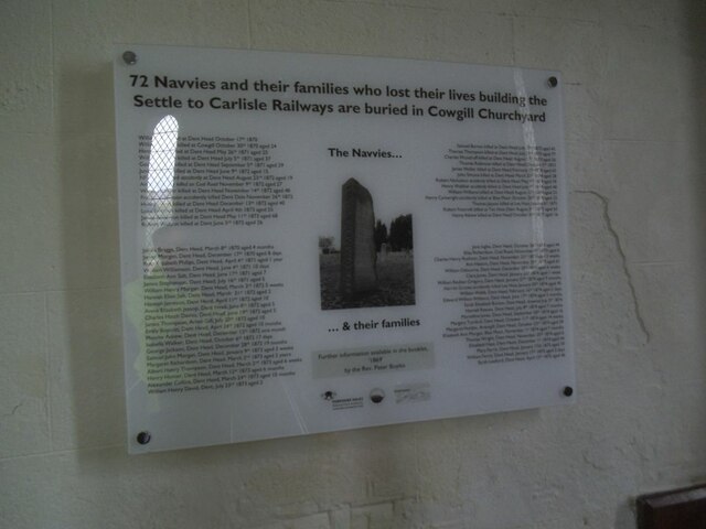
Cowgill, Cumbria

Cowgill is a village in Westmorland and Furness, Cumbria, England. It is within the historic boundaries of the West Riding of Yorkshire, and is located...

St John the Evangelist's Church, Cowgill

St John the Evangelist's Church is the Church of England parish church of the village of Cowgill, Cumbria, England. It is in the deanery of Kendal, the...

Dent railway station

Dent is a railway station on the Settle and Carlisle Line, which runs between Carlisle and Leeds via Settle. The station, situated 58 miles 29 chains...

Great Knoutberry Hill

Great Knoutberry Hill, also commonly known as Widdale Fell, is a mountain located near Dent at the heads of Ribblesdale, Dentdale and Wensleydale, in the...
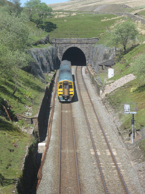
Blea Moor Tunnel

Blea Moor Tunnel is a 2,629 yards (1.494 mi)(2,404 m) railway tunnel located between Ribblehead Viaduct and Dent railway station in England. It is the...

Nearby Amenities

Located within 500m of 54.264108,-2.3577723
Power: pole
Lat/Long: 54.2624441/-2.3513458
Power: pole
Lat/Long: 54.2632973/-2.3519015
Power: pole
Lat/Long: 54.2639598/-2.3523247
Power: pole
Lat/Long: 54.2648979/-2.352934
Power: pole
Lat/Long: 54.265818/-2.3535204
Power: pole
Lat/Long: 54.2668408/-2.3541781
Power: pole
Lat/Long: 54.267679/-2.3547211
The data included in this document is from www.openstreetmap.org. The data is made available under ODbL.

Have you been to Blake Beck Force?

Leave your review of Blake Beck Force below (or comments, questions and feedback).