Black Linn
Waterfall in Northumberland
England
Black Linn

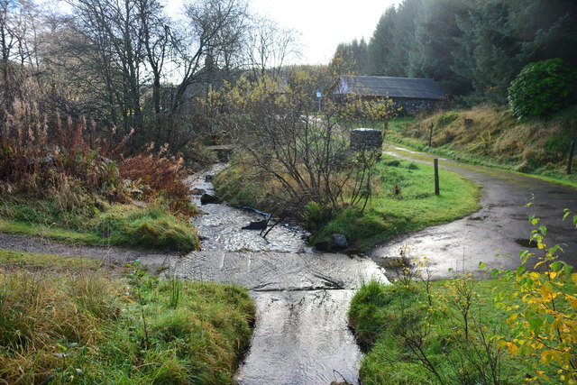
Black Linn, located in Northumberland, England, is a mesmerizing waterfall that captivates visitors with its stunning natural beauty. Situated within the picturesque landscape of the North Pennines, this waterfall offers a tranquil escape from the bustling city life. The name "Black Linn" derives from the Scots word "linn," meaning a waterfall or pool in a river.
The waterfall itself is formed by the Black Burn, a small river that cascades down a rocky cliff, creating a spectacular display of rushing water. The falls are surrounded by lush greenery, with trees and vegetation adding to the picturesque setting. The combination of the cascading water, the sound of its roaring flow, and the peaceful surroundings make Black Linn a truly serene and enchanting spot.
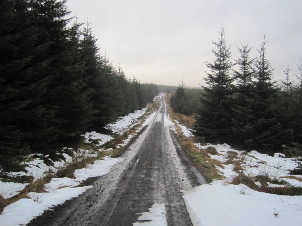
Accessing Black Linn is relatively easy, with a well-maintained footpath leading visitors to the waterfall. The path winds through the scenic landscape, allowing hikers to immerse themselves in the natural beauty of the area. Along the way, various viewpoints offer stunning vistas of the waterfall, providing ample opportunities for photography and appreciation of the surroundings.
Nature enthusiasts and outdoor adventurers are drawn to Black Linn for its tranquil ambiance and the chance to connect with nature. The waterfall is a popular destination for hiking, picnicking, and simply enjoying the soothing sounds of the cascading water. It is also a favored spot for artists and photographers seeking inspiration from the picturesque scenery.
Overall, Black Linn, Northumberland is a hidden gem, offering a serene and awe-inspiring experience for visitors who appreciate the beauty and tranquility of the natural world.
If you have any feedback on the listing, please let us know in the comments section below.
Black Linn Images
Images are sourced within 2km of 55.203504/-2.3821782 or Grid Reference NY7589. Thanks to Geograph Open Source API. All images are credited.


Black Linn is located at Grid Ref: NY7589 (Lat: 55.203504, Lng: -2.3821782)
Unitary Authority: Northumberland
Police Authority: Northumbria
What 3 Words
///fairy.forensic.watchdogs. Near Bellingham, Northumberland
Nearby Locations
Related Wikis

Black Middens Bastle House
Black Middens Bastle House lies about 7 miles (11 km) northwest of Bellingham, Northumberland. It is a two-storey fortified stone farmhouse from the 16th...

Thorneyburn
Thorneyburn is a village and former civil parish, now in the parish of Tarset, in Northumberland, England, to the northwest of Bellingham. In 1951 the...

Thorneyburn railway station
Thorneyburn railway station served the village of Thorneyburn, Northumberland, England from 1861 to 1956 on the Border Counties Railway. == History... ==

Falstone railway station
Falstone railway station is a former railway station that served the hamlet of Falstone, in Northumberland, England. == History == The station was on the...
Falstone
Falstone is a small village in Northumberland, England, just east of Kielder Water. The village is 8 miles (13 km) from the Anglo–Scottish border. The...

Falstone Bridge
Falstone Bridge is a stone bridge across the River North Tyne at Falstone in Northumberland. == History == The bridge, which has three stone arches, was...

Greystead
Greystead is a village and civil parish in Northumberland, England west of Bellingham. The population as of the 2011 census was less than 100. It shares...
Border Moors and Forests
Border Moors and Forests NCA is an upland plateau region in Northern England between the North East and North West regions, and touching the Anglo-Scottish...
Nearby Amenities
Located within 500m of 55.203504,-2.3821782Have you been to Black Linn?
Leave your review of Black Linn below (or comments, questions and feedback).