High Force

Waterfall in Yorkshire South Lakeland

England

High Force

River Dee at Hud's House This is the small river Dee in Cumbria, not the better known larger rivers of that name in Cheshire or Aberdeen. Near the end of a fairly dry summer there was barely a trickle of water in it, though it is probably prone to flash flooding in times of storm.
River Dee at Hud's House Credit: Stephen Craven

High Force is a stunning waterfall located in the county of Yorkshire, England. Situated within the North Pennines Area of Outstanding Natural Beauty, it is one of the most impressive waterfalls in the country. The waterfall is positioned on the upper course of the River Tees, near the village of Forest-in-Teesdale.

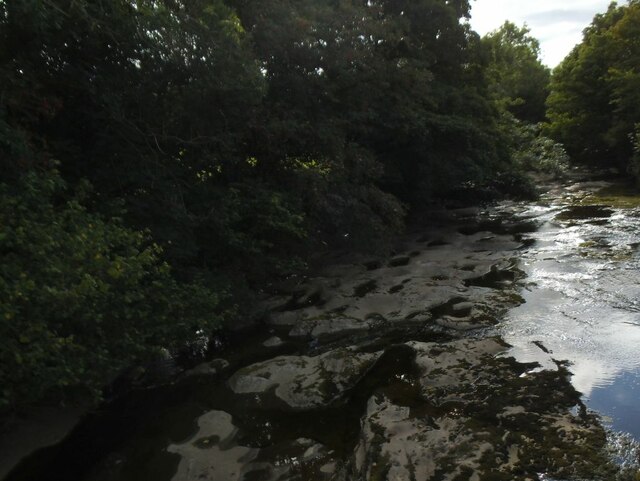
High Force boasts an impressive drop of approximately 21 meters (70 feet), making it an awe-inspiring sight for visitors. The river cascades over the Whin Sill, a layer of hard rock formed around 295 million years ago during the Carboniferous period. The force of the water plummeting down creates a powerful spectacle, especially after periods of heavy rainfall when the river is at its peak flow.

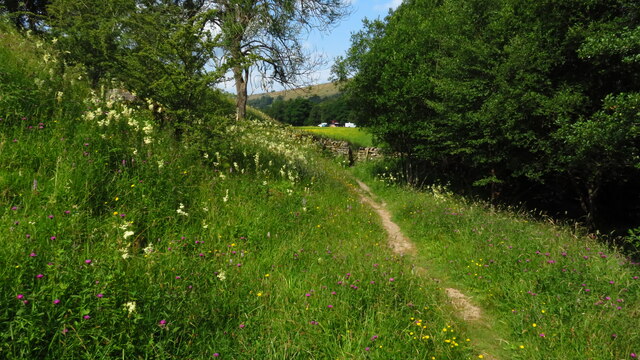
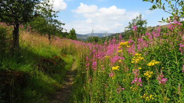
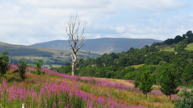
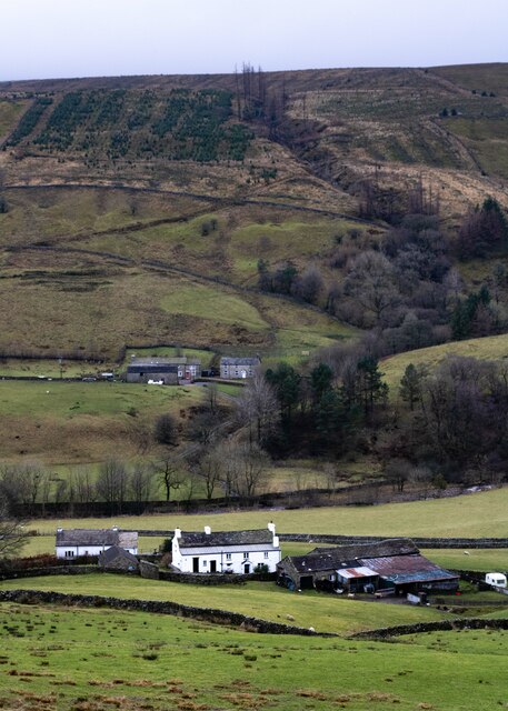
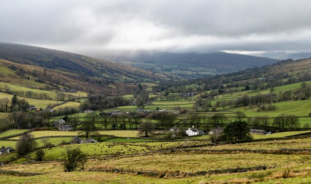
The waterfall is surrounded by a picturesque wooded landscape, with lush greenery and various plant species, adding to the natural beauty of the area. Access to High Force is provided by a well-maintained footpath, allowing visitors to admire the waterfall from designated viewpoints. Additionally, there is a visitor center nearby which provides information about the geological and natural history of the area.

High Force is a popular destination for nature enthusiasts, hikers, and photographers who are captivated by its raw beauty. The site offers a serene and tranquil atmosphere, providing a perfect escape from the hustle and bustle of daily life. Its remarkable size and the power of the water make High Force a truly remarkable natural wonder in the heart of Yorkshire.

If you have any feedback on the listing, please let us know in the comments section below.

High Force Images

Images are sourced within 2km of 54.265351/-2.3833152 or Grid Reference SD7585. Thanks to Geograph Open Source API. All images are credited.

River Dee at Hud's House This is the small river Dee in Cumbria, not the better known larger rivers of that name in Cheshire or Aberdeen. Near the end of a fairly dry summer there was barely a trickle of water in it, though it is probably prone to flash flooding in times of storm.
River Dee at Hud's House
This is the small river Dee in Cumbria, not the better known larger rivers of that name in Cheshire or Aberdeen. Near the end of a fairly dry summer there was barely a trickle of water in it, though it is probably prone to flash flooding in times of storm.
Sheep on the hillside above Hud's House Although in Cumbria, Dentdale is geologically and geographically part of the Yorkshire Dales, and this  scene could be found in any of the northern Dales.
Sheep on the hillside above Hud's House
Although in Cumbria, Dentdale is geologically and geographically part of the Yorkshire Dales, and this scene could be found in any of the northern Dales.
Datestone in the river wall opposite Hud's House The date 1928 may mark the last time the wall was rebuilt, or maybe of a major flood, or perhaps both. Other ideas?
Datestone in the river wall opposite Hud's House
The date 1928 may mark the last time the wall was rebuilt, or maybe of a major flood, or perhaps both. Other ideas?
Signpost at the bottom of Coal Road The signpost is of a type common in the area, see <a href="https://www.geograph.org.uk/photo/1370306">SD7686 : Cowgill Signpost</a> for a close-up; adjacent is a community notice board.
Signpost at the bottom of Coal Road
The signpost is of a type common in the area, see SD7686 : Cowgill Signpost for a close-up; adjacent is a community notice board.
Coal Road, Cowgill A sign warns of a single track road ahead. It doesn't mention the gradient, shown on the map with a single arrow indicating 1:7 to 1:5. As I had to push my bicycle most of the way up, I suspect it was nearer the latter figure.
Coal Road, Cowgill
A sign warns of a single track road ahead. It doesn't mention the gradient, shown on the map with a single arrow indicating 1:7 to 1:5. As I had to push my bicycle most of the way up, I suspect it was nearer the latter figure.
Telecoms installation, Lea Yeat Brow The telecoms equipment has been added since the barn was last photographed from this site in 2015 <a href="https://www.geograph.org.uk/photo/4559611">SD7687 : Barn, Lea Yeat Brow</a>.
Telecoms installation, Lea Yeat Brow
The telecoms equipment has been added since the barn was last photographed from this site in 2015 SD7687 : Barn, Lea Yeat Brow.
Dentdale service reservoir Seen from above.  There's no impounding reservoir in this dale, so it's either spring-fed, or treated water is pumped up the dale.
Dentdale service reservoir
Seen from above. There's no impounding reservoir in this dale, so it's either spring-fed, or treated water is pumped up the dale.
Allen Haw, Dentdale
Allen Haw, Dentdale
Cottages at Cowgill, Dentdale
Fingerpost - Cowgill
The Sportsman Inn, Stone House, Dentdale
The Dales Way, east of Ewegales Bridge, Cowgill
On the Dales Way between Rivling & Little Town, Dentdale
On the Dales Way, west of Little Town, Dentdale
How Gill View of How Gill in Dentdale, seen from Lea Yeat Brow.  In the foreground is Hill Farm and Hill View and in the middle distance is Hobsons Cottage.
How Gill
View of How Gill in Dentdale, seen from Lea Yeat Brow. In the foreground is Hill Farm and Hill View and in the middle distance is Hobsons Cottage.
Dentdale View of Dentdale seen from Lea Yeat Brow.
Dentdale
View of Dentdale seen from Lea Yeat Brow.
Gibs Hall, Barn The barn adjoins Gibs Hall Cottage at the far end.  The houses on the other side of the road use the more modern spelling of the place name ‘Gibbs’, which is also used by the Ordnance Survey.
There is an Ordnance Survey cut benchmark low down on the barn wall near the corner, facing the road (photograph <a href="https://www.geograph.org.uk/photo/7185964">SD7386 : Benchmark, Gibbs Hall Barn</a>).
Gibs Hall, Barn
The barn adjoins Gibs Hall Cottage at the far end. The houses on the other side of the road use the more modern spelling of the place name ‘Gibbs’, which is also used by the Ordnance Survey. There is an Ordnance Survey cut benchmark low down on the barn wall near the corner, facing the road (photograph SD7386 : Benchmark, Gibbs Hall Barn).
Benchmark, Gibbs Hall Barn Detail of an Ordnance Survey cut benchmark on the wall of a barn on the south side of the road at Gibbs Hall. The benchmark marks a height of 190.6097m above Ordnance Datum Newlyn last verified in 1953 (location photograph <a href="https://www.geograph.org.uk/photo/7185944">SD7386 : Gibs Hall, Barn</a>).
Benchmark, Gibbs Hall Barn
Detail of an Ordnance Survey cut benchmark on the wall of a barn on the south side of the road at Gibbs Hall. The benchmark marks a height of 190.6097m above Ordnance Datum Newlyn last verified in 1953 (location photograph SD7386 : Gibs Hall, Barn).
Show me another place!

High Force is located at Grid Ref: SD7585 (Lat: 54.265351, Lng: -2.3833152)

Division: West Riding

Administrative County: Cumbria

District: South Lakeland

Police Authority: Cumbria

What 3 Words

///admits.gratuity.probing. Near Sedbergh, Cumbria

Related Wikis

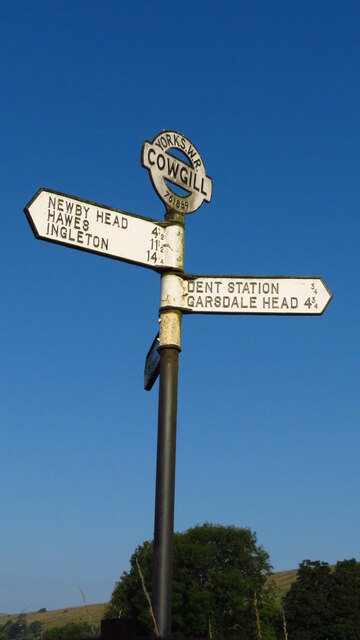
St John the Evangelist's Church, Cowgill

St John the Evangelist's Church is the Church of England parish church of the village of Cowgill, Cumbria, England. It is in the deanery of Kendal, the...
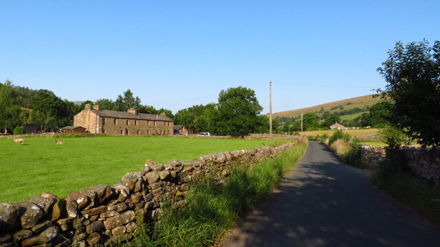
Cowgill, Cumbria

Cowgill is a village in Westmorland and Furness, Cumbria, England. It is within the historic boundaries of the West Riding of Yorkshire, and is located...

Stone House, Cumbria

Stone House is a locality at Dent Head on the River Dee, in the county of Cumbria, England, to the south-east of Cowgill and to the north-west of Newby...

Dent railway station

Dent is a railway station on the Settle and Carlisle Line, which runs between Carlisle and Leeds via Settle. The station, situated 58 miles 29 chains...

Related Videos

Feeling the Pain: The Dales Way tries to break us on Day 3

The Dales Way - 81 Miles from Ilkley to Bowness-on-windermere. On Day 3 of our Dales Way hiking challenge, we covered 30km ...

Whernside Jan 2024

Quiet nights sleep in the campervan by Ribblehead and then a nice walk up Whernside the following morning. Here is some ...

Dentdale, Cowgill

Yorkshire Dentdale, Birthplace of Adam Sedgwick's.

Arten Gill Viaduct waterfall explore!

Exploring stream with hidden waterfall under Arten Gill Viaduct!

Have you been to High Force?

Leave your review of High Force below (or comments, questions and feedback).