Hestram Stromay

Island in Inverness-shire

Scotland

Hestram Stromay

Croft at the Road End Overlooking Loch Amhlasaraigh.
Croft at the Road End Credit: Dave Fergusson

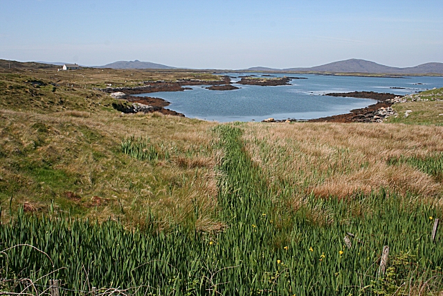
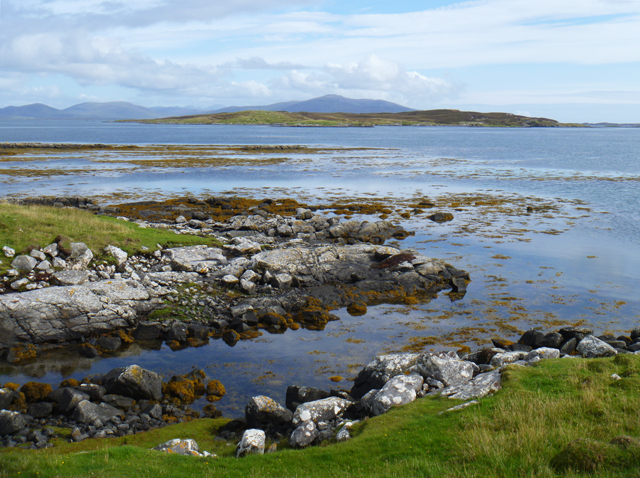
Hestram Stromay is a picturesque island located in Inverness-shire, Scotland. Situated off the west coast of the mainland, it is part of the Inner Hebrides archipelago. The island is approximately 3 square miles in size, making it a relatively small landmass.

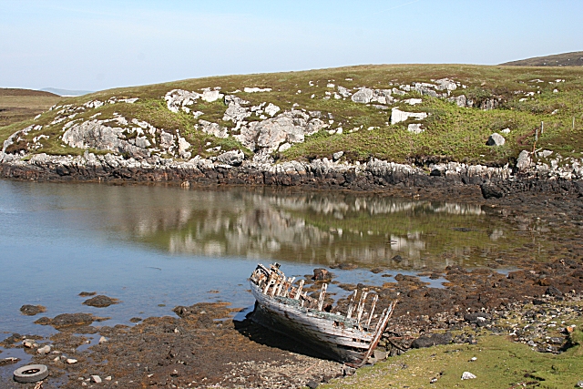
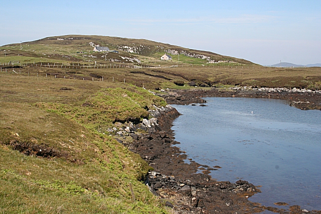
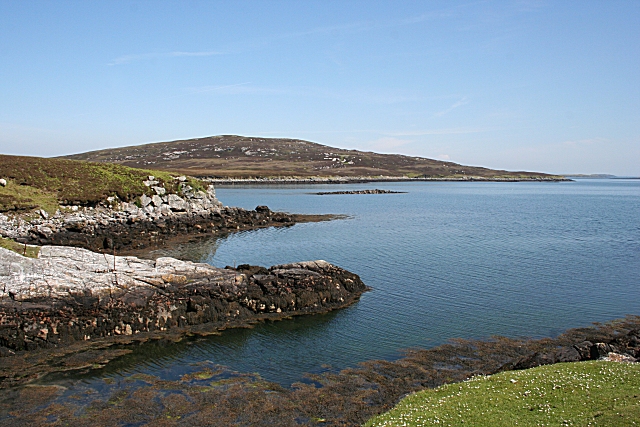
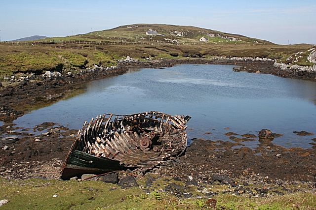
Despite its size, Hestram Stromay boasts a diverse and stunning natural landscape. The island is characterized by rolling hills, dramatic cliffs, and beautiful sandy beaches. The coastline is dotted with small coves and inlets, ideal for exploring by boat or on foot during low tide.

The island is home to a rich array of flora and fauna. Visitors can expect to see a variety of bird species, including puffins, guillemots, and oystercatchers, nesting along the cliffs. Inland, heather-covered moorlands provide a habitat for deer, rabbits, and other small mammals.

Hestram Stromay is also known for its historical significance. The ruins of a medieval castle, believed to have been originally built in the 13th century, stand proudly on a hilltop overlooking the island. Exploring the castle offers visitors a glimpse into the island's past and provides panoramic views of the surrounding landscape.

Access to Hestram Stromay is mainly by boat, with regular ferry services operating from the nearby mainland. The island offers a peaceful and tranquil retreat, far away from the bustling city life. Whether one is seeking outdoor adventures, wildlife spotting, or simply a place to relax and unwind, Hestram Stromay is an idyllic destination for nature lovers and history enthusiasts alike.

If you have any feedback on the listing, please let us know in the comments section below.

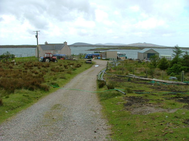
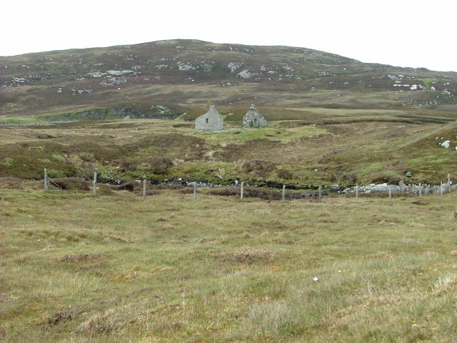
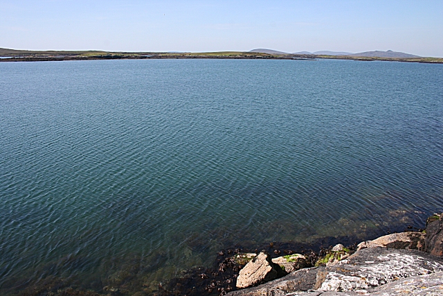
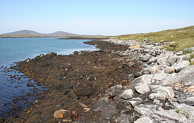
Hestram Stromay Images

Images are sourced within 2km of 57.655773/-7.1300098 or Grid Reference NF9474. Thanks to Geograph Open Source API. All images are credited.

Croft at the Road End Overlooking Loch Amhlasaraigh.
Croft at the Road End
Overlooking Loch Amhlasaraigh.
Ruined Crofthouse At Tobha Beag.
Ruined Crofthouse
At Tobha Beag.
Loch Amhlasaraigh Much of this square is water; the loch is landlocked at low tide but not at high tide. The nearest land is the island of Rusgaigh, with the island of Sròmaigh beyond.
Loch Amhlasaraigh
Much of this square is water; the loch is landlocked at low tide but not at high tide. The nearest land is the island of Rusgaigh, with the island of Sròmaigh beyond.
Rubha an Daimh 'Rubha' means 'headland' and 'damh' is 'deer', so the headland at the far end of this bay is the headland of the deer. The distant hills are Beinn Mhòr and Beinn Bhreac.
Rubha an Daimh
'Rubha' means 'headland' and 'damh' is 'deer', so the headland at the far end of this bay is the headland of the deer. The distant hills are Beinn Mhòr and Beinn Bhreac.
Going Nowhere The hulk of a boat lies rotting in a tidal inlet near Tigh-na-Hoe.
Going Nowhere
The hulk of a boat lies rotting in a tidal inlet near Tigh-na-Hoe.
Tobha Beag Not to be confused with the similarly named, and much better known, place in South Uist, this is almost the end of the road.
Tobha Beag
Not to be confused with the similarly named, and much better known, place in South Uist, this is almost the end of the road.
Island of Taghaigh There is not much of land on the North Uist shore in this square, but this side of the offshore island of Taghaigh, in the background here, is in square.
Island of Taghaigh
There is not much of land on the North Uist shore in this square, but this side of the offshore island of Taghaigh, in the background here, is in square.
Going Nowhere This is the same boat as in <a href="https://www.geograph.org.uk/photo/1343501">NF9574 : Going Nowhere</a>, with the houses at Tobha Beag in the background beyond the tidal inlet.
Going Nowhere
This is the same boat as in NF9574 : Going Nowhere, with the houses at Tobha Beag in the background beyond the tidal inlet.
Loch Amhlasaraigh One of the inlets making up the head of Loch Amhlasaraigh (Aulasary), which is almost completely landlocked, and connected to the open sea only at high tide.
Loch Amhlasaraigh
One of the inlets making up the head of Loch Amhlasaraigh (Aulasary), which is almost completely landlocked, and connected to the open sea only at high tide.
Illegal House Taken from ferry. The house is one that I think was built without planning permission in this remote spot.
Illegal House
Taken from ferry. The house is one that I think was built without planning permission in this remote spot.
Rubha an Daimh Looking out across the headland and Loch Amhlasaraigh.
Rubha an Daimh
Looking out across the headland and Loch Amhlasaraigh.
Telecom ast on Cnoc Mòr an t-Sagairt
Summit of Hoe Beg The 62m high point of the headland at Tobha Beag is marked by a weathered wooden stake.
Summit of Hoe Beg
The 62m high point of the headland at Tobha Beag is marked by a weathered wooden stake.
Bàgh a Chàise A small settlement near the end of the road to Tobha Beag.
Bàgh a Chàise
A small settlement near the end of the road to Tobha Beag.
Orasaigh A tidal island in Loch Amhlasaraigh, viewed from the northern slopes of Cnoc Mòr an t-Sagairt.
Orasaigh
A tidal island in Loch Amhlasaraigh, viewed from the northern slopes of Cnoc Mòr an t-Sagairt.
Or Eilean A small island off the northern point of Hoe Beg.
Or Eilean
A small island off the northern point of Hoe Beg.
Rudha Mor The northernmost tip of Hoe Beg.
The hills of South Harris are on the horizon.
Rudha Mor
The northernmost tip of Hoe Beg. The hills of South Harris are on the horizon.
End of the road End of the Loch Portain road.
End of the road
End of the Loch Portain road.
Show me another place!

Hestram Stromay is located at Grid Ref: NF9474 (Lat: 57.655773, Lng: -7.1300098)

Unitary Authority: Na h-Eileanan an Iar

Police Authority: Highlands and Islands

Also known as: Heastam Sròmaigh

What 3 Words

///readily.ballpoint.steepest. Near Lochmaddy, Na h-Eileanan Siar

Related Wikis

Stromay

Stromay (Scottish Gaelic: Sròmaigh) is a tidal island off North Uist in the Sound of Harris, Scotland. The low island of Stromay lies between two wide...

Loch an Duin

Loch an Duin is a complex system of freshwater, brackish and sea lochs, tidal channels and islands, on and close to North Uist off the west coast of Scotland...

Sursaigh

Sursaigh (Scottish Gaelic: Sursaigh) is an island off North Uist in the Sound of Harris, Scotland. It lies 8 kilometres (5.0 mi) northeast of the village...

Tahay

Tahay (Scottish Gaelic: Taghaigh) is an island in the Outer Hebrides of Scotland. The name originates from the Old Norse tagg-øy meaning island with a...

Have you been to Hestram Stromay?

Leave your review of Hestram Stromay below (or comments, questions and feedback).