Basaleg

Settlement in Monmouthshire

Wales

Basaleg

Ordnance Survey Cut Mark This OS cut mark can be found on the wall north side of Cardiff Road. It marks a point 11.440m above mean sea level.
Ordnance Survey Cut Mark Credit: Adrian Dust

Basaleg is a small village located in the county of Monmouthshire, Wales. Situated approximately 7 miles north of Newport, it lies on the eastern bank of the River Ebbw, near the confluence with the River Sirhowy. This picturesque village is surrounded by stunning countryside, offering residents and visitors alike a tranquil and scenic setting.

Historically, Basaleg was known for its coal mining industry, which thrived during the 19th and early 20th centuries. However, as the industry declined, the village underwent a transition towards a more residential and agricultural community.

Today, Basaleg is a charming and tight-knit community, with a population of around 2,500 people. The village boasts a range of amenities, including a primary school, a community center, and a local pub. There are also several shops and businesses that cater to the needs of the residents.

The surrounding countryside provides opportunities for outdoor activities such as hiking, cycling, and fishing. Additionally, the nearby River Ebbw is popular among anglers for its abundance of fish species.

Basaleg's location offers convenient access to major transportation routes, with the M4 motorway situated just a few miles to the south. This makes it an ideal base for those commuting to nearby cities such as Newport and Cardiff.

In conclusion, Basaleg is a peaceful village in Monmouthshire, Wales, with a rich history and a strong sense of community. Its scenic surroundings and convenient location make it an attractive place to live or visit.

If you have any feedback on the listing, please let us know in the comments section below.
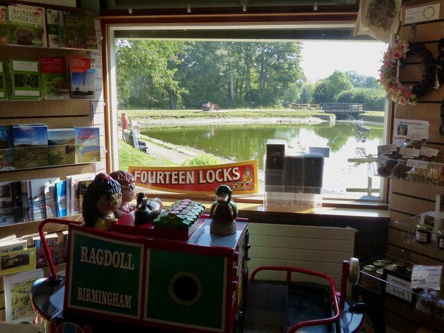
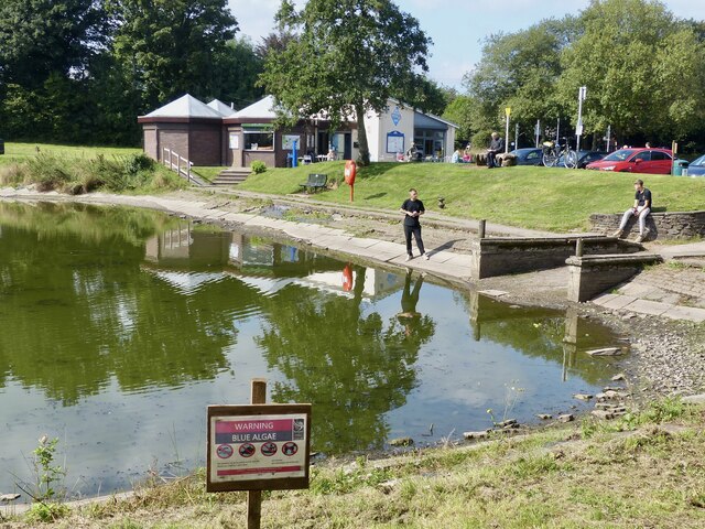
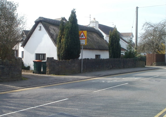
Basaleg Images

Images are sourced within 2km of 51.576084/-3.044605 or Grid Reference ST2786. Thanks to Geograph Open Source API. All images are credited.

Ordnance Survey Cut Mark This OS cut mark can be found on the wall north side of Cardiff Road. It marks a point 11.440m above mean sea level.
Ordnance Survey Cut Mark
This OS cut mark can be found on the wall north side of Cardiff Road. It marks a point 11.440m above mean sea level.
Ordnance Survey Cut Mark This OS cut mark can be found on the west face of St David's RC School. It marks a point 17.780m above mean sea level.
Ordnance Survey Cut Mark
This OS cut mark can be found on the west face of St David's RC School. It marks a point 17.780m above mean sea level.
Ordnance Survey Cut Mark This OS cut mark can be found on the wall of No3 Wells Close. It marks a point 27.760m above mean sea level.
Ordnance Survey Cut Mark
This OS cut mark can be found on the wall of No3 Wells Close. It marks a point 27.760m above mean sea level.
Ordnance Survey Cut Mark This OS cut mark can be found on the west angle of the Gaer Park Club. It marks a point 69.614m above mean sea level.
Ordnance Survey Cut Mark
This OS cut mark can be found on the west angle of the Gaer Park Club. It marks a point 69.614m above mean sea level.
Ordnance Survey Cut Mark This OS cut mark can be found on No10 Highfield Road. It marks a point 65.432m above mean sea level.
Ordnance Survey Cut Mark
This OS cut mark can be found on No10 Highfield Road. It marks a point 65.432m above mean sea level.
Ordnance Survey Cut Mark This OS cut mark can be found on the cemetery wall on Bassaleg Road. It marks a point 64.470m above mean sea level.
Ordnance Survey Cut Mark
This OS cut mark can be found on the cemetery wall on Bassaleg Road. It marks a point 64.470m above mean sea level.
Ordnance Survey Cut Mark This OS cut mark can be found on No83 Bassaleg Road. It marks a point 73.460m above mean sea level.
Ordnance Survey Cut Mark
This OS cut mark can be found on No83 Bassaleg Road. It marks a point 73.460m above mean sea level.
Ordnance Survey Rivet This OS rivet can be found on the Motorway Bridge. It marks a point 64.115m above mean sea level.
Ordnance Survey Rivet
This OS rivet can be found on the Motorway Bridge. It marks a point 64.115m above mean sea level.
Social distancing notice, Tredegar House Wales is at COVID-19 Alert Level 0.
Here is a reminder from the National Trust to main social distancing in indoor areas.
Social distancing notice, Tredegar House
Wales is at COVID-19 Alert Level 0. Here is a reminder from the National Trust to main social distancing in indoor areas.
Tredegar House, Newport View up towards the main house, across huge courtyard/stable yard
Tredegar House, Newport
View up towards the main house, across huge courtyard/stable yard
Works site, Gaer Fort, Newport For the construction for an Active Travel route around the south-western boundary of Gaer Fort.
The existing footpath is being turned into a cycle route. 
Active travel is about getting from A to B by walking or cycling.
Viewed from Wells Close where there was a kissing gate entrance to Gaer Fort.
Works site, Gaer Fort, Newport
For the construction for an Active Travel route around the south-western boundary of Gaer Fort. The existing footpath is being turned into a cycle route. Active travel is about getting from A to B by walking or cycling. Viewed from Wells Close where there was a kissing gate entrance to Gaer Fort.
Works site on the Gaer Fort, Newport Site for the construction of an Active Travel route around the south-western boundary of Gaer Fort.
The existing footpath is being turned into a cycle route.
Active travel is about getting from A to B by walking or cycling.
This is the area where the works are situated <a title="https://www.geograph.org.uk/photo/3556734" href="https://www.geograph.org.uk/photo/3556734">Link</a> .
Works site on the Gaer Fort, Newport
Site for the construction of an Active Travel route around the south-western boundary of Gaer Fort. The existing footpath is being turned into a cycle route. Active travel is about getting from A to B by walking or cycling. This is the area where the works are situated Link .
Looking westwards from the Gaer Fort, Newport. Also known as Tredegar Fort and locally as The Gollars.
This is a large Iron Age fort on the western side of the city of Newport and is a noticeable feature which is clearly visible when approaching Newport from Cardiff on the M4 Motorway.

It is bounded on the west and the south by the River Ebbw and a railway line. On the eastern side, 1930s housing encroaches almost to the summit and it is also bordered by a 1950s housing estate.

With a summit at 91 metres and much of the adjacent land at about sea level, there are extensive views of the surrounding area and across the Severn Estuary towards England.

A local historian has written “Around the fairly flat top there is room for a sizeable encampment to be laid out, with an impregnable line of ditches and embankments encircling the slopes. A panoramic view in all directions allowed ample warning of danger and there was easy access to thick forests teeming with game and to the crystal clear, salmon-rich waters of the River Ebbw that flowed round the south western base.” (The History of the Borough of Newport. Haydn Davis)
Looking westwards from the Gaer Fort, Newport.
Also known as Tredegar Fort and locally as The Gollars. This is a large Iron Age fort on the western side of the city of Newport and is a noticeable feature which is clearly visible when approaching Newport from Cardiff on the M4 Motorway. It is bounded on the west and the south by the River Ebbw and a railway line. On the eastern side, 1930s housing encroaches almost to the summit and it is also bordered by a 1950s housing estate. With a summit at 91 metres and much of the adjacent land at about sea level, there are extensive views of the surrounding area and across the Severn Estuary towards England. A local historian has written “Around the fairly flat top there is room for a sizeable encampment to be laid out, with an impregnable line of ditches and embankments encircling the slopes. A panoramic view in all directions allowed ample warning of danger and there was easy access to thick forests teeming with game and to the crystal clear, salmon-rich waters of the River Ebbw that flowed round the south western base.” (The History of the Borough of Newport. Haydn Davis)
View towards the north-west, Gaer Fort, Newport. Looking over houses at Pye Corner.
View towards the north-west, Gaer Fort, Newport.
Looking over houses at Pye Corner.
On the eastern edge of Gaer Fort, Newport Towards the edge of Gaer Estate.
On the eastern edge of Gaer Fort, Newport
Towards the edge of Gaer Estate.
Tredegar House Country Park, Newport The gateway into the parkland.
Tredegar House Country Park, Newport
The gateway into the parkland.
Fourteen Locks Visitor Centre, Newport Looking over the canal pound from the small shop in the visitor centre.
Fourteen Locks Visitor Centre, Newport
Looking over the canal pound from the small shop in the visitor centre.
Warning, Blue Algae, Fourteen Locks, Newport There have been several reports of blue algae on lakes and canals in the local area this summer.
The notice says:
No animals to be allowed in the water
Avoid contact with skin
No fishing
No swimming or paddling
Warning, Blue Algae, Fourteen Locks, Newport
There have been several reports of blue algae on lakes and canals in the local area this summer. The notice says: No animals to be allowed in the water Avoid contact with skin No fishing No swimming or paddling
Show me another place!

Basaleg is located at Grid Ref: ST2786 (Lat: 51.576084, Lng: -3.044605)

Unitary Authority: Newport

Police Authority: Gwent

Also known as: Bassaleg

What 3 Words

///jacket.pickup.holiday. Near Newport

Related Wikis

Bassaleg School

Bassaleg School (Welsh: Ysgol Basaleg) is a comprehensive secondary school for pupils aged 11 to 18 years, situated in the suburb of Bassaleg on the western...

Monmouth Comprehensive School

Monmouth Comprehensive School (Welsh: Ysgol Gyfun Trefynwy) is a comprehensive secondary school for pupils aged 11–18, situated in Monmouth, Monmouthshire...

Bassaleg

Bassaleg (Welsh: Basaleg) is a suburb on the west side of Newport, Wales. It is in the Graig electoral ward and community. Bassaleg is located two miles...

Bassaleg Junction railway station

Bassaleg Junction was a railway station which served the village of Bassaleg, Monmouthshire. == History == The station was opened by the Monmouthshire...

Nearby Amenities

Located within 500m of 51.576084,-3.044605
Traffic Signals
Traffic Signals: signal
Lat/Long: 51.5758792/-3.0426828
Turning Circle
Lat/Long: 51.5750232/-3.0433304
Noexit: yes
Lat/Long: 51.5801067/-3.0423471
Bassaleg
Is In City: Newport
Name Cy: Basaleg
Name En: Bassaleg
Place: suburb
Wikidata: Q4868001
Wikipedia: en:Bassaleg
Lat/Long: 51.5766335/-3.0480378
Bassaleg
Historic Railway: station
Railway: site
Lat/Long: 51.5788942/-3.044254
Traffic Signals
Traffic Signals: signal
Lat/Long: 51.5759388/-3.0424791
Crossing
Crossing: traffic_signals
Crossing Ref: puffin
Lat/Long: 51.5751229/-3.0426658
Entrance: main
Lat/Long: 51.5782342/-3.0444385
Bus Stop
Comprehensive School (opposite)
Bench: yes
Bus: yes
Level: 0
Lit: yes
Name Cy: Ysgol Gyfun (gyferbyn)
Naptan AtcoCode: 5310AWB30472
Naptan NaptanCode: nwpagdj
Network: Newport Bus
Operator: Newport Bus
Public Transport: platform
Ref: nwpagdj
Shelter: yes
Wheelchair: yes
Lat/Long: 51.5765098/-3.0445012
Crossing
Crossing: traffic_signals
Crossing Island: no
Lat/Long: 51.5768969/-3.0447813
Traffic Calming: cushion
Lat/Long: 51.5751512/-3.0516862
Crossing
Lat/Long: 51.5752068/-3.0435689
Traffic Signals
Traffic Signals: signal
Lat/Long: 51.5753/-3.0429659
Height: 4.1
Lat/Long: 51.5788015/-3.0434049
Height: 4.1
Lat/Long: 51.5791169/-3.0435307
Traffic Calming: cushion
Lat/Long: 51.5767633/-3.0501857
Bus Stop
Comprehensive School
Bench: no
Bus: yes
Level: 0
Lit: yes
Name Cy: Ysgol Gyfun
Naptan AtcoCode: 5310AWB30471
Naptan NaptanCode: nwpagdg
Network: Newport Bus
Operator: Newport Bus
Public Transport: platform
Ref: nwpagdg
Shelter: no
Wheelchair: yes
Lat/Long: 51.5765288/-3.0446421
Generator Method: wind_turbine
Generator Source: wind
Generator Type: horizontal_axis
Power: generator
Lat/Long: 51.5754333/-3.0479896
Crossing
Bicycle: yes
Crossing: traffic_signals
Crossing Ref: toucan
Lat/Long: 51.5778737/-3.0406328
Crossing
Crossing: traffic_signals
Crossing Ref: puffin
Lat/Long: 51.5751862/-3.0429994
Traffic Signals
Traffic Signals: signal
Lat/Long: 51.5759035/-3.0434235
Post Box
Operator: Royal Mail
Post Box Type: pillar
Lat/Long: 51.5775854/-3.0471457
Traffic Calming: cushion
Lat/Long: 51.5758202/-3.0511066
Traffic Calming: cushion
Lat/Long: 51.5762836/-3.0506641
Traffic Signals
Traffic Signals: signal
Lat/Long: 51.5757948/-3.043338
Traffic Signals
Traffic Signals: signal
Lat/Long: 51.5751414/-3.0429604
Grit Bin
Colour: yellow
Material: plastic
Lat/Long: 51.5777338/-3.0413578
Bus Stop
Park View (E-bound)
Bus: yes
Level: 0
Lit: yes
Name Cy: Gweld Parc (tua'r dwyrain)
Network: Newport Bus
Operator: Newport Bus
Public Transport: platform
Ref: nwpagat
Wheelchair: yes
Lat/Long: 51.5778153/-3.0409729
Restaurant
Junction 28
Addr City: Newport
Addr Postcode: NP10 8LD
Addr Street: Station Approach
Cuisine: british;european;fish
Email: bookings@junction28.com
Name Cy: Cyffordd 28
Opening Hours: Mo off; Tu off; We-Sa 12:00-14:00,17:30-23:00; Su 12:00-16:00
Opening Hours Covid19: Mo Off; Tu Off; We-Sa 12:00-14:00,17:30-23:00; Su 12:00-16:00
Phone: +44 1633 891 891
Website: https://junction28.com/
Lat/Long: 51.578782/-3.0439241
Pub
Tredegar Arms
Addr City: Newport
Addr Housenumber: 4
Addr Postcode: NP10 8LE
Addr Street: Caerphilly Road
Brand: Greene King
Brand Wikidata: Q5564162
Fhrs Id: 446652
Name Cy: Arfau Tredegar
Opening Hours: Mo-Su 12:00-23:00
Phone: +44 1633 893 247
Source Postcode: FHRS Open Data
Website: https://www.greeneking.co.uk/pubs/gwent/tredegar-arms
Lat/Long: 51.5776632/-3.045
Dentist
Bupa Dental Care
Addr City: Newport
Addr Housenumber: 6A
Addr Postcode: NP10 8LE
Addr Street: Caerphilly Road
Branch: Bassaleg
Brand: Bupa
Brand Wikidata: Q931628
Brand Wikipedia: en:Bupa
Healthcare: dentist
Opening Hours: Mo 08:15-18:00; Tu 08:15-17:30; We 08:15-18:00; Th 08:15-17:00; Fr 08:15-16:00; Sa off; Su off
Opening Hours Covid19: Mo 08:15-18:00; Tu 08:15-17:30; We 08:15-18:00; Th 08:15-17:00; Fr 08:15-16:00; Sa Off; Su Off
Operator: Bupa
Phone: +44 1633 893 451
Website: https://www.bupa.co.uk/dental/dental-care/practices/bassaleg
Lat/Long: 51.5777481/-3.0456955
Whitehead Sports and Social Club
Addr City: Newport
Addr Postcode: NP10 8LA
Addr Street: Park View
Club: sport
Email: secretary@whiteheadclub.co.uk
Leisure: sports_centre
Opening Hours: Mo-Fr 16:00-22:00; Sa 12:00-22:00; Su 12:00-22:00
Phone: +44 1633 893 227
Website: https://whiteheadclub.co.uk/
Lat/Long: 51.578128/-3.0387103
Direction: 160
Generator Method: photovoltaic
Generator Output Electricity: yes
Generator Solar Modules: 11
Generator Source: solar
Generator Type: solar_photovoltaic_panel
Location: roof
Power: generator
Lat/Long: 51.5789759/-3.0413084
Direction: 100
Generator Method: photovoltaic
Generator Output Electricity: yes
Generator Solar Modules: 8
Generator Source: solar
Generator Type: solar_photovoltaic_panel
Location: roof
Power: generator
Lat/Long: 51.5773307/-3.0436195
Direction: 190
Generator Method: photovoltaic
Generator Output Electricity: yes
Generator Solar Modules: 7
Generator Source: solar
Generator Type: solar_photovoltaic_panel
Location: roof
Power: generator
Lat/Long: 51.5773263/-3.043731
Bus Stop
Forge Lane (S-bound)
Bus: yes
Level: 0
Lit: yes
Name Cy: Lôn Efail (tua'r de)
Network: Newport Bus
Operator: Newport Bus
Public Transport: platform
Ref: nwpdpwg
Wheelchair: yes
Lat/Long: 51.574507/-3.0422604
Bus Stop
Park View (W-bound)
Bus: yes
Level: 0
Lit: yes
Name Cy: Gweld Parc (tua'r gorllewin)
Naptan AtcoCode: 5310AWB30469
Naptan NaptanCode: nwpagap
Network: Newport Bus
Operator: Newport Bus
Public Transport: platform
Ref: nwpagap
Wheelchair: yes
Lat/Long: 51.5780496/-3.0397744
Direction: SSE
Generator Method: photovoltaic
Generator Output Electricity: yes
Generator Solar Modules: 16
Generator Source: solar
Generator Type: solar_photovoltaic_panel
Location: roof
Power: generator
Lat/Long: 51.5786664/-3.0396751
Direction: S
Generator Method: photovoltaic
Generator Output Electricity: yes
Generator Solar Modules: 16
Generator Source: solar
Generator Type: solar_photovoltaic_panel
Location: roof
Power: generator
Lat/Long: 51.5790364/-3.0395892
Direction: SSE
Generator Method: photovoltaic
Generator Output Electricity: yes
Generator Solar Modules: 14
Generator Source: solar
Generator Type: solar_photovoltaic_panel
Location: roof
Power: generator
Lat/Long: 51.5778055/-3.0488831
Direction: 185
Generator Method: photovoltaic
Generator Output Electricity: yes
Generator Solar Modules: 12
Generator Source: solar
Generator Type: solar_photovoltaic_panel
Location: roof
Power: generator
Lat/Long: 51.5776454/-3.0460104
Direction: SSE
Generator Method: photovoltaic
Generator Output Electricity: yes
Generator Solar Modules: 18
Generator Source: solar
Generator Type: solar_photovoltaic_panel
Location: roof
Power: generator
Lat/Long: 51.578018/-3.0491459
Direction: 195
Generator Method: photovoltaic
Generator Output Electricity: yes
Generator Solar Modules: 15
Generator Source: solar
Generator Type: solar_photovoltaic_panel
Location: roof
Power: generator
Lat/Long: 51.578013/-3.0494222
Direction: 195
Generator Method: photovoltaic
Generator Output Electricity: yes
Generator Solar Modules: 15
Generator Source: solar
Generator Type: solar_photovoltaic_panel
Location: roof
Power: generator
Lat/Long: 51.5780297/-3.0494973
Direction: SE
Generator Method: photovoltaic
Generator Output Electricity: yes
Generator Solar Modules: 16
Generator Source: solar
Generator Type: solar_photovoltaic_panel
Location: roof
Power: generator
Lat/Long: 51.5728213/-3.0438633
Bus Stop
The Griffin (SW-bound)
Bench: no
Bin: yes
Bus: yes
Naptan AtcoCode: 5310AWB30492
Public Transport: platform
Ref: nwpagaj
Route Ref: 50;50A
Shelter: no
Tactile Paving: yes
Lat/Long: 51.5771249/-3.0496214
Bus Stop
Bassaleg Village Hall (NE-bound)
Bus: yes
Naptan AtcoCode: 5310AWB30493
Public Transport: platform
Ref: nwpagam
Route Ref: 50;50A
Lat/Long: 51.5775822/-3.0472553
The data included in this document is from www.openstreetmap.org. The data is made available under ODbL.

Have you been to Basaleg?

Leave your review of Basaleg below (or comments, questions and feedback).