Agate Pup

Island in Berwickshire

Scotland

Agate Pup

Weasel Loch, near Eyemouth This mini sea loch is very popular with scuba divers wanting to meet the resident wolf fish.
Weasel Loch, near Eyemouth Credit: Lynne Kirton

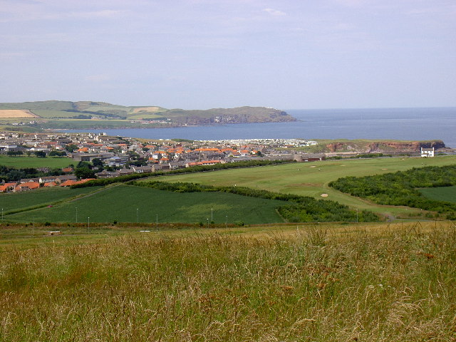
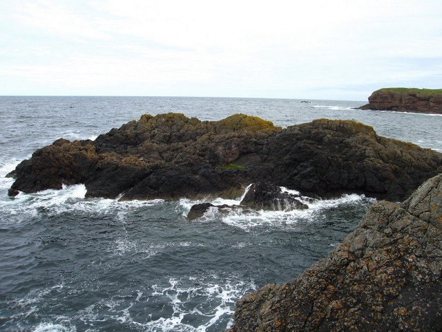
Agate Pup is a small and picturesque island located off the coast of Berwickshire, Scotland. Situated in the North Sea, it is part of the Firth of Forth archipelago. The island gets its name from the abundance of agate stones found along its shores. With a total land area of approximately 0.5 square kilometers, Agate Pup is a haven for nature enthusiasts and geology enthusiasts alike.

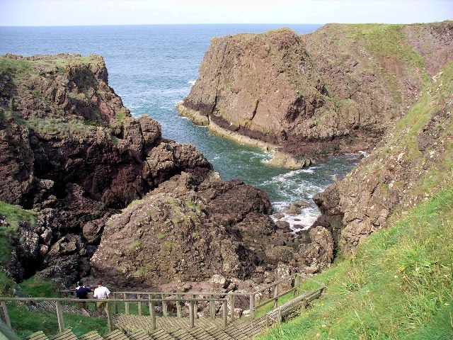
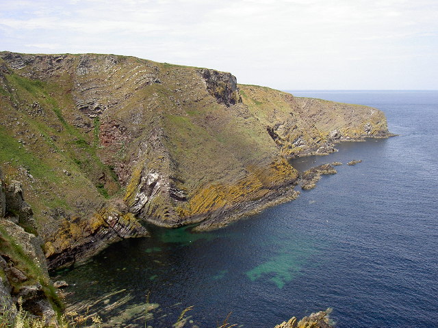
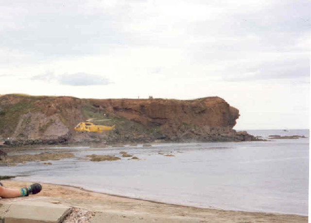
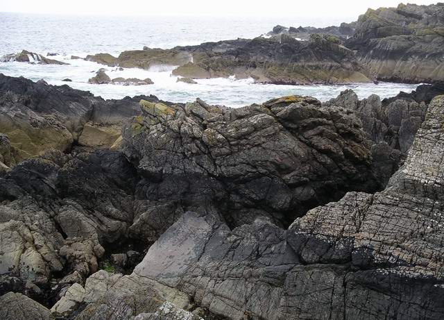
The island is known for its rugged coastline, characterized by towering cliffs and rocky outcrops. These cliffs provide nesting sites for various seabird species, including guillemots, puffins, and razorbills. Visitors can enjoy breathtaking views of the surrounding sea and observe the fascinating birdlife.

Agate Pup is also famous for the diverse range of agate stones that can be found on its beaches. These semi-precious gemstones come in a variety of colors and patterns, making them a sought-after treasure for collectors and amateur geologists. The island's unique geological composition, with its layers of sedimentary rock, creates the perfect conditions for the formation of these beautiful stones.

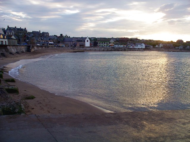
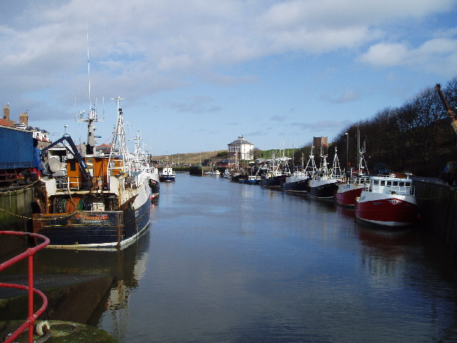
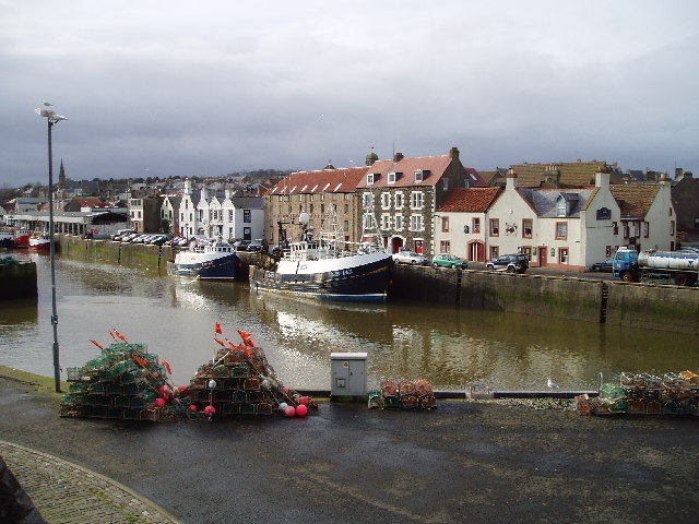
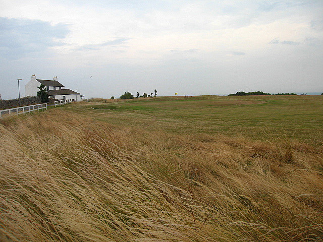
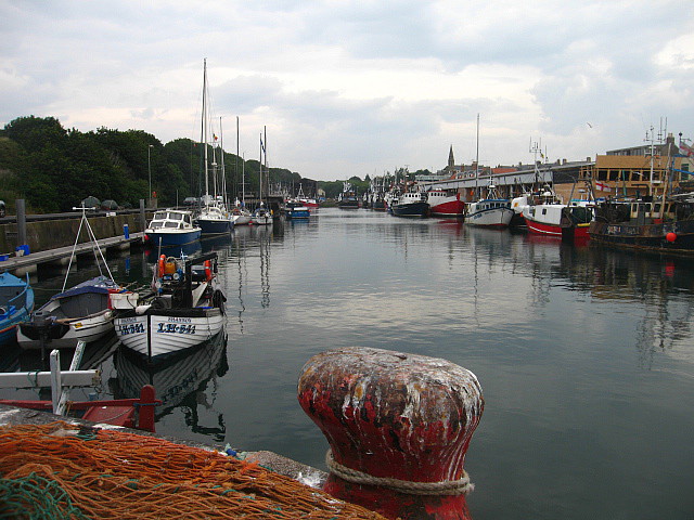
Access to Agate Pup is primarily by boat, with regular ferry services operating from nearby coastal towns. The island does not have any permanent human population, but it offers a peaceful and secluded retreat for those seeking a break from the hustle and bustle of everyday life. Visitors can explore the island's rugged terrain, take long walks along its sandy beaches, or simply relax and enjoy the tranquility of this hidden gem in the North Sea.

If you have any feedback on the listing, please let us know in the comments section below.
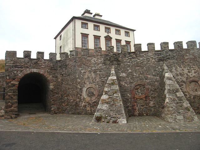
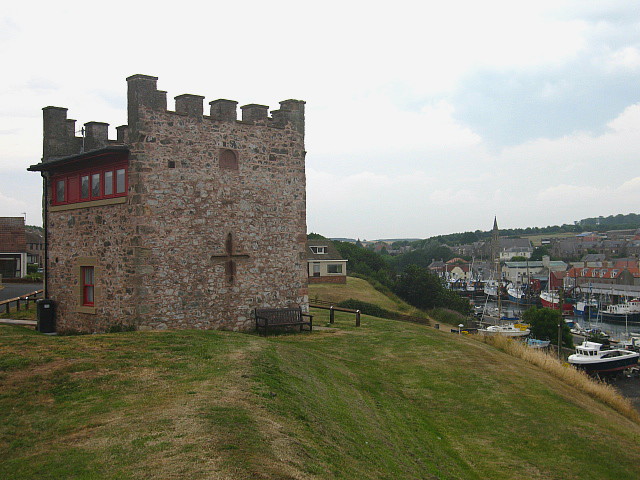
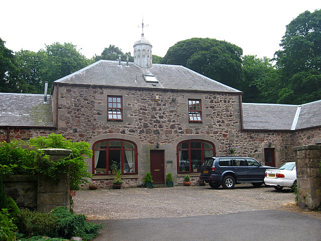
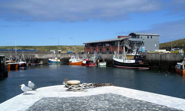
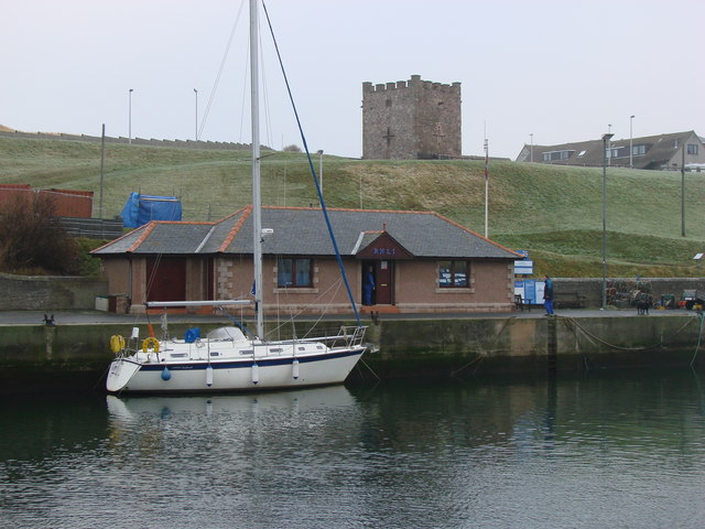
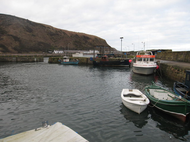
Agate Pup Images

Images are sourced within 2km of 55.870938/-2.0734679 or Grid Reference NT9564. Thanks to Geograph Open Source API. All images are credited.

Weasel Loch, near Eyemouth This mini sea loch is very popular with scuba divers wanting to meet the resident wolf fish.
Weasel Loch, near Eyemouth
This mini sea loch is very popular with scuba divers wanting to meet the resident wolf fish.
Eyemouth The historic town of Eyemouth lies 5 miles north of the Scottish border. Fishing there dates back to the 13th century, and the harbour is still active today.The town will always remember the Great East Coast Fishing Disaster of 1881, when 189 local fishermen lost their lives in a storm. The disaster is commemorated in a 15 by 4 foot tapestry, sewn by local women and on display in Eyemouth Museum.
Eyemouth
The historic town of Eyemouth lies 5 miles north of the Scottish border. Fishing there dates back to the 13th century, and the harbour is still active today.The town will always remember the Great East Coast Fishing Disaster of 1881, when 189 local fishermen lost their lives in a storm. The disaster is commemorated in a 15 by 4 foot tapestry, sewn by local women and on display in Eyemouth Museum.
North Sea off Eyemouth The ship is lying just off Eyemouth harbour.
North Sea off Eyemouth
The ship is lying just off Eyemouth harbour.
Hurker's Haven Looking down into Hurker's Haven from the coastal path close to Fancove Head. The hard geology is immediately apparent in the distorted layers of strata. Numerous seabirds use the small coastal outcrops as nesting sites accessible only from the sea. This area is popular with divers and canoeists and supports small scale fishing operations.
Hurker's Haven
Looking down into Hurker's Haven from the coastal path close to Fancove Head. The hard geology is immediately apparent in the distorted layers of strata. Numerous seabirds use the small coastal outcrops as nesting sites accessible only from the sea. This area is popular with divers and canoeists and supports small scale fishing operations.
Anyone for golf? Taken near to 'Horse Head' showing the expansion of Eyemouth. The relatively new golf course has replaced arable fields though farming is still the dominant activity around Eyemouth. New roads have been built to provide access to the golf course and also to the harbour. Only a narrow cliff top path exists between the sea and fields with rough grasses and wildflowers providing food for several species of butterflies.
Anyone for golf?
Taken near to 'Horse Head' showing the expansion of Eyemouth. The relatively new golf course has replaced arable fields though farming is still the dominant activity around Eyemouth. New roads have been built to provide access to the golf course and also to the harbour. Only a narrow cliff top path exists between the sea and fields with rough grasses and wildflowers providing food for several species of butterflies.
Air Sea Rescue Demo Taken from Prom on a "Lifeboat Fete" day c2003
Air Sea Rescue Demo
Taken from Prom on a "Lifeboat Fete" day c2003
Eyemouth Harbour Fishing Boats lined up along the river Eye in this busy harbour. In the distance you can see Gunsgreen House, an 18th century Merchants Villa designed by James Adam around 1855
Eyemouth Harbour
Fishing Boats lined up along the river Eye in this busy harbour. In the distance you can see Gunsgreen House, an 18th century Merchants Villa designed by James Adam around 1855
Eyemouth Harbour Buildings Eyemouth as well as being a busy fishing town also has many fine buildings clustered around its harbour.
Eyemouth Harbour Buildings
Eyemouth as well as being a busy fishing town also has many fine buildings clustered around its harbour.
Hairy Ness, Eyemouth Hairy Ness is a headland east of Eyemouth. In the foreground is Divers Hole, a sandy bottomed gully and to the right of Hairy Ness you enter Leeds Bay.
Hairy Ness, Eyemouth
Hairy Ness is a headland east of Eyemouth. In the foreground is Divers Hole, a sandy bottomed gully and to the right of Hairy Ness you enter Leeds Bay.
Headland at Eyemouth View from the headland Hairy Ness towards King's Mount.
Headland at Eyemouth
View from the headland Hairy Ness towards King's Mount.
Eyemouth Golf Course and Clubhouse The only links course in the Scottish Borders.
Eyemouth Golf Course and Clubhouse
The only links course in the Scottish Borders.
Eyemouth Harbour Eyemouth's harbour stretches back along the Eye Water, effectively forming the eastern edge of the town. Fishing played a vital part in the local economy as early as 1298, but it has also been a source of tragedy. During the 1800s Eyemouth's harbour was not improved as quickly as many, and its entrance was very tricky in rough weather. In 1881, 189 fishermen, including 129 from Eyemouth itself, lost their lives. The harbour was later improved to provide a much safer entrance. Most of Eyemouth's current harbour dates back to a major rebuilding in 1965.
Eyemouth Harbour
Eyemouth's harbour stretches back along the Eye Water, effectively forming the eastern edge of the town. Fishing played a vital part in the local economy as early as 1298, but it has also been a source of tragedy. During the 1800s Eyemouth's harbour was not improved as quickly as many, and its entrance was very tricky in rough weather. In 1881, 189 fishermen, including 129 from Eyemouth itself, lost their lives. The harbour was later improved to provide a much safer entrance. Most of Eyemouth's current harbour dates back to a major rebuilding in 1965.
The wall of Gunsgreen House Gunsgreen house is a 18th Century merchant's villa designed by James Adam around 1755. It was the centre of a lucrative smuggling trade in 18th Century Eyemouth. The house was alleged to have its roofspace full of illicit tea, and hiding places built into the walls between certain rooms.

The cart wheels in this photograph are the wheels of an old lifeboat launching carriage. Unfortunately, during recent renovation work, the wooden hub and spokes disintegrated and they have been removed (information added September 2009, thanks to George Davidson).
The wall of Gunsgreen House
Gunsgreen house is a 18th Century merchant's villa designed by James Adam around 1755. It was the centre of a lucrative smuggling trade in 18th Century Eyemouth. The house was alleged to have its roofspace full of illicit tea, and hiding places built into the walls between certain rooms. The cart wheels in this photograph are the wheels of an old lifeboat launching carriage. Unfortunately, during recent renovation work, the wooden hub and spokes disintegrated and they have been removed (information added September 2009, thanks to George Davidson).
Gunsgreen House Gunsgreen house is a 18th Century merchant's villa designed by James Adam around 1755. It was the centre of a lucrative smuggling trade in 18th Century Eyemouth. The house was alleged to have its roofspace full of illicit tea, and hiding places built into the walls between certain rooms.
Gunsgreen House
Gunsgreen house is a 18th Century merchant's villa designed by James Adam around 1755. It was the centre of a lucrative smuggling trade in 18th Century Eyemouth. The house was alleged to have its roofspace full of illicit tea, and hiding places built into the walls between certain rooms.
Gunsgreen House Doocot Overlooking Eyemouth Harbour and Gunsgreen House this is an early 19th century doocot. It has battlements on 3 sides and inset blind crosslets on East and North sides. There is some suggestion that it may have been a cart shed. It is now residential.
Gunsgreen House Doocot
Overlooking Eyemouth Harbour and Gunsgreen House this is an early 19th century doocot. It has battlements on 3 sides and inset blind crosslets on East and North sides. There is some suggestion that it may have been a cart shed. It is now residential.
The Coach House at Netherbyres 18th century in origin with later additions and alterations, the coach house has been converted for residential use. The former cart openings are still present and the ogee-capped, circular ridge vent on the roof may have been a former dovecot.
The Coach House at Netherbyres
18th century in origin with later additions and alterations, the coach house has been converted for residential use. The former cart openings are still present and the ogee-capped, circular ridge vent on the roof may have been a former dovecot.
Nestends, Eyemouth Rocky shoreline to the east of Eyemouth.
Nestends, Eyemouth
Rocky shoreline to the east of Eyemouth.
Eyemouth harbour Showing the recently built new harbour offices & fishmarket.
Eyemouth harbour
Showing the recently built new harbour offices & fishmarket.
Show me another place!

Agate Pup is located at Grid Ref: NT9564 (Lat: 55.870938, Lng: -2.0734679)

Unitary Authority: The Scottish Borders

Police Authority: The Lothians and Scottish Borders

What 3 Words

///partied.inspected.fashion. Near Eyemouth, Scottish Borders

Related Wikis

Eye Water

Eye Water is a river in the Scottish Borders, it flows in a general southeasterly direction from its source in the Lammermuir Hills to its estuary at Eyemouth...

Eyemouth Lifeboat Station

Eyemouth Lifeboat Station is a Royal National Lifeboat Institution (RNLI) marine-rescue facility in Eyemouth, Berwickshire, Scotland. The station was founded...

Eyemouth disaster

The Eyemouth disaster was a severe European windstorm that struck the south-eastern coast of Scotland on 14 October 1881. One hundred and eighty-nine fishermen...

Hurkar Rocks

The Hurkar Rocks are a group of rocks outside the harbour of Eyemouth in the Scottish Borders area of Scotland. The rocks become exposed during low tide...

Eyemouth railway station

Eyemouth railway station served the village of Eyemouth, Scottish Borders, Scotland from 1891 to 1962 on the Eyemouth Railway. == History == The station...

Eyemouth

Eyemouth (Scots: Heymooth) is a small town and civil parish in Berwickshire, in the Scottish Borders area of Scotland. It is two miles (three kilometres...

Burnmouth railway station

Burnmouth railway station served the village of Burnmouth, Ayton, Scotland from 1848 to 1962 on the East Coast Main Line. == History == There is some confusion...

Burnmouth

Burnmouth is a small fishing village located adjacent to the A1 road on the east coast of Scotland. It is the first village in Scotland on the A1, after...

Nearby Amenities

Located within 500m of 55.870938,-2.0734679
The data included in this document is from www.openstreetmap.org. The data is made available under ODbL.

Have you been to Agate Pup?

Leave your review of Agate Pup below (or comments, questions and feedback).