Balbithan Island
Island in Aberdeenshire
Scotland
Balbithan Island

Balbithan Island is a small, uninhabited island located off the coast of Aberdeenshire, Scotland. Situated in the North Sea, it lies approximately 1.5 miles east of the village of Collieston. The island covers an area of about 5 acres and is notable for its diverse wildlife and historical ruins.
The island is predominantly rocky and rugged, with steep cliffs rising up to 100 feet in some areas. Its shores are composed of rocky beaches and tidal rock pools. The vegetation on Balbithan Island is sparse, consisting mainly of grasses, heather, and low-growing shrubs.
Balbithan Island is home to a variety of bird species, including kittiwakes, fulmars, and gulls, which nest on the cliffs. Seals can also be spotted along the rocky shores, providing a picturesque sight for visitors.
The island is rich in historical remains, with the most prominent feature being the ruins of Balbithan Castle. Dating back to the 16th century, the castle was once a fortified tower house and is now a crumbling structure with only a few walls remaining. The ruins offer a glimpse into the island's past and attract history enthusiasts.
Access to Balbithan Island is challenging due to its remote location and lack of ferry services. However, visitors can view the island from a distance by taking a boat tour along the Aberdeenshire coastline, providing an opportunity to appreciate its natural beauty and historical significance.
If you have any feedback on the listing, please let us know in the comments section below.
Balbithan Island Images
Images are sourced within 2km of 57.242339/-2.3387839 or Grid Reference NJ7916. Thanks to Geograph Open Source API. All images are credited.


Balbithan Island is located at Grid Ref: NJ7916 (Lat: 57.242339, Lng: -2.3387839)
Unitary Authority: Aberdeenshire
Police Authority: North East
What 3 Words
///chuckling.gourmet.tensions. Near Kintore, Aberdeenshire
Nearby Locations
Related Wikis
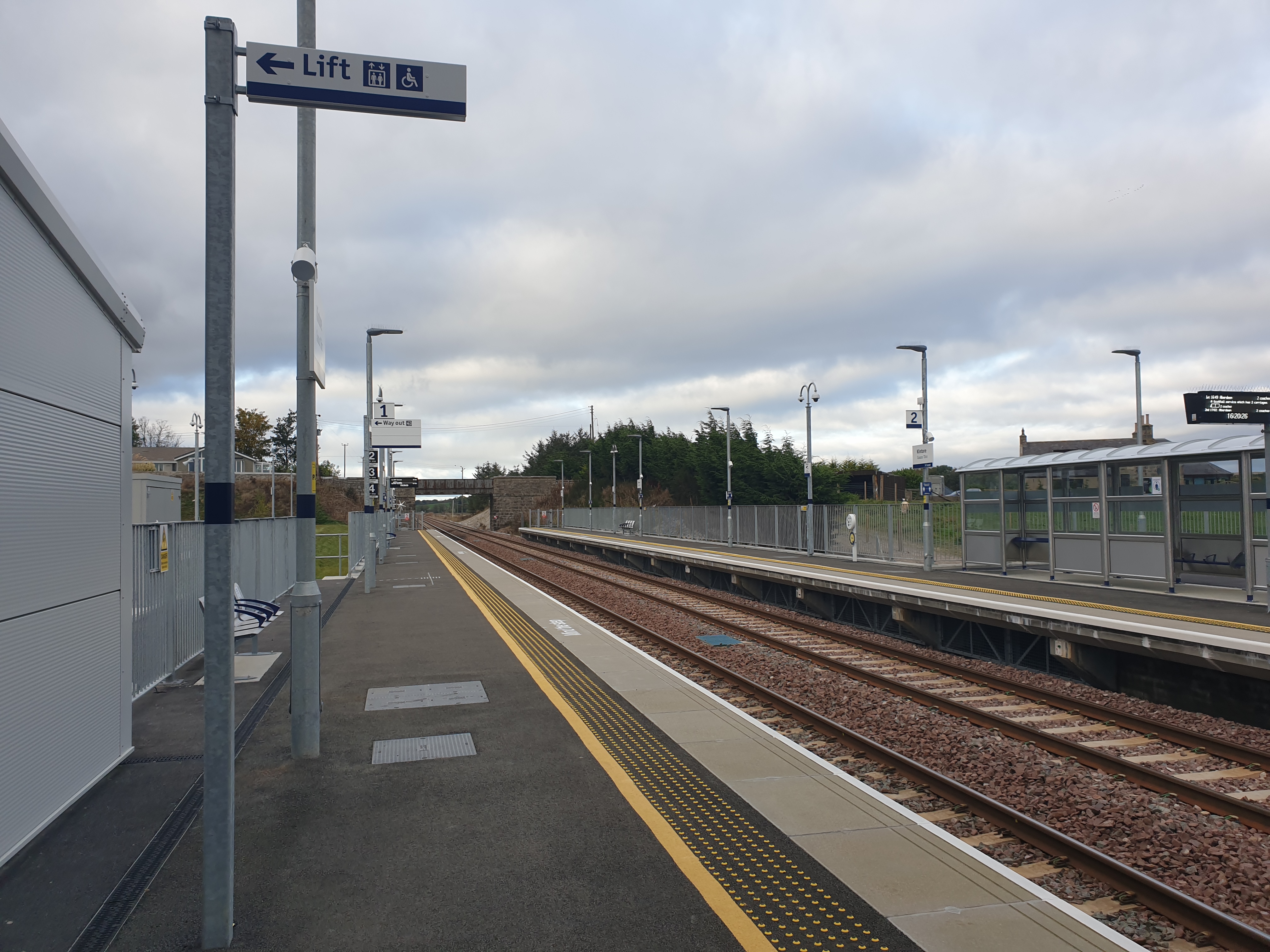
Kintore railway station
Kintore railway station is in Kintore, Scotland on the Aberdeen–Inverness line. Originally opened in 1854, it closed in 1964 but was reopened on a different...
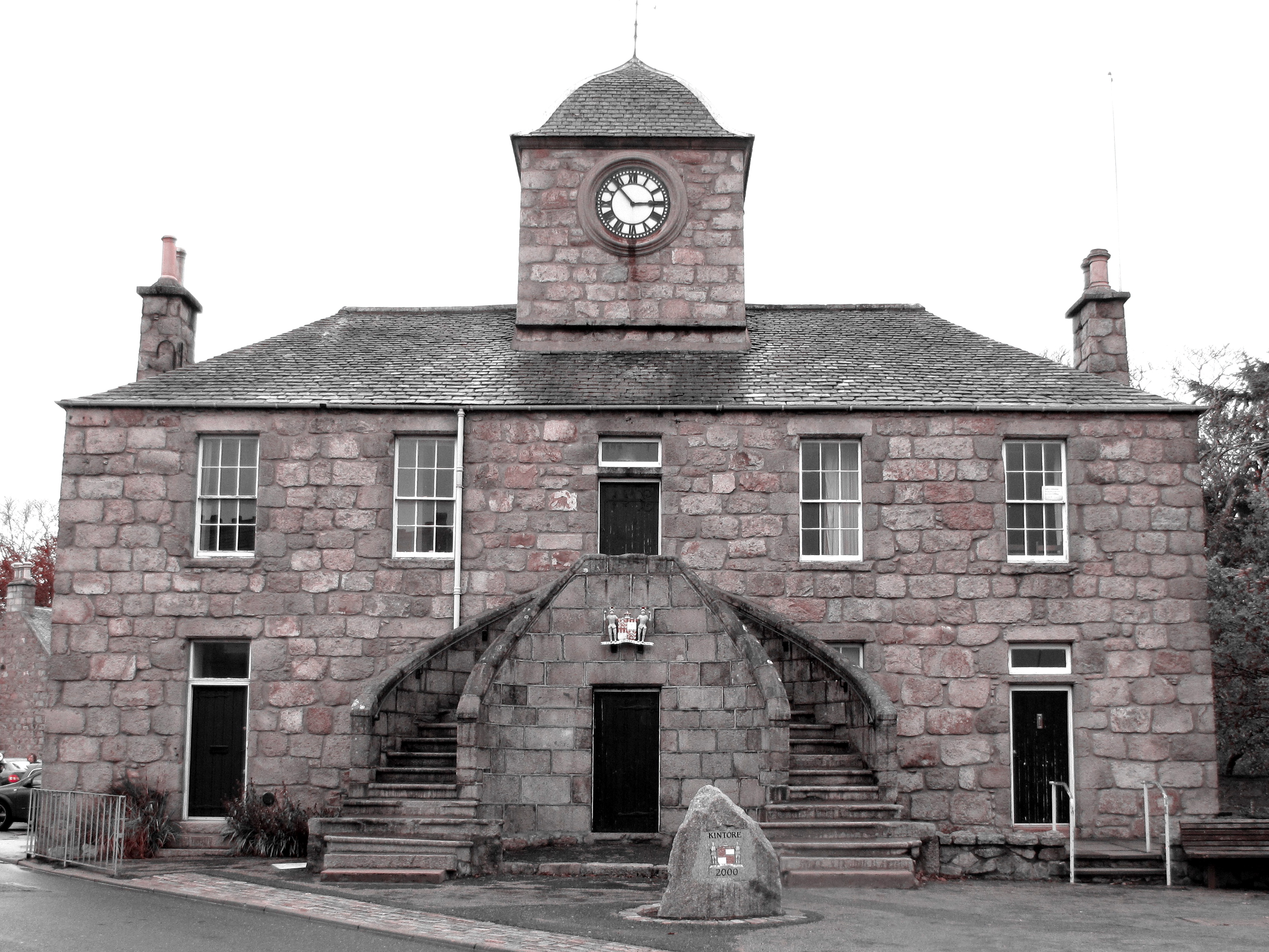
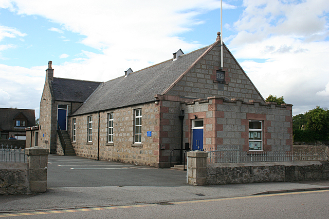
Kintore Town House
Kintore Town House is a municipal structure in The Square, Kintore, Aberdeenshire, Scotland. The structure, which is used as commercial offices, is a Category...

Kintore, Aberdeenshire
Kintore (; Scottish Gaelic: Ceann Tòrr) is a town and former royal burgh near Inverurie in Aberdeenshire, Scotland, now bypassed by the A96 road between...

Deers Den
Deers Den is an archaeological site at Kintore, Scotland in Aberdeenshire. The site has mesolithic remains, Iron Age artefacts and is a known Roman Camp...
Nearby Amenities
Located within 500m of 57.242339,-2.3387839Have you been to Balbithan Island?
Leave your review of Balbithan Island below (or comments, questions and feedback).