Isle of May

Island in Fife

Scotland

Isle of May

Simmer Dim at the Low Light, Isle of May The Fife coast extends to Fife Ness in the distance. Mist-nets are erected in the foreground below the old lighthouse for the evening tape-luring of Storm Petrels.
Simmer Dim at the Low Light, Isle of May Credit: Greg Fitchett

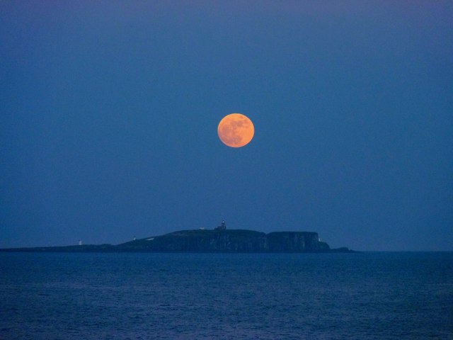
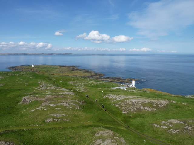
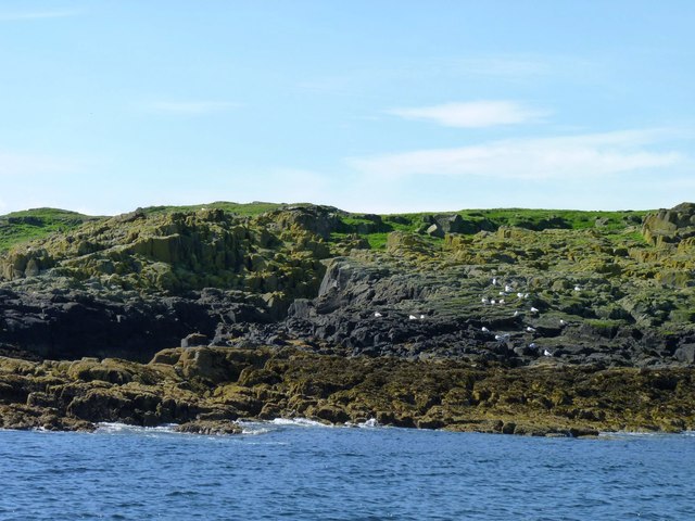
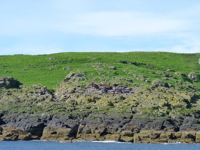
The Isle of May is a small, uninhabited island located in the Firth of Forth, off the coast of Fife, Scotland. With an area of just 57 hectares, it is a nature reserve and a Site of Special Scientific Interest (SSSI), renowned for its diverse wildlife and rich historical significance.

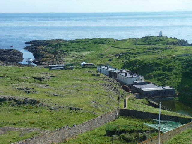
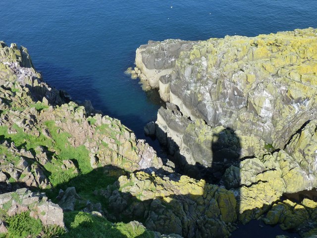
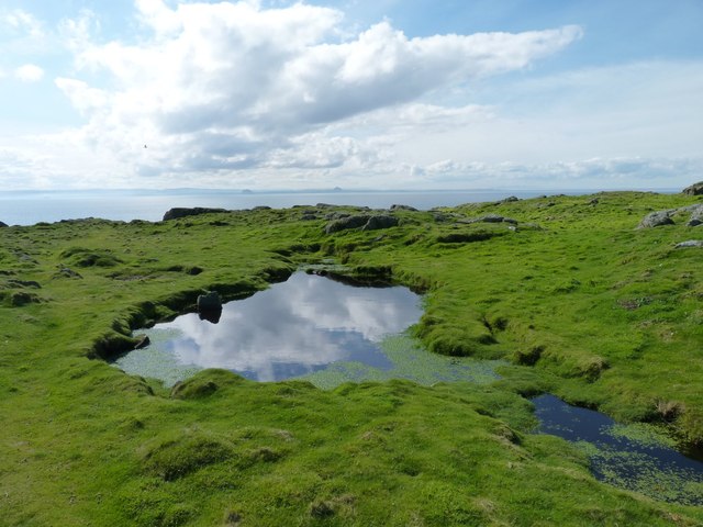
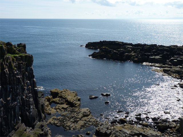
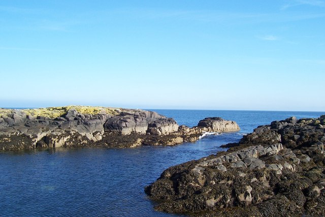
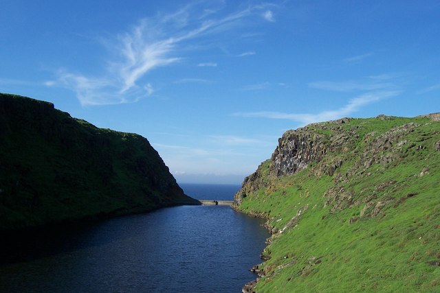
The island's landscape is predominantly rocky and rugged, with a mixture of grassy slopes and cliffs that provide nesting sites for a plethora of seabirds. It is home to over 200,000 breeding seabirds during the summer months, including puffins, guillemots, razorbills, and kittiwakes. These birds create a cacophony of sound and an awe-inspiring spectacle for visitors who come to witness their nesting rituals.

In addition to its avian population, the Isle of May is also known for its seal colony. Grey seals can be spotted lounging on the rocky shores, giving birth to their pups in the winter months. The island's waters are abundant with marine life, making it an ideal spot for birdwatchers, wildlife enthusiasts, and photographers.

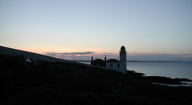
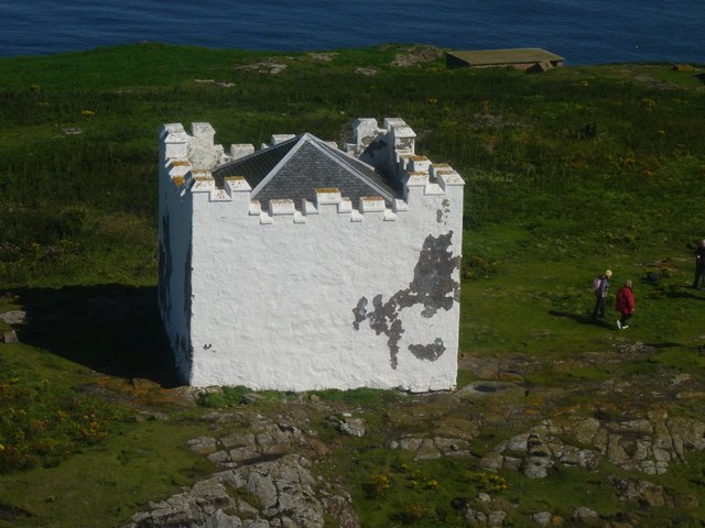
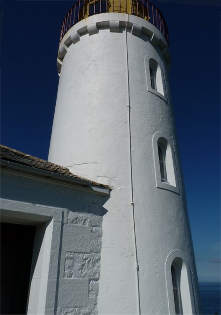
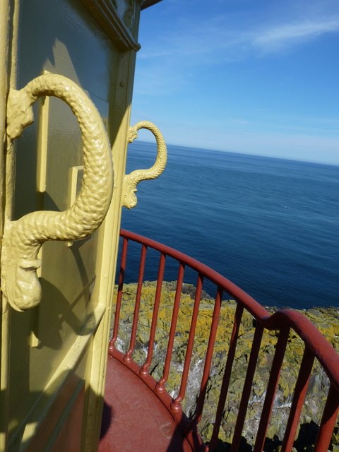
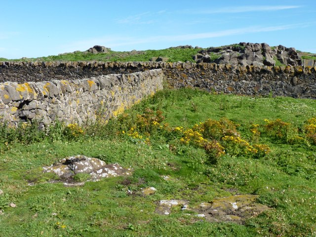
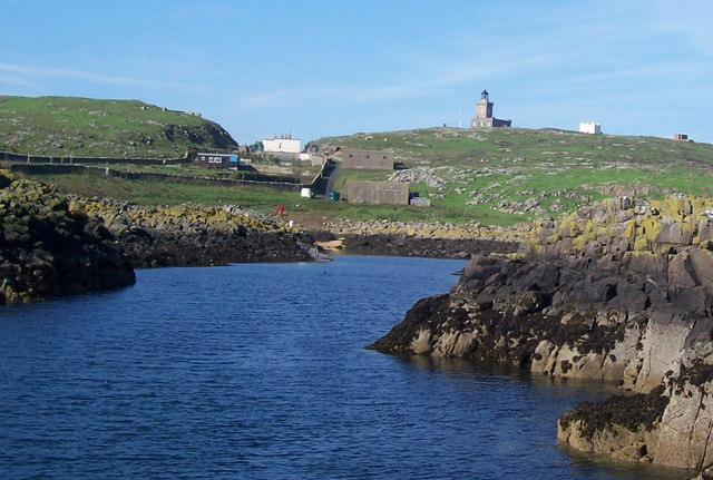
The Isle of May also holds historical significance, with evidence of human occupation dating back to the Iron Age. It was once a site for religious pilgrimage and later became a lighthouse station in the 19th century. The remains of a medieval priory and a 19th-century lighthouse still stand as reminders of the island's past.

Access to the Isle of May is limited and regulated, with boat trips available from Anstruther and other nearby ports. Visitors can explore the island on foot, following marked trails and guided tours to ensure minimal disturbance to the wildlife. It is a truly unique destination, offering a glimpse into the natural beauty and historical heritage of Scotland's coastal ecosystems.

If you have any feedback on the listing, please let us know in the comments section below.

Isle of May Images

Images are sourced within 2km of 56.186464/-2.5576011 or Grid Reference NT6599. Thanks to Geograph Open Source API. All images are credited.

Simmer Dim at the Low Light, Isle of May The Fife coast extends to Fife Ness in the distance. Mist-nets are erected in the foreground below the old lighthouse for the evening tape-luring of Storm Petrels.
Simmer Dim at the Low Light, Isle of May
The Fife coast extends to Fife Ness in the distance. Mist-nets are erected in the foreground below the old lighthouse for the evening tape-luring of Storm Petrels.
Full moon over the May
Ghostly Footsteps on Isle of May
Looking down on the Beacon The truncated tower of Scotland's oldest lighthouse (the 1636 Beacon) seen from the cupola of the Stevenson-built 1816 Main Light.
Looking down on the Beacon
The truncated tower of Scotland's oldest lighthouse (the 1636 Beacon) seen from the cupola of the Stevenson-built 1816 Main Light.
Fluke Street Looking from the top of the Main Light on the Isle of May towards the buildings in Fluke Street (said to have been so called by naval personnel during WW2, having gained its name from a street in the red-light district of Dundee). The buildings were used to house to fog-horn air compressors and lighthouse personnel. On the left is Kirk Haven, with the ferry from Anstruther moored there and on the right is the white tower of the South Horn.
Fluke Street
Looking from the top of the Main Light on the Isle of May towards the buildings in Fluke Street (said to have been so called by naval personnel during WW2, having gained its name from a street in the red-light district of Dundee). The buildings were used to house to fog-horn air compressors and lighthouse personnel. On the left is Kirk Haven, with the ferry from Anstruther moored there and on the right is the white tower of the South Horn.
Low Light Built in 1844 this light was used by sailors to avoid the Carr Rocks, but was rendered redundant after about 50 years, when a light ship was moored just off the Carr Rocks. The former lighthouse keepers' accommodation is now regularly used by ornithologists.
Low Light
Built in 1844 this light was used by sailors to avoid the Carr Rocks, but was rendered redundant after about 50 years, when a light ship was moored just off the Carr Rocks. The former lighthouse keepers' accommodation is now regularly used by ornithologists.
Grab that serpent Grab handles on the light platform of the Low Light on the Isle of May.
Grab that serpent
Grab handles on the light platform of the Low Light on the Isle of May.
Light casts a shadow The shadow of the Low Light on the Isle of May cast by the sun on the rocks below.
Light casts a shadow
The shadow of the Low Light on the Isle of May cast by the sun on the rocks below.
North end of the island Looking from the top of the Main Light towards the North Horn on the Isle of May. The distant coast is Fife, near Crail, about five miles away.
North end of the island
Looking from the top of the Main Light towards the North Horn on the Isle of May. The distant coast is Fife, near Crail, about five miles away.
Small pond One of the few places where water collects on the Isle of May. The 'lumps' on the far horizon are the Bass Rock in the Firth of Forth and Berwick Law in East Lothian.
Small pond
One of the few places where water collects on the Isle of May. The 'lumps' on the far horizon are the Bass Rock in the Firth of Forth and Berwick Law in East Lothian.
Can you describe a spiral stairway ... ... without using your hands? The ornate stairway leading up the light tower of the Stevenson-built Main Light on the Isle of May, one of the finest examples of the famous builder's work.
Can you describe a spiral stairway ...
... without using your hands? The ornate stairway leading up the light tower of the Stevenson-built Main Light on the Isle of May, one of the finest examples of the famous builder's work.
South extremity The southernmost tip of the Isle of May.
South extremity
The southernmost tip of the Isle of May.
Rocks and stone walls Walls, presumably constructed by inhabitants of the small village that once existed on the island.
Rocks and stone walls
Walls, presumably constructed by inhabitants of the small village that once existed on the island.
Seabirds on the Pillow A rocky promontory just north of the landing place of Kirk Haven.
Seabirds on the Pillow
A rocky promontory just north of the landing place of Kirk Haven.
Wreck of the Island The Danish steamship Island ran aground on the Isle of May in 1937. Those rusty steel ribs are all that remains of her above water level now. Divers can explore more of her remains between 15 and 29 metres deep in the off-shore waters.
Wreck of the Island
The Danish steamship Island ran aground on the Isle of May in 1937. Those rusty steel ribs are all that remains of her above water level now. Divers can explore more of her remains between 15 and 29 metres deep in the off-shore waters.
Isle Of May: Kirkhaven A view of the narrow inlet which the May Princess negotiates to land passengers on the May.
Isle Of May: Kirkhaven
A view of the narrow inlet which the May Princess negotiates to land passengers on the May.
Isle Of May: Approach To Kirkhaven Quay A view of some of the features of the island including the buildings at 'Fluke Street' centre left and the Main Light right of centre.
Isle Of May: Approach To Kirkhaven Quay
A view of some of the features of the island including the buildings at 'Fluke Street' centre left and the Main Light right of centre.
Isle Of May: The Loch A small artificially-created loch can be found near Fluke Street.
Isle Of May: The Loch
A small artificially-created loch can be found near Fluke Street.
Show me another place!

Isle of May is located at Grid Ref: NT6599 (Lat: 56.186464, Lng: -2.5576011)

Unitary Authority: Fife

Police Authority: Fife

What 3 Words

///quaking.spectacle.beast. Near Crail, Fife

Related Wikis

Isle of May

The Isle of May is located in the north of the outer Firth of Forth, approximately 8 km (5.0 mi) off the coast of mainland Scotland. It is about 1.5 kilometres...

Battle of May Island

The Battle of May Island is the name given to the series of accidents that occurred during Operation E.C.1 in 1918. Named after the Isle of May, a nearby...

Isle of May Priory

The Isle of May Priory was a monastery and community of Benedictine monks established for 9 monks of Reading Abbey on the Isle of May in the Firth of Forth...

SS Sneland I

Sneland I (Norwegian for “snowland one”) was a 1,791 GRT cargo ship which was built by Nüscke & Co. shipyard at Stettin-Grabow (then Germany) in 1922....

Nearby Amenities

Located within 500m of 56.186464,-2.5576011
Source: PGS
Lat/Long: 56.182287/-2.5547514
Source: PGS
Lat/Long: 56.182493/-2.5549764
Source: PGS
Lat/Long: 56.1827024/-2.5552033
Source: PGS
Lat/Long: 56.1830696/-2.5559318
Source: PGS
Lat/Long: 56.1831844/-2.5572016
Source: PGS
Lat/Long: 56.1833409/-2.5573118
Source: PGS
Lat/Long: 56.1835176/-2.5577834
Source: PGS
Lat/Long: 56.1837709/-2.5578571
Source: PGS
Lat/Long: 56.1839677/-2.5583718
Source: PGS
Lat/Long: 56.1842849/-2.5583139
Source: PGS
Lat/Long: 56.1843262/-2.558162
Source: PGS
Lat/Long: 56.1845963/-2.5587527
Source: PGS
Lat/Long: 56.1846969/-2.5588501
Source: PGS
Lat/Long: 56.1847512/-2.558798
Source: PGS
Lat/Long: 56.1848551/-2.5588246
Source: PGS
Lat/Long: 56.1847794/-2.5580647
Source: PGS
Lat/Long: 56.184939/-2.5584593
Created By: almien_coastlines
Source: PGS
Lat/Long: 56.184944/-2.55868
Created By: almien_coastlines
Source: PGS
Lat/Long: 56.185072/-2.558907
Created By: almien_coastlines
Source: PGS
Lat/Long: 56.185332/-2.559822
Created By: almien_coastlines
Source: PGS
Lat/Long: 56.185461/-2.560051
Source: PGS
Lat/Long: 56.1854432/-2.5603639
Source: PGS
Lat/Long: 56.1858189/-2.5607225
Source: PGS
Lat/Long: 56.185977/-2.5610755
Source: PGS
Lat/Long: 56.1859595/-2.5615717
Source: PGS
Lat/Long: 56.186064/-2.5616406
Source: PGS
Lat/Long: 56.1863839/-2.562312
Source: PGS
Lat/Long: 56.1866787/-2.562669
Source: PGS
Lat/Long: 56.1880584/-2.5625904
Created By: almien_coastlines
Source: PGS
Lat/Long: 56.189568/-2.562759
Source: PGS
Lat/Long: 56.1897005/-2.563052
Source: PGS
Lat/Long: 56.1906005/-2.5597532
Source: PGS
Lat/Long: 56.1904139/-2.5592835
Source: PGS
Lat/Long: 56.1901456/-2.5591051
Source: PGS
Lat/Long: 56.1894614/-2.5598028
Source: PGS
Lat/Long: 56.1895287/-2.5608741
Source: PGS
Lat/Long: 56.1894313/-2.5605868
Source: PGS
Lat/Long: 56.1892048/-2.559022
Source: PGS
Lat/Long: 56.1888545/-2.5588493
Source: PGS
Lat/Long: 56.1887957/-2.5589952
Source: PGS
Lat/Long: 56.1886084/-2.5584359
Source: PGS
Lat/Long: 56.1885226/-2.5583531
Source: PGS
Lat/Long: 56.1884101/-2.5578625
Source: PGS
Lat/Long: 56.1883631/-2.5575001
Source: PGS
Lat/Long: 56.1883696/-2.5570803
Source: PGS
Lat/Long: 56.1883432/-2.5568368
Source: PGS
Lat/Long: 56.1882532/-2.5566018
Source: PGS
Lat/Long: 56.188146/-2.5563226
Source: PGS
Lat/Long: 56.1880078/-2.5561126
Source: PGS
Lat/Long: 56.1881778/-2.5555743
Source: PGS
Lat/Long: 56.1867385/-2.5529988
Source: PGS
Lat/Long: 56.1865096/-2.5530023
Source: PGS
Lat/Long: 56.186469/-2.5527982
Source: PGS
Lat/Long: 56.1863698/-2.5526056
Source: PGS
Lat/Long: 56.1862822/-2.5525622
Source: PGS
Lat/Long: 56.1859477/-2.5518141
Source: PGS
Lat/Long: 56.1856686/-2.5518538
Source: PGS
Lat/Long: 56.1855213/-2.5516532
Isle of May Lighthouse
Height: 78
Man Made: lighthouse
Operator: Northern Lighthouse Board
Operator Wikidata: Q918253
Seamark Light Character: Fl
Seamark Light Colour: white
Seamark Light Group: 2
Seamark Light Height: 73
Seamark Light Period: 15
Seamark Light Range: 22
Seamark Light Reference: A 3090
Seamark Light Sequence: 0.3+(1.6)+0.3+(12.8)
Seamark Type: light_major
Source: US NGA Pub. 114. 2011-05-26.
Website: https://www.nlb.org.uk/lighthouses/isle-of-may/
Wikidata: Q17817380
Wikipedia: en:Isle of May Lighthouse
Lat/Long: 56.1856454/-2.5574451
Disused Man Made: lighthouse
Old Name: Low Light
Lat/Long: 56.1877826/-2.5574791
Tourism: picnic_site
Lat/Long: 56.1833342/-2.5522126
Altarstanes
Tourism: viewpoint
Lat/Long: 56.1888355/-2.5624092
Tourism: viewpoint
Lat/Long: 56.1842703/-2.5579935
Tourism: viewpoint
Lat/Long: 56.1829358/-2.5552737
Helgoland traps
Board Type: wildlife
Information: board
Tourism: information
Lat/Long: 56.1833094/-2.5521028
Tourism: picnic_site
Lat/Long: 56.1834291/-2.5522511
Entrance: main
Lat/Long: 56.1835609/-2.5515865
Toilets
Access: yes
Lat/Long: 56.1836046/-2.5516037
Board Type: history
Information: board
Tourism: information
Lat/Long: 56.1854173/-2.5565788
Bench
Backrest: yes
Lat/Long: 56.1856491/-2.5576067
The Low Light
Information: board
Tourism: information
Lat/Long: 56.1872521/-2.557758
The Main Light
Information: board
Tourism: information
Lat/Long: 56.1855572/-2.5570639
Bishop's Cove
Tourism: viewpoint
Lat/Long: 56.1860309/-2.5614597
Isle of May
Ele: 50
Natural: peak
Lat/Long: 56.1853807/-2.5569907
The data included in this document is from www.openstreetmap.org. The data is made available under ODbL.

Have you been to Isle of May?

Leave your review of Isle of May below (or comments, questions and feedback).